
Anton Thomas
@AntonThomasMaps
Followers
4,054
Following
509
Media
209
Statuses
1,122
Exploring the confluence of geography and art with hand-drawn maps. Prints available on my website:
Melbourne, Victoria
Joined March 2017
Don't wanna be here?
Send us removal request.
Explore trending content on Musk Viewer
Renzo
• 149514 Tweets
#WWERaw
• 82544 Tweets
#GodMorningTuesday
• 37096 Tweets
Scarlett Johansson
• 33379 Tweets
Oilers
• 32756 Tweets
Fani Willis
• 31365 Tweets
定額減税
• 30436 Tweets
Kingdom Hearts
• 28122 Tweets
राजीव गांधी
• 26553 Tweets
梅雨入り
• 25308 Tweets
Birds Nurturing
• 24042 Tweets
給与明細
• 24010 Tweets
Gunther
• 22163 Tweets
#Canucks
• 20882 Tweets
Vancouver
• 20788 Tweets
#ファンパレハーフアニバーサリー
• 18934 Tweets
Edmonton
• 17581 Tweets
ドジャース
• 17426 Tweets
金額明記
• 17231 Tweets
Amber Rose
• 15464 Tweets
ショートアニメ
• 14937 Tweets
キングダムハーツ
• 14089 Tweets
Lyra
• 12452 Tweets
国民実感
• 10659 Tweets


Pinned Tweet

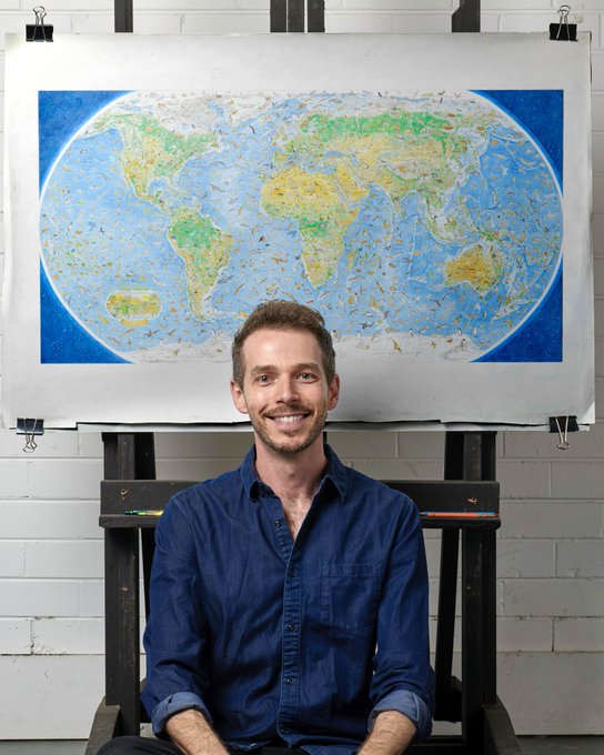
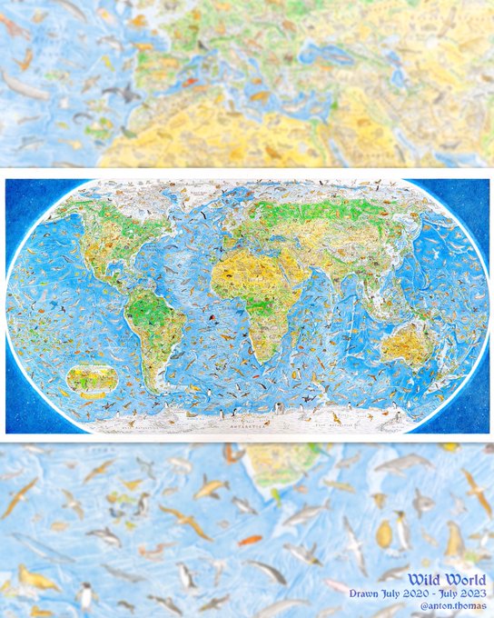
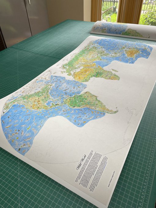
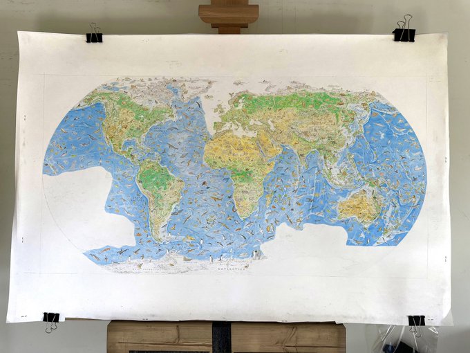
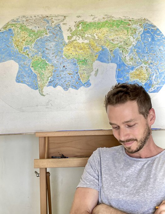
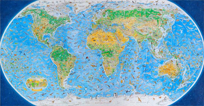
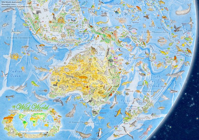
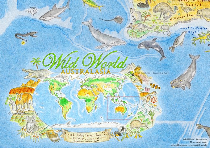
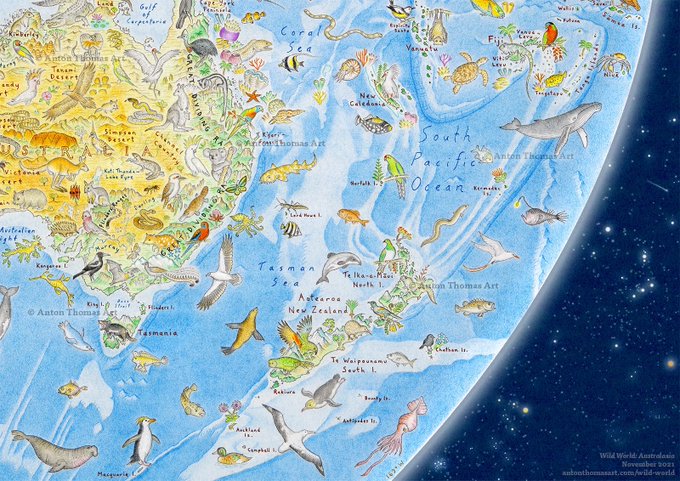
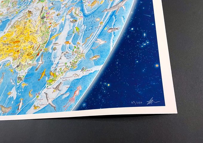
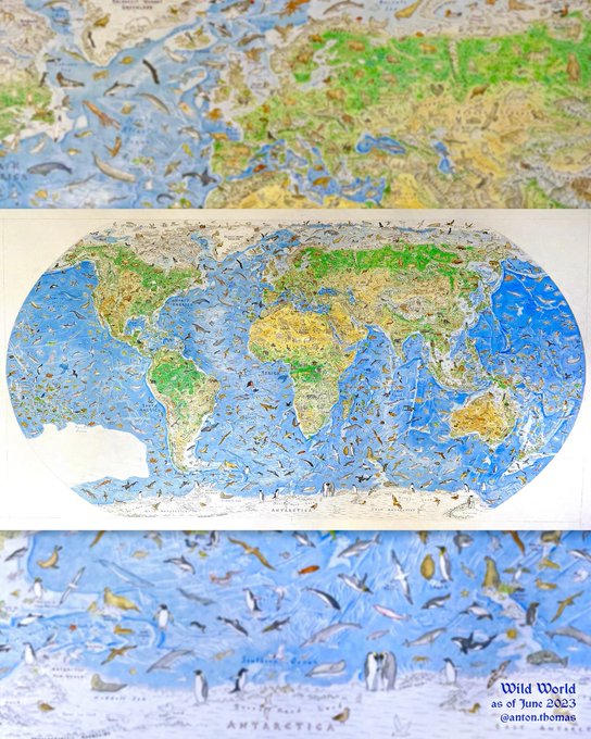
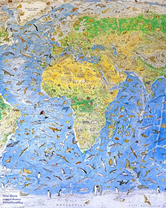
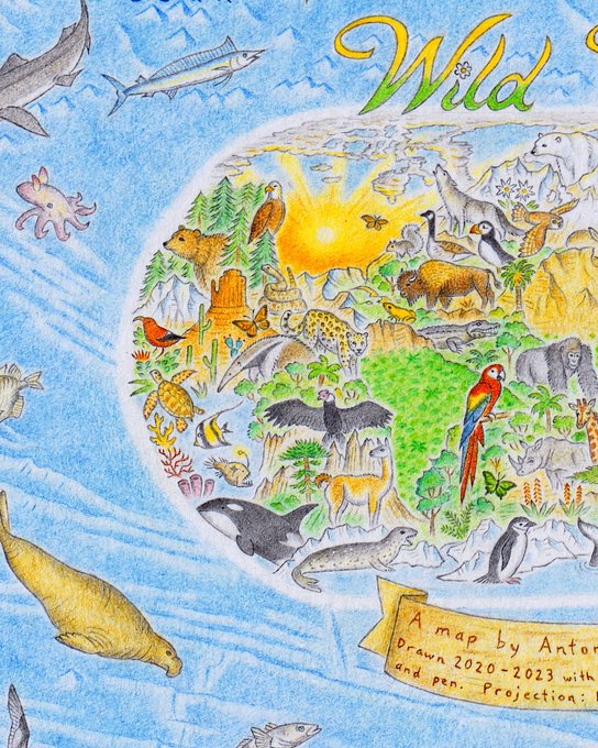
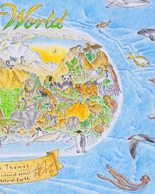
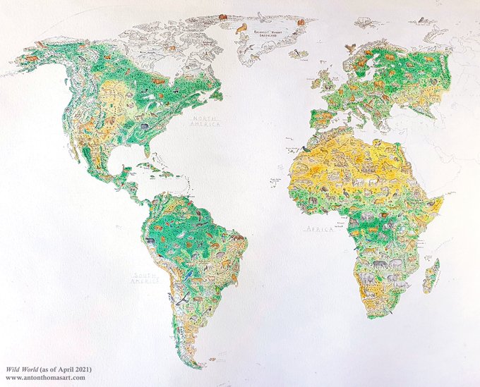
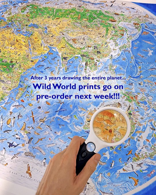
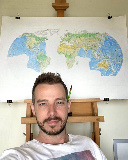
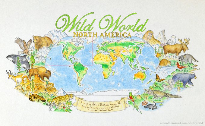
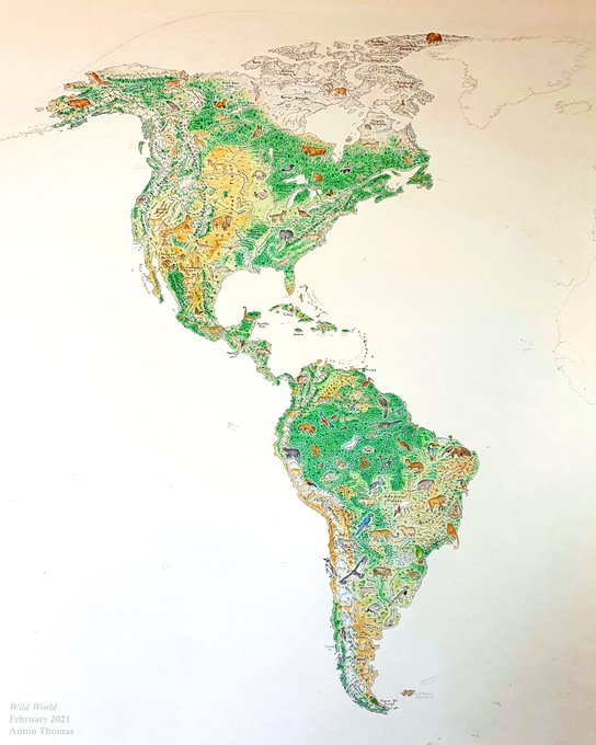
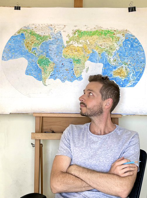
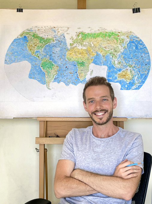
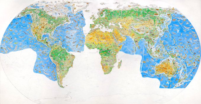
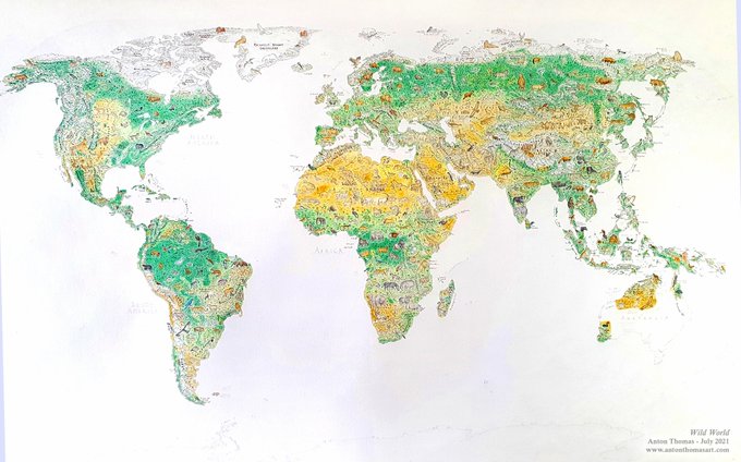
It. Is. COMPLETE!!!! I can’t believe it. After 3 years putting my heart & soul into this map, Wild World is finished. Thank you everyone for the encouragement over the years, this was a beautiful journey and I’m deeply proud of it… a map of nature I’ve dreamt of since childhood.
50
350
3K
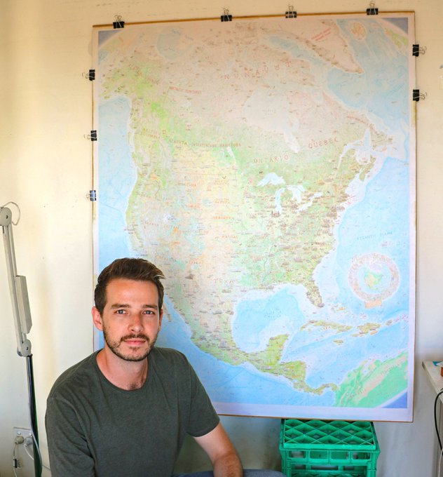
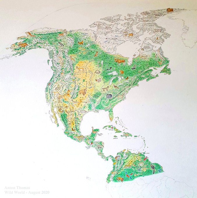
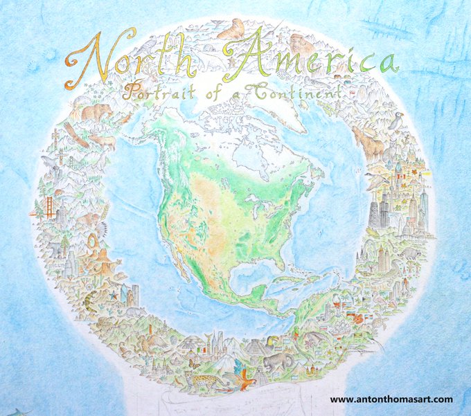
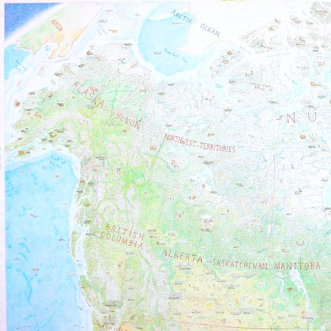
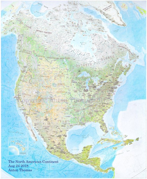
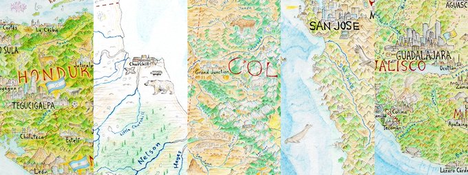
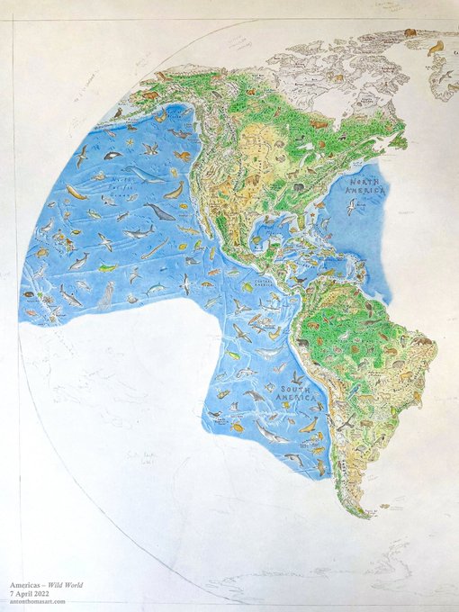
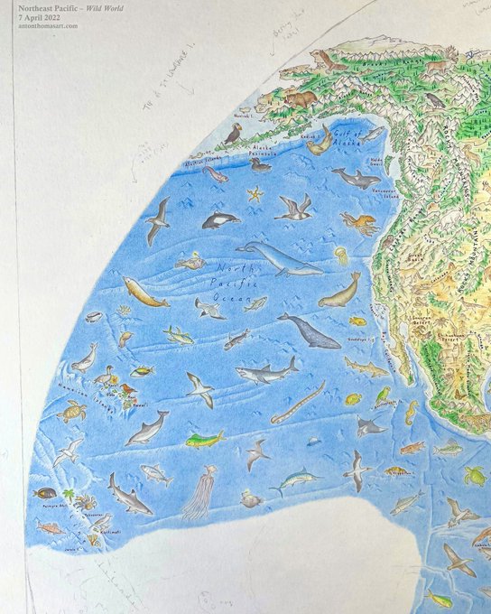
It is done. I can't believe I'm really able to announce this. But my hand-drawn
#map
of North America is complete, more than 4 and a half years since it began. I signed it off on Thursday and have been in disbelief ever since. It's a new day my friends 😁
58
243
1K
I started a new map last month. It is called Wild World, and I'm 150 hours in. For over a year I've been focussed only on my business... and to be mapping again, pencils in hand, exploring the possibilities... it is absolute bliss.
#WildWorldMap
34
113
856
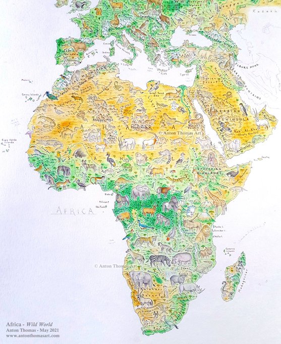
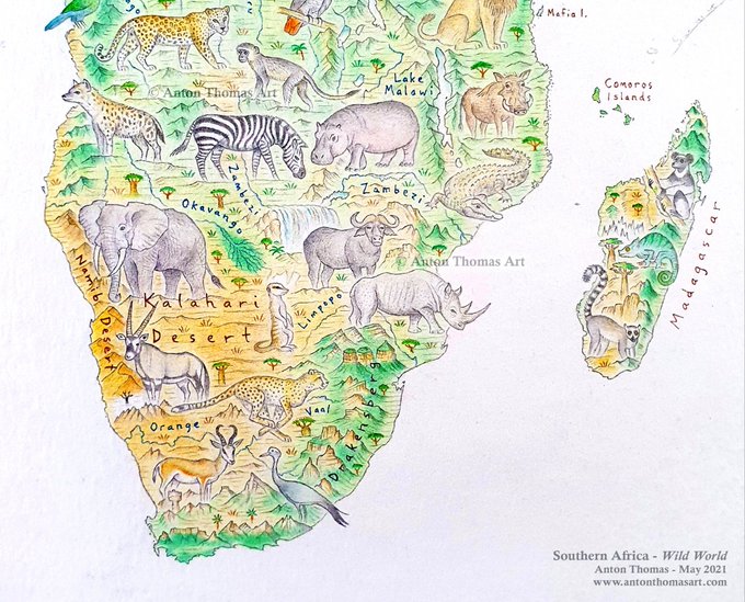
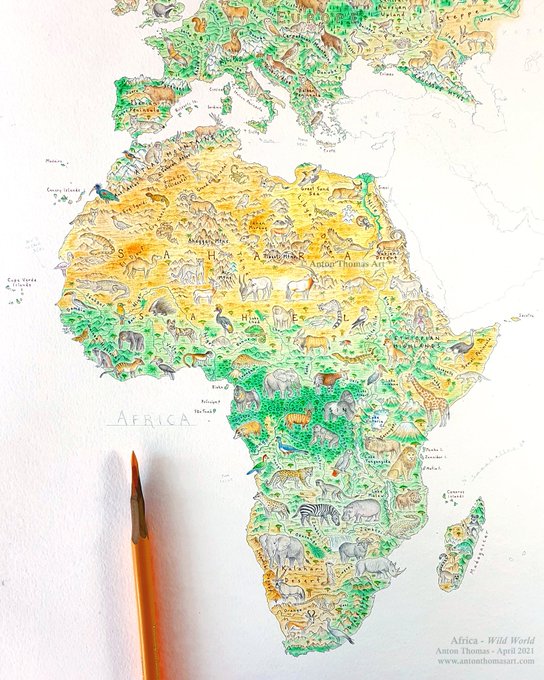
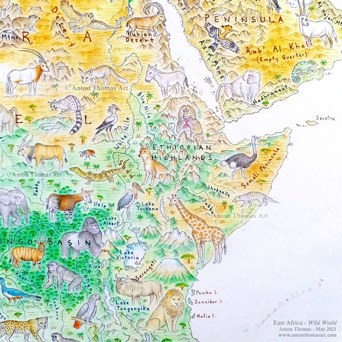
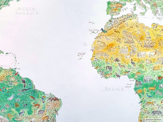
I'm so excited to share the completed Africa, from my
#WildWorldMap
✍As a map about wildlife & physical geography, Africa was likely to be a huge challenge. It surpassed all expectations. Researching & drawing this incredible continent was one of the best experiences of my life.

16
127
763
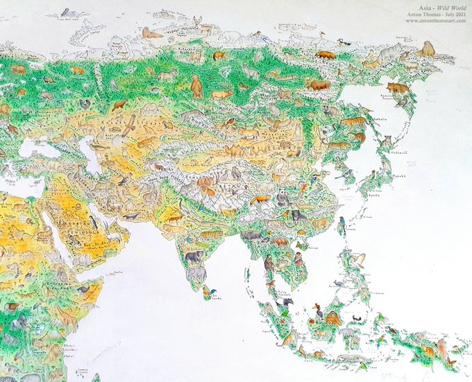
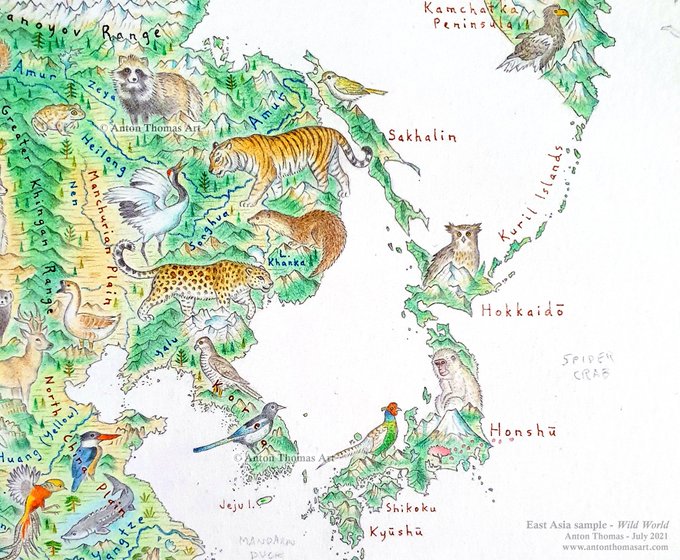
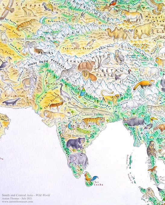
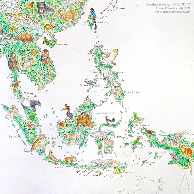
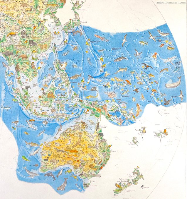
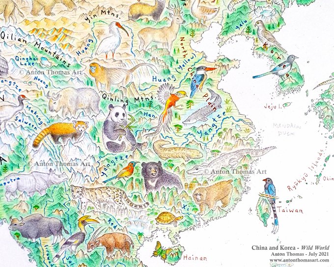
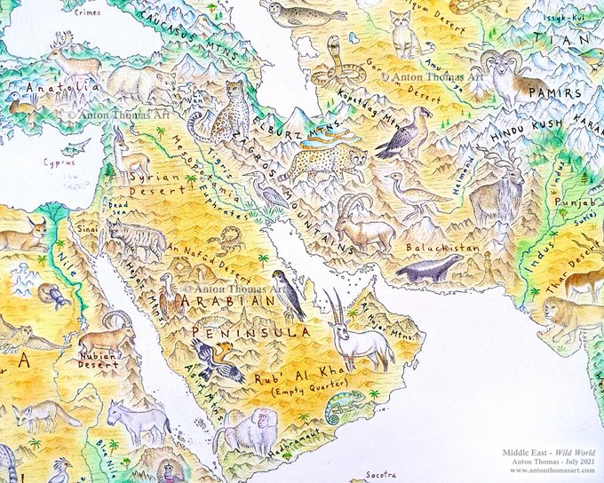
Asia, finally completed, from my
#WildWorldMap
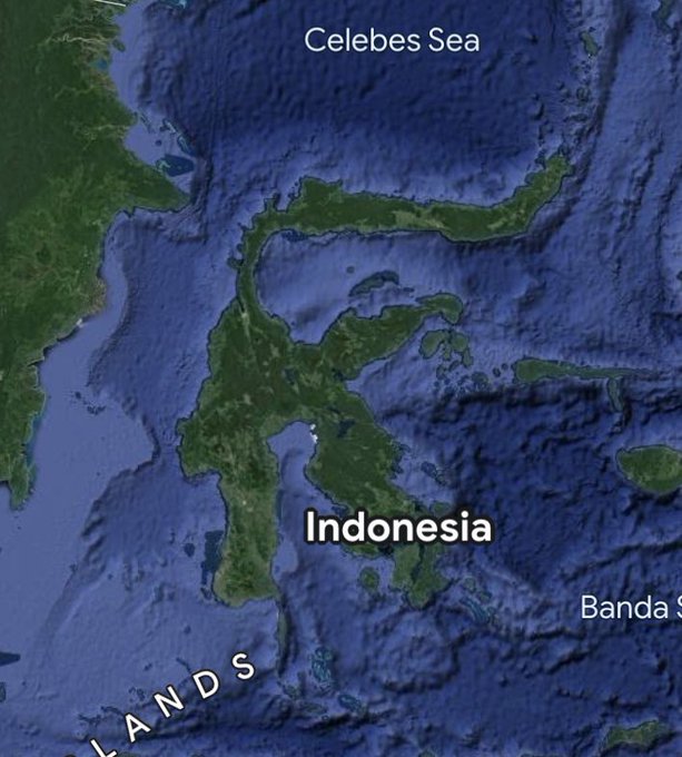
. From Turkey to the Bering Strait to Sulawesi, it took me 2.5 months of constant drawing. Went through a lot of pencils...✍This was the greatest odyssey of the map yet, with profoundly diverse landscapes & animals (172 in total).🐼
15
91
396
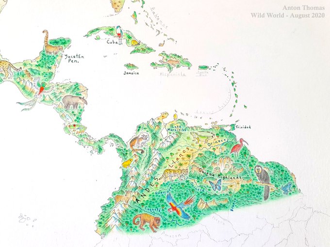
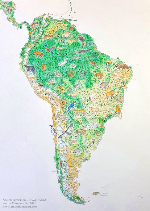
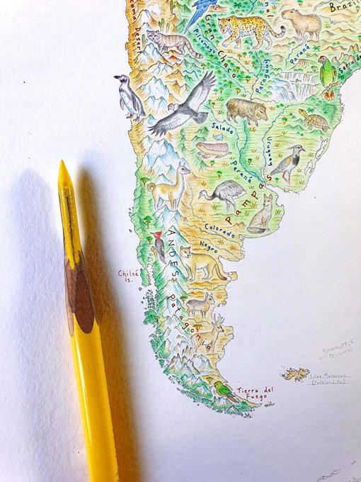
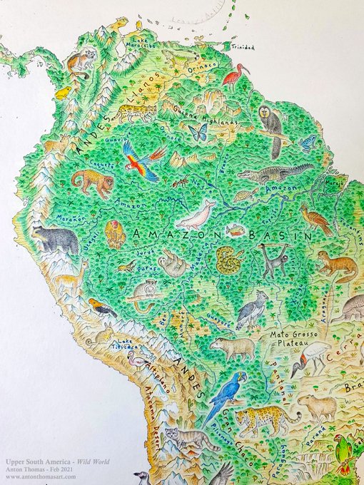
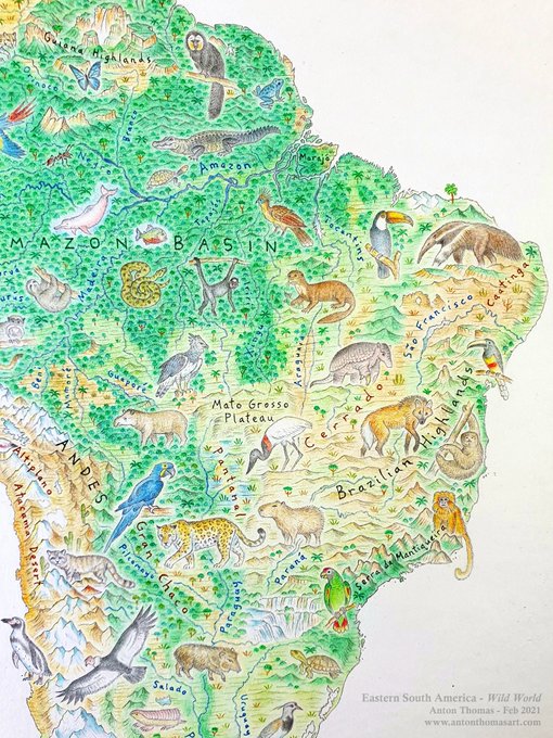
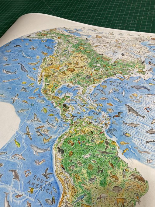
South America complete, from my map Wild World. What an incredible challenge drawing this awe-inspiring continent.
Sorry there've been no Twitter updates on this for ages, I was on other projects for months. But this is all I'll be doing for the forseeable future.
#WildWorldMap
7
61
389
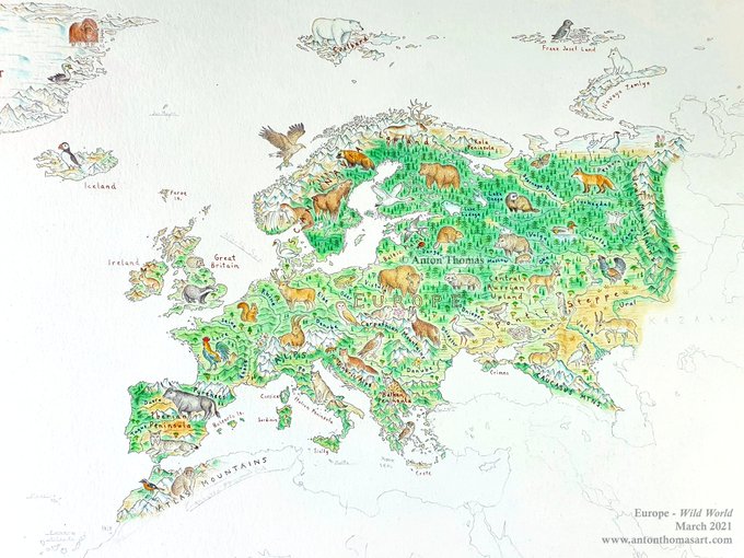
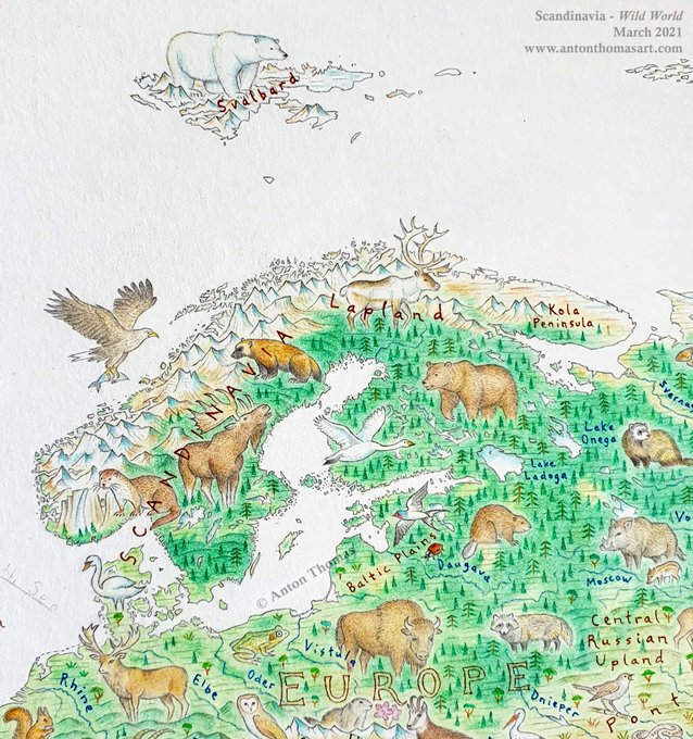
Europe complete, from my
#WildWorldMap
. Another continent finished! ✍
Keep in mind there is no ocean yet - I'll draw it at the end. Sea creatures and birds (e.g. the sea eagle off Norway) will be numerous - very helpful when landmasses don't fit animals easily.
Next, Africa.
8
37
261
🐳🌀🌊🌊🌴🌴🌊🌊🌴🌊🌊⛴
🌊🌊🌊🐊☀️☀️🌊🌊🌴⛰🌊🌊
🌊🌊☀️🦂🔥🔥🐍🐊☀️⛰🌴🌊
🌊☀️🦂🔥🔥🐪🐪🔥☀️🌴⛰🏄♀️
🦈☀️☀️☀️🔥🌅🔥🕷🦎🐂⛰🏘
🌊🐍🌾🌾🚂☀️☀️☀️🐍🚜🌳⛰
🌊🏘🌳🌳☀️🌊🌊🏘🍇🍏⛰🏘
🌊🌳⛰🐧🌊🌊🐋🌊🐨🍺🇦🇺⛰
🌊🌊🌊🌊🌊🌊🌊🌊🌊🏘🏈🌊
🛥🌊🌊🌊🌊🐳🌊🌊🌊🌊🌊🐋
🌊🐳🌊🌊🌊🌊🌊🐟🌊🌊⛰🌊
5
38
201
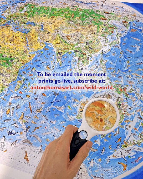
The first ever full print of my
#WildWorldMap
, heading with me to NZ for
#Geocart2022
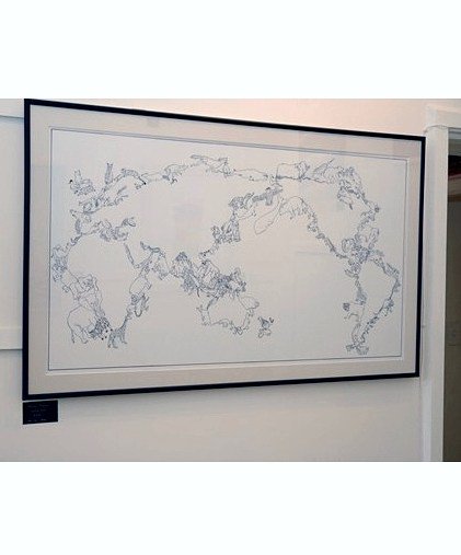
. After two years of intense work, the map has over 1,000 animals drawn across it. I am overwhelmed with emotion seeing the result of those thousands of hours, and excited to bring it home to NZ.
6
17
192
Hard to believe that after almost 3 years, Wild World approaches completion. Just 3 regions to complete. An emotional final day is coming up…
#WildWorldMap

4
7
163
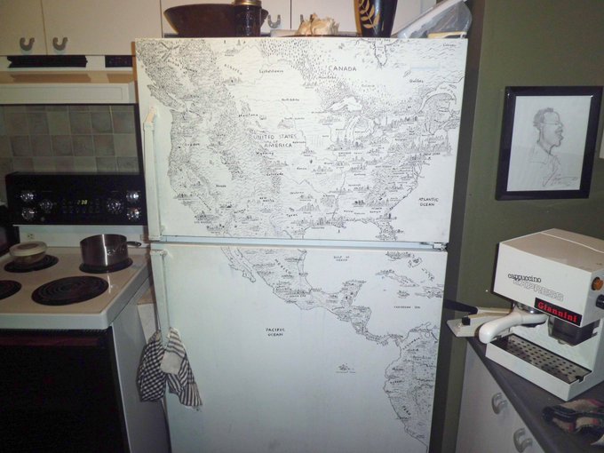
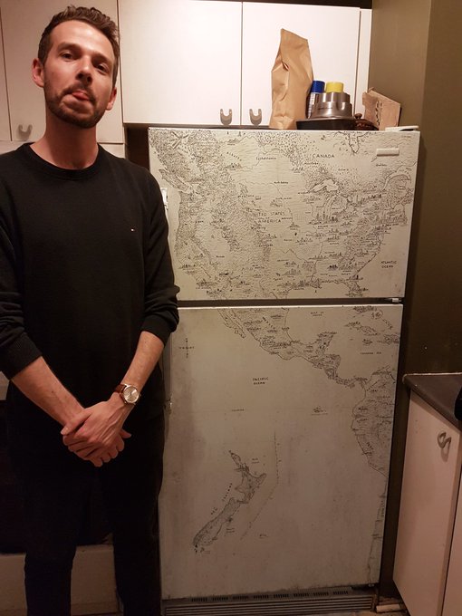
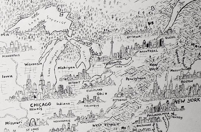
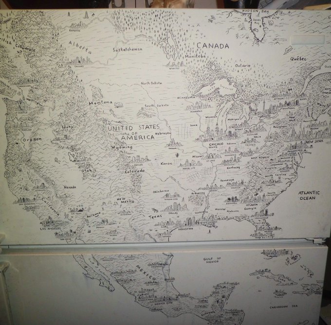
This month is the 10-yr anniversary of a certain fridge map. I was 22, a cook/busker, living in Montréal while backpacking the continent. I chose to express my awe for N.American geography via a fridge✍️ I never would’ve guessed this fridge would alter the direction of my life…
2
6
145
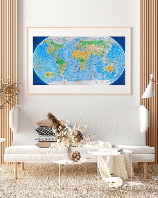
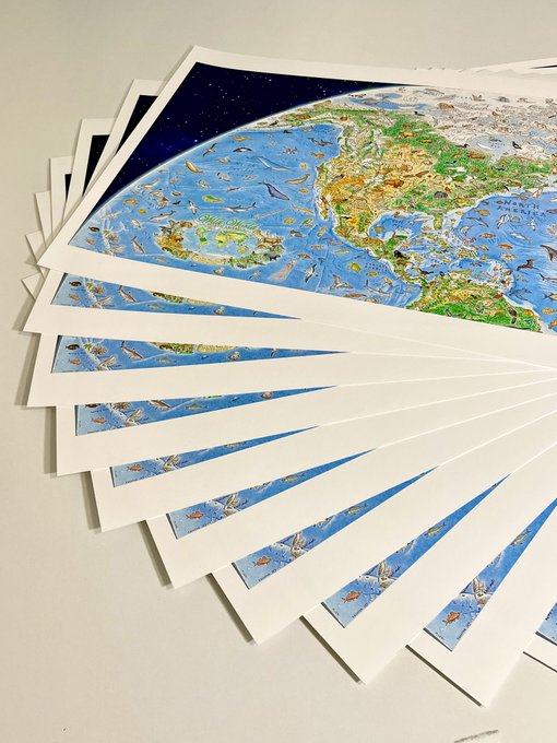
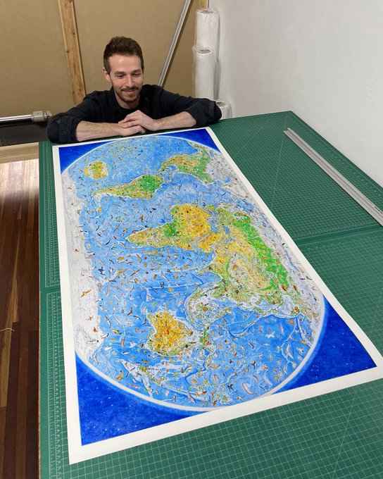
What a moment… after 3 years of relentless work, prints of my
#WildWorldMap
are now available!
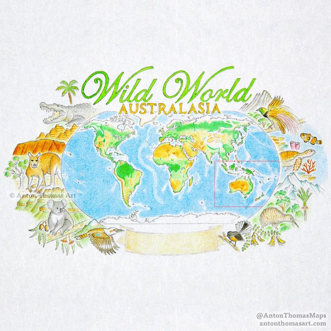
The fulfilment of a childhood dream (see image 4 😅🦜), & a proud moment in my life. I’m so excited to share this labour of love with you all.
8
18
132
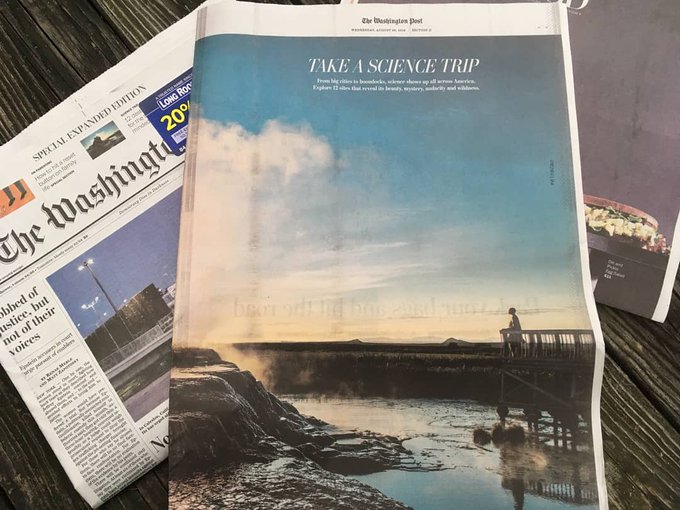
Very excited to share this- I provided the illustrations & maps for this piece from the
@washingtonpost
. All colour pencil. It involved drawing an eclectic range of content, from a particle collider to the Scopes trial! Full 48 map at end of the sequence.
5
21
125
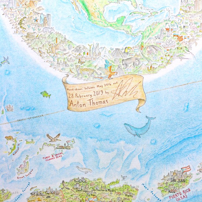
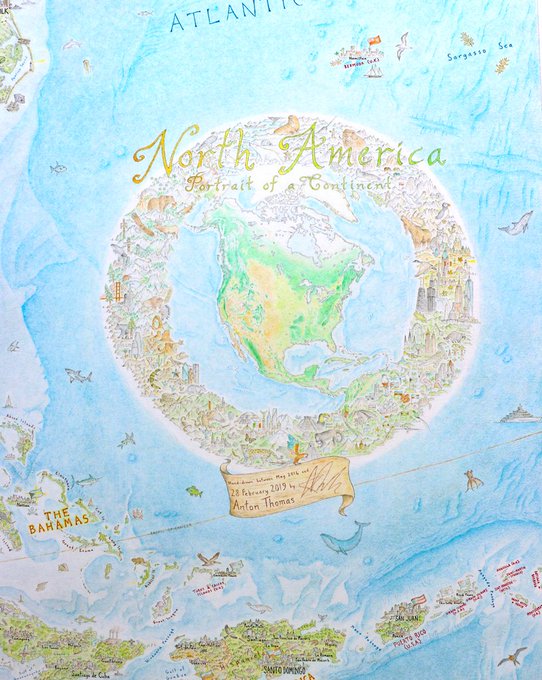
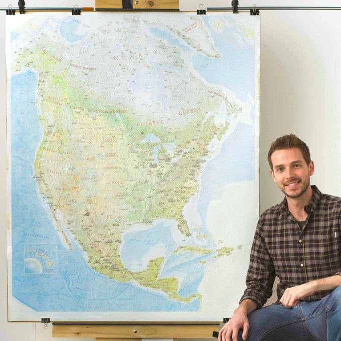
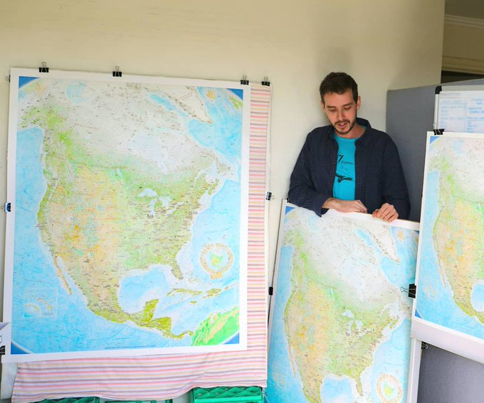
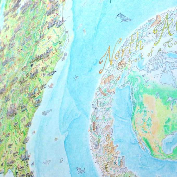
136 hours later, the cartouche for the (renamed) North America: Portrait of a Continent
#map
. The scarlet macaw at the bottom will be clutching a scroll where I'll sign off and date. Final sessions now & will sign off for good later this month. Yes, that's February 2019.
7
21
123
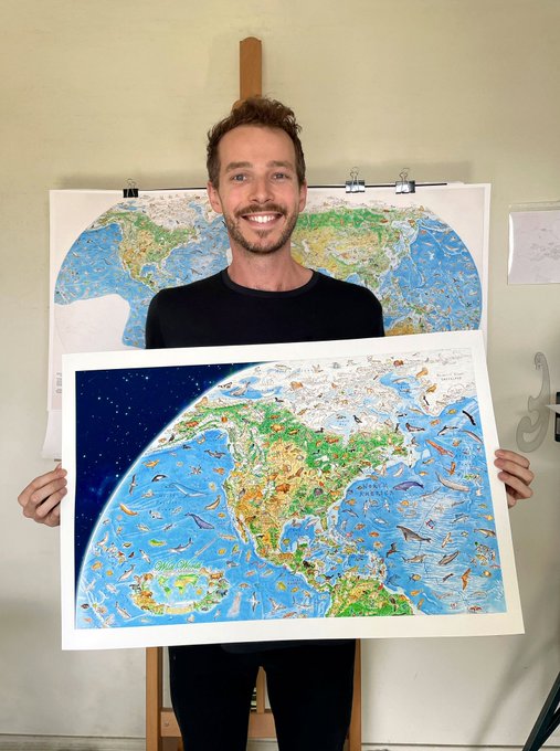
For over a year, I’ve been drawing my world map of nature. The first segment is finally here, which I’ve turned into a standalone print (with its own cartouche)! I’m super thrilled with the Earth curve and constellations - an effect I’ve dreamed of in prior maps...
3
20
105
(1/2) Setting the map in space with a star effect in the corners. It's easy to improvise starry skies, but with real constellations you draw from the celestial gallery we've been gazing at since our earliest ancestors. Take any opportunity to tap into the innate. Shade your...
4
15
89
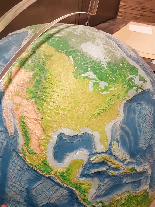
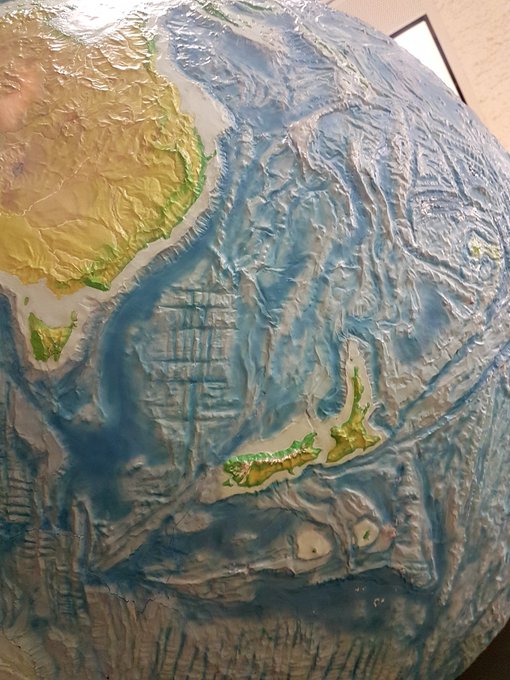
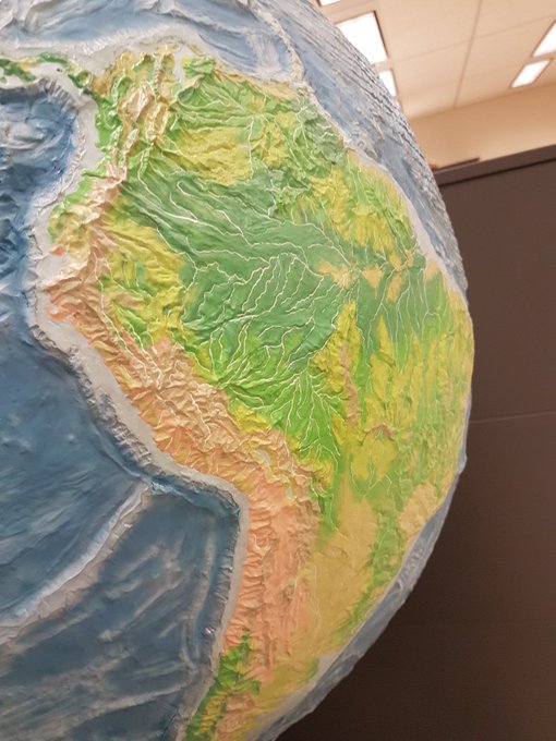
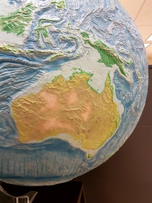
One of the highlights of a visit to the Library of Congress yesterday - the Hammond Terrasphere. A spectacular relief globe (18-inch diameter) that was hand-crafted by Ernst Hoffman, once head of cartographic design at Hammond. It is very beautiful.
1
21
79
Very excited to be taking a world tour in the next
#nacis2021
session - Big Ideas. The talk is about the world map I’ve been drawing for a year - Wild World. I can’t wait to share.
Here’s a sample of the latest from the map... the ocean. 🌊
2
13
89
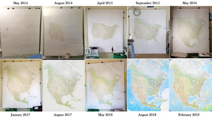
Threw this together for a recent talk, showing the progress of the North America map over the years. Thanks for being such a pure friend for so long, Map. I do miss drawing you sometimes.
1
6
85
Always an exciting moment, final proof and prints rolling! 🥳
Wild World: North America is my favourite print I’ve ever released.
1
6
85
Animal coastline world map, 2006.The Montréal fridge laid the ground for the North American Continent, but it wasn't my first map. Drawing them since I was a kid,+this map I drew at 16 is one.Region-specific wildlife banded together to show Earth's coastline with negative space.
3
26
83
I absolutely LOVE drawing a cartouche. It’s one of my favourite things. For the release of this region of my
#WildWorldMap
, I drew one in 3 manic days (banner yet to be filled). ✍️ It’ll be placed in the SW of the map.
As a Kiwi in Aus, this one is especially close to my heart.
2
11
84
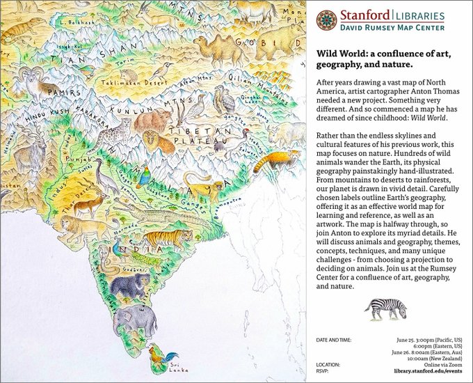
I'll be presenting with the
@rumseymapcenter
this Friday, a deep dive into my
#WildWorldMap
- its details, techniques and concepts. This is my first talk focused on the map, and I'm very excited to unpack it. All are welcome to join! RSVP here:
3
21
84
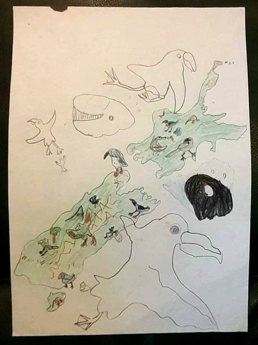
My mum found this the other day in an old box in storage. A map of New Zealand and its birdlife that I drew in 1995 or 6, age 5 or 6. Nothing much has changed it seems! Also I don't trust that whale at all.
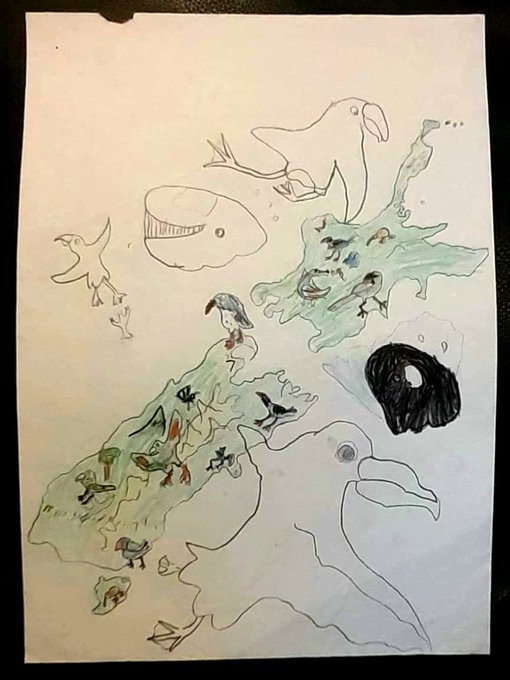
9
2
80
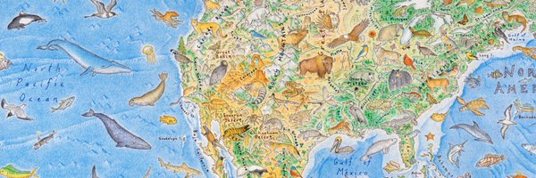
⛰☔⛰⛰🐻🌲🛶🌊🐟🌊🏒🍁⛰
🌲🌋🐐🌲⛰⛺🌾🌲🌊🌳🐿⛰⚾️
⚘⛰🥔🦅♨️🐺🌾🐄🌊🚘🎷🗽🌊
🌲⛰🦌⛰🐻⛰🚜🌽🏣🏀⛰🚕🌊
🌁🍇⛷⛰🧗♂️⛰🌻🌽🎩🏇⛰🇺🇸🌊
🏄♀️📱⛰🎲🦂⛰🌩🌳🎸⛰🎻⚓🌊
🌊🎭🎥🌵🏜🛸🐍⛰🏈⛰🐢🌊🌊
🌊🌊🇲🇽🇲🇽☀️🌵⭐🐊🎺🥜🍑🌊🐳
🌊🌊🇲🇽🌊🇲🇽🇲🇽🐂🌊🌊🌊🌴🚀🌊
🐳🌊🌊🇲🇽🌊🇲🇽🇲🇽🌊🐋🌊🌊🌴🌊
3
11
76
A final look at the
#WildWorldMap
before I draw constellations and cosmos in the corners. 🌌 The gap in the Southeast Pacific is for a likely cartouche.
Hard to believe it’s so close to completion after 3 years of hand-drawing and 1,500 different animals… 🐋

2
16
75
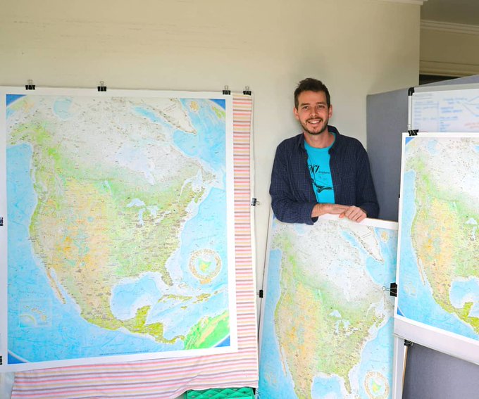
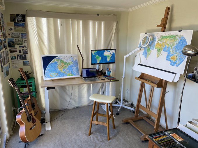
A timelapse from last year. It answers a few basic questions I often get asked about how I work. So the map is always upright, I stand up to draw. I work behind that magnifying lamp a lot. It allows me to transcend the limits of my eyes - and hopefully save them for the long run!
2
10
71
This file is really intense (all 433 million pixels of it). A lot of fun to work on as I gear up towards printing.
PS - I have significantly toned down the overwhelming greens and yellows of Central America since making this video.
0
7
72
This beautiful alpine ridge in Kahurangi National Park (near my hometown Nelson NZ) is a dead ringer for Sulawesi.
2
8
66
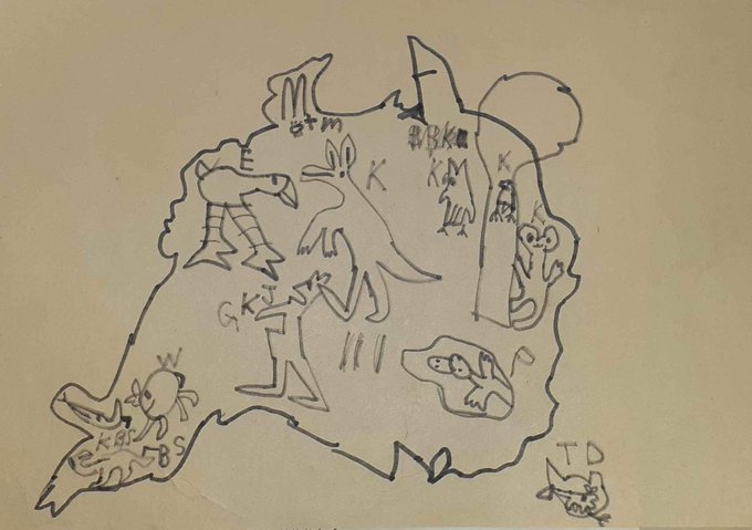
Stumbled upon a map I drew in early childhood - Australia and it’s wildlife. Then, and now!
1
3
68
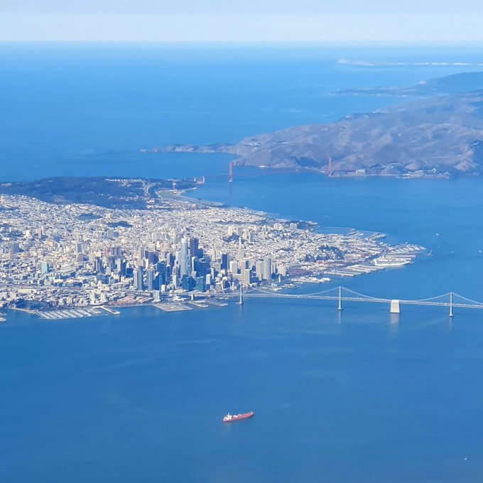
Flying out of San Francisco the other day. 🌁 Not many cities have a geography quite this epic. Window seats forever.
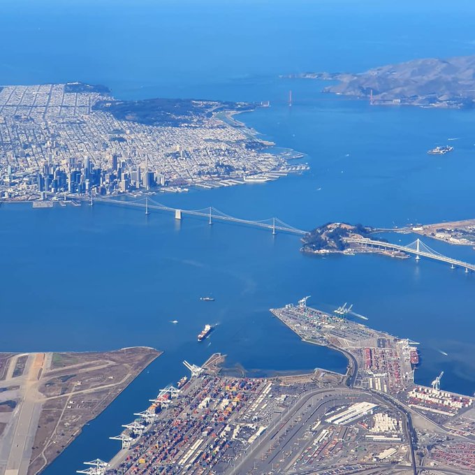
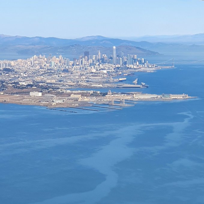
0
5
68
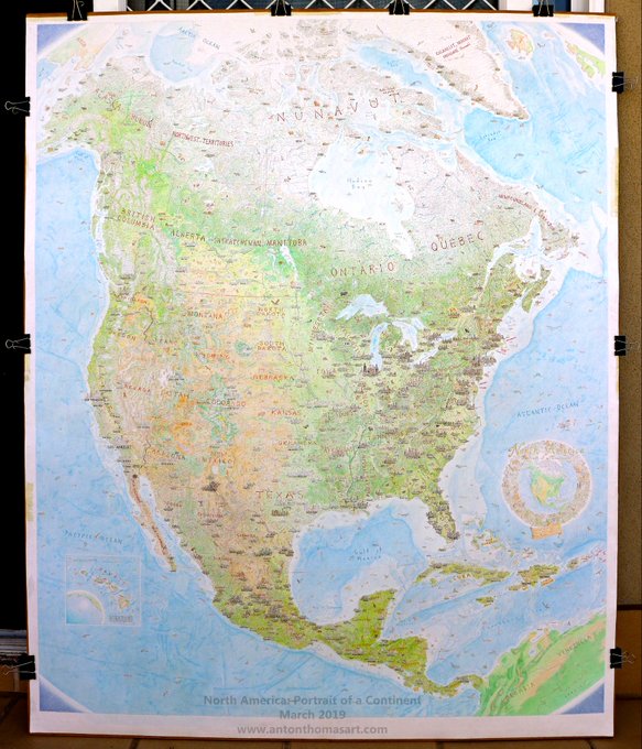
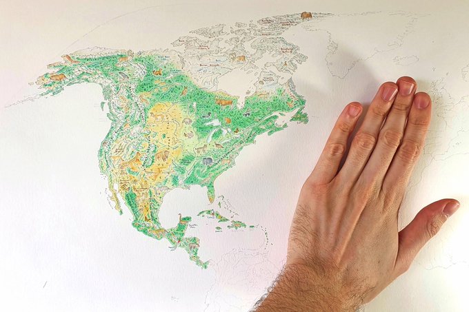
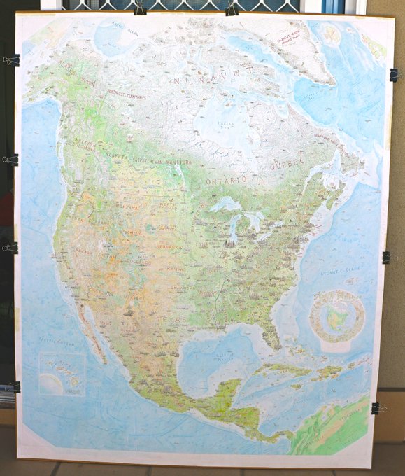
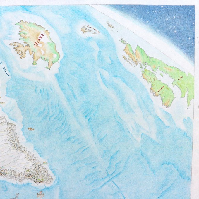
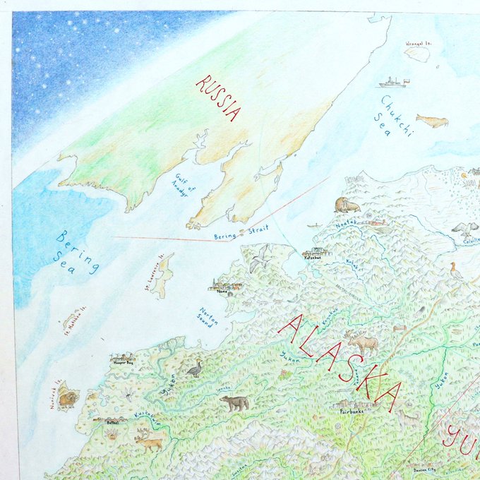
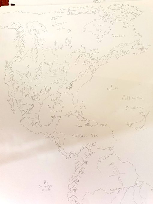
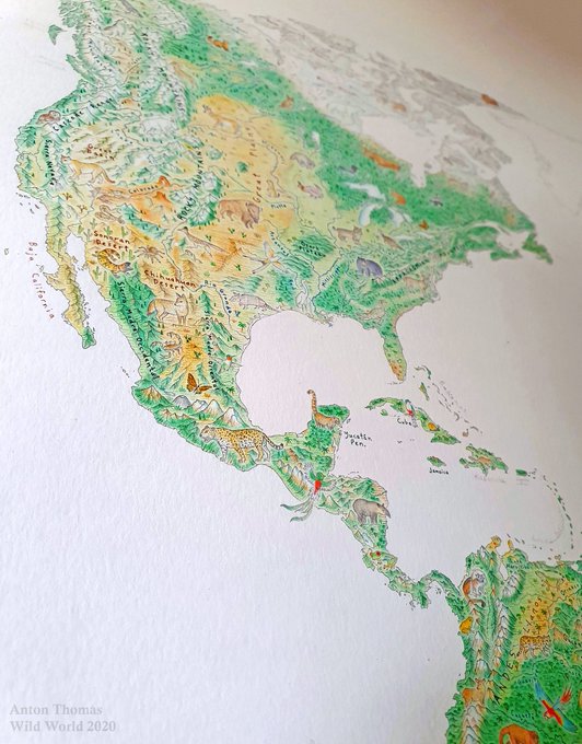
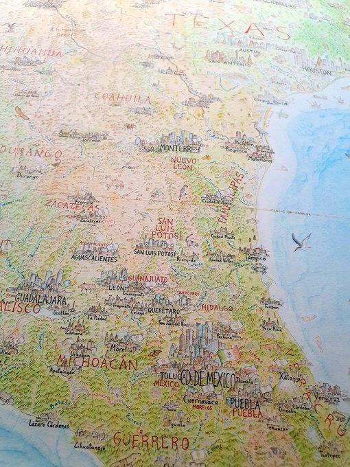
The North American Continent.Very close to 100% done.All that's left is the SE corner (with low-res Venezuela/Colombia, same style as Russia/Iceland/UK in northern corners),curves of corners to be shaded & with atmosphere effect,& title/key cartouche design in mid-Atlantic ocean.
3
2
67
And I’ll just add – prints will be available very soon, going on pre-order later this month! You can sign up to be notified here 😊:
1
3
68
If you pick up today's edition of the
@washingtonpost
you'll find the science trip article with my maps and illustrations in print. Really super excited to see them in there. Unfortunately I can't pick it up here in Melbourne, but North Americans - enjoy!
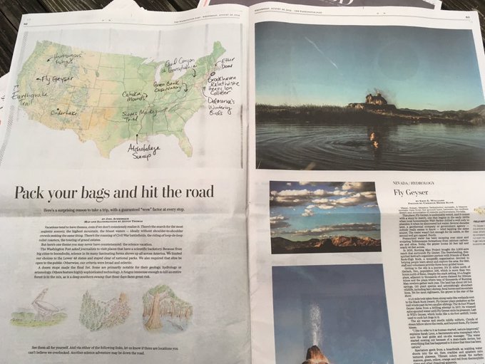
2
7
66
I have a new blog up: It is the best summary I've written on the origins of the North America map, its current status, and more. It's filled with colourful new pictures showing plenty of detail.
#Cartography
#mapart
7
14
64
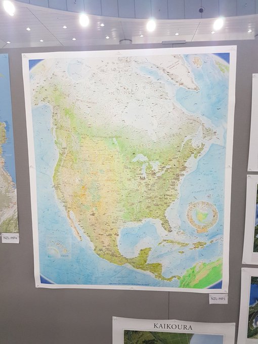
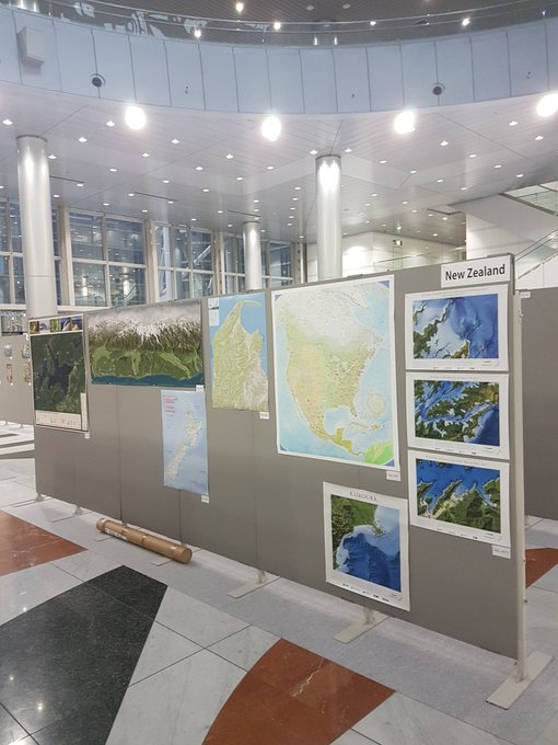
So happy seeing my North America map in the phenomenal
#icc2019tokyo
exhibition, in print as a finished map for the first time after 4.5 years of pencil work. Check it out when you're there! This print is just 60% the size of the original, but the detail comes through nicely.
5
2
65
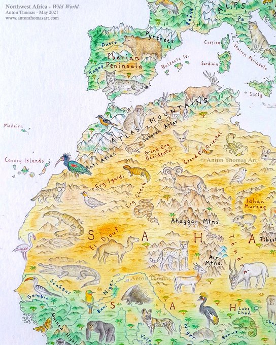
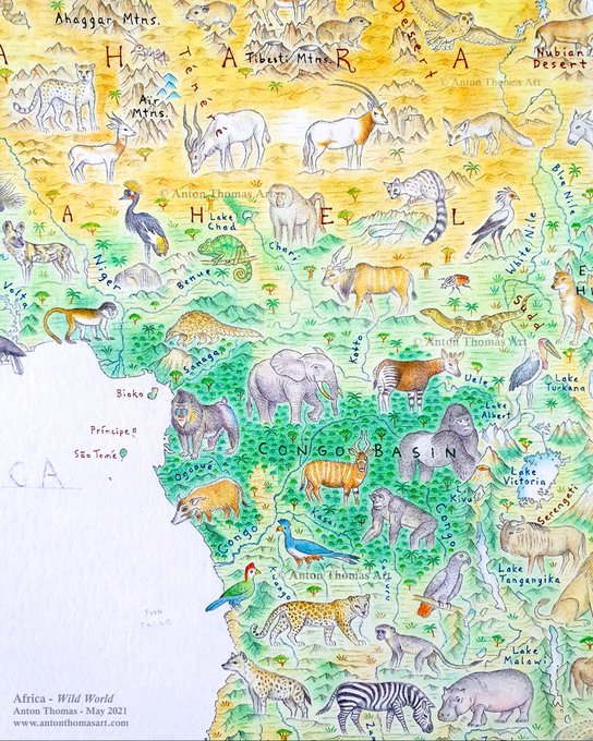
North Africa, from the
#WildWorldMap
. 🌍✍ I love drawing deserts, & the Sahara is the greatest of all. I like how charting rivers is replaced by determining where the great sand seas (ergs) stretch, & differentiating them from the otherworldly Saharan mountain ranges.
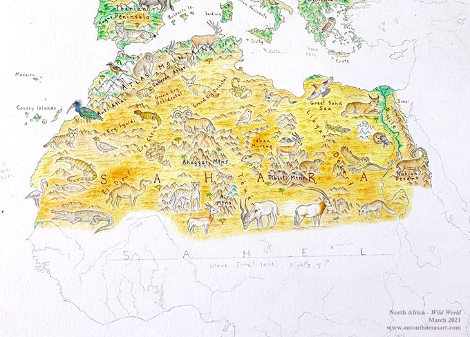
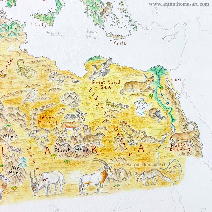
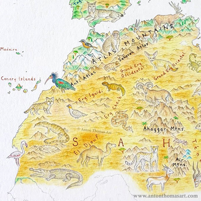
5
5
63
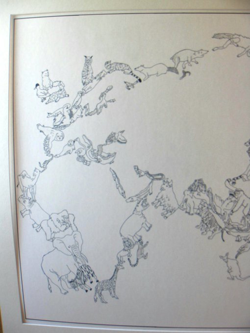
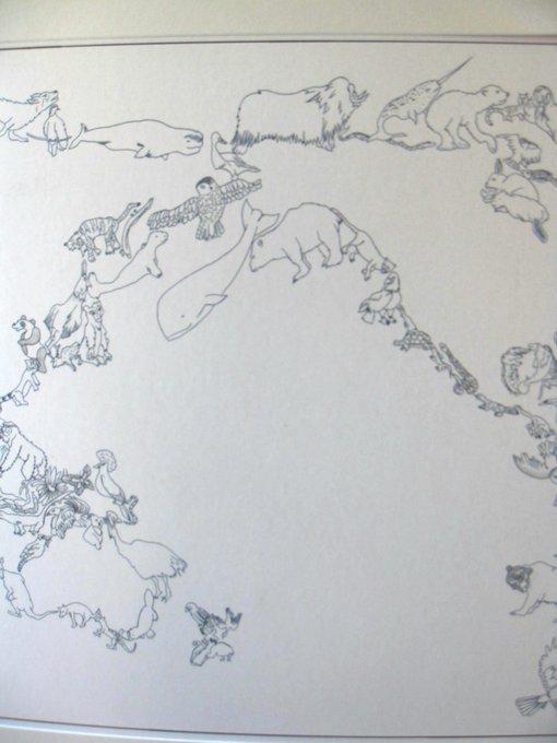
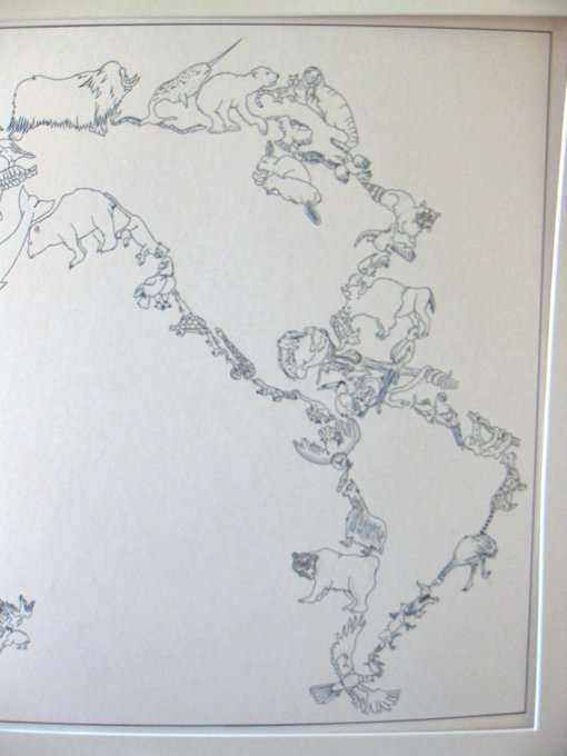
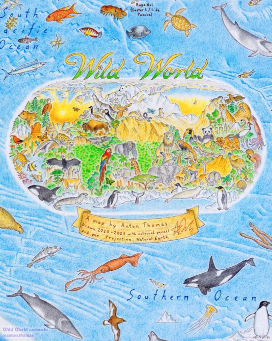
Through the land & animals, you will see the world. THIS is the cartouche for
#WildWorldMap
, the final step. I love drawing elaborate cartouches, & for such a monumental project it needed something special. A world map hidden amidst some of Earth’s most iconic fauna 🦍🏜️🦘
0
5
65
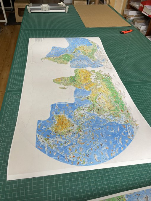
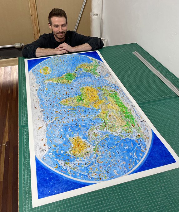
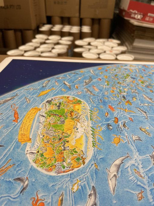
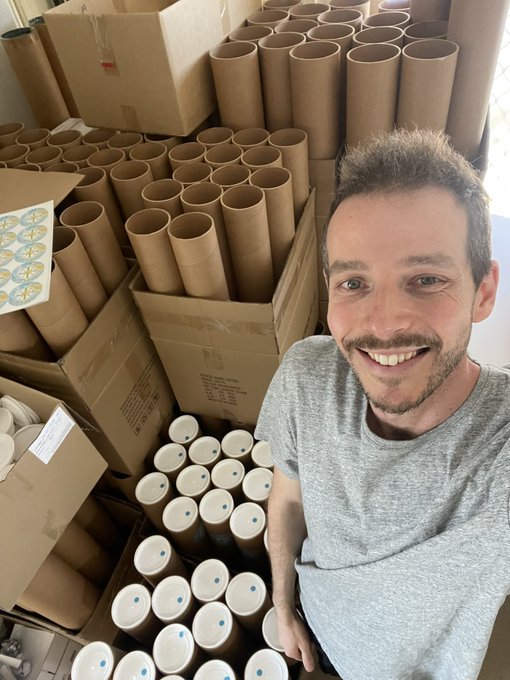
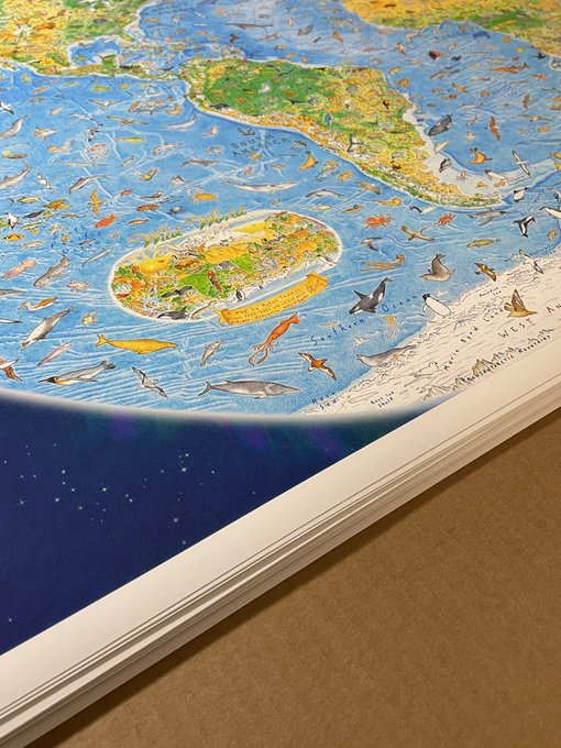
Didn't think my house could get any more dominated by this map, but... test printing!! Trying different sizes and stocks, very immersed in it all. The detail and quality of the giclee prints are mindblowing. Print close-up on image no. 2
3
4
61
Here are more pics, including the full map so far. I'm drawing Asia now (prepping the Tian Shan tonight)! The ocean is yet to be drawn too, which will transform the map🐬
If you'd like to be notified when prints are ready, you can subscribe here: 🌍🌏🌎✍
3
10
58
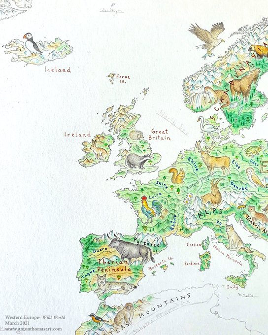
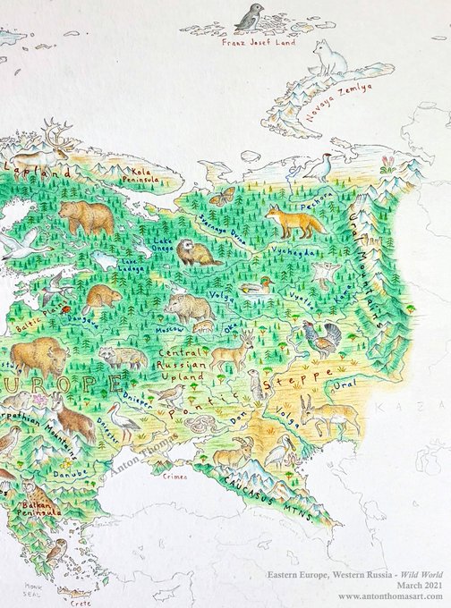
Working through the intricate geography of Europe on the
#WildWorldMap
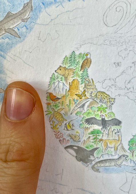
, having so much fun. Index finger to show the scale.
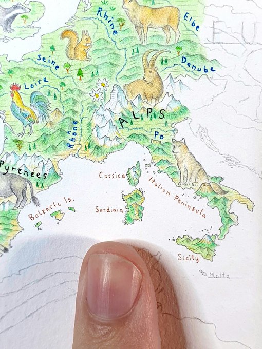
3
6
59
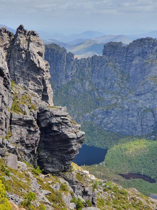
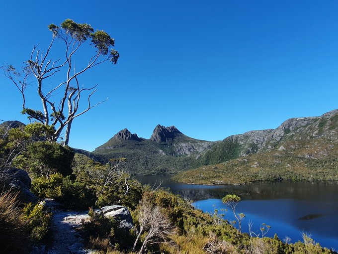
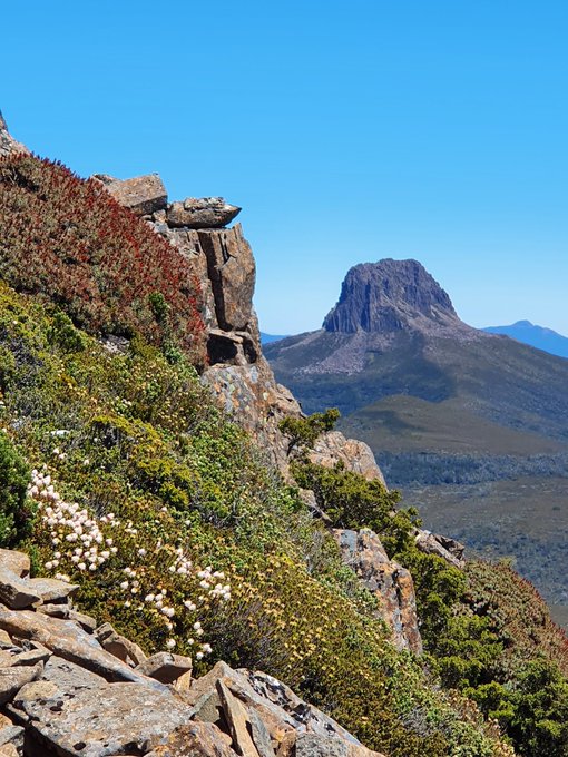
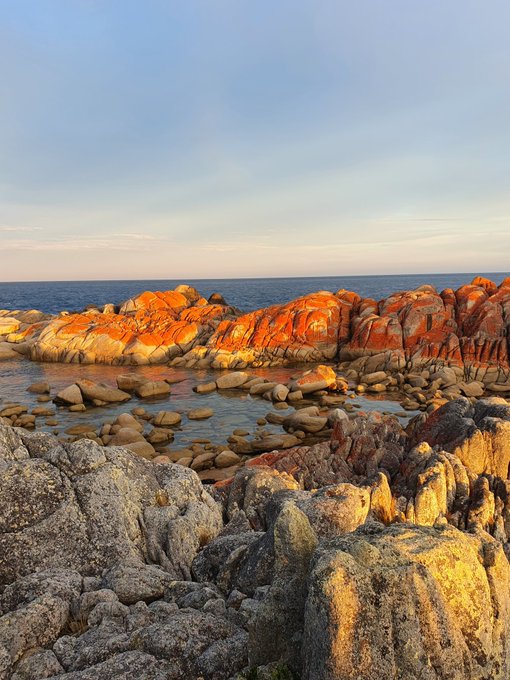
I'm currently in Tasmania for the first time, mostly off grid. This is one of the most spectacular, unique places I've been. So incredible. 2 more weeks of exploring + then a year of mapping awaits, so making the most of it. Tas is so beautiful it's hard to get my mind around it.
1
2
59
I've written up a new blog that goes on a tour of 12 places on the North America map. It looks at topics like Montana's triple divide peak, map waterfalls, raining fish in Honduras, and when to draw your volcanoes erupting.
3
13
59
An astonishing moment to see myself & my maps in The
@nytimes
. Apparently in the print newspaper today too!! It’s a wonderful piece & I’m so grateful to
@natashamfrost
for her beautiful storytelling about my cartographic journey. Wow! 🌍

3
6
56
📣📣📣 It’s happening!!!!!!! After 3 years of intensive research and drawing, prints of Wild World will go on pre-order next week. This has been a long time coming and I’m beyond excited. Pre-orders will ship by the end of September - many details to follow! ✈️🌎🌏🌍🎉
2
5
54
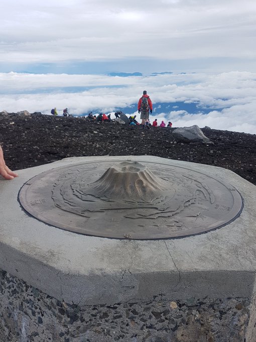
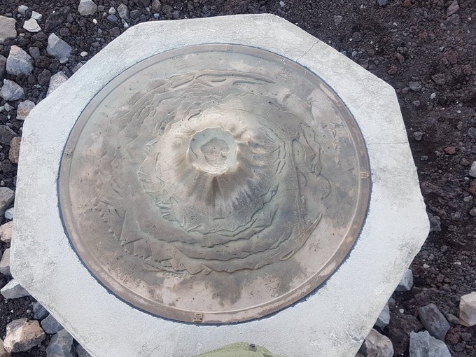
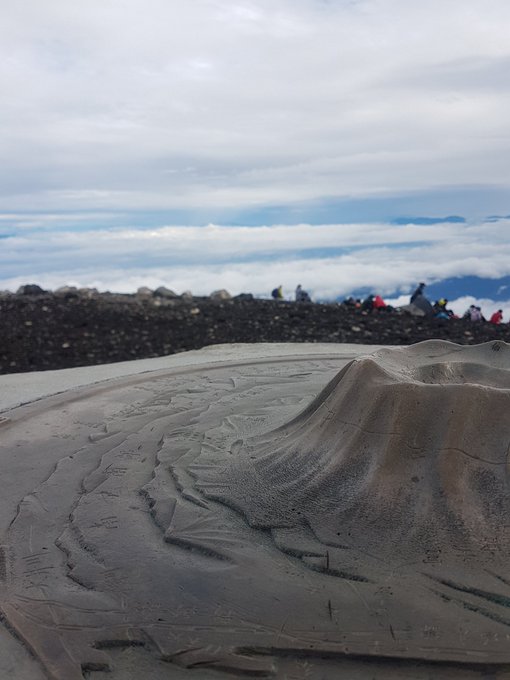
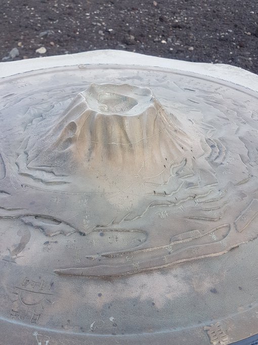
Found this lovely tactile map in an extremely dramatic location - the summit of Mt Fuji. Shows a kind of fisheye perspective, with all sorts of features around it, stretching as far as Tokyo Bay and the Izu Islands.
#mapsinthewild
#icc2019tokyo
2
10
53
Thanks to
@MollyOHalloran_
and
@sarahbellmaps
for the wonderful hand-drawing session yesterday to finish up
#nacis2018
! We all learned so much.These are my attempts at watercolour & shaded relief.. looking fwd to doing a lot more in the future.Thanks for the tips and inspiration!
2
3
53
Apologies for being so quiet here recently. I took a hiatus from social media, but have been mapping a lot. Wild World is going well, unfolding in exciting, unexpected ways. I’m currently immersed in the Pacific, about to give the Americas a makeover (where the map began in ‘20).
1
0
53
Happy New Year everyone! 🌏🌎🌍 Here's a scribble from yesterday, a map from memory with biro pen. After a very tough year for the world, I'm hopeful for 2021. Will need plenty of patience, but things are turning around. May your new year be happy, creative and inspiring!
2
2
52
Today, I shipped a selection of maps to Antarctica (actually to Tas, then it goes on a supply boat south). I’m honoured and excited by this, and pretty thrilled to have a map in every continent now. Not sure if I’ll ever make it down there, but nice to know my maps will.
5
0
53
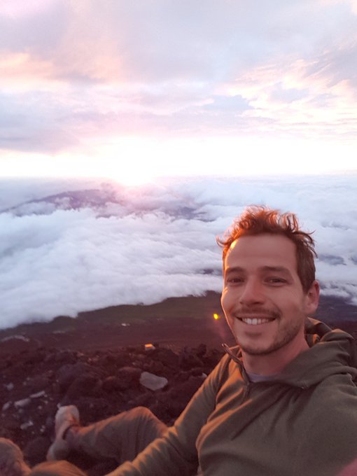
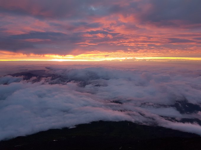
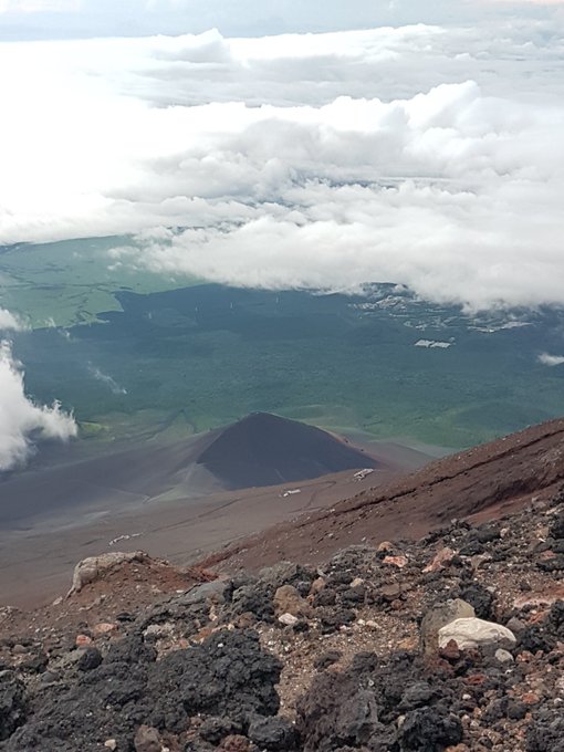
Watching the sun rise from the summit of Mt Fuji was an incredible finisher to a wonderful week and a half in Japan. I'll never forget it.
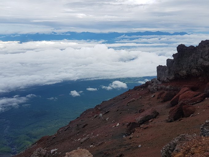
2
1
49
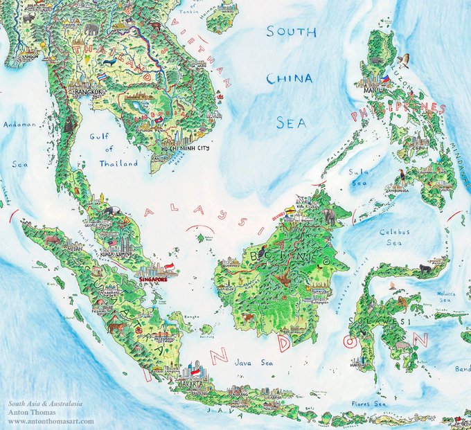
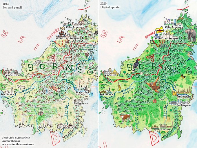
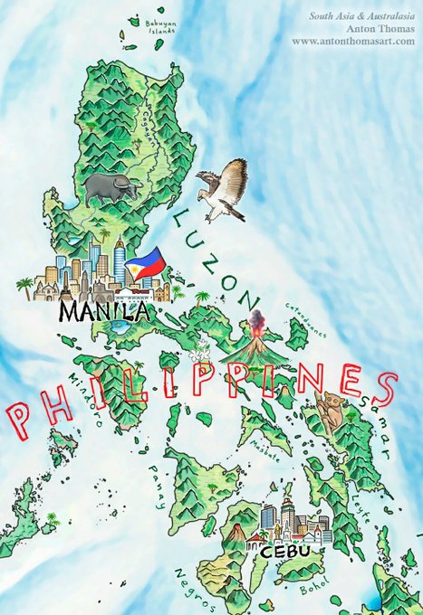
A few months ago, I hopped on Photoshop to upgrade my 1st big map South Asia & Australasia. I drew it in 2013 while still very inexperienced. I thought the changes would be minor, but they escalated... a lot!! Here's a new blog all about it. 1/4
2
2
48
I'll be speaking today about my illustrated map of North America, finally complete after 4.5 years of hand-drawing. In the 10:50-12:10 session, Saturn room of the Miraikan building,
#icc2019tokyo
3
2
47
It has been a tough, often lonely year for so many of us, & I can't begin to say how grateful I am to
#NACIS2020
for putting together such a phenomenal conference, complete with amazing social events. Blown away.
@NACIS
is always one of the big highlights of my year, and...
1
2
47
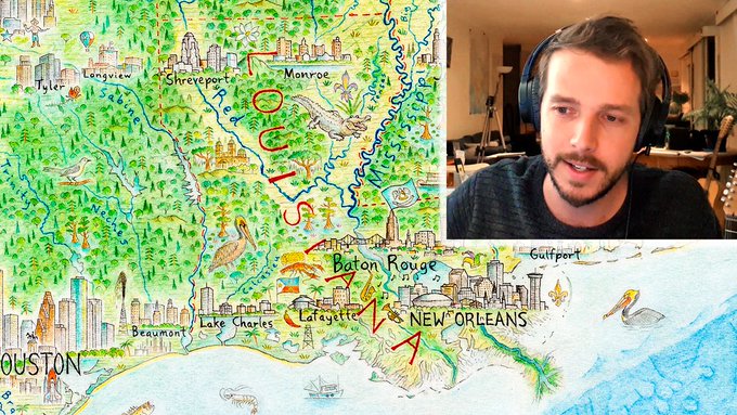
So excited to share this - I made a video about the N.A. map. It's a tour down the Mississippi, discussing much along the way. Also, I dusted off the guitar + harmonica, composing the music to try & match the feel of the journey. Recommend watching in HD🌎
5
8
47
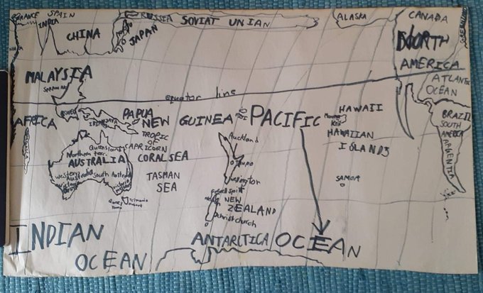
Another early childhood map my mum unearthed. There's a lot going on here.. While I'm a 90s kid, I would've used an 80s globe or atlas to reference ("Soviat Unian"). Also... here's a handy labelling trick. The word Pacific is too far from the word Ocean? Just draw a giant arrow!
1
0
46
Few things I love drawing more than a cartouche. Here’s the latest, for a new print release next month. It took a whirlwind 35 hours to complete. ✍️
Next, to reveal North America itself! Utterly transformed since the early days of the
#WildWorldMap
2
4
47
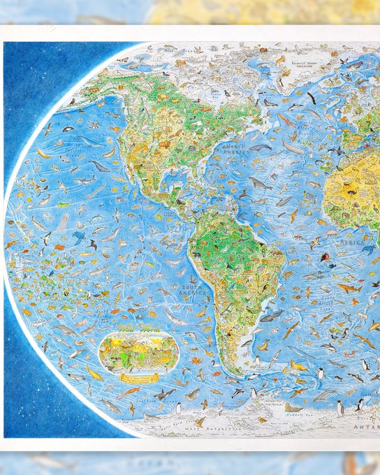
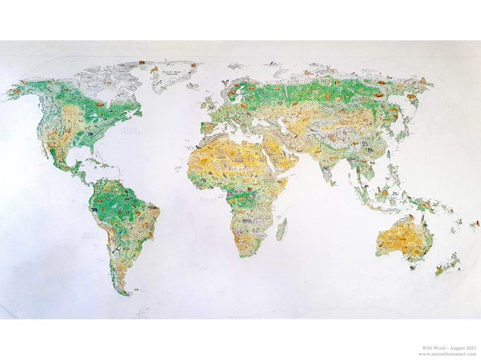
The last photos of Wild World before I began drawing ocean. All continents drawn except Antarctica, after approx. 10 months of full-time drawing.
The ocean is well underway - blank spaces are already beginning to fill with rich blue bathymetry and marine life. 🦑
#WildWorldMap
0
3
44
Sometimes you take a hiatus from the canvas to focus on business & career.Takes time & must be done. But I dream of mapping every day,& I'm finally able to return to it for the 1st time in a year. Doodling some ideas today - I can't describe how fun it is or how badly I missed it
1
1
45
@amazingmap
This is an extremely misleading map! You have the broadest possible definition of Tokyo (the entire Kanto region), which includes a lot of rural and even wilderness areas... against a narrow definition of London. Sure, Tokyo is a bigger city but this is ridiculously misleading.
2
2
42
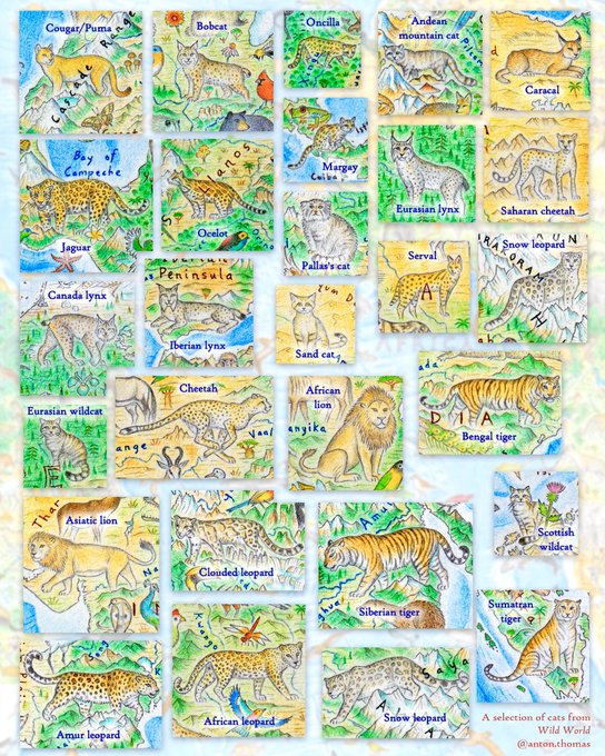
(Some of the) cats of Wild World.I’m always blown away how diverse the felids are. Which is your favourite? For me it’s the snow leopard, I visited Ladakh India in ‘18 and while I didn’t see one, they were spoken about with such reverence & I knew they were up there in the mtns…
1
2
41
Well… this is a truly amazing moment. To see my maps & I profiled in The New York Times. Feeling blessed, and thrilled with this wonderful article.

6
7
41
My talk at the
@rumseymapcenter
is now up! A world tour of wildlife and natural geography, via my latest map Wild World. 🌍✍ So thrilled to share this.
The talk itself runs until 40:30, the rest is Q&A.
1
11
39
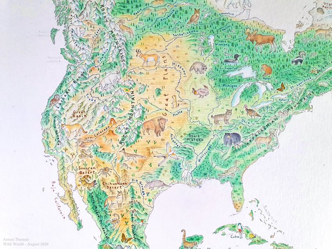
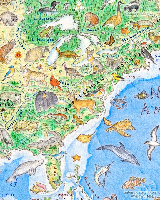
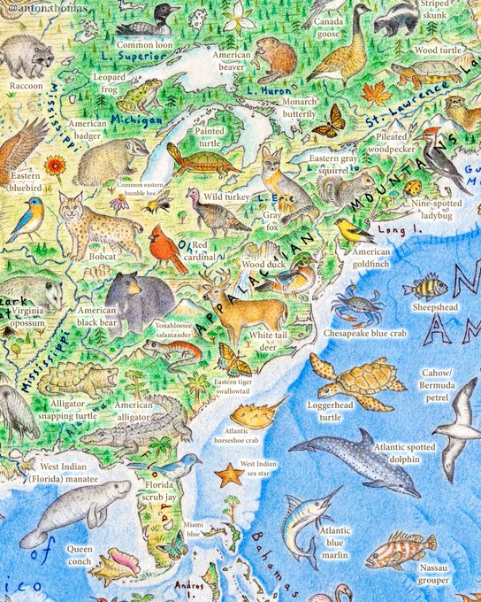
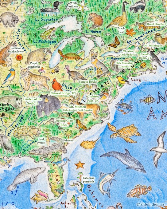
As I find with mapping generally, deciding what NOT to include is half the job. Trying to balance & cover a cross-section of eastern geography & biodiversity at this scale… it was tough. So, from Appalachian salamanders to alligator snappers, here’s my attempt. ✍️
#WildWorldMap
2
5
40
The North America map has a practically endless amount of detail, and I'm working on several ways to tell its stories. In that spirit, I selected 12 interesting places and cases all across the continent to discuss in this new blog. It was a lot of fun. 🌎
0
8
40
Pumped for
#nacis2019
, & to present in the Artistic Cartography session.The intense challenge of determining how to release this giant art map in print (which'll be in full swing around NACIS time) will be covered. & a dive into new map content, of course!
2
0
40
And here it is with the rest of the piece so far. The projection is Natural Earth centered on 11E.
I'm already onto Europe now. For anyone interested, I post updates and in-progress pics most regularly on Instagram - my handle is anton.thomas
2
5
39
Sun is starting to rise here in Melbourne 🌞 The time zone struggle has been 1000% worth it, absolutely loving all the talks at
#nacis2021
I miss you all!!
1
2
40
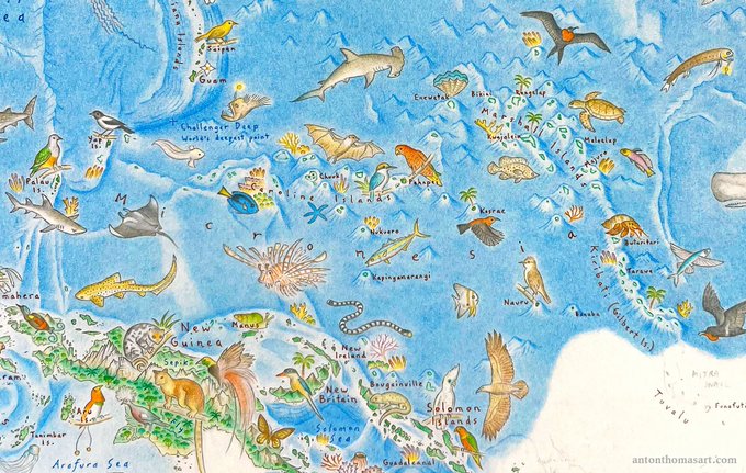
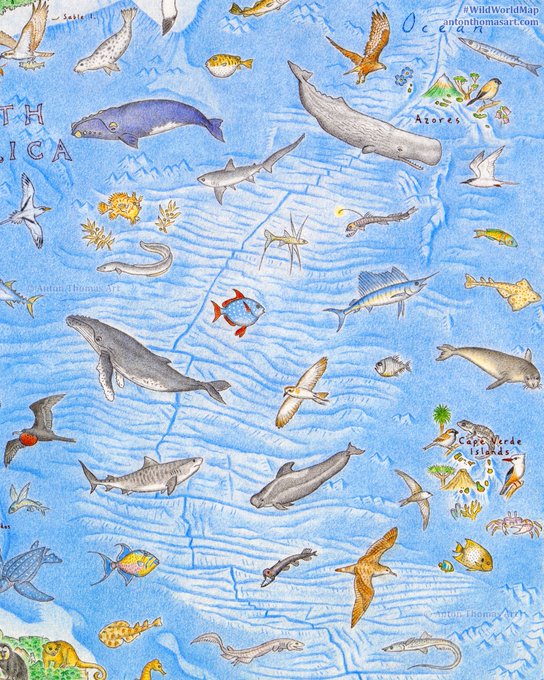
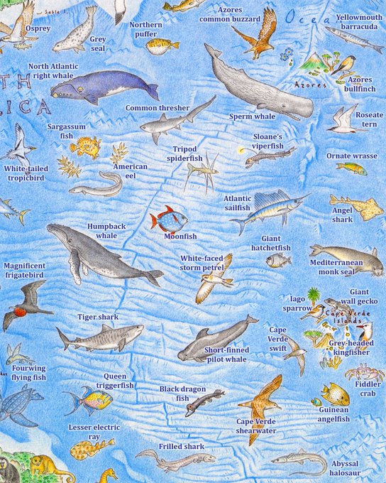
I love drawing bathymetry, and few undersea features are more exciting than the Mid-Atlantic Ridge. Here’s my take on the northern half (img 3 has species names).
Also, I tried something new in the Azores & Cape Verde, with their highest peaks prominently drawn.
#WildWorldMap

0
3
37
A belated happy new year everyone. May your 2023 be filled with good health, inspiration, and nature 🌿🎨🌏
May surprise no-one that my top goal of the year is to finish and launch the
#WildWorldMap
0
0
37
I intend to finish drawing Wild World in 2023. It was never my desire to follow NA: Portrait of a Continent with another multi-year behemoth of a map. Projects of this scale come with all kinds of extreme costs and sacrifices, as much as I love them…
1
0
38
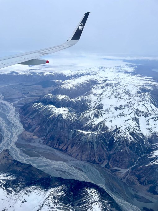
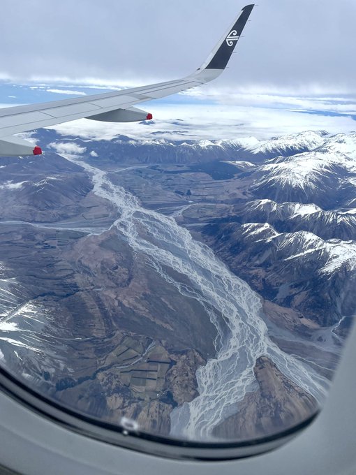
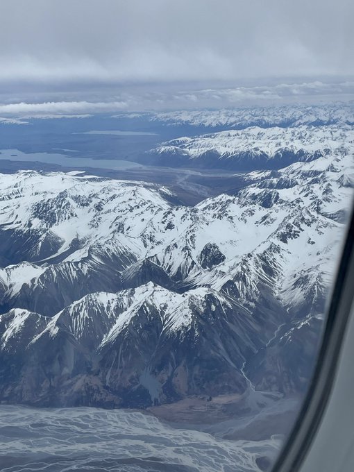
Magnificent views over braided rivers and the Southern Alps the other day, en route to Christchurch then Welly for
#geocart2022
. So wonderful to be home 💚🏔 Window seats forever
1
2
36
My first blog post in 2 years is up, a long-overdue deep dive into the
#WildWorldMap
I’ve been drawing for… 2+ years. This explores its origins, themes, animals, and much more:

2
7
37
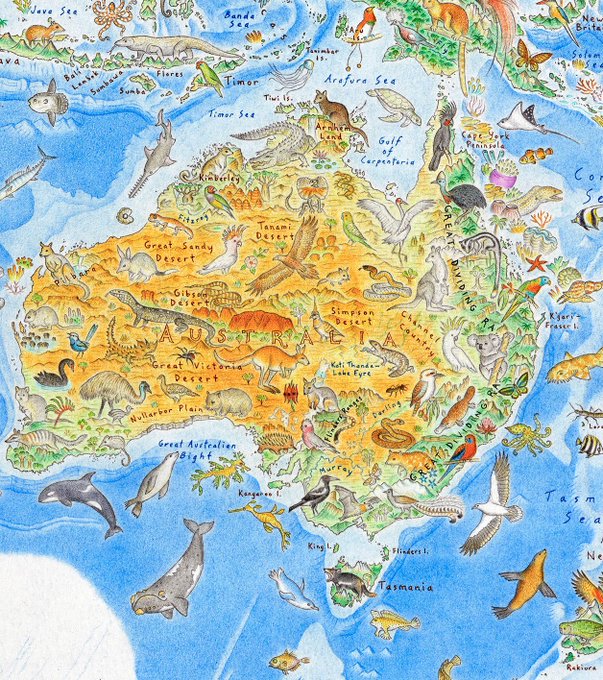
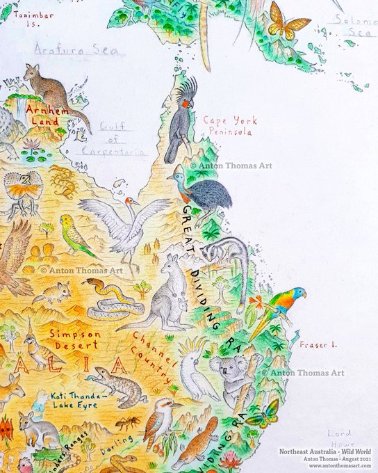
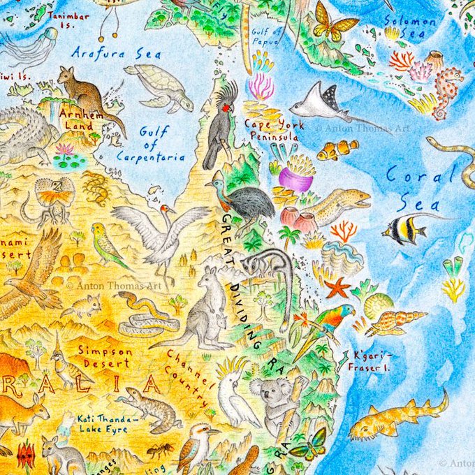
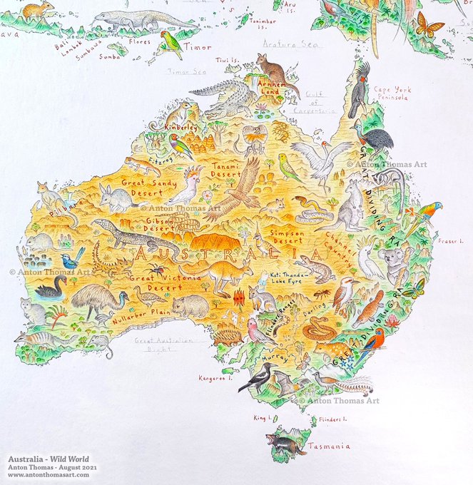
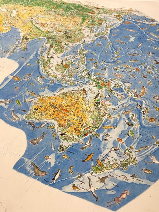
Australia from my
#WildWorldMap
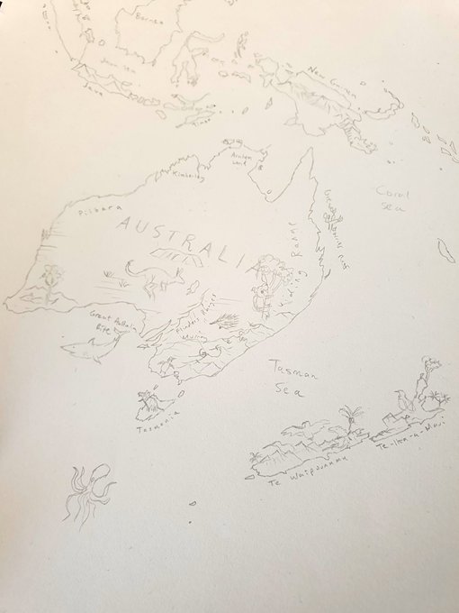
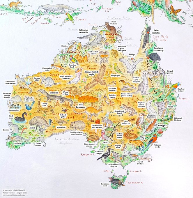
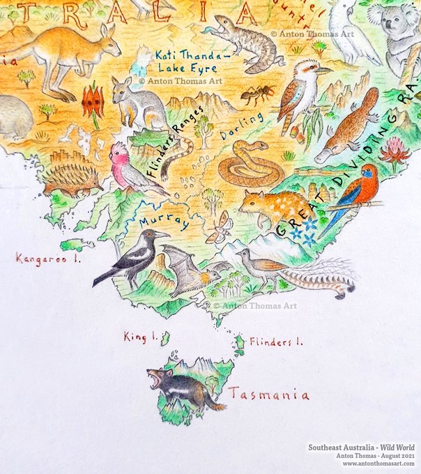
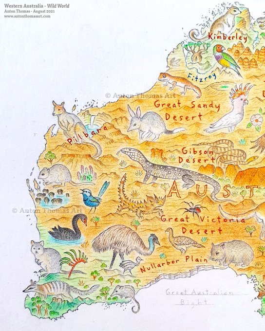
.🦘✍️ Loved drawing this magnificent continent I live in, after drawing the whole world to get here. We are blessed with such unique wildlife & landscapes, & I hope this map shows my love for Aus.
(Apologies for slow updates, behind on twittering.)
1
3
35
A snippet from my
#WildWorldMap
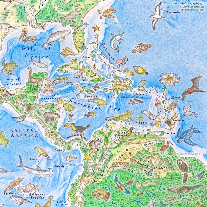
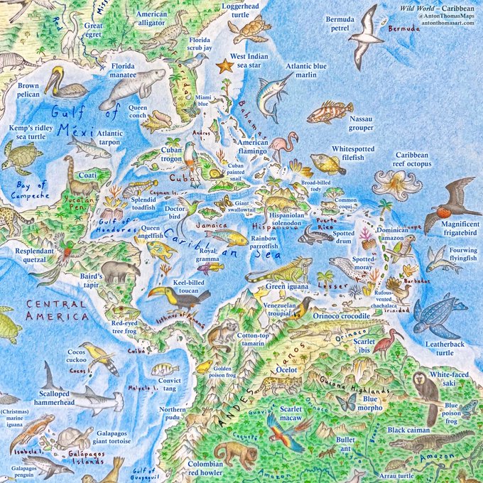
centred on the Caribbean. Img 2 has species names. Still some work to do here, including additions to Nth, Sth & Central America… and the Atlantic Ocean. But I’m happy with the art here, especially the tropical fish and Caribbean reef octopus 🐙
5
2
36
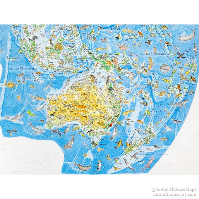
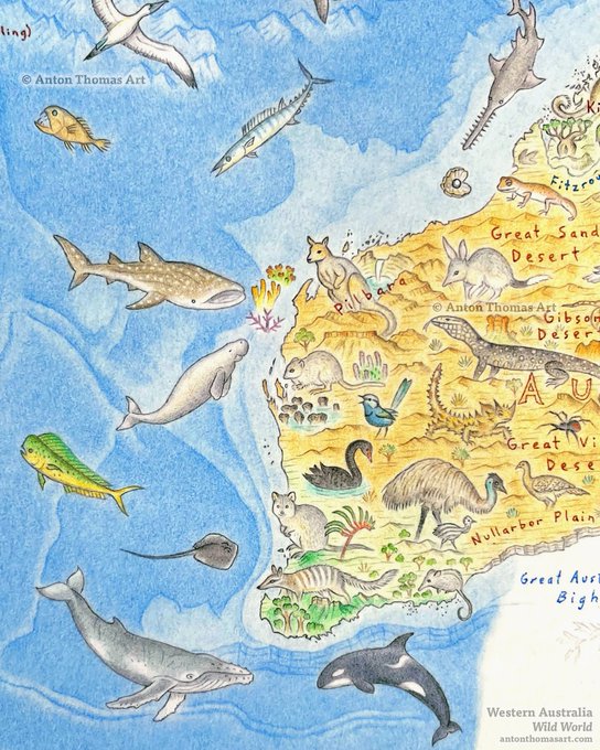
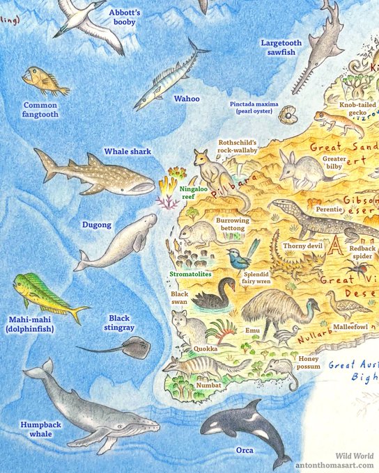
First glimpse at the ocean sweeping the Wild World map. Western Australia is a good place to start, given the incredible marine biodiversity along its vast coastline.🐋
As ocean covers approx 71% of Earth’s surface, I’m going to get a lot of bathymetry practice...
#WildWorldMap
2
3
35
Finally, had a little video made about my North American continent map. Shot right in the studio where it was all drawn. 🌎✍ I've wanted to do something like this for ages, so... here goes...!

0
10
36
Just pre-recorded my
#nacis2021
talk! A world tour of wildlife and geography, from my map Wild World. I’m so excited to speak on a new project. Wish I was there in person, but I’m grateful to be able to beam in from Aus. 🦘 Looking forward to virtually seeing everyone!
@NACIS

0
1
36
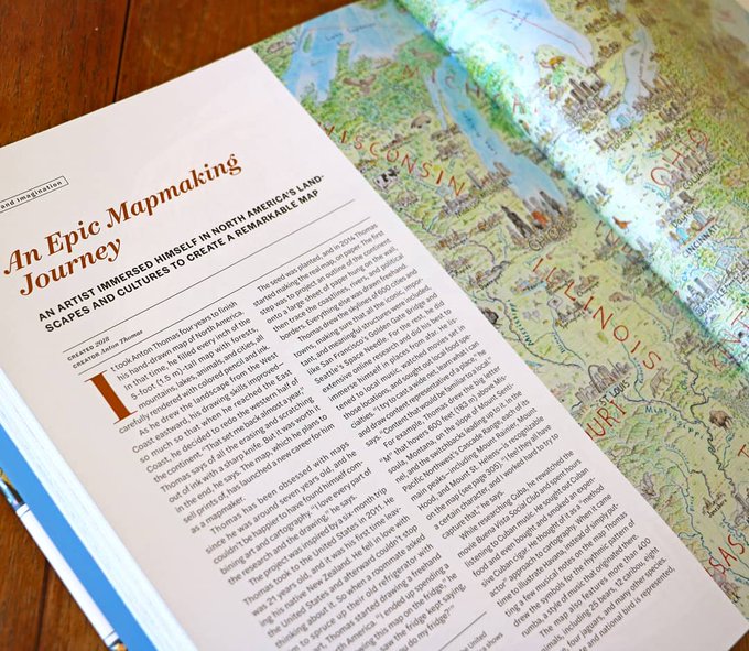
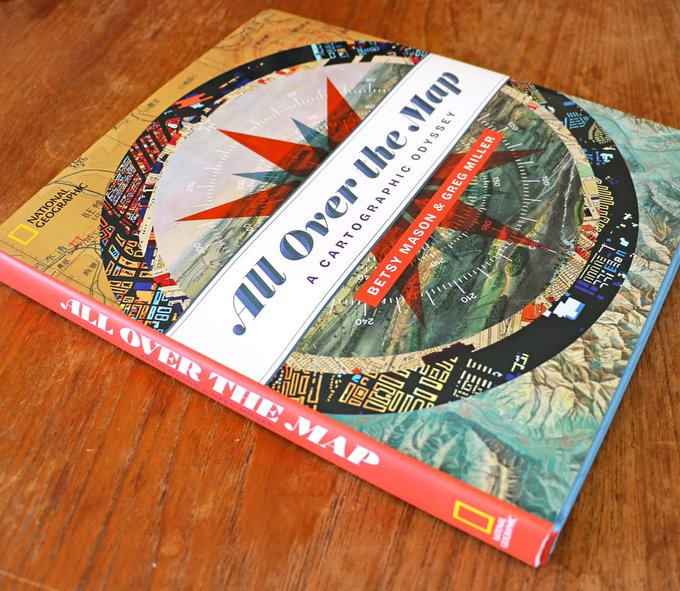
Honoured to be in Nat Geo's new beautiful book "All Over the Map: A Cartographic Odyssey". Much to say but being Twitter it's brief. Thankyou
@mapdragons
so much for the feature! Love the writeup, which includes my cigar+music method-mapping of Cuba 😁🎶
1
6
36
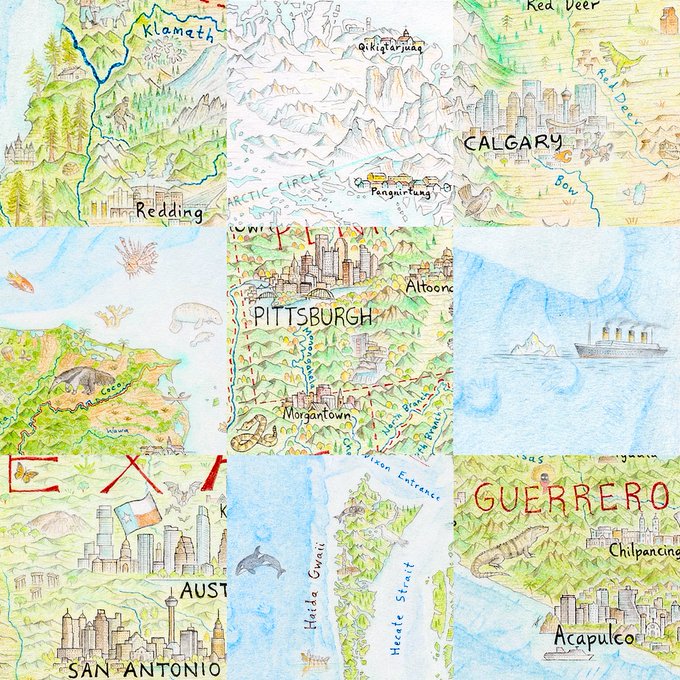
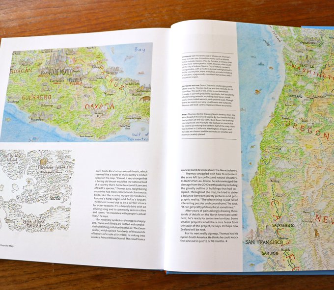
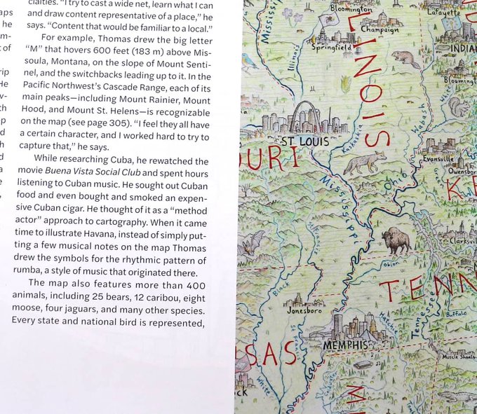
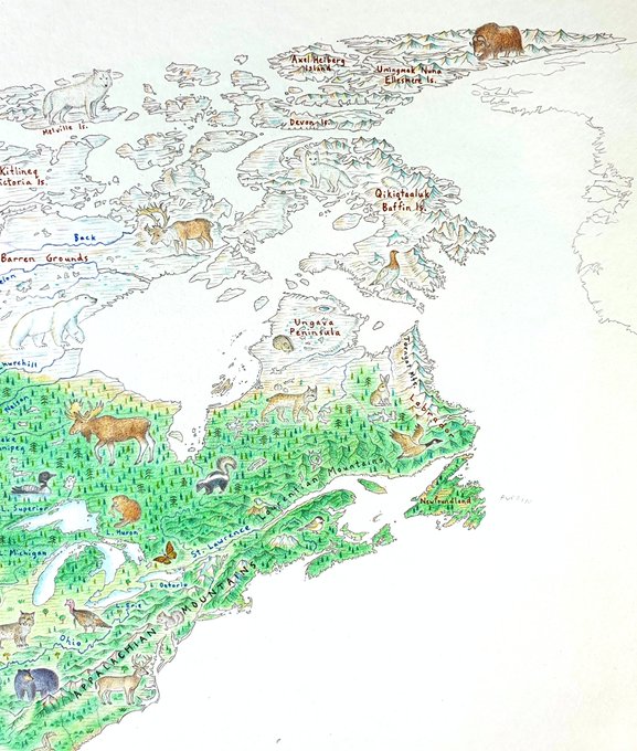
Here are a few more photos (and a pencil for scale). You'll notice many specific geographic features around the map, such as Angel Falls or Delicate Arch. On Baffin Island you can see Mt Thor and Mt Asgard. And the Pingualuit Crater on the Ungava Peninsula.
1
7
35
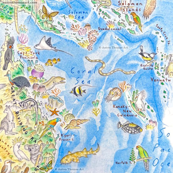
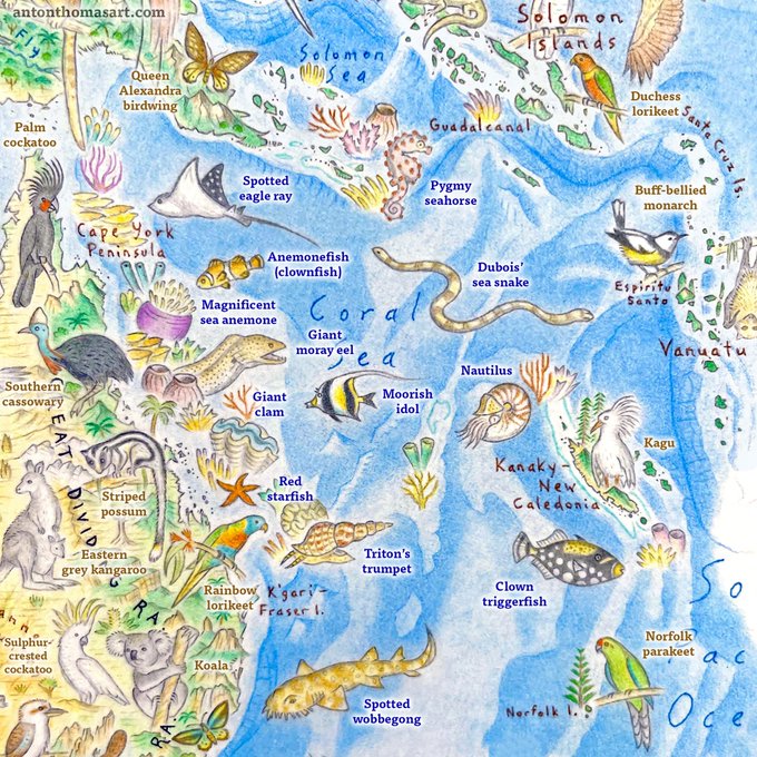
Rarely does a geographic label fit so perfectly with the illustrations, but Coral Sea fits the bill. A principle feature drawn here is the Great Barrier Reef - an enormous challenge to draw, but something I’m very proud of.
#WildWorldMap
0
1
34
Very grateful for this feature on The Atlantic's
@CityLab
today. Thank-you so much
@mslaurabliss

1
10
34
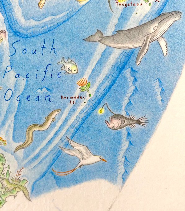
For Halloween, here’s a spooky animal I just drew. A southern seadevil (Ceratias tentaculatus) - SE of the Kermadecs. It lives deep in the Tonga Trench - second deepest on Earth. I love drawing the mysterious, nightmarish creatures of the deep.
0
0
34
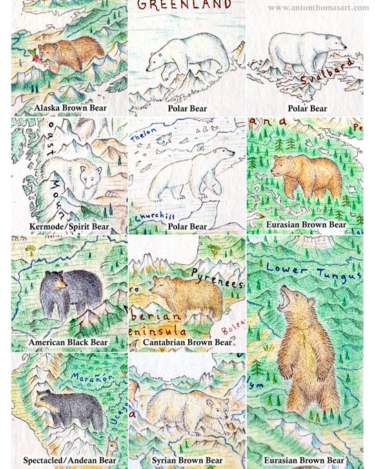
The 11 bears drawn on the
#WildWorldMap
so far. There are many more to go, including the giant panda 🐼, sloth bear, Asian black bear and sun bear. I'll update this chart when there are more.
Which one is your favourite?
2
0
34
What an incredible, intense time this is!! Rolling maps frantically as pre-orders for Wild World close tomorrow. Truly a dream come true. & I couldn’t be prouder with the product 🐘. Pre-order bonuses/discounts are still available for one more day!
2
1
31
Loving reading through
@kennethfield
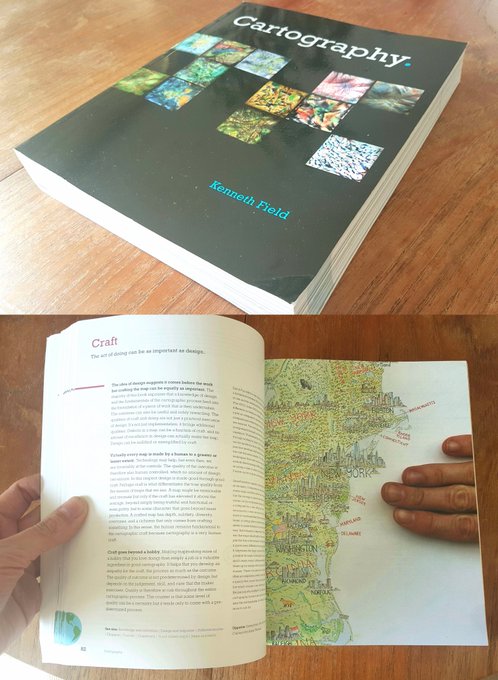
's incredible book "Cartography". It is so thorough, filled with outstanding design and great writing. I can only imagine the work that went in. It's an amazing resource. Honoured that my map (and hand) are featured on the page about Craft.
0
6
33
Very excited to talk about what's happening with my North America map at the last session of the day, with an awesome selection of creators in the Artistic Cartography session - Pavilion Room A. 🗺✍ All new material from last year, of course!
#nacis2019
0
4
31
While drawing my
#WildWorldMap
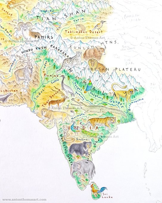
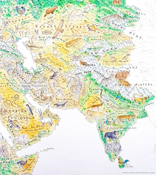
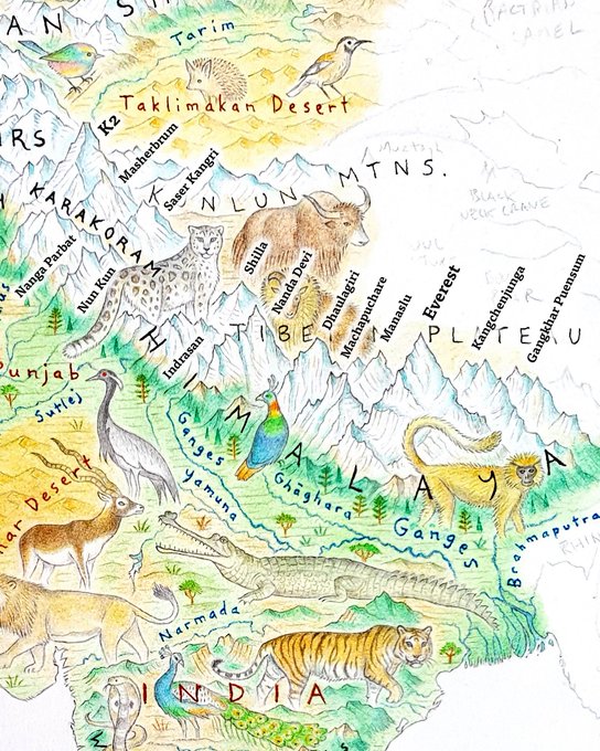
, I've been particularly excited for India, the Himalayas & Central Asia. I'm working hard to develop my mountain style through this map, & I tried to fit many major peaks (as labelled in image 3). Plus, the wildlife is so incredible in this region.
4
3
32
To everyone in NZ, I’ll be on TV tonight talking maps! 🗺📺 Be sure to tune in from 7pm with TVNZ 1 -
@SevenSharp
Excited!
2
4
30
When in new countries it's very fun seeing all the ways they use their unique shape. Japan has a beautiful, elegant coastline, and it can double as a rooster just in case.
#icc2019tokyo
3
4
30
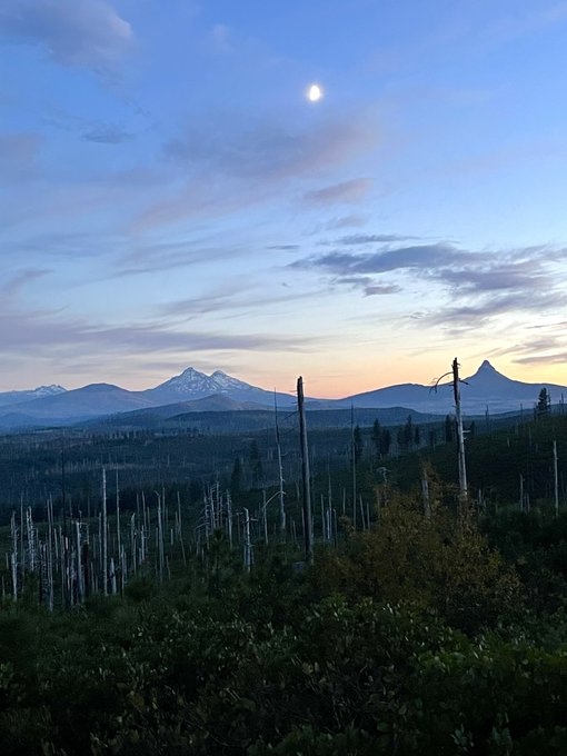
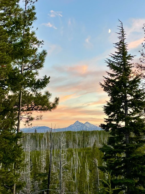
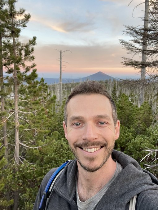
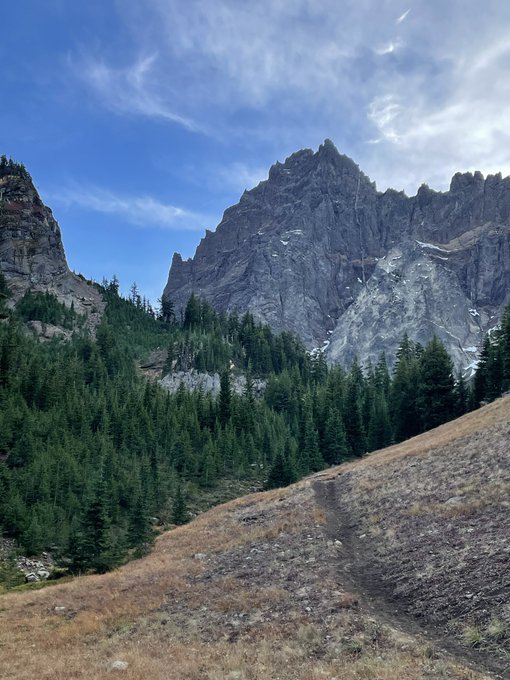
Found myself in Bend post-NACIS and it’s absolutely beautiful. This is how the map inspiration happens, at the source 💚
1
0
28
Here are a few more samples, including the entire project so far. Getting close to finishing all land!! 🌏✍
For anyone interested in seeing more of the map, or to subscribe to be notified when prints are ready, it's all here:
0
4
29
Another of my favourite
#mapsathome
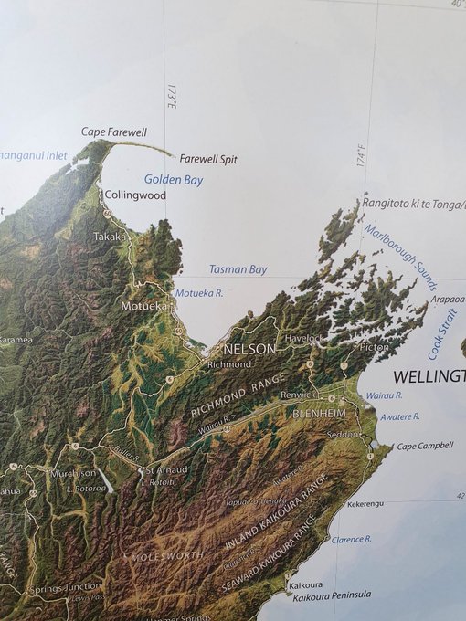
... the best general map of NZ I've ever seen, from the amazing Roger Smith of
@geographx
. I want to get one twice the size and frame it.
1
2
29
Wishing SO much I was at
#NACIS2022
, my favourite event of the year. 🗺 It feels weird to get to October and it not be on the agenda! I really hope you all have an amazing time, catching up in-person must be wonderful. I’m excited to see everyone at NACIS 2023, for sure.
0
0
28
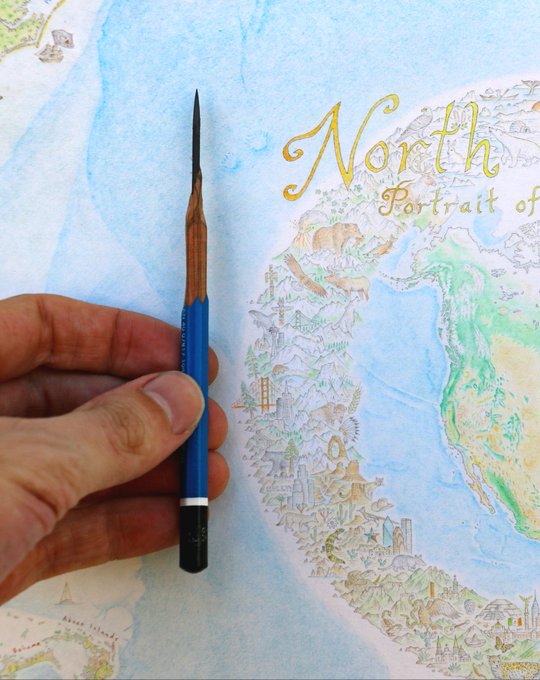
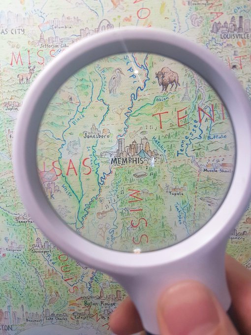
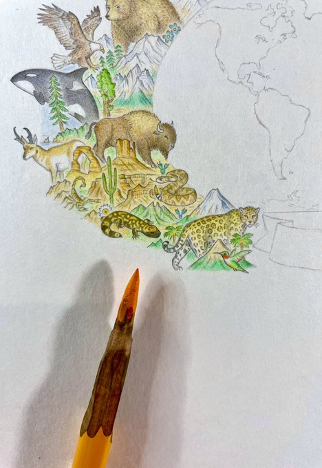
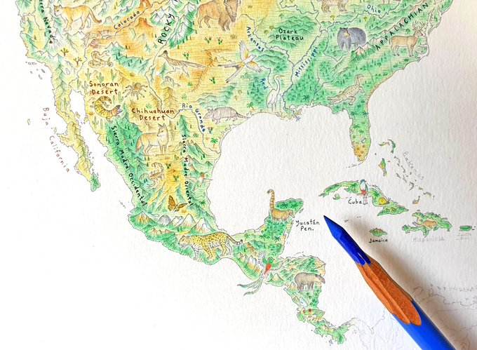
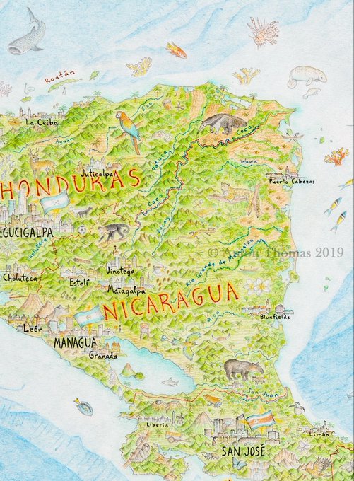
It can be tricky to show how small I had to draw everything to fit so much detail on a single map. This shot from Central America gives some idea of what was required, and why I drew at magnification. 7cm = 2.7 inches.
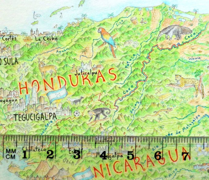
1
4
26