Amazing Maps Profile Banner
Amazing Maps Profile
Amazing Maps

@amazingmap

Followers
616,752
Following
14,259
Media
1,479
Statuses
8,686

Amazing maps brought to your attention. Turn our tweet notifications ON to never miss a tweet! Business/Map Ideas

Joined March 2011
Don't wanna be here? Send us removal request.
Explore trending content on Musk Viewer
@amazingmap
Amazing Maps
1 year
States with a smaller population than Los Angeles County
Tweet media one
992
11K
110K
@amazingmap
Amazing Maps
1 year
The Northernmost part of Brazil is closer to Canada than it is to the Southernmost part of Brazil
Tweet media one
441
5K
94K
@amazingmap
Amazing Maps
1 year
50% of Canadians live south of the red line
Tweet media one
560
4K
89K
@amazingmap
Amazing Maps
1 year
Melbourne is closer to Antarctica than it is to Darwin
Tweet media one
438
3K
66K
@amazingmap
Amazing Maps
1 year
All of US history has occurred within a single Pluto orbit
Tweet media one
1K
9K
63K
@amazingmap
Amazing Maps
3 years
Amazingly comprehensive map of every country in the world that uses the MMDDYYYY format
Tweet media one
531
6K
60K
@amazingmap
Amazing Maps
1 year
France's longest border is shared with Brazil
Tweet media one
149
4K
59K
@amazingmap
Amazing Maps
2 years
The Mississippi River and its tributaries
Tweet media one
341
5K
52K
@amazingmap
Amazing Maps
1 year
The United States and Canada at the same latitudes as Europe
Tweet media one
620
3K
52K
@amazingmap
Amazing Maps
1 year
Satellite map of La Plata, Argentina
Tweet media one
313
2K
46K
@amazingmap
Amazing Maps
1 year
Regional giraffe patterns
Tweet media one
153
2K
35K
@amazingmap
Amazing Maps
1 year
A map of the world made from timezones
Tweet media one
169
2K
32K
@amazingmap
Amazing Maps
1 year
Population density in Egypt
Tweet media one
128
1K
32K
@amazingmap
Amazing Maps
1 year
Antarctica without ice
Tweet media one
507
2K
31K
@amazingmap
Amazing Maps
1 year
Each section has 10% of the world's population
Tweet media one
98
2K
31K
@amazingmap
Amazing Maps
1 year
Gravity is not 9.8 ms^2. That's just the global average. On this globe it is stronger in the red areas and weaker in the blue areas
534
3K
31K
@amazingmap
Amazing Maps
1 year
Air traffic control zones in the USA
Tweet media one
183
1K
30K
@amazingmap
Amazing Maps
1 year
Tracking of an eagle over a 20 year period
Tweet media one
264
2K
30K
@amazingmap
Amazing Maps
2 years
You can fit the entirety of Poland into Texas and still be able to drive around it.
Tweet media one
340
1K
29K
@amazingmap
Amazing Maps
1 month
Maximum size of a PDF, version 7. 381km x 381km
Tweet media one
99
2K
30K
@amazingmap
Amazing Maps
1 year
Sunshine duration in hours per year. USA and Europe
Tweet media one
425
3K
28K
@amazingmap
Amazing Maps
1 year
Global distribution of penguins
Tweet media one
231
1K
27K
@amazingmap
Amazing Maps
10 months
'It's Greek to me' for each language
Tweet media one
500
2K
26K
@amazingmap
Amazing Maps
9 months
Brazil's northernmost point is closer to every country in the Americas than it is to Brazil's southernmost point
Tweet media one
161
2K
25K
@amazingmap
Amazing Maps
2 years
None of the countries that bordered Poland before 1990 exist today
Tweet media one
243
2K
24K
@amazingmap
Amazing Maps
1 year
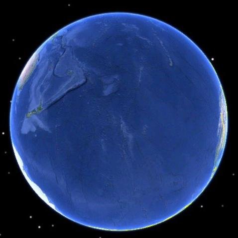
The oceanic pole of inaccessibility, also known as Point Nemo, is the place in the ocean that is farthest from land
Tweet media one
156
1K
24K
@amazingmap
Amazing Maps
8 months
Pluto: 1994 vs 2019.
Tweet media one
298
2K
24K
@amazingmap
Amazing Maps
8 months
Endings of place names in Poland
Tweet media one
193
1K
24K
@amazingmap
Amazing Maps
5 months
How a coastline 100 million years ago influences modern election results in Alabama
Tweet media one
86
2K
23K
@amazingmap
Amazing Maps
1 year
World map according to Google Street View in 2023
Tweet media one
215
1K
23K
@amazingmap
Amazing Maps
1 year
In 1992, around 29,000 rubber ducks fell off a cargo ship in the Pacific Ocean. This is where they made landfall.
Tweet media one
158
2K
22K
@amazingmap
Amazing Maps
2 years
These two areas of Africa have roughly equal populations
Tweet media one
143
2K
22K
@amazingmap
Amazing Maps
8 years
Metal bands per 1 million people (Europe)
Tweet media one
1K
4K
20K
@amazingmap
Amazing Maps
2 years
Japan is farther east, west, north and south than Korea
Tweet media one
94
1K
21K
@amazingmap
Amazing Maps
1 year
Global distribution of flamingos
Tweet media one
189
982
21K
@amazingmap
Amazing Maps
1 year
Location of every city founded by the Roman Empire, outside of Italy
Tweet media one
244
1K
20K
@amazingmap
Amazing Maps
1 year
The Netherlands in 1300 vs The Netherlands today
Tweet media one
177
642
18K
@amazingmap
Amazing Maps
13 days
A map of all countries that use the MMDDYYYY date format
Tweet media one
224
1K
17K
@amazingmap
Amazing Maps
10 months
Where were the 100 fastest 10,000m runners of all time born?
Tweet media one
194
1K
16K
@amazingmap
Amazing Maps
1 year
Abandoned and out-of-service railroad lines
Tweet media one
155
1K
16K
@amazingmap
Amazing Maps
1 year
Territorial evolution of France from 985 AD to 1947
155
2K
16K
@amazingmap
Amazing Maps
4 months
The Mississippi River and its tributaries
Tweet media one
156
1K
16K
@amazingmap
Amazing Maps
1 year
Obesity in North America (2021)
Tweet media one
338
825
15K
@amazingmap
Amazing Maps
1 year
Nobody lives here
Tweet media one
112
747
14K
@amazingmap
Amazing Maps
5 years
Tracking of an eagle over a 20 year period
Tweet media one
170
3K
14K
@amazingmap
Amazing Maps
1 year
US-Mexico border distance in a straight line over Europe
Tweet media one
87
2K
14K
@amazingmap
Amazing Maps
1 year
Christmas gift-bringers of Europe Via @JakubMarian
Tweet media one
231
1K
13K
@amazingmap
Amazing Maps
2 years
The roundest countries.
Tweet media one
112
953
13K
@amazingmap
Amazing Maps
9 months
None of the countries that surrounded Poland before 1990 exist today
Tweet media one
80
788
13K
@amazingmap
Amazing Maps
1 year
The Republic of Ireland extends further north than Northern Ireland
Tweet media one
143
497
12K
@amazingmap
Amazing Maps
1 year
40% Of the Greek population lives in the red area
Tweet media one
109
980
12K
@amazingmap
Amazing Maps
1 year
Nordic Cross Flags of Northern Europe
Tweet media one
71
506
12K
@amazingmap
Amazing Maps
4 months
Japan is farther north, south, east and west than Korea
Tweet media one
56
513
12K
@amazingmap
Amazing Maps
1 month
No hurricane has ever crossed the equator
Tweet media one
171
561
12K
@amazingmap
Amazing Maps
1 year
Percentage of young adults still living with their parents in Europe
Tweet media one
196
897
11K
@amazingmap
Amazing Maps
1 year
A map of the entire internet as of May 1973
Tweet media one
85
1K
11K
@amazingmap
Amazing Maps
2 years
The entirety of continental South America lies east of Michigan #Amazingmap #Amazingmaps #Map #Maps #SouthAmerica #michigan
Tweet media one
111
748
11K
@amazingmap
Amazing Maps
1 year
North America 92 million years ago
Tweet media one
134
509
11K
@amazingmap
Amazing Maps
1 year
Every US State shown as a country with similar GDP
Tweet media one
177
1K
11K
@amazingmap
Amazing Maps
1 year
A map of every country that has gained independence from the UK
Tweet media one
282
1K
11K
@amazingmap
Amazing Maps
4 months
Railways in China, 2008 vs 2020
Tweet media one
137
922
11K
@amazingmap
Amazing Maps
1 year
The submerged continent of Zealandia
Tweet media one
76
423
10K
@amazingmap
Amazing Maps
1 year
Map of languages spoken in China
Tweet media one
117
718
10K
@amazingmap
Amazing Maps
9 months
Percentage of the world's population that lives in each Indian state
Tweet media one
35
437
10K
@amazingmap
Amazing Maps
2 years
The red part contains more people than the blue put together
Tweet media one
74
1K
10K
@amazingmap
Amazing Maps
1 month
Cycle paths of Europe
Tweet media one
149
687
10K
@amazingmap
Amazing Maps
1 year
Australia plotted by every mapped stream and river... all 1.3 million of them
Tweet media one
62
405
10K
@amazingmap
Amazing Maps
1 year
Map of Italy in 1796
Tweet media one
72
415
10K
@amazingmap
Amazing Maps
3 months
Passenger trains in the United States vs Europe
Tweet media one
189
777
10K
@amazingmap
Amazing Maps
2 months
Comparing North American climatic zones to Eurasian Regions
Tweet media one
225
821
10K
@amazingmap
Amazing Maps
17 days
Independence from Britain is celebrated somewhere in the world roughly every six days. Here's a map of every country that has gained independence from the UK.
Tweet media one
116
919
9K
@amazingmap
Amazing Maps
4 months
United States GDP, split in half
Tweet media one
85
654
9K
@amazingmap
Amazing Maps
2 months
Map showing the actual distance between two points and how it looks using the mercator projection
Tweet media one
83
889
9K
@amazingmap
Amazing Maps
4 years
None of the countries that surrounded Poland before 1990 exist today
Tweet media one
62
1K
9K
@amazingmap
Amazing Maps
9 months
Sunshine duration in hours per year. USA and Europe
Tweet media one
177
592
9K
@amazingmap
Amazing Maps
9 years
Amazingly comprehensive map of every country in the world that uses the MMDDYYYY format http://t.co/aNFOHW3oiC
Tweet media one
334
10K
8K
@amazingmap
Amazing Maps
7 months
Real size of countries
Tweet media one
86
782
9K
@amazingmap
Amazing Maps
7 months
Mapping China's population density
Tweet media one
57
378
8K
@amazingmap
Amazing Maps
3 years
World Mercator map projection with true country size and shape added
Tweet media one
55
1K
8K
@amazingmap
Amazing Maps
6 years
New favourite map projection. Hellereal Boreal Triaxial Projection
Tweet media one
116
1K
8K
@amazingmap
Amazing Maps
8 months
World map based on population
Tweet media one
81
753
8K
@amazingmap
Amazing Maps
1 year
A map of Paris but it’s actually a #JohnWick4 poster.
Tweet media one
58
600
8K
@amazingmap
Amazing Maps
4 years
France's longest border is shared with Brazil #Maps #Map #Amazingmap #Amazingmaps #France #Brazil
Tweet media one
46
1K
8K
@amazingmap
Amazing Maps
2 years
Greater Tokyo vs Greater London
Tweet media one
108
536
7K
@amazingmap
Amazing Maps
9 months
A blonde hair map of Europe
Tweet media one
89
345
7K
@amazingmap
Amazing Maps
2 months
The shortest driving route through all 48 contiguous US states (Takes 113 hours)
Tweet media one
79
328
7K
@amazingmap
Amazing Maps
4 months
The most popular browsers in each country. 2012 vs 2022
Tweet media one
273
457
7K
@amazingmap
Amazing Maps
2 months
Love this
@Jefferies_
Harry Jefferies
2 months
My grandpa who is 85 started making this rock map of Scotland in 1992.He collected rocks during amateur geology trips over 30 years. He says it had to be geologically correct and also aesthetically pleasing.He asked if I could share online as He wants to go viral so please share
Tweet media one
Tweet media two
3K
31K
168K
11
282
7K
@amazingmap
Amazing Maps
1 year
The largest volcano in our solar system (Olympus Mons on Mars) compared to Arizona.
Tweet media one
57
396
7K
@amazingmap
Amazing Maps
4 months
Which country is across the ocean
Tweet media one
66
578
7K
@amazingmap
Amazing Maps
4 years
Melbourne is closer to Antarctica than it is to Darwin
Tweet media one
37
645
7K
@amazingmap
Amazing Maps
2 years
Position of the north magnetic pole since 1590
Tweet media one
87
740
7K
@amazingmap
Amazing Maps
5 months
Historic vs Present distribution of lions
Tweet media one
89
446
7K
@amazingmap
Amazing Maps
9 months
Showing how different map projections distort the globe
48
888
7K
@amazingmap
Amazing Maps
4 years
Average flag colour by latitude
Tweet media one
44
821
6K
@amazingmap
Amazing Maps
8 months
Map of Scottish clans and families
Tweet media one
145
721
6K
@amazingmap
Amazing Maps
4 years
Tweet media one
32
659
6K
@amazingmap
Amazing Maps
3 years
Map of the internet in 1969
Tweet media one
30
718
6K
@amazingmap
Amazing Maps
1 year
Why spacecraft orbits look like a sine wave on a flat map
34
441
6K
@amazingmap
Amazing Maps
1 year
Map of the Unexplored World, 1881. From The Great Explorers of the Nineteenth Century by Jules Verne.
Tweet media one
59
332
6K