

Wherobots
@wherobots
Followers
549
Following
258
Media
51
Statuses
320
The spatial intelligence cloud, by the original creators of @ApacheSedona
San Francisco, CA
Joined September 2020
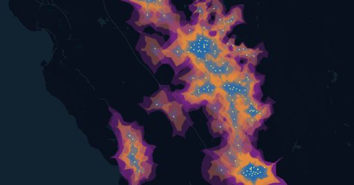
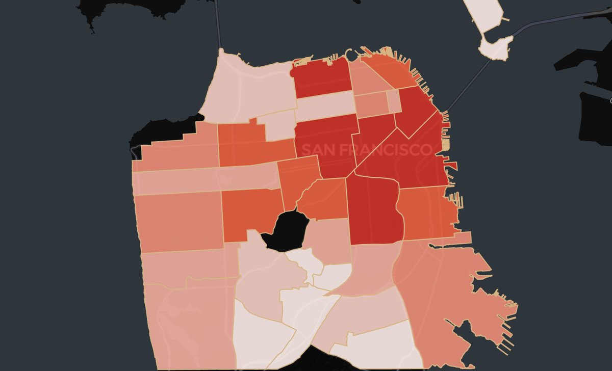
What are travel isochrones? They show how far you can go from a point in a set time (e.g., 30 min drive), factoring in real roads & traffic—not just distance. We used them to ID U.S. fire risk zones—all in <30 min compute & <$110. Interactive demo 👉
cloud.wherobots.com
Create drive time isochrones (travel areas) quickly with large volumes of data and no external API dependencies.
0
0
0
🚀 The agenda is live for Accelerate Climate Innovation with Earth Data & AI in SF, with AWS & 9Zero! We’re excited to welcome AWS to the stage for a keynote on geospatial and climate tech on AWS. More details on the keynote here: #ClimateTech #AWS

0
2
4

🚗 Heading to the ADAS & Autonomous Vehicle Tech Summit next week? Catch us at booth 3045! Learn how Wherobots + Apache Sedona help supercharge ADAS & fleet ops. 💬 Let’s talk data, safety, & savings: #avtexpousa #avtexposanjose.

wherobots.com
Learn how you can leverage Wherobots to help understand and analyze fleet operations and management for ADAS and autonomos vehicles.
0
0
1
🧩 In the world of geospatial data, entity matching and data integration are common challenges. Discover how to use the Overture Maps Foundation GERS IDs within Wherobots to link information about the same physical location across different datasets. 👉
wherobots.com
Follow this tutorial to match non-GERS datasets to Overture Maps GERS IDs in Wherobots. Learn GERS matching functions, scalable Apache Sedona processing, and methods for seamless cross-dataset...
0
0
0
🌍 Join us and @AWS for a hands-on workshop + innovation showcase on building intelligent solutions with geospatial data, AI, and LLMs. Discover how climate innovators are driving environmental resilience at unprecedented scale and performance. RSVP here:

lu.ma
Join AWS, Wherobots and co-hosts 9Zero at the AWS GenAI Loft for a hands-on workshop and innovation showcase focused on building climate intelligence solutions…
0
1
1
🚀 Introducing the Wherobots Fundamentals Course—your free guide to scalable geospatial analytics and data engineering with Wherobots’ cloud-native platform. From distributed spatial queries to working with modern data formats, we’ve got you covered!

learn.wherobots.com
Learn the foundations of Wherobots and the Spatial Intelligence Cloud and get certified for your skills!
0
2
3
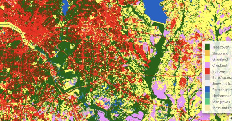
Spatial joins between raster and vector data can be relatively straightforward for one task until you scale. We used ESA WorldCover & Overture Maps datasets to analyze land near Texas buildings. Which tool was faster? It was us! 🚀 Get the full breakdown:
wherobots.com
Perform scalable spatial joins and zonal statistics with vector and raster data using Google Earth Engine & BigQuery vs. Apache Sedona & Wherobots. Compare performance, architecture, and geospatial...
0
3
6
Turn your spatial SQL queries into dynamic, interactive maps. Achieve unmatched price-performance, streamline visualization, and leverage a modern lakehouse architecture for actionable insights using Wherobots and Dekart. Save your spot:
wherobots.com
Discover how data teams process spatial data fast and turn those SQL queries into interactive maps using Wherobots and Dekart.
0
1
1
Check out the latest article from @BigDataWireNews featuring us and @ApacheSedona! It covers the origins of Sedona, early adopters like @Amazon Last Mile and the @OvertureMaps Foundation, and the challenges that we're helping to solve.

bigdatawire.com
Technologists have built distributed systems designed to process a variety of data types for many use cases. We have key-value stores, relational
0
3
5
New integration: Dekart now supports Wherobots as a spatial SQL engine!.⚡ Run fast spatial queries from S3.🗺️ Visualize instantly—no ETL, no GIS lock-in.🔗 Share the results of your geospatial analysis as a live map.👉 Get started here:
wherobots.com
Leverage WherobotsDB as a powerful Spatial SQL Engine to run fast spatial queries and visualize results instantly with the Dekart platform.
0
0
0
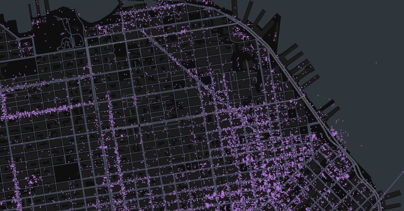
📍Learn to work with @Foursquare's continuously updated POI dataset using Wherobots in this new tutorial blog post. Includes complete code examples and visualization techniques.
0
1
1
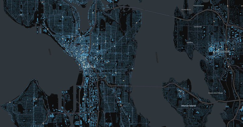
Working with spatial joins, GeoAI on satellite imagery or map matching? Join us for a hands-on session on how to make this process scalable, fast, and cost-efficient. 📈⚡💰 For more details:

wherobots.com
Build high-performance map matching pipelines and validate road networks using Wherobots and computer vision on satellite imagery. Learn to process GPS traces, run spatial joins, and apply GeoAI...
0
2
2
🚨 New Chapter Alert! The latest chapter of Cloud Native Geospatial Analytics with Apache Sedona, published by O'Reilly, explores how to use Sedona with today’s most popular cloud providers. Learn how Sedona fits into your cloud stack:
resources.wherobots.com
Based on Apache Sedona, Cloud Native Geospatial Analytics With Apache Sedona guides data practitioners through the world of planetary-scale geospatial analytics.
0
0
1
Wherobots is thrilled to announce that we have achieved our SOC 2 Type II attestation in accordance with American Institute of Certified Public Accountants (AICPA) standards for SOC for Service Organizations (SSAE 18). Read more here:

0
4
6
Open map data just got easier to use. Explore Overture Maps Foundation datasets right in the Wherobots Spatial Catalog, and see how simple it is to build powerful visualizations with them.
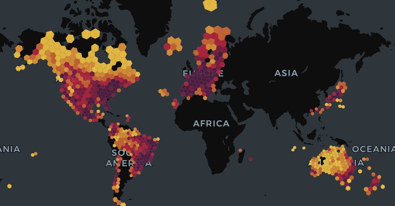
wherobots.com
Wherobots makes Overture data easy to access & analyze. Get optimized performance with Havasu Iceberg for powerful geospatial visualizations.
0
0
2
👋 We’re ready for Day 2 at the Data+AI Summit! Come say hi to us at booth E407 in the Dev Tools section and talk geospatial with us. Don’t forget our Iceberg meetup is happening tonight with PuppyGraph and CARTO! Details and location:


0
1
2
We’re looking forward to an amazing week at the Data+AI Summit! Come visit us at booth ✨ E407 to learn how Wherobots supports spatial ETL and AI with Databricks. Be sure to ask about our demos on Sedona + Databricks and how Wherobots fits in.

0
1
3
🧊 Join us next week for an Iceberg Meetup in San Francisco! Hear from speakers at PuppyGraph, CARTO, and Wherobots. It’ll be a fun evening of networking, drinks, and light bites. RSVP here:

0
0
0
We’re excited to be at the upcoming #DataAISummit! Find us at Booth E406 in the Dev Tools and DS section. Join us Wednesday evening for the Iceberg Meetup, and don’t miss our talk on Iceberg Geo on Thursday. For more details:

events.wherobots.com
Meet Wherobots at the Data+AI Summit! Visit booth E406 to get a demo and meet the team, attend our talk on Iceberg GEO and join us for happy hour!
0
0
1
It’s easier than ever to work with geospatial data, with Iceberg and Parquet now offering powerful solutions for both geospatial experts and non-spatial professionals. Join this session with industry leaders from Foursquare, Databricks, Planet, and Wherobots as they discuss the

0
1
2