
Vintage Maps
@vintagemapstore
Followers
341K
Following
2K
Media
3K
Statuses
4K
Exploring the world through the lens of cartography and design. 🗺️ Vintage maps, propaganda posters, modern infographics, and heraldry.
Joined December 2021
Global flag chart (Homann, c. 1718) – hand‑colored engraving.
3
10
72

@vintagemapstore A similar finding wrt. modern Poland 🇵🇱👇👇 @Valen10Francois 🤓 …

One of my biggest pet peeves: When old historic maps overlap with modern political maps. A 🧵
0
5
49

@vintagemapstore Yep, the Otroman Empire is well know for support for social democrats :)
5
1
41
European colonial presence in North America by 1750
21
144
1K
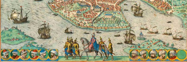
The 2014 Romanian Presidential Elections and the Ottoman Europe of 1876. Work by Bilal Selim Filiz.
32
162
2K
Great Greece map claimed by Venizelos at Paris Peace Conference, 1919
42
106
1K
Reconstruction drawing of the Throne Room, Knossos Palace. Published 1935 in 'Palace of Minos' after the original watercolour by Edwin J. Lambert (1881–1928), 1917
3
45
321
Reconstruction of Ҫatalhöyük showing the importance of the roof spaces. Illustration by John Swogger.
2
38
407
A portrait of Tenochtitlan: a 3D reconstruction of the capital of the Aztec Empire.
12
158
1K

@vintagemapstore A time when the world was divided by two equally influential and militarily mighty superpowers…
1
6
38

@vintagemapstore A 1945 Time magazine map (May 28 issue) depicting Stalin looking westward over Europe, highlighting the emerging “Russian Sphere of Influence."
2
11
53
Ethno‑linguistic Map of Austria‑Hungary (Shepherd, 1911)
5
74
541