verygoodmaps
@verygoodmaps
Followers
13K
Following
159
Media
744
Statuses
1K
I make maps and occasionally comment on stuff. Not a cartographer.
Joined June 2022
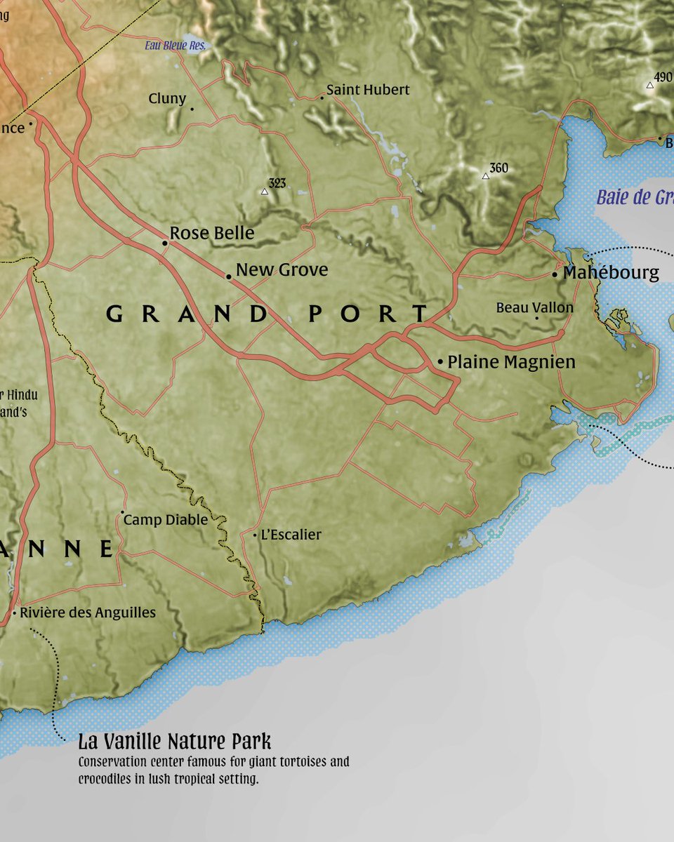
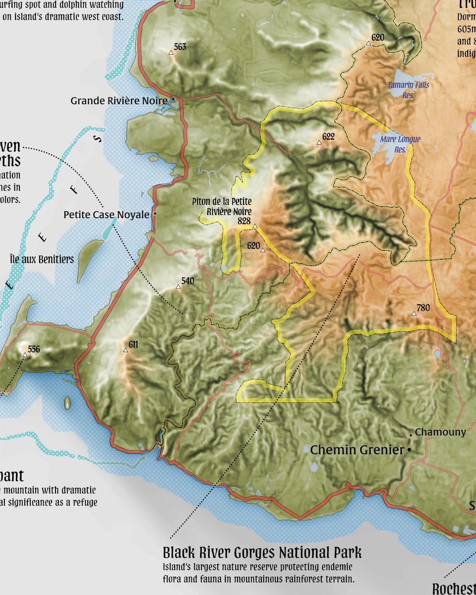
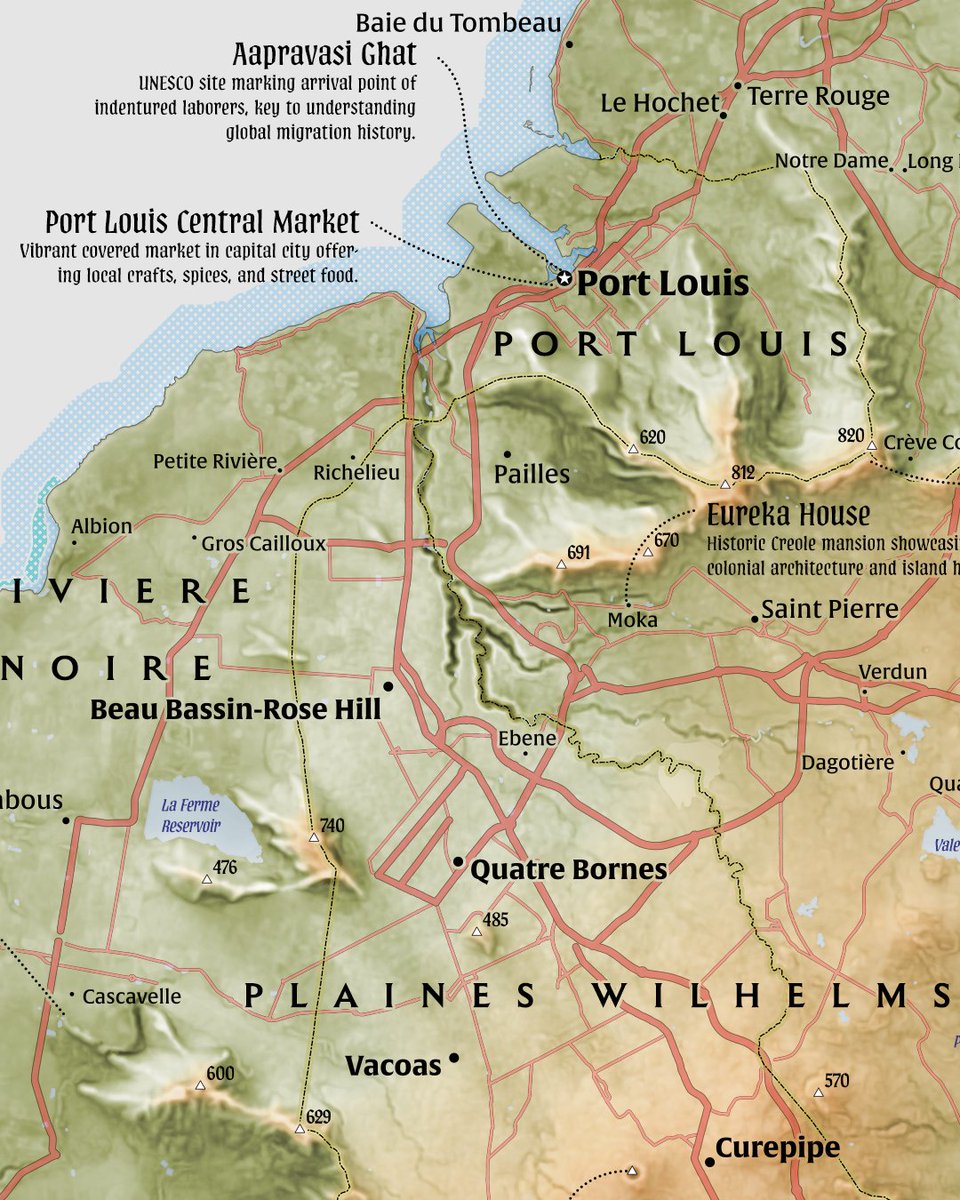
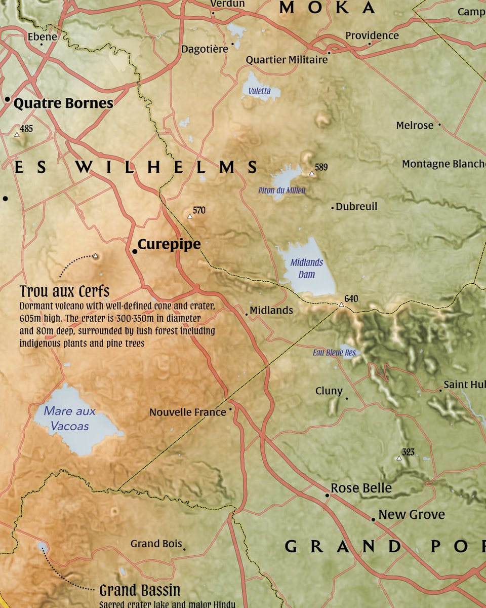
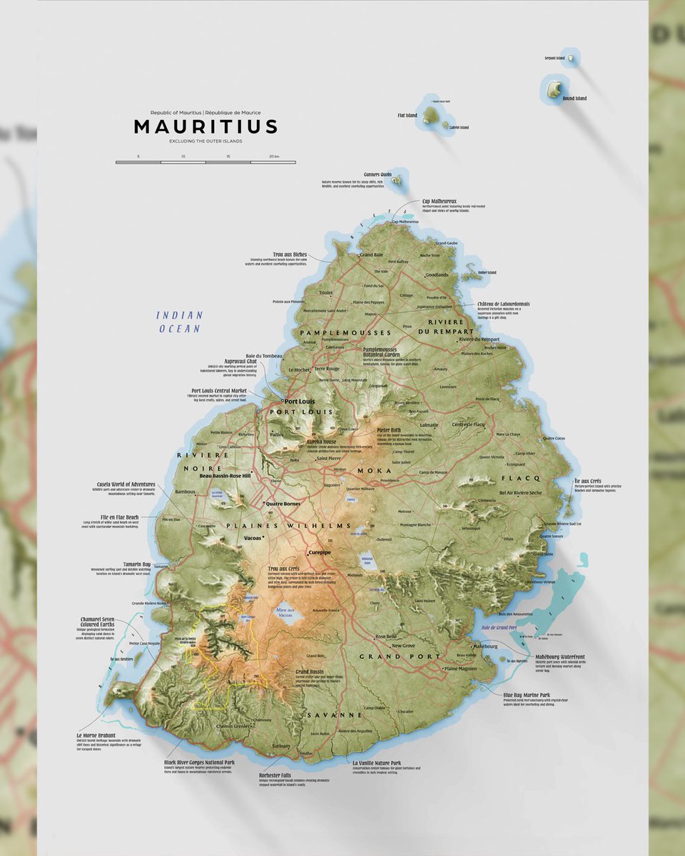
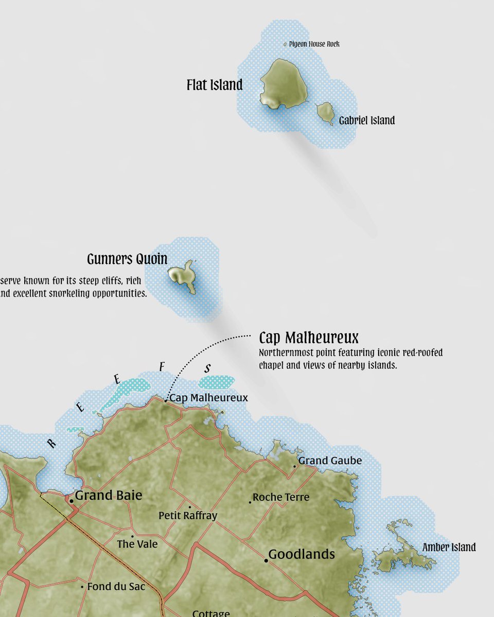
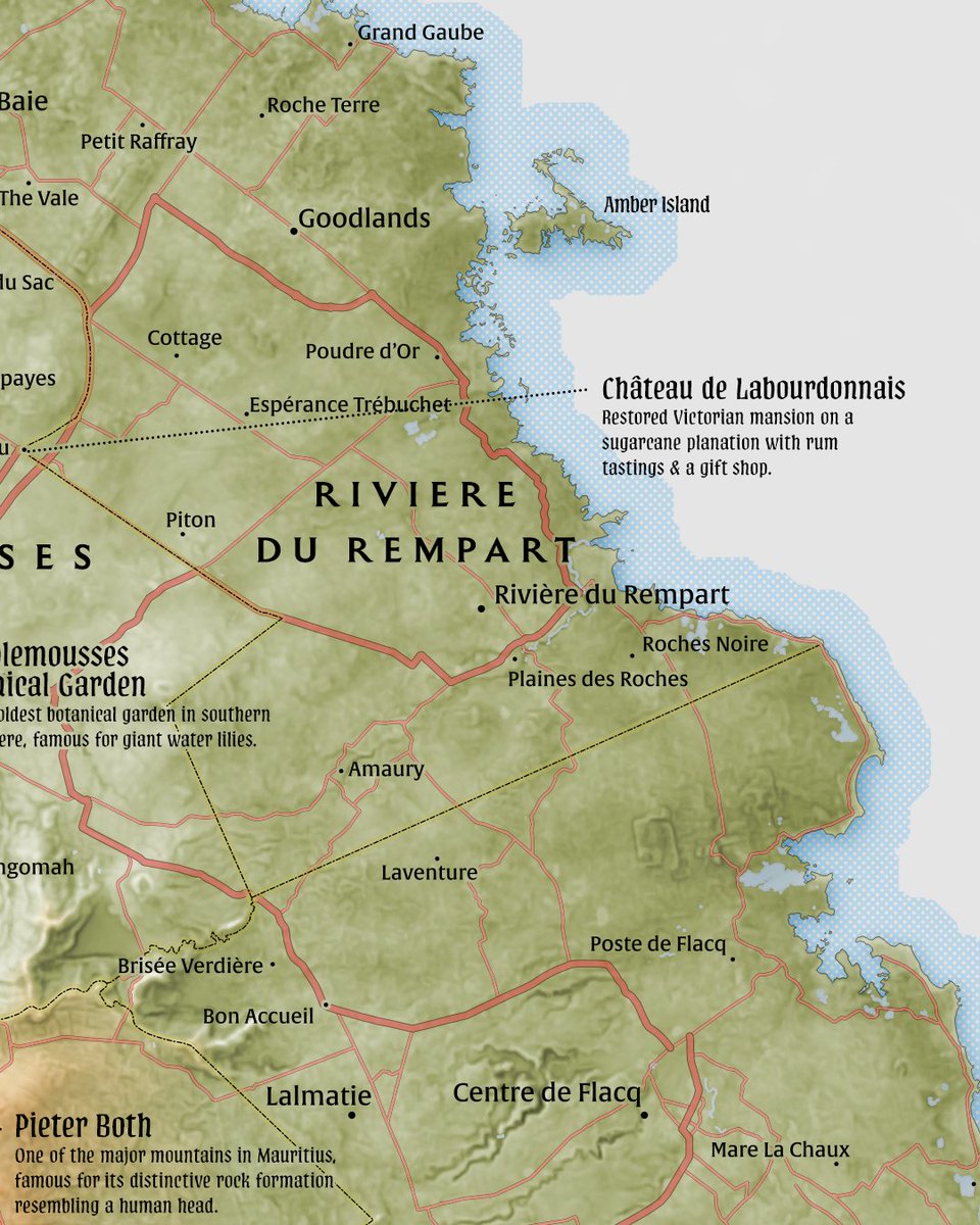
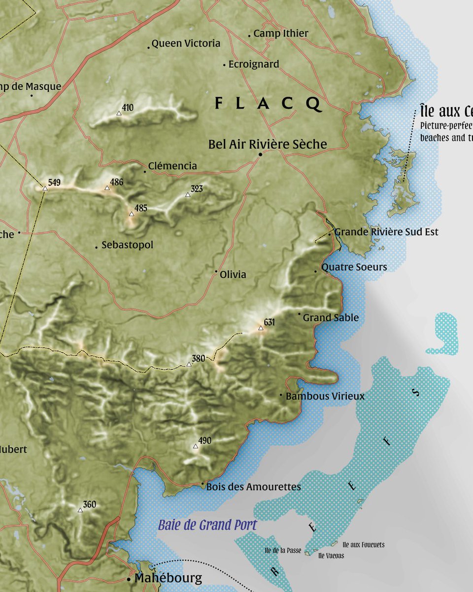
Website at: will most likely open next week. Mauritius, minus the outer islands. I started this as very contrasty map, but eventually decided to go with low contrast, light theme so I can add some text boxes around the map. #mauritius #indianocean #maps
1
7
50

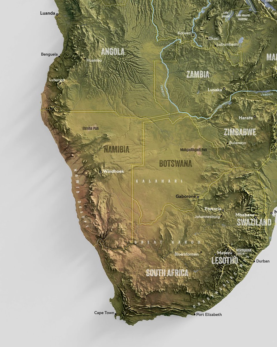

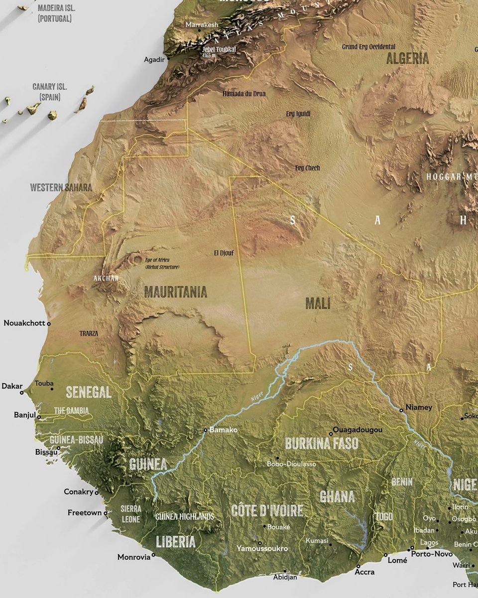
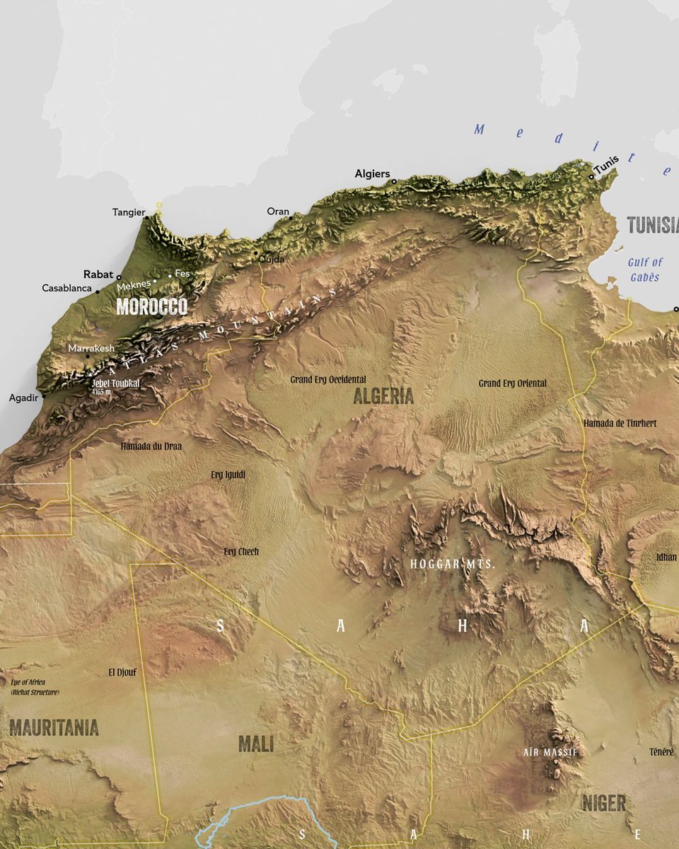
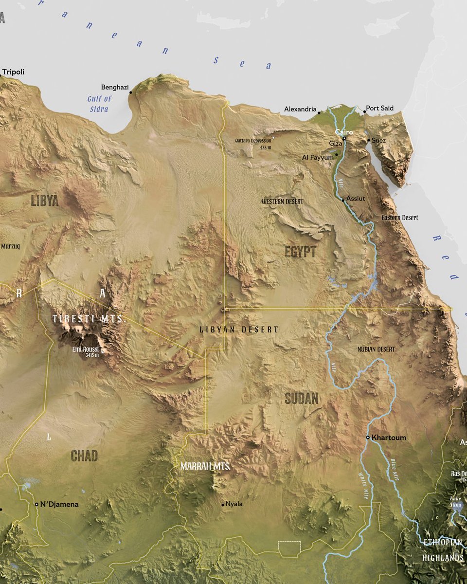
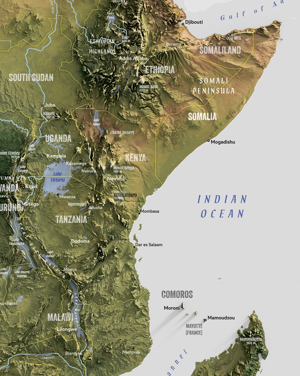
Why not make a map of Africa (work in progress). I'm suffering a heatwave currently, there's about 800 degrees celcius in Finland for couple of weeks. I'm fed up with it. So fed up. #Africa #MapMaking #geography

7
12
94
Haha. What if Appalachian Trail map would be in the spirit of yesterday's Chile map? Too funny. #appalachiantrail #hiking #thruhike

0
2
25
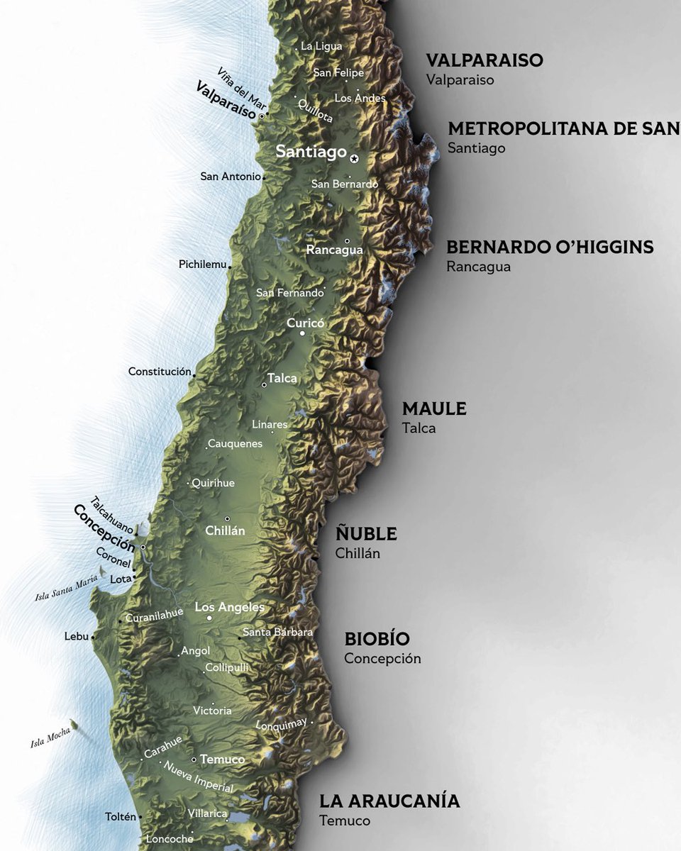
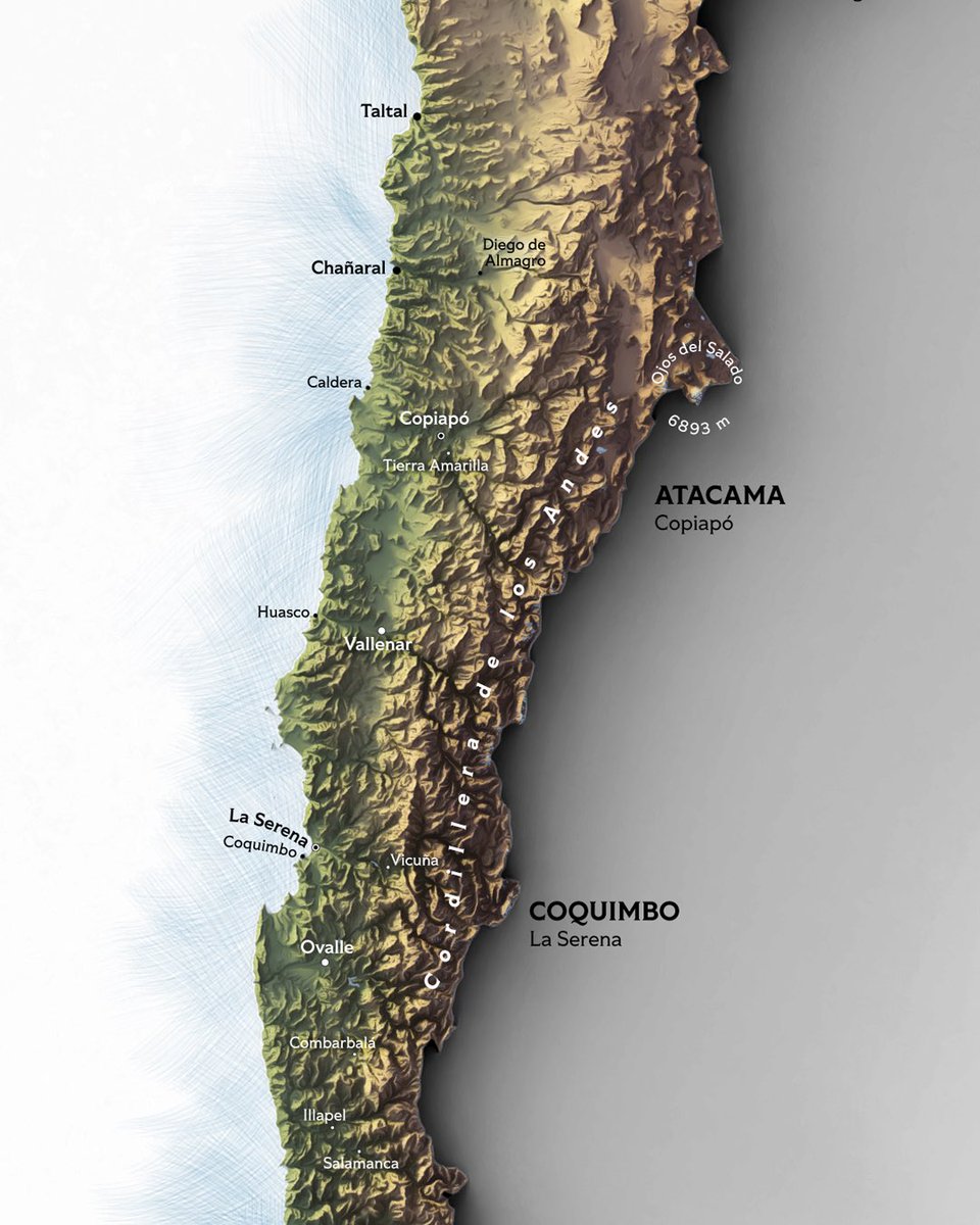
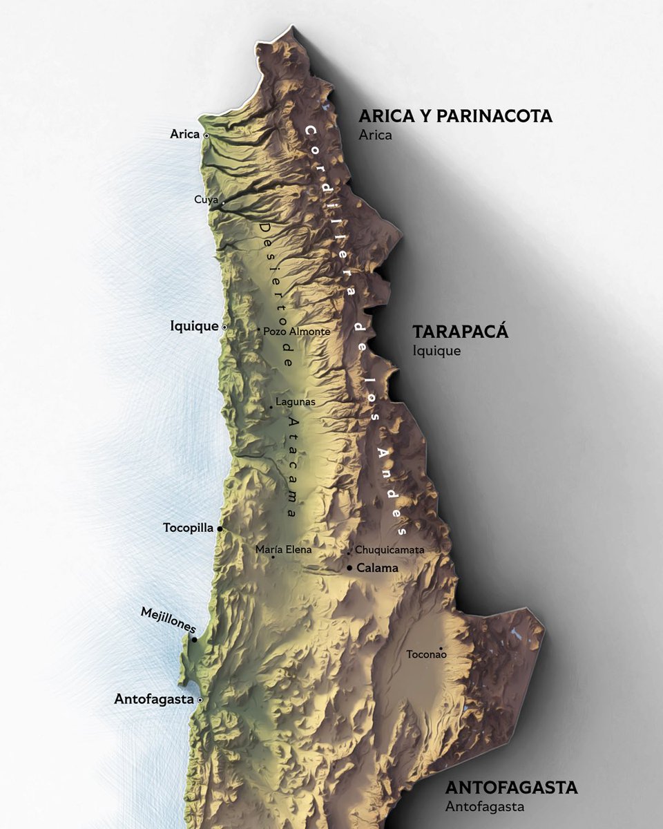
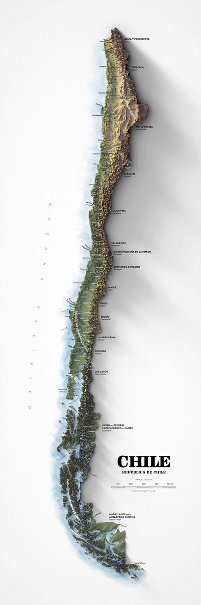
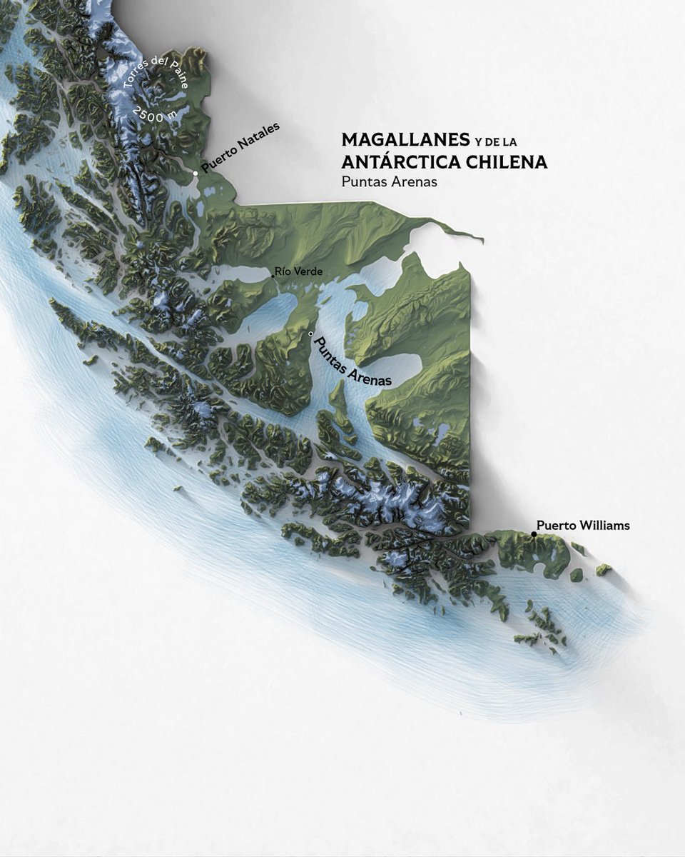
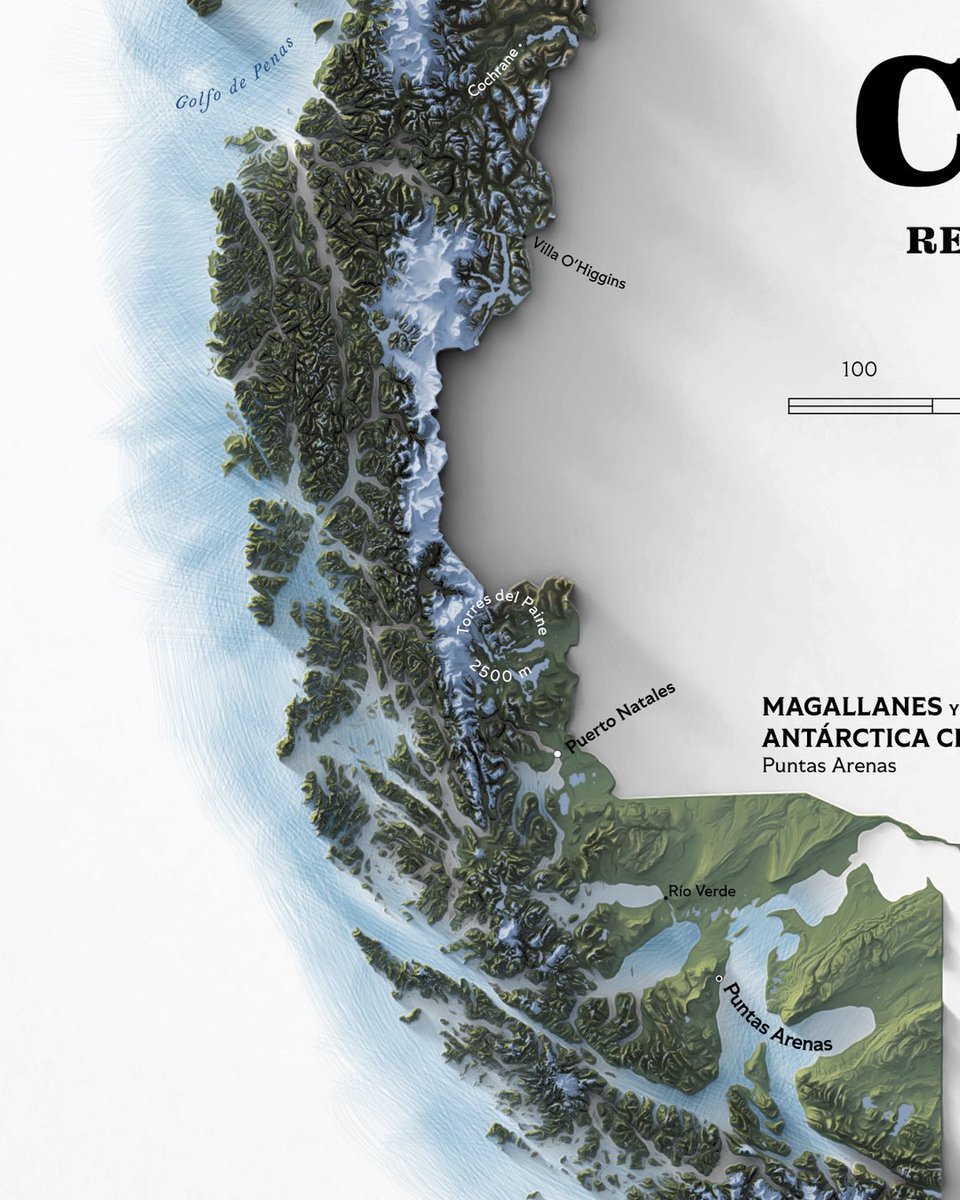
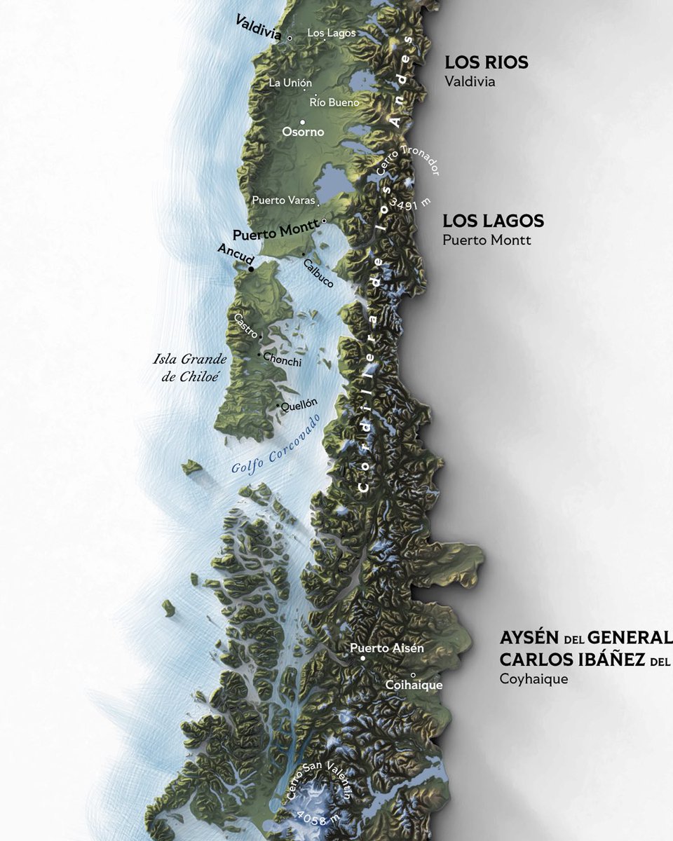
Chile. Got a little too busy today and I have to check… just about everything. The relief works nicely and liking the type. #chile #southamerica #andes
2
4
97
Tell me everything you HATE about this map. Once again, not a finished product yet. #america #geography #maps


3
3
60
This inverted South America printable file is now available at: This is a big one, 24x36 inches but there's also an A3-version included with slightly less labels for your convenience. #southamerica #brazil #chile


0
0
13
Nobody asked, so I made this upside down South America thing. Just a small fun thing to do. #southamerica #brazil #argentina


1
3
39
Three versions from the same project data. Left we have a light shaded relief suitable for complex labelling and thematic data. Middle: hypsometric tint with vintage'ish colours, and right: the same tint with relief enhancement. #newjersey #mapping #geography

2
5
42
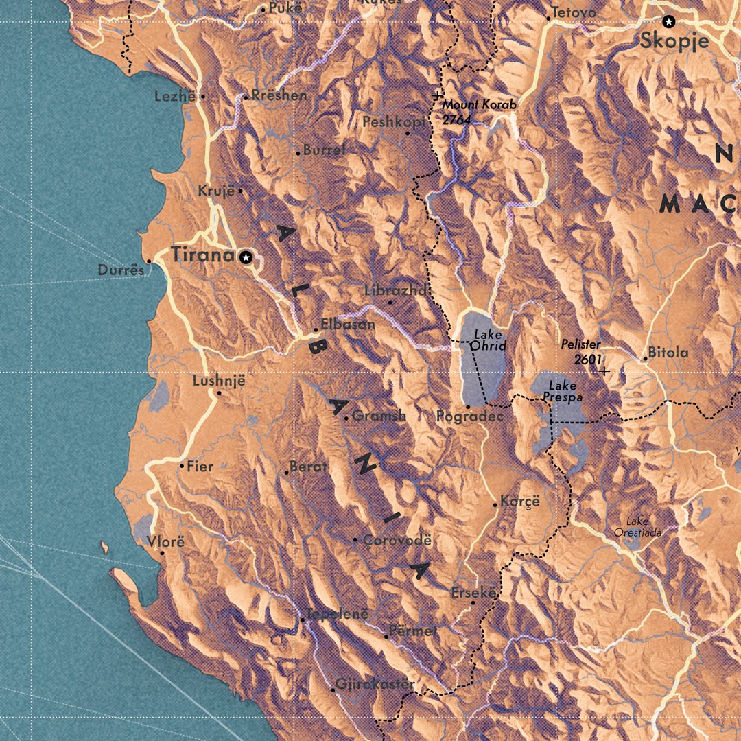
You can also make maps without shaded relief and just use hypsometric tint. Yesterday found an old large Atlas from my closet, forgot I had that book. Maps are produced by Bartholomew and Son and wanted to try something similar. #yugoslavia #baltics #geography

2
7
57
Making exaggerated and dramatic shaded relief maps is fun. For the first 300-400 times. But eventually one needs new challenge. Now I'm doing my best to make some informative maps. Starting with Tennessee, because the shape is awesome. More later. #tennessee #america #geography


2
4
67
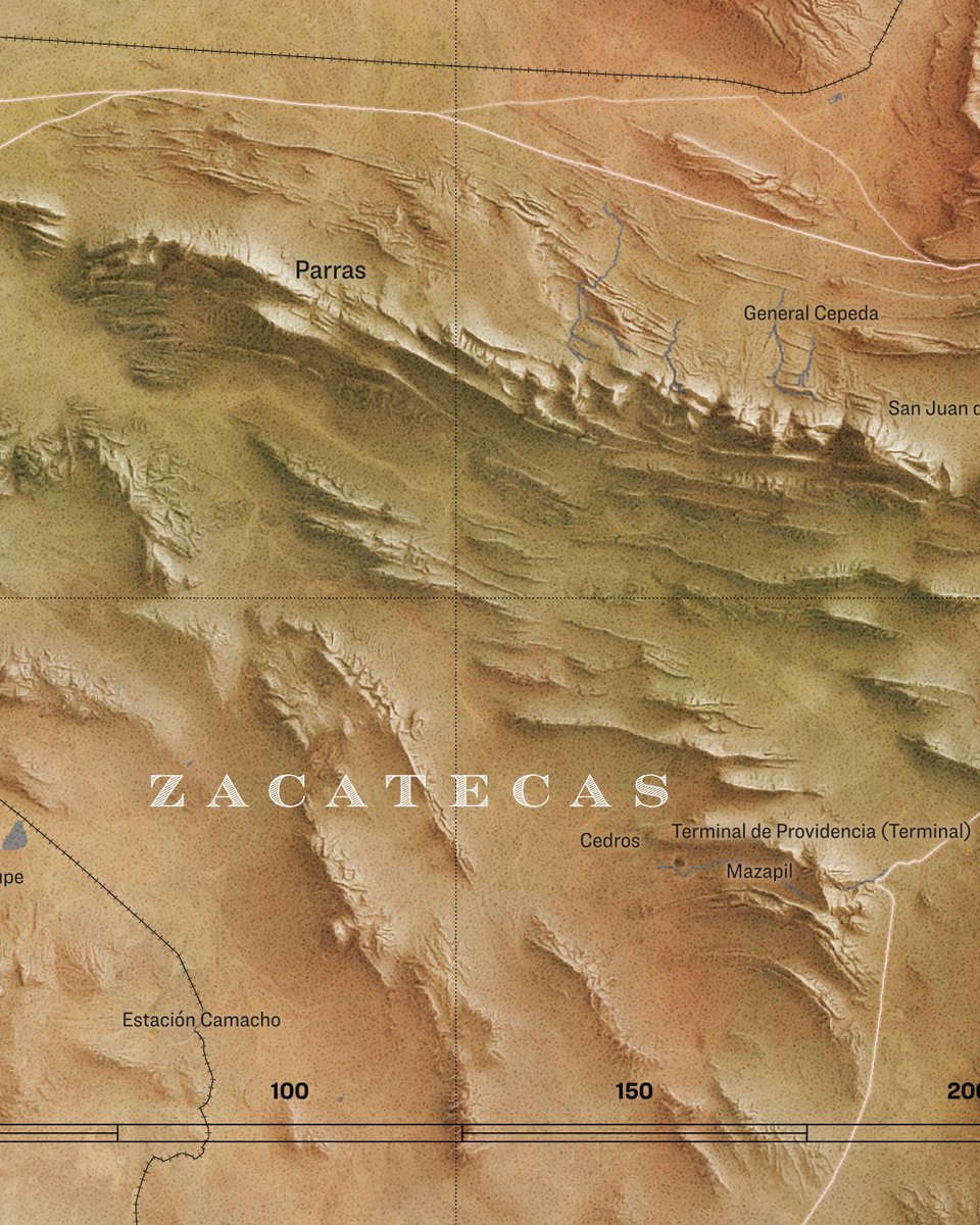
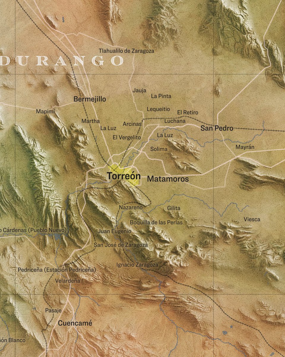
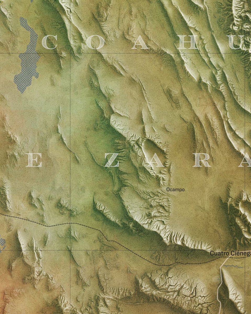
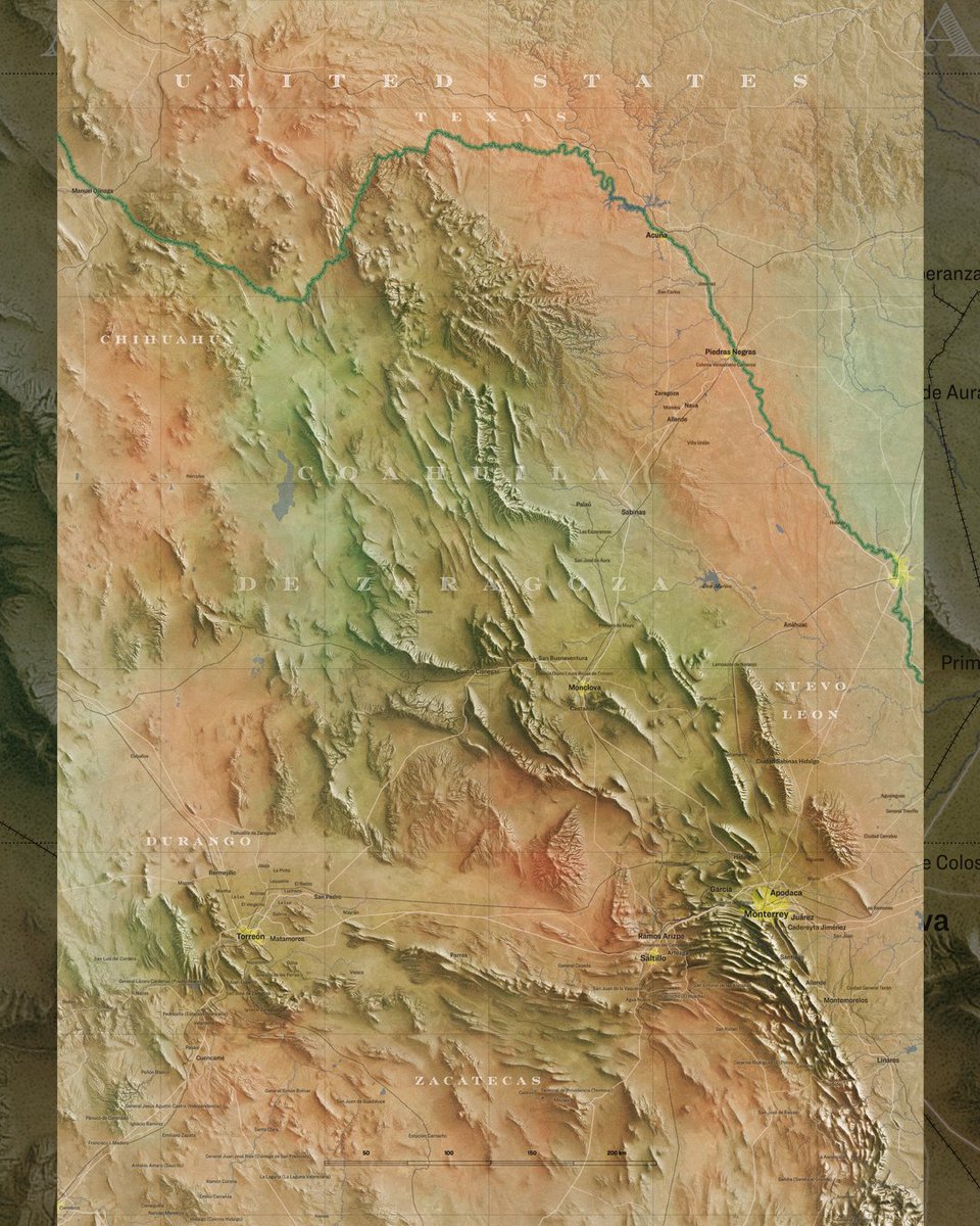
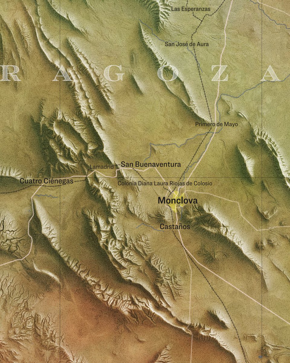
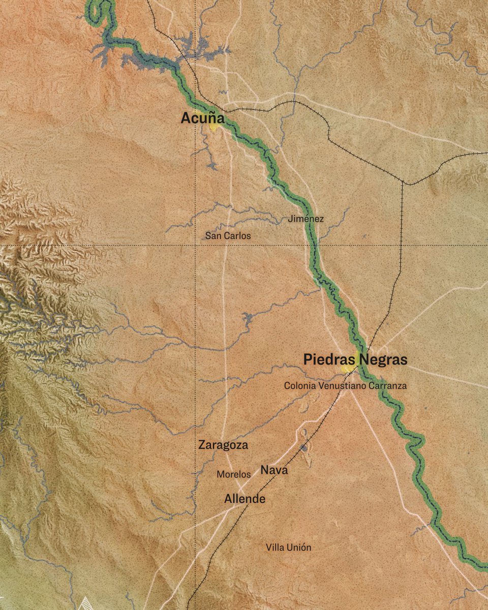
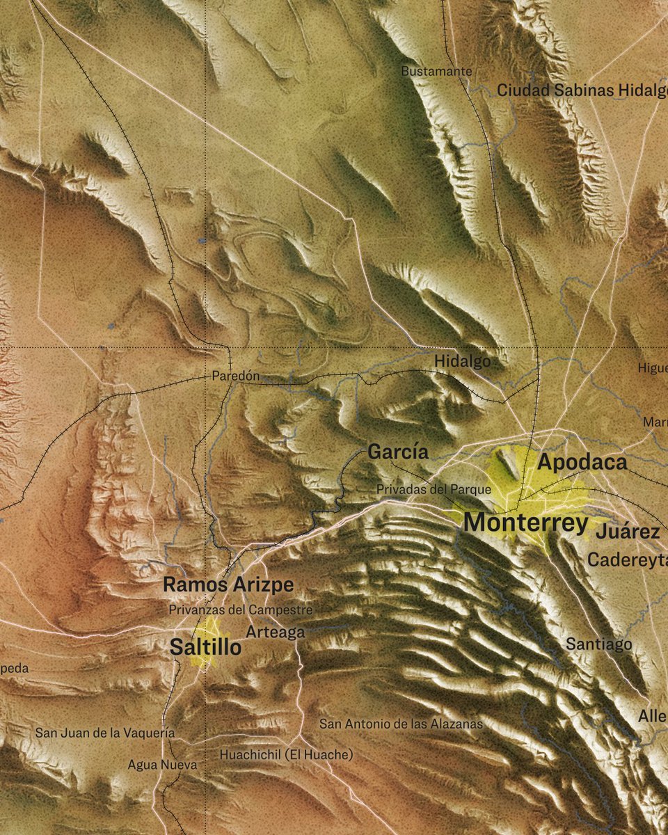
Today's random place: Coahuila de Zaragoza, Mexico. Focused mainly on the terrain. It's a blend of several raster- and adjustment layers. Also painted rather random colour overlay. #coahuila #mexico #geography
1
7
79


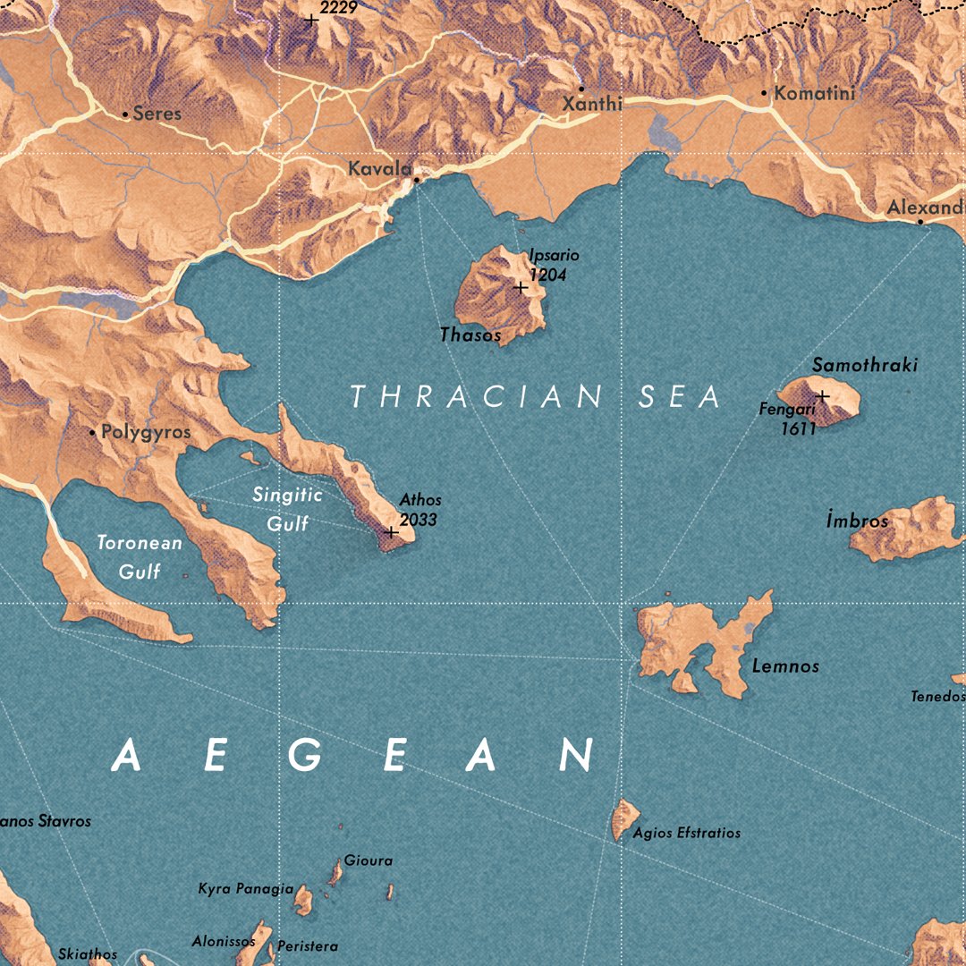

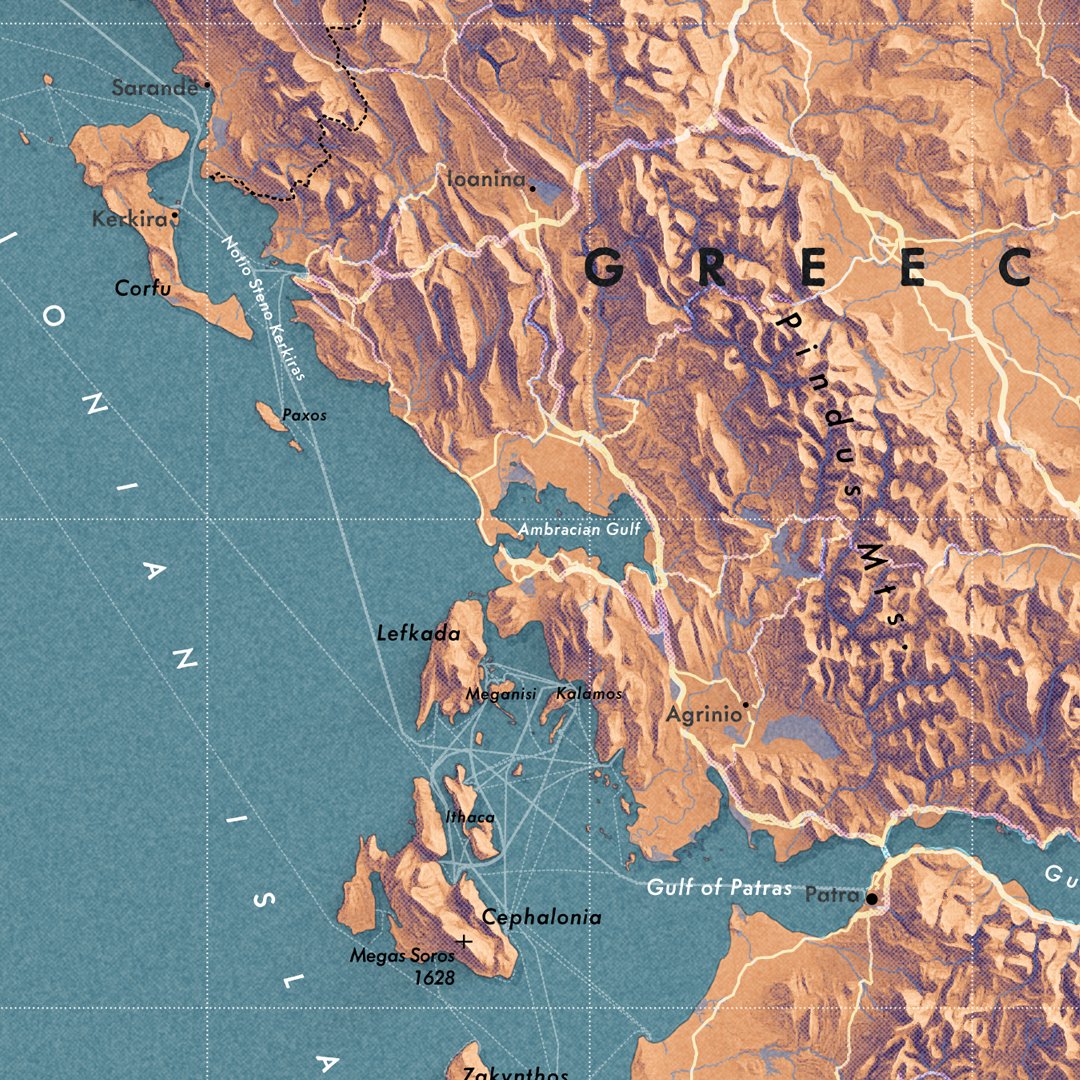
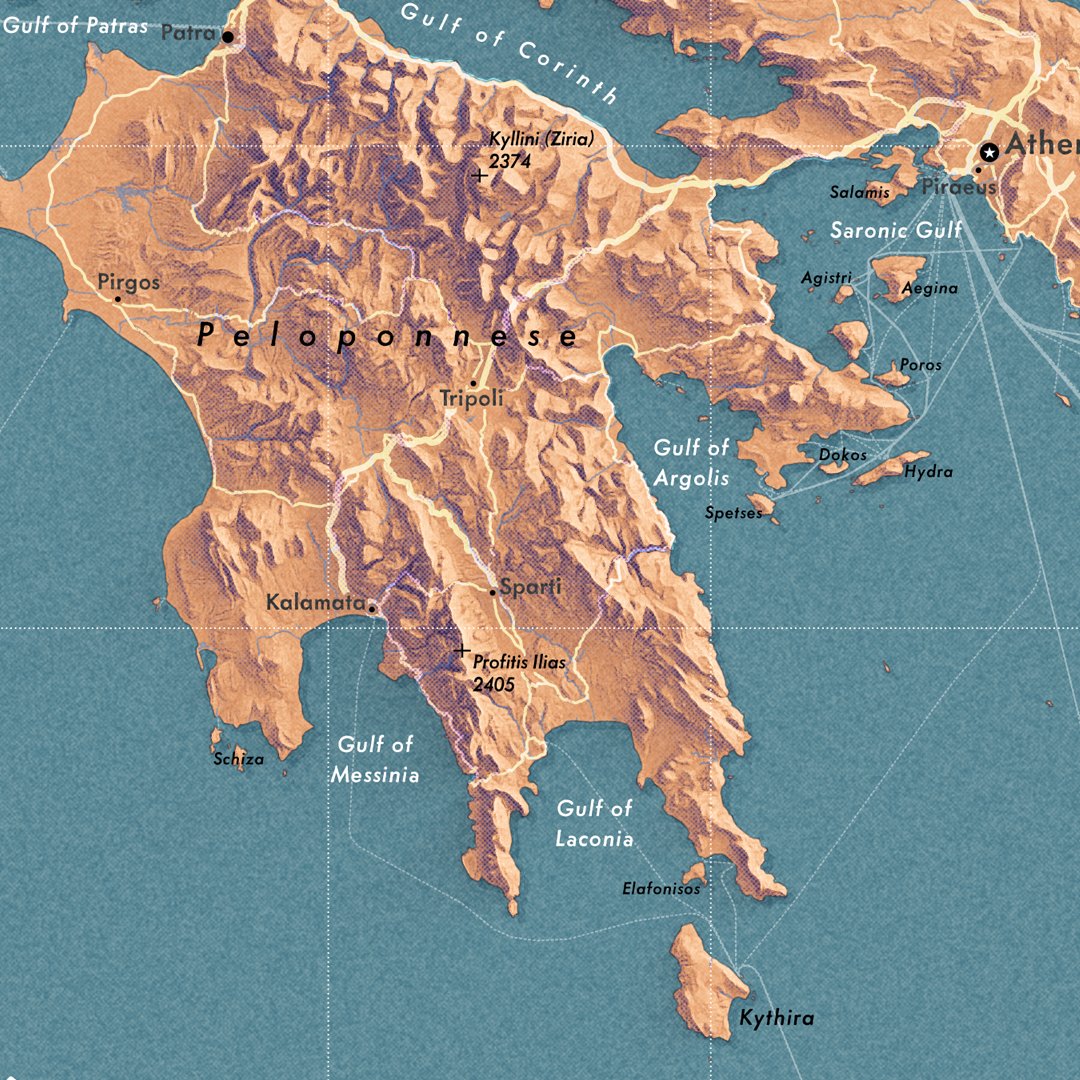
Continued from yesterday. My vintage experiment is still pleasing my eyes. So here's Greece and adjacent areas. #greece #balkans #geography
1
4
94

10
14
228


