
UMD GLAD
@UMD_GLAD
Followers
2K
Following
557
Media
166
Statuses
786
University of Maryland Global Land Analysis and Discovery (UMD GLAD)team is focused on global land cover change mapping using satellite imagery.
College Park, MD
Joined September 2015
Dr. @xpsong_geo of @UMD_GLAD @umdgeography presenting operational #soybean #mapping method at the session on #EUDR compliance at ESA #LPS25

0
1
5
🌍 Big news for remote sensing:. GLAD Landsat ARD (16-day surface reflectance, 1997–present) is now on AWS! 🚀.📥 2020–present: 🗃️ Full archive: #OpenData #Landsat #GLADARD #RemoteSensing #Geospatial #EarthObservation @umdgeography.
0
4
4
🌳 The 2024 global tree cover loss data by @UMD_GLAD are now live!. 📊 View & download GeoTIFFs via the Earth Engine App: 🗂️ Also in the EE Data Catalog: #ForestChange #TreeCoverLoss #EarthEngine @umdgeography.
0
8
14
RT @SteveBraceGeog: Prof Peter Potapov @UMD_GLAD @umdgeography “2024 was worst year for fire-driven forest loss. If it continues, it could….
0
7
0
RT @SteveBraceGeog: Prof Matthew Hansen @umdgeography @UMD_GLAD described the new results as frightening & warned of possible "savannisat….
0
3
0
RT @WorldResources: 🌳@globalforests’ analysis of #TreeCoverLoss data from @umd_glad reveals the tropics saw an unprecedented level of fires….
0
73
0
RT @umdgeography: 🌳🗺️ After 13 years of refining methods for forest loss maps, @UMD_GLAD's Sasha Tyukavina and colleagues have published a….
0
6
0
DIST-ALERTs by @UMD_GLAD are featured by the @NASAEarthData Worldview Image of the Week, highlighting the new interactive Land Disturbance tour story on the NASA Wordview portal with examples of DIST-ALERT detection.
0
2
7

Hundreds of #landslides in #Peru after a storm on October 28, 2024. Vegetation loss loss following the landslides is captured by @UMD_GLAD near-real-time disturbance #alert system, DIST-ALERT: View the landslides on our GEE App:.


0
1
1
RT @umdgeography: The @UMD_GLAD helped Nepal’s Ministry of Forests and Environment develop its National Land Cover Monitoring System. Thi….
0
1
0
Southern California #fires 🔥detected from space 🛰️ by the DIST-ALERT near-real time disturbance alert product from @UMD_GLAD @umdgeography & @NASAJPL's OPERA project.View and download the data: #EatonFire #PalisadesFire #LAfires

0
2
6
New @UMD_GLAD #dataset: Latin America Woody Vegetation Structure and Change #Map, 2015-2023. Dataset download, citation and technical note with methodology description: #Data visualization: @umdgeography #remotesensing

0
4
4
RT @globalforests: 📢 We added DIST-ALERT to GFW, a new global data set developed by @UMD_GLAD and @NASAJPL's OPERA project in collaboration….
0
6
0
RT @globalforests: Tree cover gain data from @UMD_GLAD on GFW now allows users to calculate how much tree cover was gained compared to addi….
0
4
0
RT @umdgeography: PhD student @rahayu_boleh from @UMD_GLAD combines field work, @GEDI_Knights LiDAR data, awesome open source satellite….
0
1
0
RT @umdgeography: Dr. Diana Parker of @UMD_GLAD on the disturbance intensity of tropical forest landscapes using @GEDI_Knights LiDAR data….
0
1
0
RT @umdgeography: #AGU24 Day 4🧵. Representation from @UMD_GLAD with PhD student Shi Jun Wee (his poster is on forest carbon loss due to cr….
0
3
0
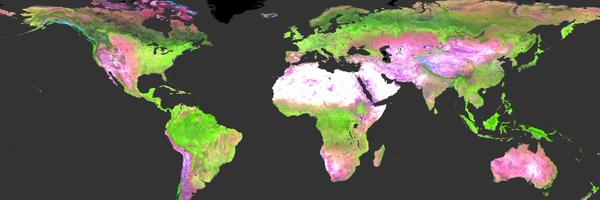
30m map by @UMD_GLAD outperforms 2 out of 3 global 10m land cover maps, and has accuracies comparable to ESA's World Cover. GLAD GLC preserves small features and complex patterns better than ESRI LULC and Dynamic World. Read more in a @landcarbonlab blog:


0
2
10
RT @umdgeography: Xinyuan Li from @UMD_GLAD presenting her work on dryland woody cover mapping in Senegal 🛰️🌳

0
1
0