Teledyne Geospatial
@tdygeospatial
Followers
2K
Following
1K
Media
1K
Statuses
2K
The unification of Teledyne’s Optech and CARIS businesses to offer holistic solutions
Fredericton, NB, Canada
Joined February 2009
USGS has published #topobathymetric data of the Potomac River acquired by Teledyne Geospatial's CZMIL SuperNova. Congrats to our partner, Dewberry, on a great job!
0
0
3
#ICYMI Teledyne Geospatial announced that CARIS software now be available for purchase online.
0
0
0
Don't miss us at Hydro 2023 with our sister company @teledyne-marine We have lots of exciting software developments!.
0
0
1
Still time to sign up for #TeledyneCARIS' 5-day instructor-led online #training course in #HIPSandSIPS from September 25 - 29, 2023; 9:00 am - 4:00 pm (GMT+2). For additional information, or to register: .
0
0
1
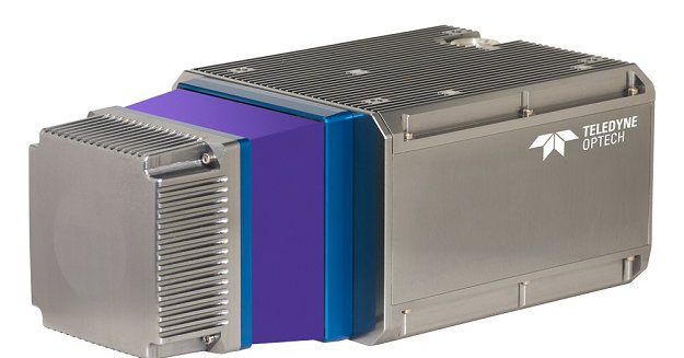
The Teledyne Geospatial CL-360 for marine applications is a LiDAR sensor that can be seamlessly integrated with high-resolution multibeam systems and the CARIS Ping-To-Chart workflow.
spatialsource.com.au
Teledyne Geospatial CL-360 marine LiDAR sensor that can be integrated with high-resolution multibeam systems.
0
0
0


