

James Peacock
@peacockreports
Followers
8K
Following
25K
Media
9K
Statuses
20K
Head #Meteorologist MetSwift: A company working to revolutionise #WeatherInformation delivery. LinkedIn: https://t.co/pUCAQfAfRP
England, United Kingdom
Joined April 2019
A glossary thread to stick to my profile. NWP: Numerical weather prediction (models). ECMWF: NWP modelling by GFS: NWP modelling by UKM: NWM modelling by

metoffice.gov.uk
Met Office weather forecasts for the UK. World leading weather services for the public.
3
2
37
. which suggests accumulations of 1-2 mm, perhaps very locally 3 mm from it. Whereas presuming that e.g. 76 mm per hour lasted 5 minutes gives you 6.3 mm. This effect scales as the peak rain rate increases. Rates over 100 mm per hour rarely last for even 1 minute.
1
0
1
Being almost all the rain that fell here yesterday, this brief downpour has handily proved that my theory is correct. The radar estimated accumulation is 8-10 mm wherever one of the 5 minute interval frames had 76+ mm per hour. Yet in reality such rates lasted 1-2 minutes.


1
0
2
RT @malamuteandpolo: @peacockreports Damage caused by the rain on Isle of Wight Sainsbury’s had to close the roof collapsed .
0
1
0
Well scratch that because I just had a very sharp shower. From sunny to torrential rain to sunny again in less than ten minutes!. Peak rain rate looks to have been nearly 80 mm per hour, ever so briefly.
1
0
0
It rapidly collapsed, making for a fascinating structure.
1
0
6
Just kicked off not far to my southwest. Small but feisty!

2
0
10
I say 'may have' because these estimates are prone to being too high when very high rainfall rates have occurred. Possibly the rates seen every 5 minutes are treated as if they were occurring throughout those 5 minutes, though I could be wrong.
2
0
3
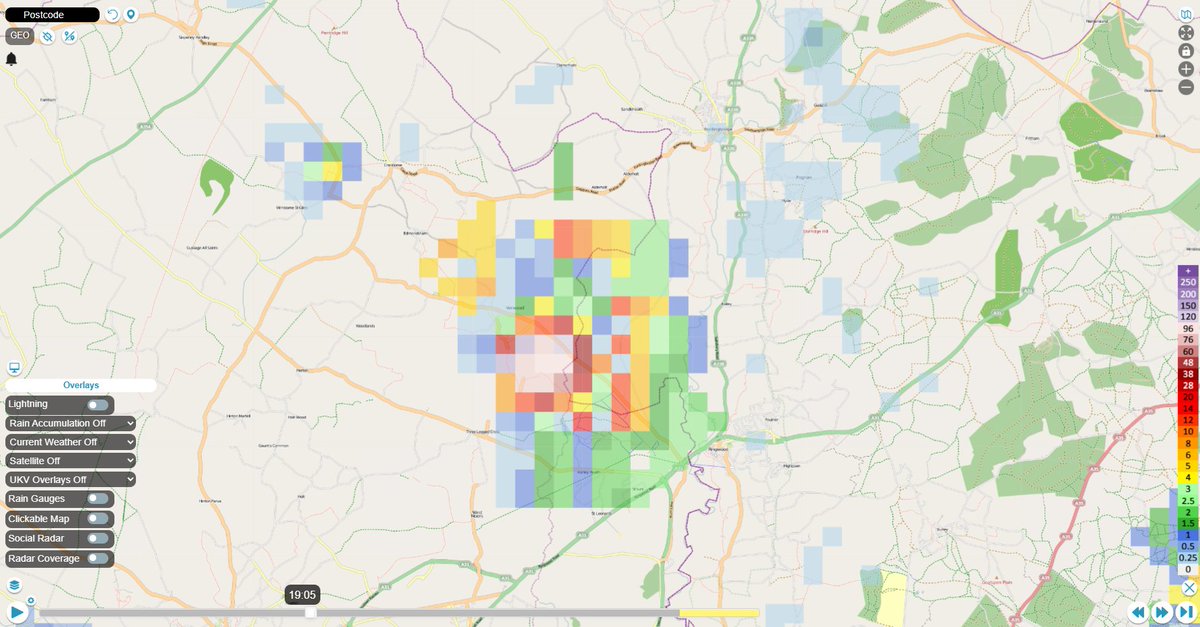
Radar estimated totals for so far today exceed 5 mm over a wide swathe from central Wales to SE England, with over 10 mm for many of the places within. Some may have seen over 20 mm, a few more than 30 mm. Southampton around the harbour area might have seen over 60 mm!

5
2
16
In fact it's trying to be a fine evening here, with increasing amounts of sunshine. At this rate the daily total will be around 0.2 mm, with a monthly total just over 20 mm. I wonder how many places have been drier than that?

4
0
4
Radar sequence since 3 am today. You can see the widespread activity, plus the avoidance of my hometown (Verwood). The way the activity from the northwest fizzles out near the end is just classic. Right at the end, a tiny cell kicks off within a mile to my east 😆
4
3
12
No sooner has one thunderstorm cleared off, another has kicked off, passing over much of the same area of Southampton. Must be some major surface water flow going on there now. Wild seeing thunderstorms kick off just downwind (east) of me twice in a row while it stays dry here.

0
0
3
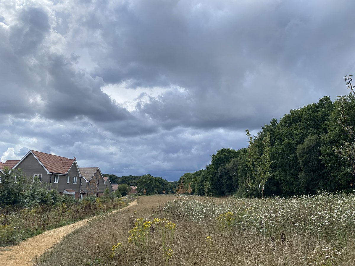
Got that ‘fake autumn’ look around here due to the major shortage of rainfall that’s somehow still ongoing as I type this.
0
2
12
This is a pretty strong signal from the sub-seasonal ECMWF for dry & warm or hot weather in the UK & Ireland during the middle stages of August. Not a dependable one, though. Before then, it seems the weather will be changeable but perhaps gradually turning more settled overall.


1
1
22

Starting to wonder if the Met Office might as well establish whereabouts I am whenever issuing a weather warning for high rainfall or thunderstorms, so that they know where to exclude.

3
1
21
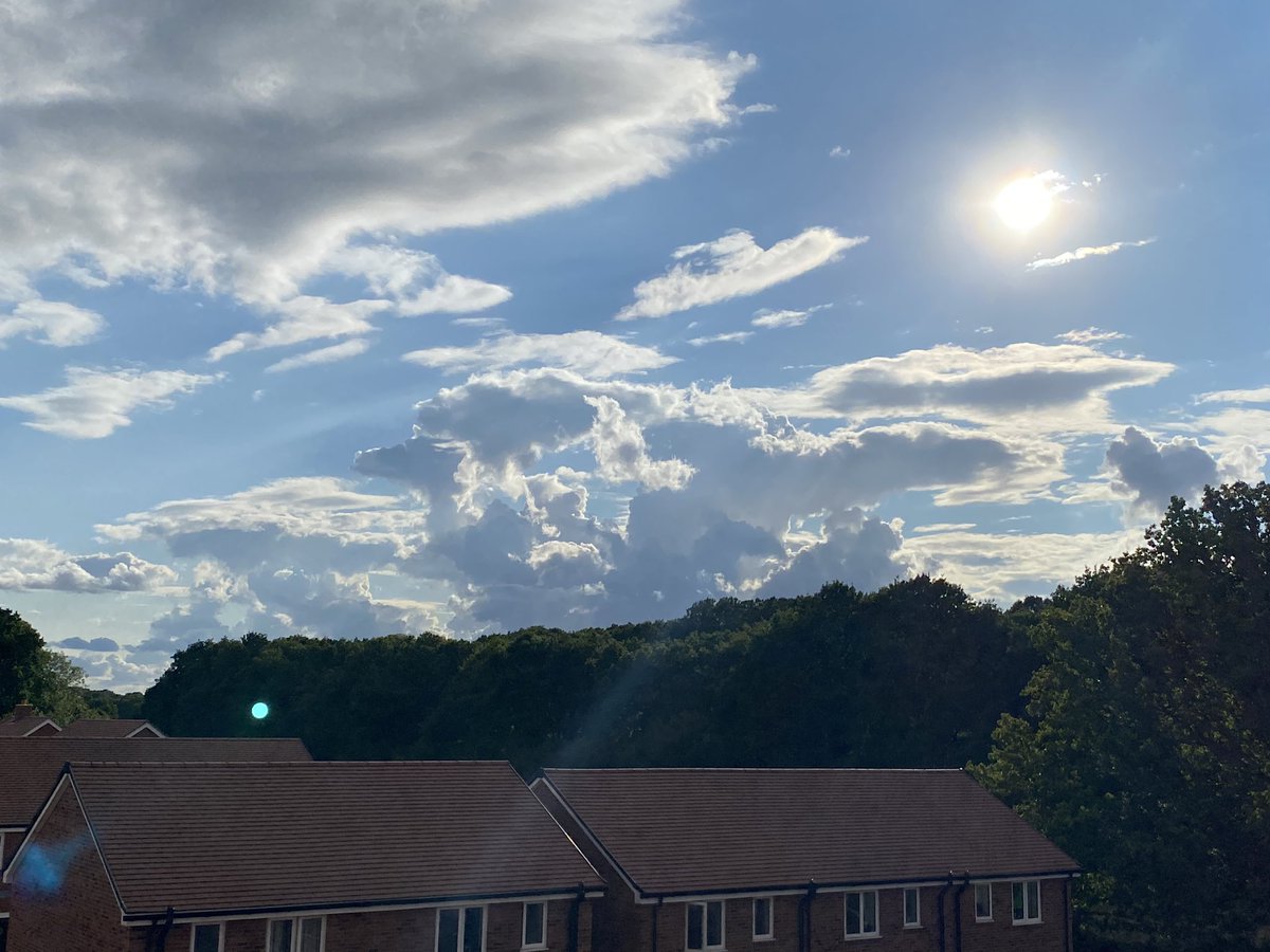
Sampled dramatic skies as a thunderstorm passed about 15 miles to the south of me. Faintest suggestion of thunder heard.


3
4
21
RT @PaulBlight6: Models now finally all converging on the idea of a significant low pressure centre most likely moving across Scotland on M….
0
9
0
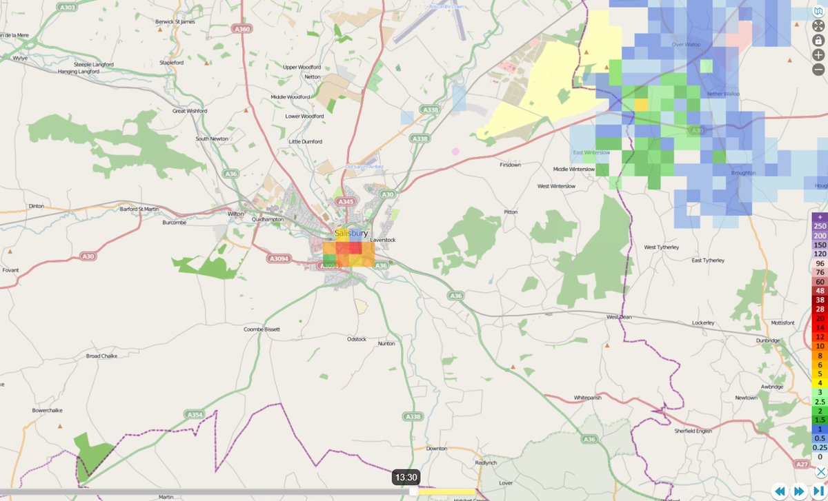
I suspect this is an artefact & not truly a very teeny downpour over Salisbury at 13:30 - but if anyone knows otherwise please do let me know 😁
0
0
2
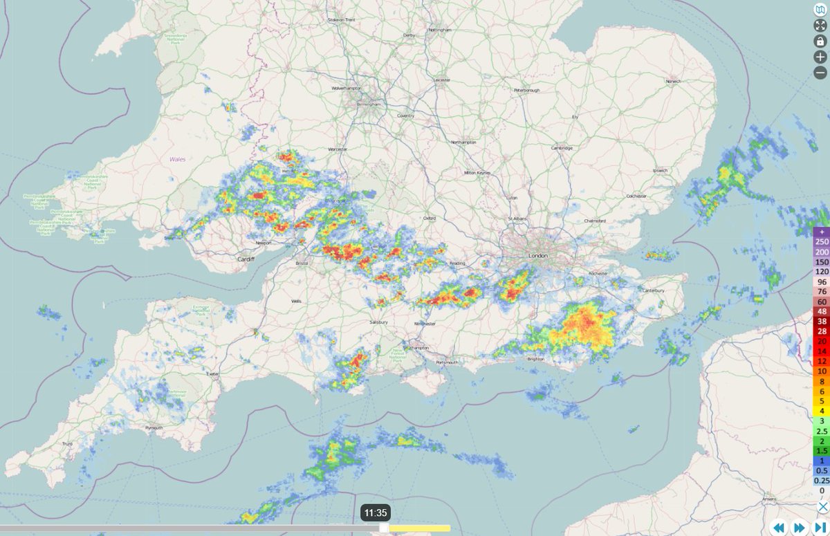
Update: Similar situation to before but with a couple of thunderstorms now in the mix. Hints in the wind observations of the convergence along the southern coast starting to establish, but moist convection has yet to respond much.

3
0
4
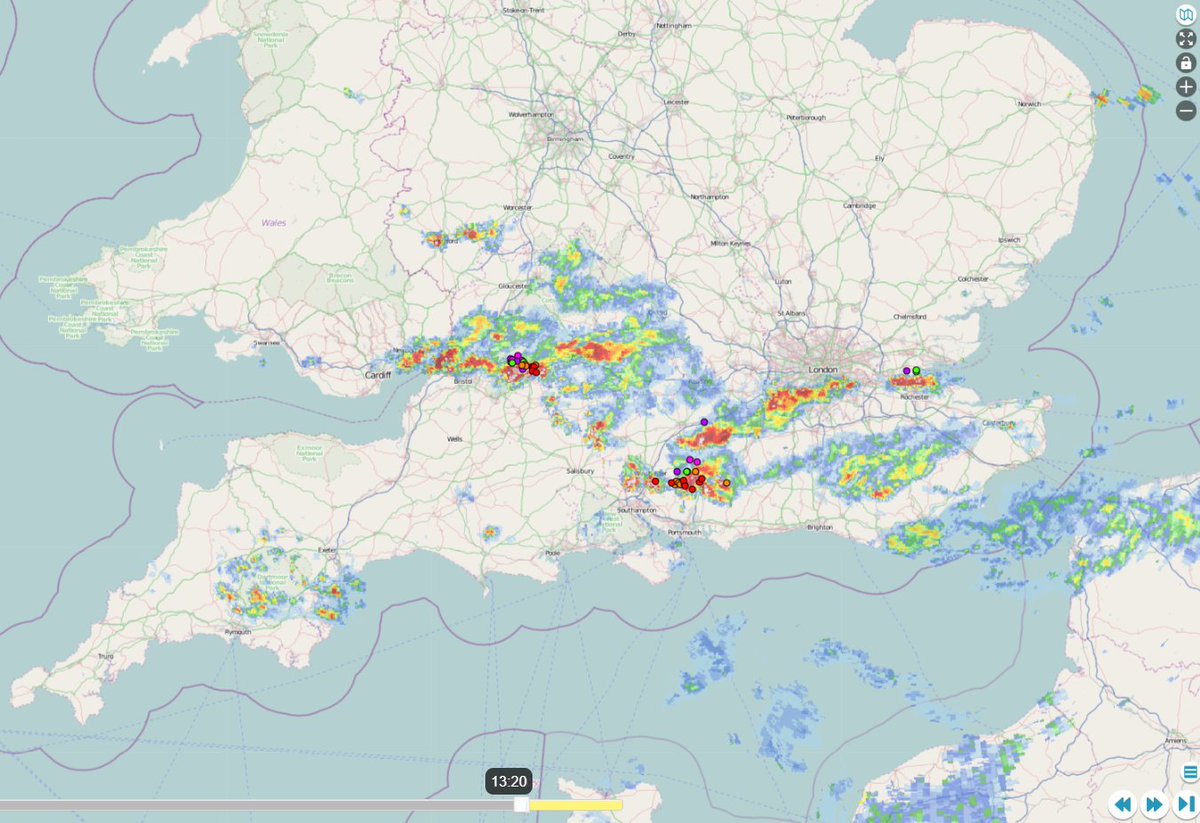
Sit rep: Most of the moist convection has so far occurred within a swathe from southern Wales to the SE corner of England. A distinct feature has crossed southern Dorset & is now passing just south of my location. Little sign yet of a convergence line along the southern coast.
7
4
20