
Ordnance Survey of NI
@osni_maps
Followers
1K
Following
934
Media
346
Statuses
863
Ordnance Survey of Northern Ireland (OSNI) is the official producer of high quality, accurate and current geographic mapping data for Northern Ireland.
Northern Ireland
Joined March 2015
Great day at #BelfastMela! 🎉. OSNI was proud to be part of the celebration - thanks to everyone who visited our stand and chatted maps with us! 🗺️🌍. #OSNI #MappingNI #Mela2025 #Geospatial #Community

0
0
2
🎉 OSNI will be at #BelfastMela this Sunday at Botanic Gardens!. Come say hi, explore our work, and enjoy a day of music, dance, food & culture. We can't wait to meet you! 🌍. #OrdnanceSurveyNI #Mela2025 #MappingNI #CommunityEngagement

0
1
2
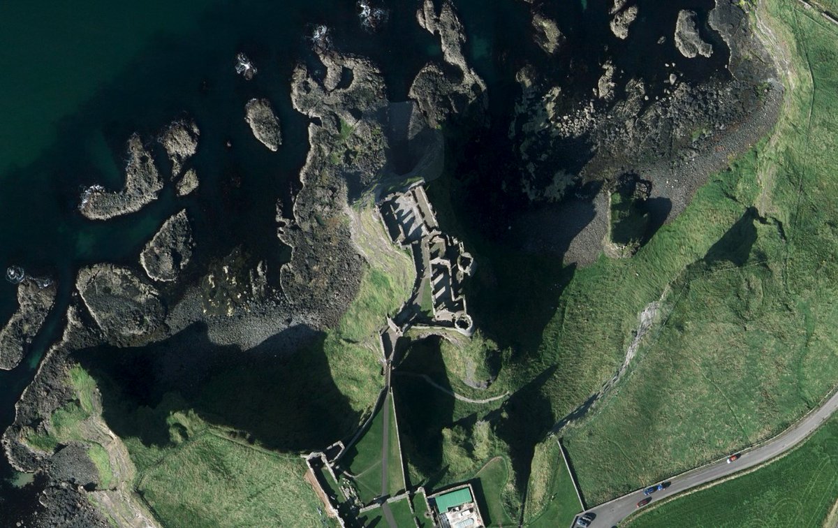
🗺️ Guess the Place!. This coastal ruin once had a kitchen that fell into the sea…. Can you name it? 👀. #GuessThePlace #MappingNI #OrdnanceSurveyNI #OrthoPhotography #GIS
1
0
3
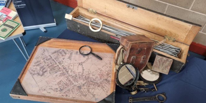
🗺️ Ordnance Survey NI joined the #FestivalOfArchaeology launch at Divis Mountain on July 19!. From prehistoric finds to 200 years of mapping history - we brought maps, LiDAR models, kids’ activities & more. Big thanks to all who came!. #MappingHistory #GIS #GetKidsIntoSurvey

0
0
2
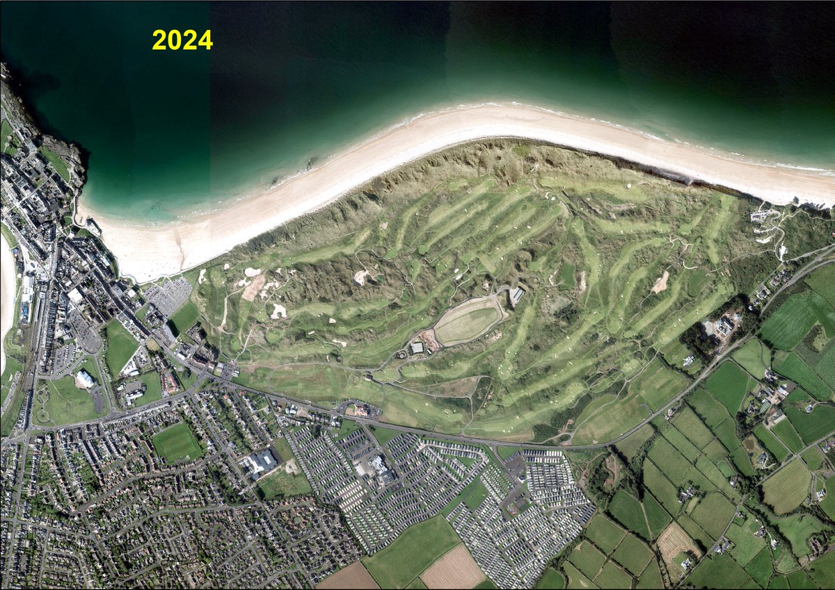
From a 9-hole start in 1888 to hosting The Open 2025 — Royal Portrush has come a long way. 🏌️♂️. OSNI mapping tells the story of its rise to golfing greatness. Who’s heading to the Port this weekend to watch history in the making?. #TheOpen #RoyalPortrush #Golf #OSNI #TheOpen2025

0
0
5
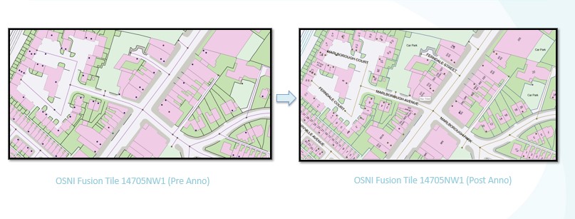
🚀 Big news from OSNI!.We’ve launched Fusion Tiles + a new annotation layer in ALLNI outputs!. ✅No more manual text placement.✅Toggle on/off as needed.✅Clear, query-able, intuitive maps. 📩 Sample the data: mapping.helpdesk@finance-ni.gov.uk. #OSNI #Geospatial #Cartography
0
1
5
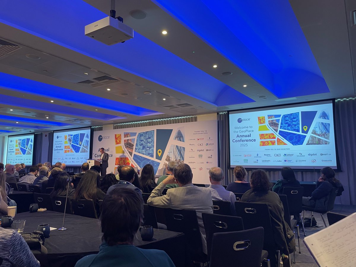
OSNI joined #GeoPlace2025 in London to explore how geospatial + addressing data can connect people & places, cut costs, and power smarter services. 🚀🌍. Big ideas, great conversations, and a bright future for location data!.#Geospatial #SmartServices #OSNI
0
0
6
👏 Huge congratulations to the NI EPG team for leading this critical initiative—laying the groundwork for a safer, more resilient future.
0
0
2
📍 Proud moment for OSNI!.Our team joined the launch of Northern Ireland’s Resilience Strategy 2025–2030, where data and mapping are critical components of emergency preparedness. #ResilienceStrategy #EmergencyPreparedness #TeamOSNI #ShapingTheFuture

1
2
5
Hint: I’m hiding in plain sight at a UNESCO World Heritage Site known for its legendary stepping stones. Drop your guesses below! ⬇️. #WhereAmI #HiddenInNature #GiantSurprise #GreenRoofGoals.
1
0
1
From above, I might look like just another patch of wildflowers… but beneath this blooming green roof lies a hub of stories, science, and spectacular views. This building is as much a part of the landscape as the basalt columns nearby. Can you guess where I am? 👀

1
0
2

Our very own, Trevor Rea discussing how the LPS Strategic Asset Management Unit can enhance and support government services #AGINI25

0
1
6
Don’t miss out on the chance to connect with experts and discover how our innovative solutions can benefit you. See you there! 👋🏻. #AGINI25 #OrdnanceSurveyNI #Geospatial #Mapping #Innovation.
0
0
0
Come visit our stand to explore the latest in geographic data. Whether you’re a seasoned professional or just curious about the world of geospatial information, we’ve got something for everyone.
1
0
0
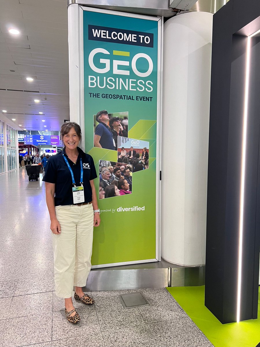
Great to connect with partners, customers and fellow geospatial professionals at GeoBusiness 2025. Comment below if you would like to meet and see how we’re shaping the future of location data. #geobusiness #geospatial #osni #locationintelligence
1
3
7
OSNI attended the 2025 ESRI conference in London last week. The message ‘GIS uniting our world’ is very applicable to our work in OSNI. Our OSNI Identifiers in Fusion and Pointer help to support this vision. For more information please contact; mapping.helpdesk@finance-ni.gov.uk.

0
0
3
Our Geospatial Survey Service team were out last week in Carrickfergus with our DJI Matrice UAV capturing imagery and LiDAR in order to support GSNI with their geotechnical monitoring programme. #dronephotography #lidar #aerialphotography @DJIGlobal


0
0
3