
Chris Holmes
@opencholmes
Followers
4K
Following
3K
Media
113
Statuses
2K
Working towards Cloud-Native Geospatial, through involvement in @GeoParquet, @planet, @STACSpec, @cogeotiff, @cloudnativegeo & @source_coop.
San Francisco, CA
Joined May 2013
I'm very pleased to share the full details on 'fiboa' - a data schema and ecosystem to improve the interoperability of agricultural field boundaries and related data. It's my favorite project to work on lately. Start with our intro post: https://t.co/Wqr4SBrD87 🧵(1/n)
cloudnativegeo.org
Announcing fiboa (Field Boundaries for Agriculture), a new project we’re collaborating on with the Taylor Geospatial Engine focused on improving interoperability of farm field boundary data and other...
1
12
40

QGIS' GeoParquet Downloader Plugin now supports OpenStreetMap's weekly Parquet feed https://t.co/0PbLC0HUBC Ignore the custom URL step in the above guide as OpenStreetMap now has its own tab in the plugin. Thanks @opencholmes, @ianthetechie and everyone else working on this.
1
20
118

This week we begin rolling out recordings from #CNG2025. First up: @opencholmes on "Towards a Global Spatial Data Ecosystem." As Chris states: "We have the tools & people to make a huge impact...as long as we do it together." ▶️ https://t.co/7D7vCwub2B New videos dropping weekly!
0
2
6

🌍 Meta’s basemaps are now powered by Overture! @Meta has transitioned its global basemaps to #OvertureMaps’ open data, improving accuracy, validation, and industry collaboration. Read the case study:
overturemaps.org
Meta, one of the founding members of Overture Maps Foundation, has successfully transitioned its suite of global basemaps used across apps such as Facebook and Instagram to Overture’s base data...
0
5
20
Introducing the keynote speakers headlining the CNG Conference 2025, happening April 30 - May 2 at Snowbird, Utah ▪️ @opencholmes, VP of Product at @planet ▪️ Eli Holmes, Open Science Lead at @NOAA Fisheries ▪️ @Schneider_ly, Research Director at @IDC 🔗 https://t.co/Q4idvLQts1
0
1
8
(unless you love SQL and have your lat/long coordinates memorized). A big thanks to all the new contributors!
0
0
1
I think my favorite (pictured in the gif) is the ability to select multiple @OvertureMaps layers and then have the plugin download them all at once. I'm pretty confident it's now the easiest way to get a bunch of Overture data for your area of interest.
1
0
1
It's so cool to see the plug-in get better as different people 'scratch their own itch' and add what they think is useful.
1
0
0
Just published a post on new features in the GeoParquet Downloader QGIS Plug-in I've been working on, see https://t.co/MlgM1cvHQK The most exciting thing to me is that a majority of the new enhancements have come from outside contributors.
medium.com
Many new improvements have landed recently, from a variety of contributors, turning this plug-in to a true open source project
1
0
4
I'm incredibly pumped that we'll be launching 'phase 2' of the TGE initiative that lead to Fields of The World ( https://t.co/IjGSUrySW9) and fiboa ( https://t.co/5iSfGzTawg). And I'd like to invite you to join us! See https://t.co/DCaZfnW4xQ for more info...
tgengine.org
Learn about our plan for Phase 2 of the AI for Earth Observation and Field Boundaries Initiative and how to get involved.
2
7
41
...and I give my take on it at
cholmes.medium.com
Join Taylor Geospatial Engine’s initiative to build towards a global field boundary dataset using AI and satellite imagery.
0
0
1
I'm incredibly pumped that we'll be launching 'phase 2' of the TGE initiative that lead to Fields of The World ( https://t.co/IjGSUrySW9) and fiboa ( https://t.co/5iSfGzTawg). And I'd like to invite you to join us! See https://t.co/DCaZfnW4xQ for more info...
tgengine.org
Learn about our plan for Phase 2 of the AI for Earth Observation and Field Boundaries Initiative and how to get involved.
2
7
41

Experimenting with CRS tracking support in DuckDB Spatial 🗺️👀
1
5
19

I just published a blog post sharing some videos on how to make a QGIS plugin with AI coding tools: https://t.co/cgyNaOr9NZ I've been having great fun with it, so wanted to help demystify the process for anyone curious & hopefully inspire more people to add cool stuff to QGIS!
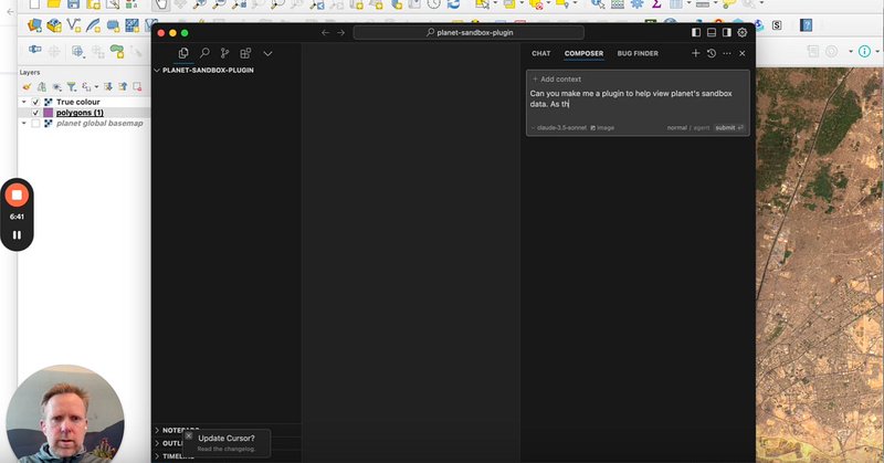
cholmes.medium.com
A couple of videos to help demystify the process of using AI coding tools like Cursor to create QGIS plugins.
2
20
106
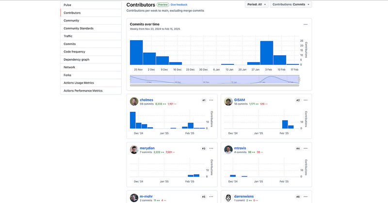
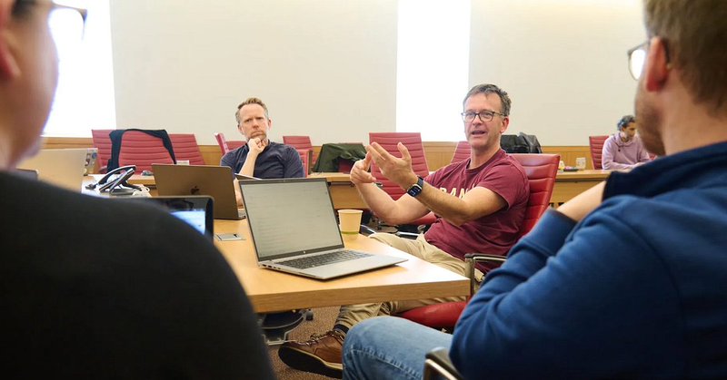
It was an amazing group of collaborators, all pulling in the same direction to lay real foundations for global field boundary data. We have some great momentum now, and I'm excited TGE has secured funding for to build on those foundations and accelerate towards the vision.
0
0
0
Helping start Fiboa ( https://t.co/VaimRc5YL4) and Fields of The Worlds ( https://t.co/5oKIi2exyz) as part of TGE's first Innovation Bridge is easily the thing I'm most proud of contributing to last year. Read this great blog post summarizing what happened: https://t.co/x9Vuk6NkIm
tgengine.org
1
5
43
You, yes you, can help the Cloud Native Geospatial Movement! Have you benefitted from Cloud-Optimized GeoTIFF’s? SpatioTemporal Asset Catalogs? Zarr, COPC or GeoParquet? Learn how to give back in my post https://t.co/yf54mv2X5l
2
3
16
The tools are really quite magical, greatly shortening the learning curve. And if you'd like a problem to work on feel free to contribute to my project at https://t.co/IU6i5t1fq8 I had a new contributor for the 0.4.0 release, and I'm fully welcoming of AI-assisted contributors.
0
0
1
and even more satisfying to contribute back to the open source ecosystems that enable it. I do believe that you'll find success as long as you've got a real problem you want to solve and you're willing to be a bit hard-headed and keep trying even if it doesn't work at first.
1
0
1
I'm excited that it's already inspired at least a couple people to write their own QGIS and Esri plugins, and I'm hoping this post will inspire even more. It's been an awesome experience for me to get back into creating software...
1
0
1