Neil Lareau
@nplareau
Followers
6,520
Following
352
Media
1,284
Statuses
4,326
Prof. of Atmos Sci. @unevadareno . Mountain WX, Wildfire Plumes, Backcountry Skiing, Frontcountry Dadding. Formerly: @SJSUmeteorology @UUtah @Livermore_Lab @MWObs
Truckee, CA
Joined December 2009
Don't wanna be here?
Send us removal request.
Explore trending content on Musk Viewer
Amethi
• 239258 Tweets
राहुल गांधी
• 157583 Tweets
علي النبي
• 74037 Tweets
Stacey
• 63227 Tweets
DONBELLE IN SOCCSKSARGEN
• 56872 Tweets
憲法改正
• 53276 Tweets
Hayırlı Cumalar
• 37349 Tweets
La ONU
• 36894 Tweets
स्मृति ईरानी
• 35001 Tweets
#يوم_Iلجمعه
• 29483 Tweets
ゴジラ-1.0
• 26951 Tweets
covered by
• 24611 Tweets
#スポ男
• 21565 Tweets
#最強スポーツ男子頂上決戦
• 13695 Tweets
ランウェイ
• 12671 Tweets
ミスター
• 11857 Tweets
革命デュアリズム
• 11340 Tweets
CREATE AWESOME WITH BINI
• 10345 Tweets


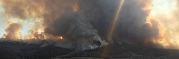
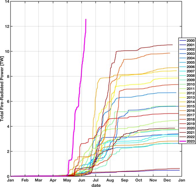
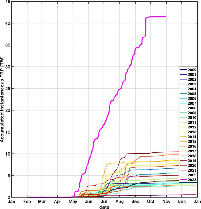
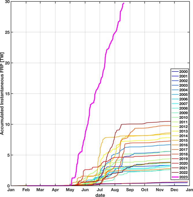
It just won't stop. Canada realized its most intense episode of fire growth to date (as shown by accumulated FRP), never-mind that it happened on a date after which every previous season (in the MODIS record) had slowed to a trickle...
#pyrocene
#canadianwildfires
41
456
1K

Anyone else have reviewers tell them they should use Python instead of MATLAB? This seems out of line in a review, IMO.
108
15
785
Update (6/12/2023): Continued extreme and widespread fire activity propel the
#CanadianWildfires
season total Fire-Radiative Power (FRP) into uncharted terrain (for 2000-2023 satellite record). So much fire, so much smoke, and so much fire season yet to come.
#pyrocene
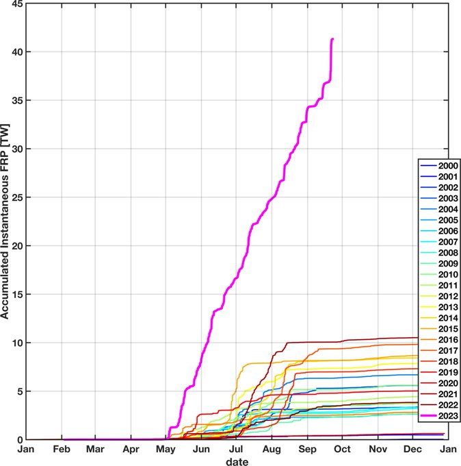
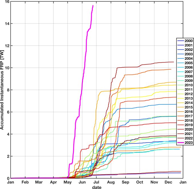
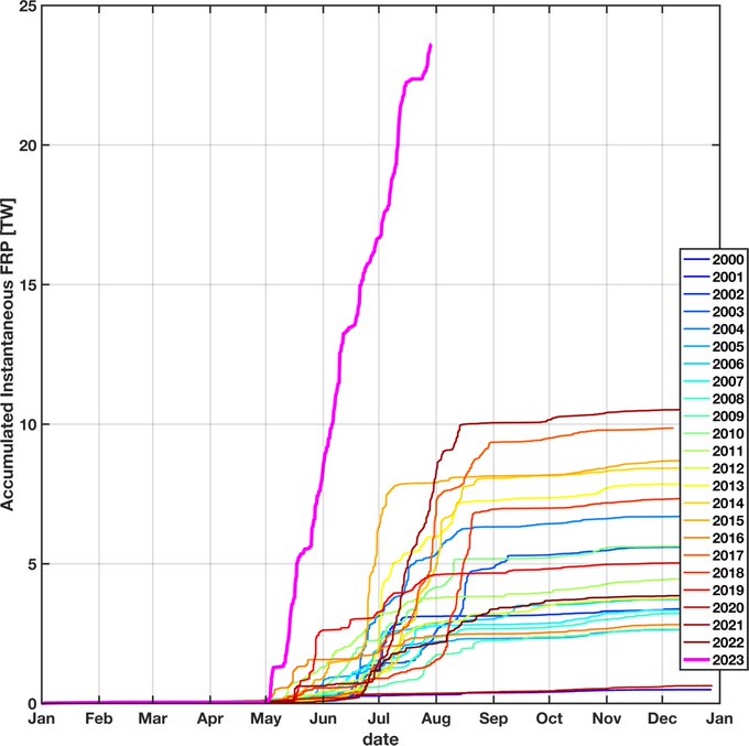
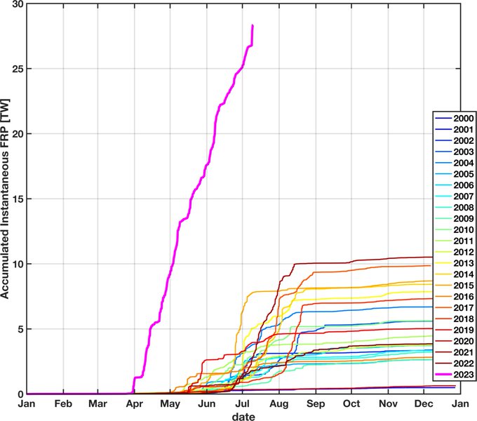
The 2023 Canadian fire season is like no-other in the satellite record (2000-pres). Here are the accumulated fire-radiative power (FRP) curves, with 2023 (magenta) in a league of its own. Note that smoke production is proportional to FRP. (data= MODIS, results= prelim)
#pyrocene

20
292
574
28
382
670
The 2023 Canadian fire season is like no-other in the satellite record (2000-pres). Here are the accumulated fire-radiative power (FRP) curves, with 2023 (magenta) in a league of its own. Note that smoke production is proportional to FRP. (data= MODIS, results= prelim)
#pyrocene
20
292
574


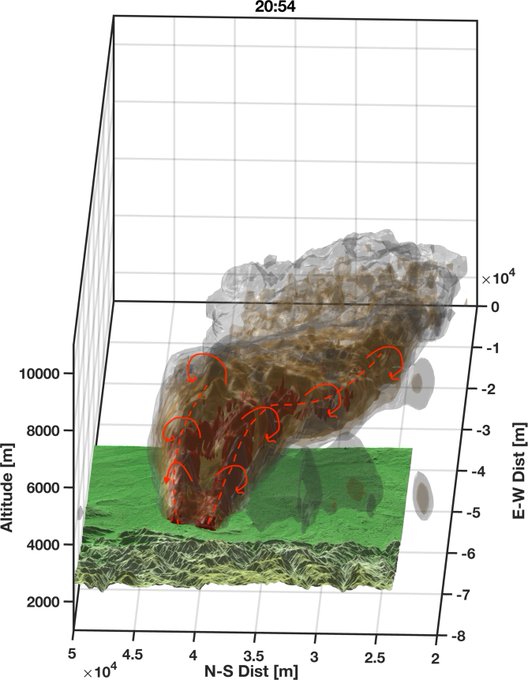
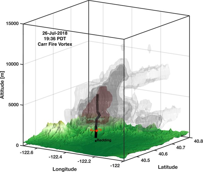
3D NEXRAD radar reconstruction of the
#McKinneyFire
's impressive nocturnal
#pyroCb
early Sat AM. Image shows a deep, nearly vertical, pyrometeor laden updraft (deep reds) reaching to ~12 km as well as the descending "ashfall" region that extends downwind from the updraft core.
14
116
386

Deepening of the secondary low is well-evidenced in this afternoon's satellite loop. Great week to be teaching about cyclone structure and dynamics
@UNRScience
!
10
59
370
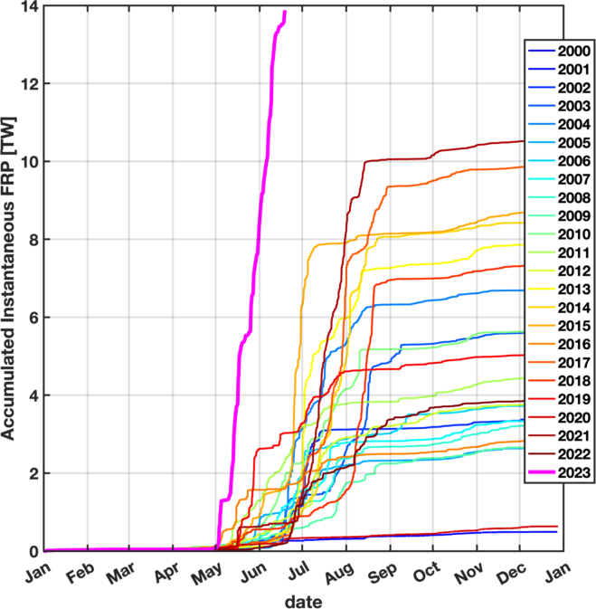
1/n: With the onset of active cool-season weather across Canada in late Sept., the off-switch for the superlative 2023 fire-season has been finally been thrown. The season started early, ended late, and exceeded the previous maximum by a factor of 4.
#pyrocene
#canadianwildfires
9
170
367
Summary of Canada's off-the-charts season-to-date accumulated Fire Radiative Power. Now more than triple the previous high-mark in the MODIS satellite period of record (2000-Present).
#CanadianWildfires
#Pyrocene
10
172
335
Newest numbers for Canada's season-to-date accumulated FRP (sum of instantaneous values), showing the continued absurdity of this year's combined fire size and intensity.
#Pyrocene
#Canadianwildfires
Updating Canada's season-to-date accumulated FRP (sum of instantaneous values) once again to capture recent additional fire growth following modest slow down. Will have to adjust axes soon...
#canadianwildfires
#pyrocene
7
39
90
11
149
307
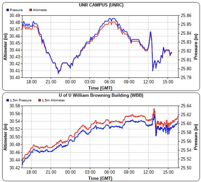
A number of folks have posted similar obs, but here are two pressure traces showing the
#HungaTongaHungaHaapai
shock wave observed at UNR in Reno and UoU in Salt Lake City this morning. The SLC data seem to show subsequent oscillations (sloshing) in the valley cold pool.
#UTwx
13
91
292
Following a devastating week of destructive fires in
#BritishColumbia
, here is the updated Canadian season-to-date accumulated Fire-Radiative Power (FRP). It really looks like tripling the previous high mark is possible. That is nuts.
#Pyrocene
9
127
296
As noted by others (
@mn_storm
) the lookers right flank is producing anticyclonic rotation. Earlier the lookers left flank had cyclonic rotation.
#RiverFire
.
10
123
286
So what are the rules when some one abandons their Tesla in your yard after sliding off the road? You get to keep it right ;)
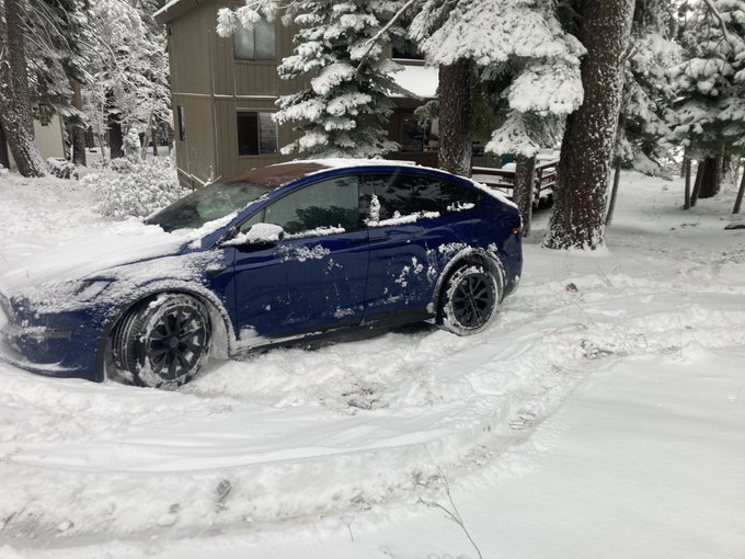
35
8
280
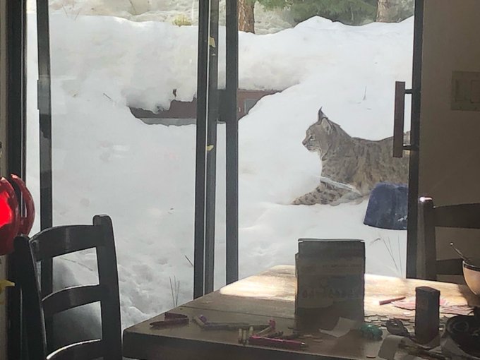
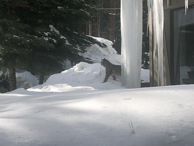
I did not know it could be this green in September in the Sierra. Grasses and fine fuels still look like spring at 7000 ft. (Not everywhere mind you… definitely elevation and aspect dependent)

17
15
267
I think a lot about counter-rotating vortex pairs (CVPs) in wildland fire. But you find these CVPs everywhere that flow splits around an obstacle. Here, you can see the snow scouring in the vortices, and the deposition extending downstream in the confluent wake.

5
24
260
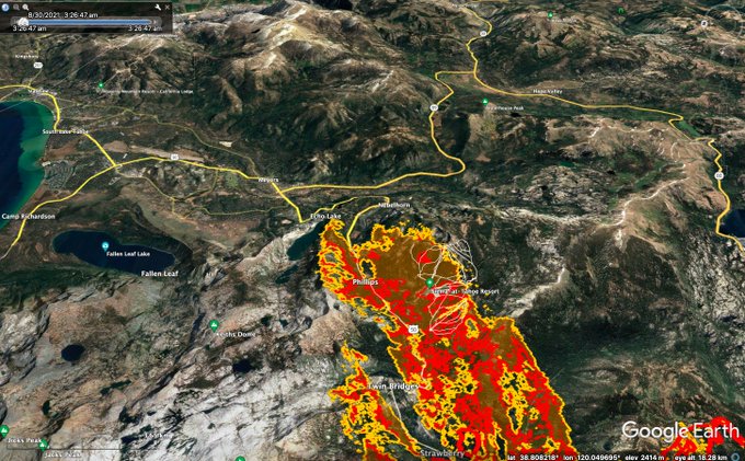
Gotta say, the outlook for the
#CaldorFire
is not good. With fire established on both sides of 50 east of
#Strawberry
and crescendoing SW winds for the next 48 hrs (including at night) it is hard to imagine scenarios in which it doesn't make a run toward Hwy 89 south of
#Meyers
.

15
93
251
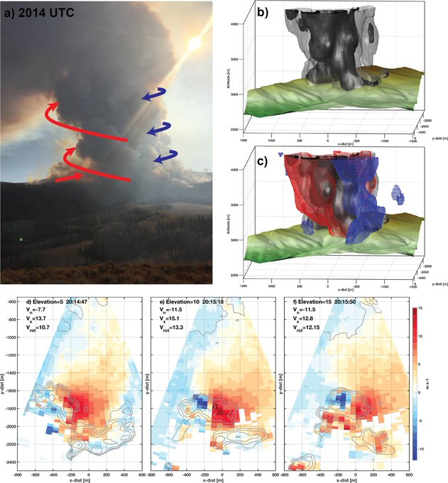
NEXRAD rendering of the
#MosquitoFire
plumes at 707 PM on 9/8/2022 during the vortex signature. There are two plume cores, one on the SE run (the cyclonic vortical one) and a narrow plume off the NE branch (close to where we were). Will add fire data and time sequence later...
13
48
250
Looking back at the
#CreekFire
's big run up to Mammoth Pool: Here is a radar animation of the explosive
#pyroCb
plume development. This plume was massive, producing multiple pushes above 12 Km.
#CAwx
#CAfire
10
116
251
For folks near the
#TamarackFire
today (e.g.,
#Gardnerville
): If you experience
#ashfall
from the plume we'd love photos of the ash with an object for scale (coin). These
#CitizenScience
data will help us understand radar data from wildfire plumes such as this (last night).
#NVwx
55
113
232

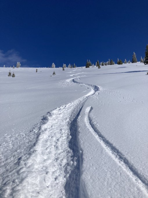
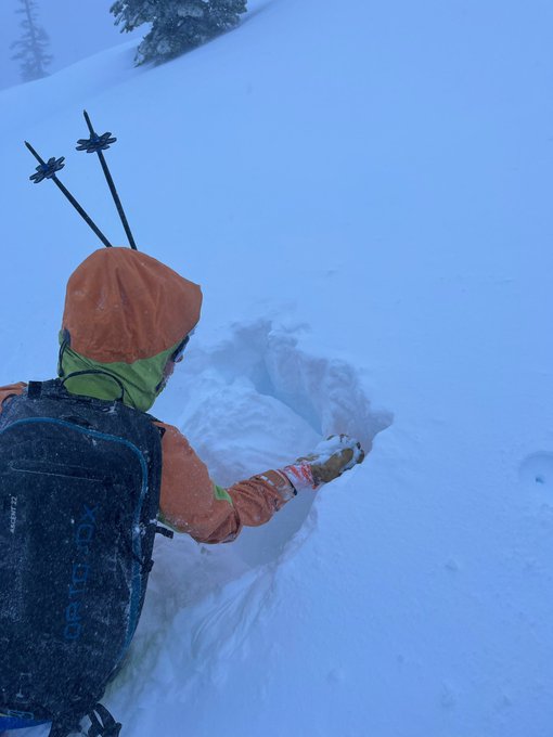
Sobering day in the Sierra following the avalanche at Palisades. Had the chance to stroll around the hills with friends, which revealed a rotten snowpack and non-stop whumphing, indicative of widespread instability. Quick hand pits revealed the culprit facets.
7
17
225
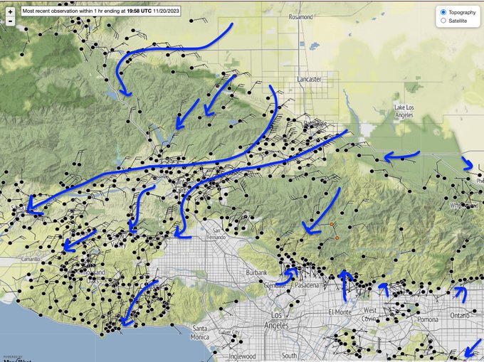
Strong orographic enhancement and suppression in Hillary’s the easterly flow across the terrain of Northern Baja California. Flow-topography interaction will play a big role today for focusing precipitation impacts across the southwest.
7
42
216
Radar volume rendering of the
#AppleFire
plume at ~6PM on 1 August. Note the deep core of high reflectivity, then the descending region of ash fall out (red isosurface). Plume was pushing >30Kft at this time.
#CAfire
#CAwx
4
62
205
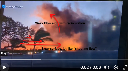
Watching this devastating video you can see the telltale signs of a downslope windstorm with strong near-surface flow overtopped with much weaker and sometimes recirculating winds. We've seen this time and time again: downslope wind storms are drivers of the highest impact fires.

10
67
204
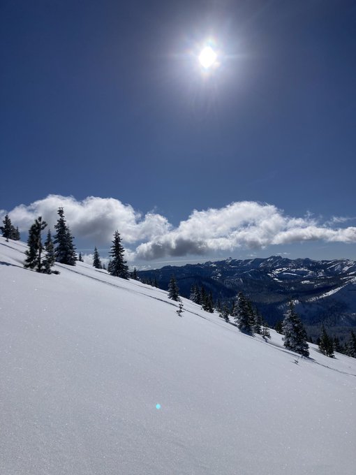
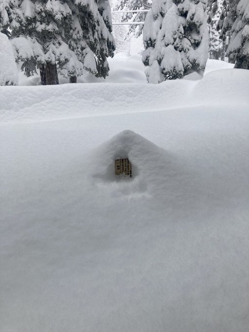
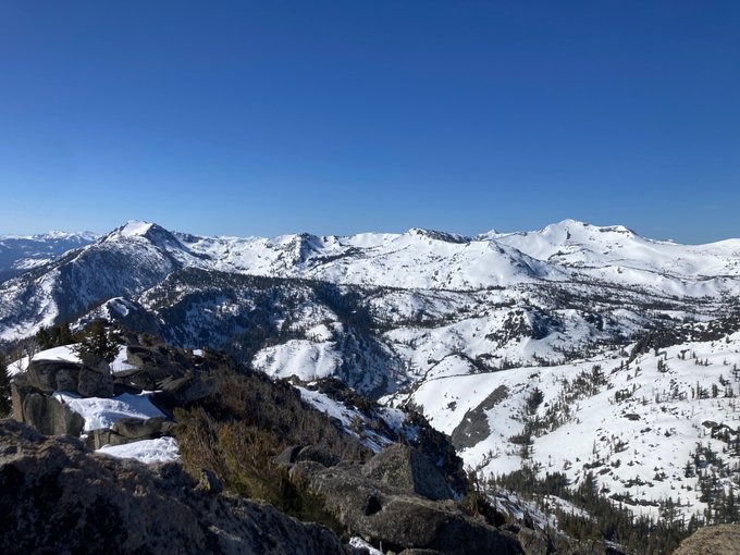
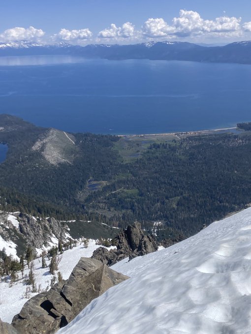
Looks mostly like summer at lake level, but more like winter in the desolation wilderness
0
15
203
Reconstruction of the radar and satellite detected plume and fire hot spots in
#Lahaina
. An aspect of this disaster to probe is the surprising north-south fire extent despite the strong east-to-west winds. Possible oscillation in the island wake contributing to this spread?
10
54
203
More radar analysis: Clear evidence for the plume bifurcation characteristic of the counter rotating plume elements.
#CalWoodFire
#COwx
#COfire
6
53
202
7
52
195

After a brief pause in wildfire activity last week, the Canadian year-to-date accumulated instantaneous Fire-Radiative Power curve continues its climb into the record books.
#CanadianWildfires
#Pyrocene
8
85
182
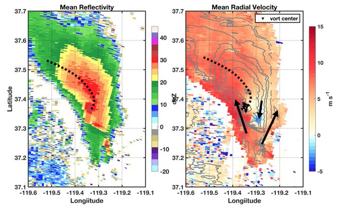
Still digging into the
#CreekFire
plume/vortex evolution. Can we call this a hook echo? I'm going with yes. Left shows reflectivity, right radial velocity. Averaged over ~1 hr (23-24 UTC). Right also shows vortex centers ID'd from individual times.
#CAwx
#FireWxIsExtremeWx
12
50
179
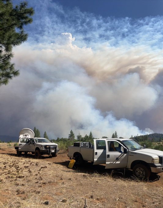
Long field day on the
#mosquitofire
but hats off to
@FireWeatherLab
&
@UNRScience
students for a successful day of radar/lidar plume obs. It’s not easy: finding locations, overcoming adversities, and walking away with a pile of data that will drive the science forward.
#CalFIDE

6
16
176
Preposterous quantities of fire in Northern Alberta and NWT contributing to skyrocketing season-to-date accumulated FRP for Canada. Will we triple previous satellite derived records?
#Canadianwildfires
#pyrocene
12
63
172
Beautiful example of the positive feedbacks (i.e., non-linear processes) that allow a low-amplitude digging short-wave trough to explode into a record breaking cyclone in <24 hours!
#bombogenesis

Flying along with the jet stream to the landfall of the meteorological bomb
11
148
498
0
66
172
My favorite thing about the iPad/iPencil is that it has upped my doodling while on phone calls game....

8
7
168
Totally different breed of
#pyrocumulus
over CA this afternoon. These shallow clouds are likely caused by the heating of the top of the smoke layer by solar radiation, rather than fire-driven updrafts.
#CAwx
9
43
159
A banana slug warning has been issued for the Santa Cruz mountains…. ( am I the only one that sees slugs when I look at the core segments?)
10
22
165
Getting real in wildfire country... I've already been dropped, but we're going to have to recon with this on some higher level as a society... it's not an option for people to just not live in these localities.
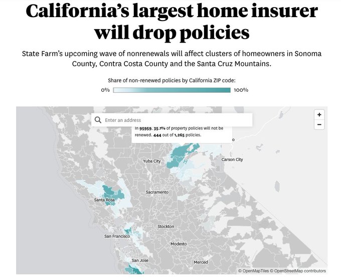

State Farm is about to drop 30,000 policies in certain California ZIP codes. This map reveals if you live in one of them.
1
7
17
18
58
165
Thinking back to the devastating Western US fires in Sept. 2020 and comparing that year's profoundly dry root-zone soil moisture (Sept 2020) to the remarkably wet present (Sept 2023). (Data from NASA GRACE: )
6
41
159
Radar volume rendering of today's explosive
#pyroCb
from the
#DixieFire
. As the
@AlertWildfire
videos show, rapid growth of the lookers left plume after the first
#pyroCb
pulse. Outflow from the former to the latter could have been a contributor.
#CAwx
#CAfire
#FireWxIsExtremeWx
6
56
161

Christmas came a few days early! Feeling grateful, privileged, and honored to cross this milestone.
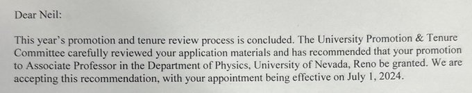
22
1
157

Gusts moving across Donner Lake this afternoon. Usually when it’s this windy in September I’m in a heightened state of alert for potential fast moving wildfires. Not feeling that stress this year!
8
11
148
Want to know more about rotating pyro-convective plumes? Check out our new paper in
@IJWildlandFire
:
.
These data were collected during a
#FASMEE
Rx fire in 2019 in the
@FishlakeNF
of Utah with
@FireWeatherLab
5
32
138
Crazy watching the influx of research interest, people, and $ into the previously-neglected world of fire weather/behavior. Part of me feels defensive about it, but really this is great. Bring it on. More minds, more tools, more progress. And for no reason, a plume animation:
9
7
136
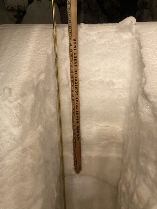
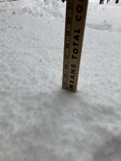
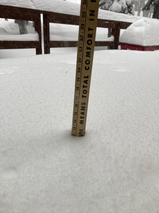
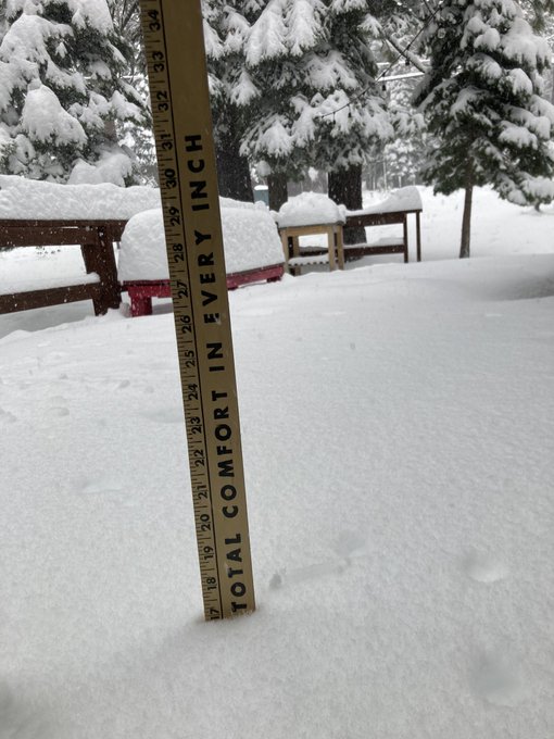
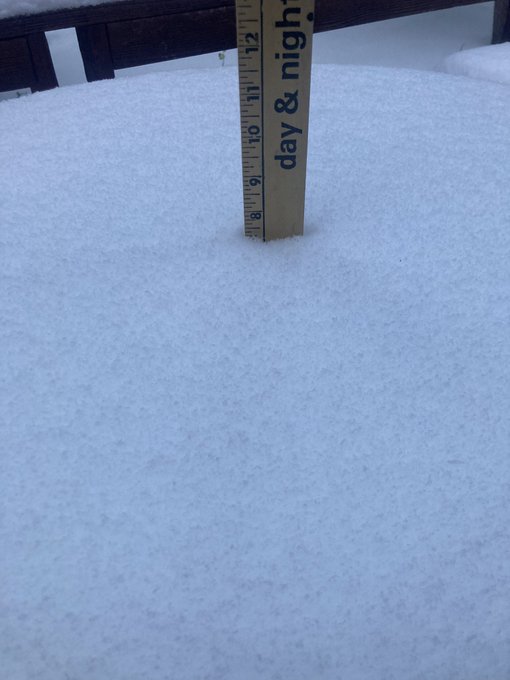
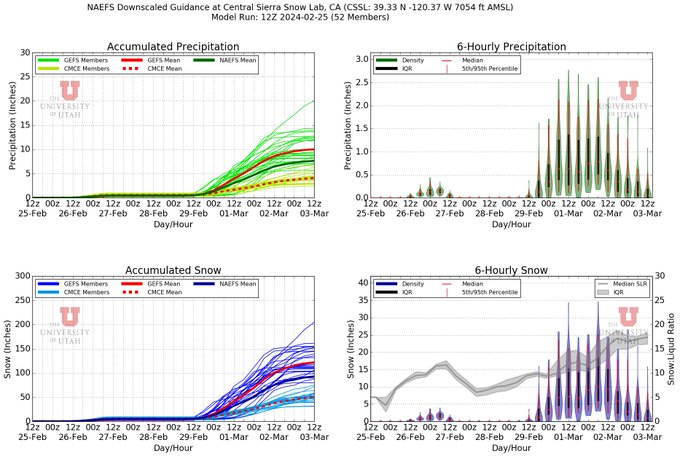
The GFS-based ensemble snowfall amounts for Thursday evening-> Sunday over the Sierra Crest (e.g.,
@UCB_CSSL
) are eye popping (almost runs >50", many>100"). A long way out and should be treated with normal skepticism, but has the ingredients to be a significant snowfall event.

10
25
132

Really sad. Had hoped (against hope I guess) for a stop as the fire descended from the terrain. It’s only July 10th…
2
37
122
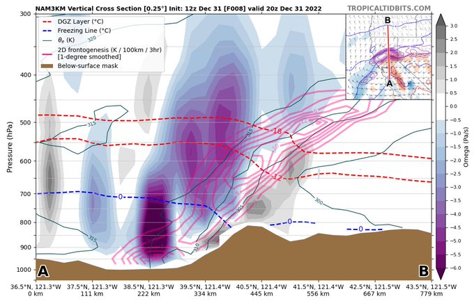
We're now in the phase of the storm with strong confluent frontogenetical forcing for ascent draped across the northern Sacramento Valley and the North-Central Sierra. Not something we regularly see.
12
12
129
I’ve really come to love my commute along the Truckee River. Always something beautiful along the way…
4
5
130
#CastleFire
in the southern Sierra (near Camp Nelson) is one of the more active fires today, with most others shading themselves out. East wind component driving it back upslope to the west.
#CreekFire
still consuming acreage too.
#CAfire
#CAwx
4
64
126

Fire's and hydraulic jumps...a surprisingly common feature of high impact fires. There really needs to be a whole book chapter about this some day.
3
32
129
330 AM PDT IR mapping for the
#CaldorFire
showing fire poised to make a further run to the east, descending from Echo Summit today. Unrelenting west and southwest winds and low humidity in the forecast.
6
45
127
A pictorial guide to why weather is more effective than humans at suppressing fire.
#VLAT
for scale. (Taking nothing away from the heroics of the fire fight and it’s success at protecting structures).
#mosquitofire
9
19
124
It’s 8:30 pm, and the
#CreekFire
is producing yet another anticyclonic tornado strength vortex.
10
47
120
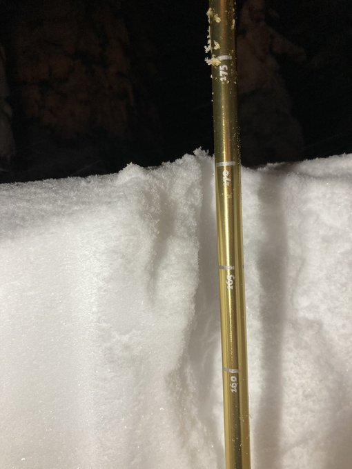
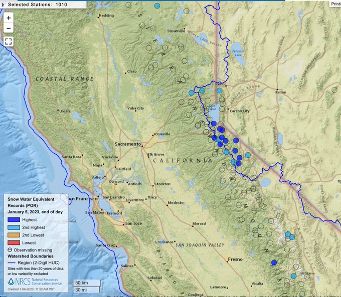
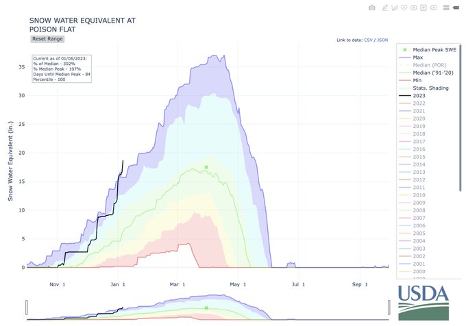
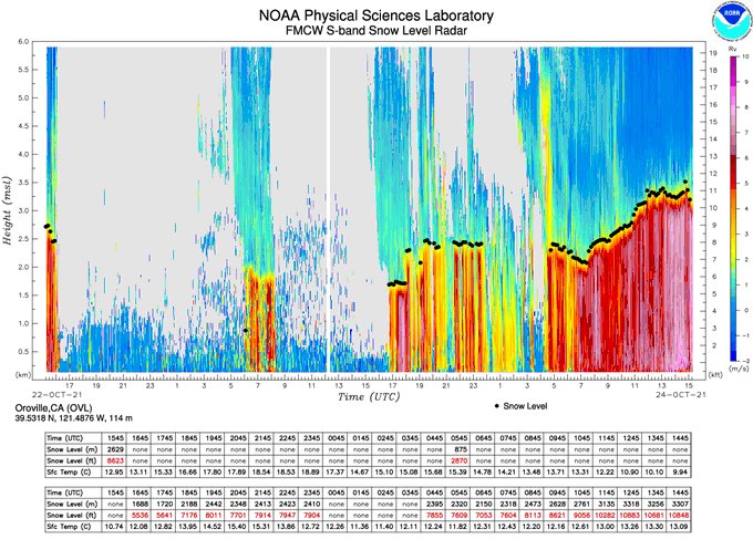
11,000 ft snow levels with the current very heavy precipitation over the northern Sierra, as observed at the Oroville Radar Wind profiler.
5
22
118