

Mapware
@mapwareai
Followers
436
Following
256
Media
142
Statuses
578
Mapware is the future of drone mapping software. Generate bigger, better 3D maps in the cloud.
Washington, DC
Joined December 2015
The crowd has spoken. Mapware is proud to be a leading company for Photogrammetry in the top right quadrant on G2 - the #1 independent software review site. Read unbiased reviews from real customers and compare yourself. #reviews #g2 #photogrammetry
0
0
0
💬 Four different factors come together to help you avoid errors in remote sensing. Uncover these and other important considerations. #Mapware #Photogrammetry.
0
0
0

🗺 Learn how drones and photogrammetry can be used to create highly accurate topographic maps based on digital elevation models: #Mapware #DigitalElevationModel #photogrammetry.
0
0
0
Capturing drone images is just one part of 3D mapping and modeling. 🗺 You also need the best photogrammetry software. Learn what to look for: #Mapware #drones #photogrammetry.
0
0
0
An orthomosaic map 🗺 is kind of like a puzzle. See how it brings pieces together to mitigate image distortion. #Photogrammetry #Orthomosaic.
0
0
0
🗺 Digital elevation models are used to create topographic maps for a variety of applications. Learn more in our latest article: #Mapware #DigitalElevationModel.
0
0
0
Do you understand Part 107 regulations for drone pilots? Be aware of these common pitfalls. ➞ #Mapware #Drones #UAV #Part107 #DronePilot.
0
1
1
Looking for the best photogrammetry software? 💻 Be sure to evaluate these five features: #Mapware #drones #photogrammetry.
0
0
0
Photogrammetry relies on high-resolution images. 📷 See the three pieces that impact resolution: #Photogrammetry.
0
0
0
Multispectral remote sensing for soil mapping uses #drones to analyze the soil content and balance of large areas of farmland. Here’s how it works: #Agriculture.
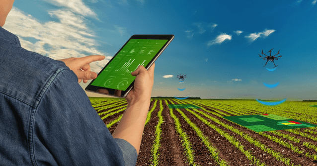
mapware.com
Maintaining healthy and productive farmland is no easy task. It requires the knowledge of different care and conditioning practices that have been honed over thousands of years. In recent yea…
0
0
0
🗺 How do you create a digital elevation model? Learn all about it in our latest article: #Mapware #DigitalElevationModel.
0
0
0
✈️ Watch for these nine potential pitfalls as a new drone pilot: #Mapware #Drones #UAV #Part107 #DronePilot.
0
0
0
Advances in #agricultural tech helps farmers collect the right field data. Here’s how digital #soil mapping works:
mapware.com
Maintaining healthy and productive farmland is no easy task. It requires the knowledge of different care and conditioning practices that have been honed over thousands of years. In recent yea…
0
0
0
What features will you find in the best photogrammetry software? 💻 Read our latest article to find out: #Mapware #drones #photogrammetry.
0
0
0
What’s multispectral remote sensing for soil mapping, and how can it help farmers make better decisions? We explain in our latest article: #Agriculture #Photogrammetry.
mapware.com
Maintaining healthy and productive farmland is no easy task. It requires the knowledge of different care and conditioning practices that have been honed over thousands of years. In recent yea…
0
0
0
New to drone piloting? ✈️ Know these pitfalls before you take flight: #Mapware #Drones #UAV #Part107 #DronePilot.
0
0
0
Multispectral remote sensing gives farmers the ability to make smarter decisions about where to plant certain crops. Learn more: #Mapware #Agriculture.
mapware.com
Maintaining healthy and productive farmland is no easy task. It requires the knowledge of different care and conditioning practices that have been honed over thousands of years. In recent yea…
0
1
1
Photogrammetry or LiDAR? 📷 Aerial or terrestrial? ✈️ Find out which approach makes the most sense for your application: #Mapware #Drones #Photogrammetry #RemoteSensing #LiDAR.
0
0
0
🎯 When accuracy matters, you need a drone flight plan: #Mapware #Drones #Photogrammetry #DroneFlightPlan.
0
0
1
Pipeline operators use aerial images for surveying and inspections. ✈️ Check out our blog post to learn how drones do it better: #Mapware #drones #photogrammetry #pipelines #UAV.
0
0
1
Curious about LiDAR remote sensing? 📡 Our blog post covers the basics: #Mapware #Drones #Photogrammetry #RemoteSensing #LiDAR.
0
0
0