John Nelson Profile Banner
John Nelson Profile
John Nelson

@John_M_Nelson

Followers
24,216
Following
97
Media
3,690
Statuses
18,608

Maker of maps. Talker of making of maps. Purveyor of gumption. Mitten State. I make map videos now? (views mine, etc.)

Grand Ledge, MI
Joined September 2011
Don't wanna be here? Send us removal request.
Explore trending content on Musk Viewer
@John_M_Nelson
John Nelson
2 years
Beautiful geography textbook from 1874. Look at that terrain.
Tweet media one
Tweet media two
4
36
352
@John_M_Nelson
John Nelson
5 years
I made this geodesic globe ornament at lunch. Will share the template tomorrow. In the meantime please get ready to live.
Tweet media one
Tweet media two
Tweet media three
11
60
350
@John_M_Nelson
John Nelson
6 years
Here's a map of the Columbia River Gorge in the new Imhof style.
Tweet media one
10
47
320
@John_M_Nelson
John Nelson
4 years
Sparkline map of coronavirus cases since Feb, updated daily.
Tweet media one
Tweet media two
Tweet media three
4
83
294
@John_M_Nelson
John Nelson
1 year
Here's how to throw shade from multiple angles and hues.
Tweet media one
Tweet media two
3
26
287
@John_M_Nelson
John Nelson
2 years
Optica gives you a multi-scale look at earth as you whip around. Zoom in or zoom out? Why not both?
7
38
263
@John_M_Nelson
John Nelson
2 years
Here is another for-funzies collaboration with @vannizhang that lets you always have multiple map scales visible as you zip around. That's it.
9
46
253
@John_M_Nelson
John Nelson
7 months
Lake Isabella, in Central Michigan, looks like Randall.
Tweet media one
Tweet media two
6
32
226
@John_M_Nelson
John Nelson
5 years
Don't look at this thing about Antarctic iceberg motion.
6
61
220
@John_M_Nelson
John Nelson
2 years
If you want to make LOTR style maps in ArcGIS Pro of various journeys and adventures, here's a style resource.
Tweet media one
7
29
219
@John_M_Nelson
John Nelson
2 years
How to make a bathymetric diorama micro world sort of thing for Challenger Deep.
Tweet media one
9
35
212
@John_M_Nelson
John Nelson
2 years
This is a thing of absolute beauty. @ArcGISStoryMaps
1
41
213
@John_M_Nelson
John Nelson
2 years
Status:
Tweet media one
16
2
213
@John_M_Nelson
John Nelson
3 years
I make YouTube how-to videos about maps. I'd be grateful if you let me know how I might improve. Roast me at this link, and thanks!
Tweet media one
11
38
205
@John_M_Nelson
John Nelson
2 years
Here's one way to while away one minute of your allotted time on earth.
5
42
207
@John_M_Nelson
John Nelson
2 years
By golly look at what I just found. There is nothing new under the sun.
Tweet media one
Tweet media two
Tweet media three
Tweet media four
6
22
204
@John_M_Nelson
John Nelson
3 years
It worked! The third installment of the GIS nerd Christmas ornament project comes out tomorrow.
Tweet media one
10
13
204
@John_M_Nelson
John Nelson
1 year
hey, fun news, ArcGIS Pro styles are now available in @LivingAtlas . here is a pile that i've added, if you want to get weird:
Tweet media one
6
26
202
@John_M_Nelson
John Nelson
2 years
I've been at this one-minute map hack thing for 65 minutes now.
Tweet media one
9
28
197
@John_M_Nelson
John Nelson
6 years
This is a map of US national parks, by visitor count.
Tweet media one
11
37
194
@John_M_Nelson
John Nelson
2 years
Goofing around with minor pixel animation in the micro world graphic using the Motionleap app, for giggles.
3
14
187
@John_M_Nelson
John Nelson
2 years
Whoa, check out this accidental rendering of elevation as unique values.
Tweet media one
Tweet media two
12
6
186
@John_M_Nelson
John Nelson
5 years
Whoever it was that popularized "small scale" and "large scale" terms in engineering and geography, I scowl at you across the generations.
25
27
181
@John_M_Nelson
John Nelson
4 years
Because making touchable looking maps is fun, I’m working on a cross-stitch style for @ArcGISPro
Tweet media one
Tweet media two
Tweet media three
2
10
175
@John_M_Nelson
John Nelson
3 years
Here's a shot at making one of those fun 3D-boosted vintage topo maps. And a how-to if you want to try it in Pro.
11
25
173
@John_M_Nelson
John Nelson
2 years
Just two cartographers mapping out the woods of coastal Michigan. With @pinakographos
Tweet media one
6
1
170
@John_M_Nelson
John Nelson
3 years
Map of Emperor Seamounts undersea range. Lots of fun making labels with pseudo perspective.
Tweet media one
Tweet media two
Tweet media three
Tweet media four
6
21
166
@John_M_Nelson
John Nelson
3 years
WIP one of those idealized earth hypersaturated globe stock image things.
Tweet media one
Tweet media two
9
3
166
@John_M_Nelson
John Nelson
1 year
Here's a video showing how to make one of those micro world 3D diorama things. This one of the glorious Straits of Mackinac.
Tweet media one
7
15
163
@John_M_Nelson
John Nelson
3 years
It's not a map unless it has a north arrow, so please don't read this.
7
20
159
@John_M_Nelson
John Nelson
2 years
Maps in movies. Iron Man 3, Tony visualizing extruded data columns but probably having trouble making height comparisons because of foreshortening, occlusion, and the variability of underlying terrain.
Tweet media one
Tweet media two
7
16
162
@John_M_Nelson
John Nelson
4 years
A thing for some stuff.
6
27
161
@John_M_Nelson
John Nelson
6 years
It worked!
Tweet media one
6
16
158
@John_M_Nelson
John Nelson
4 years
Tweet media one
13
7
157
@John_M_Nelson
John Nelson
2 years
These seafloor river-like formations around NZ are really something.
Tweet media one
4
19
153
@John_M_Nelson
John Nelson
2 years
Maps rule?
Tweet media one
6
1
153
@John_M_Nelson
John Nelson
3 years
Here is a fun way to visualize vessel traffic around the US. Also, you can download it in manageable chunks.
Tweet media one
Tweet media two
Tweet media three
7
39
152
@John_M_Nelson
John Nelson
3 years
Experiment: 3D embedded mist in @ArcGISPro
Tweet media one
9
6
151
@John_M_Nelson
John Nelson
7 years
Look! A literal projection. Light thru a glass globe. Old school.
Tweet media one
3
42
148
@John_M_Nelson
John Nelson
5 months
A great series of short explainers covering the what/why/who of mapping from @wiuhighwayman
Tweet media one
2
23
148
@John_M_Nelson
John Nelson
1 year
I made a video for this free mooc about spatial analysis that starts next week. It's about classification methods and how different methods tell different stories and none of them are lies so long as you are clear in your presentation and stuff.
Tweet media one
6
18
147
@John_M_Nelson
John Nelson
4 years
I had the @ArcGISPro template open so I made this map of the lovely Slovenia for my friend @BojanSavric .
Tweet media one
Tweet media two
Tweet media three
Tweet media four
7
8
145
@John_M_Nelson
John Nelson
1 year
Globe thing made in Pro with NASA visible earth imagery some Tom Patterson natural earth hillshade and a bunch of fake atmosphere gradients.
Tweet media one
5
11
145
@John_M_Nelson
John Nelson
5 years
Please do not look at this Appalachian Trail journal field map.
16
34
144
@John_M_Nelson
John Nelson
6 months
I'm 18 weeks late to this challenge, but better late than never. Attempting to re-create the look of an AI-generated topo environment in Pro.
Tweet media one
Tweet media two
Tweet media three
8
9
144
@John_M_Nelson
John Nelson
3 years
Today is the first day of the free mooc, Cartography. You can still sign up for a couple weeks. It's self-paced and includes software for duration of the course. I wrote a new lesson for it, too. We'll be making this Spilhaus map:
Tweet media one
6
27
144
@John_M_Nelson
John Nelson
1 year
How to turn those inner tint bands into inner glow sorts of things.
5
12
144
@John_M_Nelson
John Nelson
3 years
Using population density as a color saturation mask in ArcGIS Online. For funsies.
Tweet media one
Tweet media two
Tweet media three
Tweet media four
6
15
142
@John_M_Nelson
John Nelson
2 years
Found a practical use for the diorama thing. As the base of a GIS Layer illustration. Adding the layers will be a challenge but I like where it’s headed.
Tweet media one
6
9
139
@John_M_Nelson
John Nelson
2 years
Here's how you can make those cute little 3D diorama things in ArcGIS Pro.
Tweet media one
6
16
138
@John_M_Nelson
John Nelson
5 years
It was six years ago today I made the Breathing Earth gif. It's had a pretty fun life of its own since then.
2
27
138
@John_M_Nelson
John Nelson
5 years
Please do not read this blog about the makery process of a map of Panama.
10
24
137
@John_M_Nelson
John Nelson
1 year
I just got these stickers to give away at the @EsriUC ! Drawn by @WarrenDz
Tweet media one
10
7
136
@John_M_Nelson
John Nelson
6 years
"Gap" vs. "Pass" from US place name gazetteer.
Tweet media one
7
28
135
@John_M_Nelson
John Nelson
5 years
Here is the template/instructions to make your own globe ornaments!
6
48
134
@John_M_Nelson
John Nelson
8 months
The USGS Topographic Map Explorer has been updated. Please do not look at it.
Tweet media one
5
24
133
@John_M_Nelson
John Nelson
3 years
Tweet media one
15
6
134
@John_M_Nelson
John Nelson
5 months
Please don't make AI-inspired topo landscapes. Leave it to the bots.
Tweet media one
Tweet media two
Tweet media three
Tweet media four
2
17
133
@John_M_Nelson
John Nelson
3 years
Georeferenced and hillshaded 1874 lithograph of woodland density with current Forest Service lands rendered as little forests.
Tweet media one
Tweet media two
Tweet media three
8
8
134
@John_M_Nelson
John Nelson
5 years
Working on a reusable style to turn any vector data into a Lego map. Because Lego!
Tweet media one
7
16
133
@John_M_Nelson
John Nelson
2 years
Low poly earth sticker. Approve.
Tweet media one
3
1
133
@John_M_Nelson
John Nelson
1 year
Love to see this type of research reaching a broad audience. Rainbow is not just hard to interpret, it leads to misinterpretation.
Tweet media one
@nature_LANDFIRE
LANDFIRE
1 year
This paper lays out a "scientific case" for not using rainbow or red-green diverging color schemes to convey information Check it out: "The misuse of colour in science communication" Perhaps required reading for anyone presenting scientific info?
Tweet media one
32
525
2K
1
19
130
@John_M_Nelson
John Nelson
3 years
Sean Fleming isn't on twitter, but holy smokes are his elevation graphics, over on ig, glorious.
Tweet media one
1
9
130
@John_M_Nelson
John Nelson
3 months
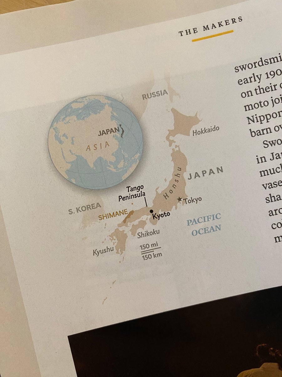
Really liking these handsome minimalist (uncredited?) locator maps in the new issue of @NatGeoMag . Charming hillshade, subtle water lines, red pop color
Tweet media one
Tweet media two
3
6
126
@John_M_Nelson
John Nelson
10 months
Here is a Pacific blue whale migration animation. And here's the how-to:
6
18
126
@John_M_Nelson
John Nelson
4 years
Tricking these suckers into learning coordinate systems.
Tweet media one
9
0
128
@John_M_Nelson
John Nelson
3 years
"Dynamic Range Adjustment" stretches a color scheme to only the lowest and highest values within your view. So panning and zooming around can look pretty hypnotoad cool.
9
8
126
@John_M_Nelson
John Nelson
4 years
Geography and cartography professors faced with offering online courses...starting now...here are the full materials for the "Cartography." MOOC. Click Download to get materials, and follow the youtube links for the videos.
Tweet media one
9
66
124
@John_M_Nelson
John Nelson
2 years
Challenger Deep is as deep as a walk from the north end of Central Park to the south pool of the 9/11 Memorial.
Tweet media one
2
21
125
@John_M_Nelson
John Nelson
9 months
Seeing the cover in realz life!
Tweet media one
3
2
119
@John_M_Nelson
John Nelson
2 years
Definitely check out today's Google Doodle about the brave brilliant and persistent Marie Tharp, who stuck to the data in the face of dogma and elevated our understanding of the world. Science is about persistently proving itself wrong.
Tweet media one
2
21
119
@John_M_Nelson
John Nelson
2 years
This Friday I get to participate in the Delmarga GIS Conference where I will show Office memes. And how to make this thing.
Tweet media one
4
10
120
@John_M_Nelson
John Nelson
2 years
Don't make maps like this in @ArcGISOnline , what is this, the 18th Century? Come on. But if you're feeling like a scoundrel...
Tweet media one
Tweet media two
Tweet media three
Tweet media four
3
11
118
@John_M_Nelson
John Nelson
4 months
Deforestation in the Brazilian state of Rondônia, around Buritis, since 1985. View these Landsat images in sequence, here:
2
46
116
@John_M_Nelson
John Nelson
5 years
Whew! @EsriUC plenary in the boooooks! Shout out to my co-host @lisaberry_gis !
Tweet media one
9
1
116
@John_M_Nelson
John Nelson
5 years
Working on a basemap experiment that blends Kenneth Townsend's vintage painted hillshade () with NASA satellite imagery. I like where it's going!
Tweet media one
6
6
113
@John_M_Nelson
John Nelson
8 years
The movingness of droughts over five years.
Tweet media one
4
76
110
@John_M_Nelson
John Nelson
1 year
The tapered polygon effect is a cartographic technique to give rivers a sense of direction and representative form. Here's how (and how to reverse the geometry if some rivers accidentally flow uphill).
Tweet media one
8
14
111
@John_M_Nelson
John Nelson
5 months
Here's one of those 3D block diagram, diorama, cutaway, tiny world sort of things. I wanted to play with labeling and adding a geological element to the rock faces. Please don't look at it.
Tweet media one
Tweet media two
Tweet media three
7
6
111
@John_M_Nelson
John Nelson
7 years
@jscarto JS: "This is the last possible eclipse map possible" Challenge accepted.
Tweet media one
6
42
107
@John_M_Nelson
John Nelson
3 months
Landsat Explorer. It's too easy not to try out.
1
14
108
@John_M_Nelson
John Nelson
5 years
I never made a reusable style for Willow's felt map. Remedying that this Monday morning.
Tweet media one
2
7
105
@John_M_Nelson
John Nelson
2 years
Undersea diorama WIP. This is Challenger Deep, with 10x exaggeration and not-real depth cutaway illustration.
Tweet media one
Tweet media two
7
3
107
@John_M_Nelson
John Nelson
3 years
Found some maps my dad, Burton Nelson, made in grade school. ~1950
Tweet media one
Tweet media two
Tweet media three
Tweet media four
2
1
108
@John_M_Nelson
John Nelson
5 years
Please do not make felt maps with this resource.
8
13
109
@John_M_Nelson
John Nelson
1 year
Please do not emboss your imagery basemap. Here's how:
4
17
105
@John_M_Nelson
John Nelson
1 year
Really early experiment with a Tharp/Berann-like oblique view of the seafloor.
Tweet media one
1
6
107
@John_M_Nelson
John Nelson
4 years
Tweet media one
Tweet media two
Tweet media three
Tweet media four
3
12
106
@John_M_Nelson
John Nelson
3 years
Here's how to make an 1883 map of forests all 3D and stuff using modern forest density data by tricking Pro into thinking it's elevation. Please do not similarly misuse software in this way.
Tweet media one
8
12
107
@John_M_Nelson
John Nelson
6 years
I was wrestling with traditional v multidirectional hillshades. But when I do both, I likes it. In a Bertin-ish palette.
Tweet media one
3
13
104
@John_M_Nelson
John Nelson
1 year
More progress on the Tharp/Berann impersonation.
Tweet media one
6
11
106
@John_M_Nelson
John Nelson
6 years
There are lots of ways to point out your map's Area of Interest. Do not try any of these.
2
31
105
@John_M_Nelson
John Nelson
3 years
Oh wow, hadn’t noticed these. Little lensed laser lines form the glass globe. I’ll just be moving this out of the light now thanks.
Tweet media one
14
14
104
@John_M_Nelson
John Nelson
3 months
I finally tried out a Joy Plot map thing. There are a zillion ways to do it probably and mine is likely the least efficient
Tweet media one
Tweet media two
Tweet media three
Tweet media four
11
7
104
@John_M_Nelson
John Nelson
9 months
Kudos to @snwalljasper for this work of cartographic art in @NatGeoMag
Tweet media one
Tweet media two
Tweet media three
5
11
105
@John_M_Nelson
John Nelson
11 months
Gunther is my order pickup name. It reduces confusion in a word full of Johns.
Tweet media one
17
1
104
@John_M_Nelson
John Nelson
2 years
Happy Halloween, map (and oceanography) nerds!
Tweet media one
5
1
105
@John_M_Nelson
John Nelson
6 months
“Fantasy Mapping: Drawing Realms & Kingdoms” is available on Amazon. Written and illustrated by my friend @wesleytjones , not only is is a beautiful and fun how-to, it’s also got the best landform diagrams I’ve ever seen.
3
20
103
@John_M_Nelson
John Nelson
5 years
Work in progress map of Panama. My favorite part so far is the north arrow. I don't do north arrows very often so I'm really saucing it up.
Tweet media one
12
6
100