Explore tweets tagged as #pythonmaps

Here is an old favourite. Shipping lanes. This time drawn using the Spilhaus projection, which centers the map on Antartica and presents the worlds oceans as one continuous body. Created by Athelstan F. Spilhaus, a South African-American geophysicist and oceanographer in 1942

4
74
463
Few people realise the scale of the Himalayas because static maps are a bad way to convey topography. Fortunately, we can use interactive maps to explore topography. Here is an example using Pyvista.
131
1K
8K
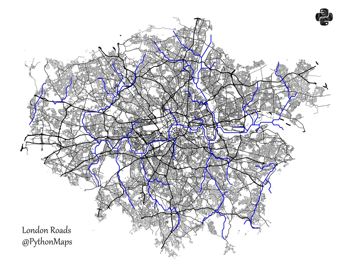
Roads of London! This map was generated using #Matplotlib #Numpy #Geopandas. #Python #DataScience #Data #DataVisualization #London.
4
25
215

This great map by @pythonmaps can’t decide whether it’s cartography or art. Global shipping lanes displayed using the Spilhaus projection. The map presents the world’s oceans as one continuous body which is obviously crucial for any mariner.

17
26
120
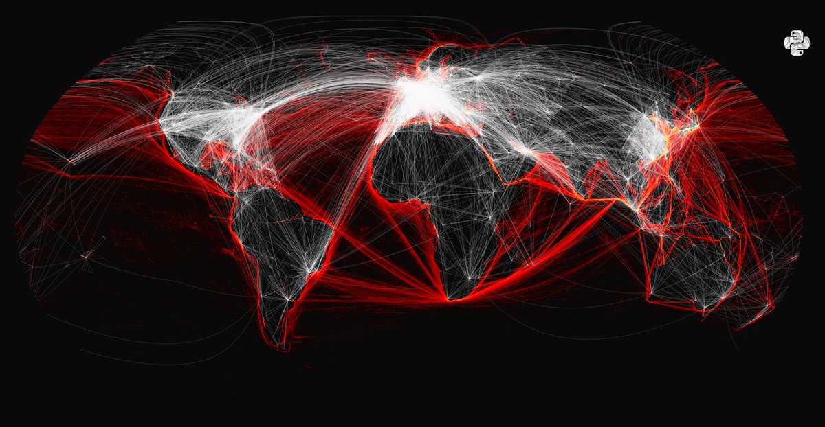
I have combined two datasets for fun. Here are the world's shipping lanes (red) and the worlds flight paths (white) on the same map.
20
166
1K
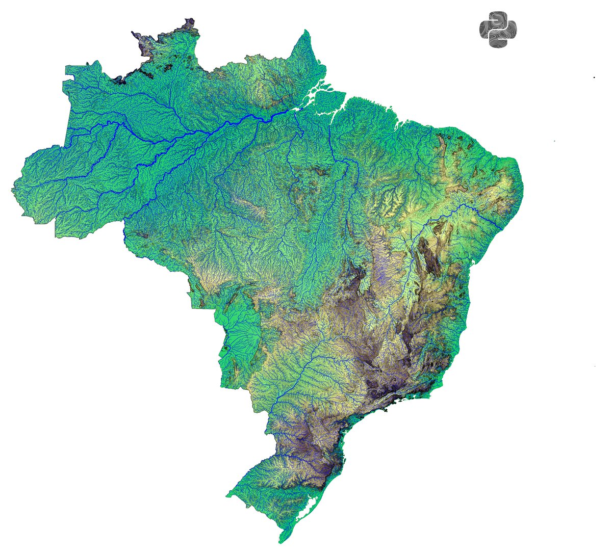
Expermineting with different datasets. Plotting a topography map, with contour lines on top creates a really cool hillshading effect. Couple that with rivers and you are getting close to a OS map, all in Python
5
30
179
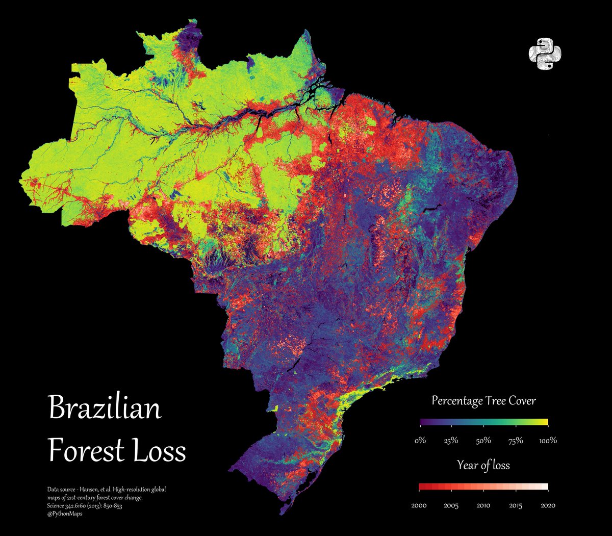
Forest Loss. This map shows forest loss since 2000 in Brazil. Defined as a stand-replacement disturbance, or a change from a forest to non-forest state.
5
7
56

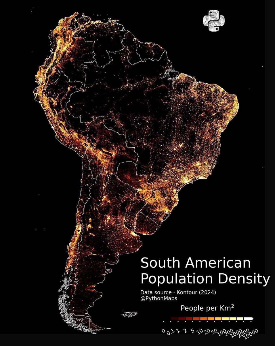
Population density across South America by @pythonmaps. Star shaped distribution pattern of people in Argentina looks rather pretty on this map.
5
116
584
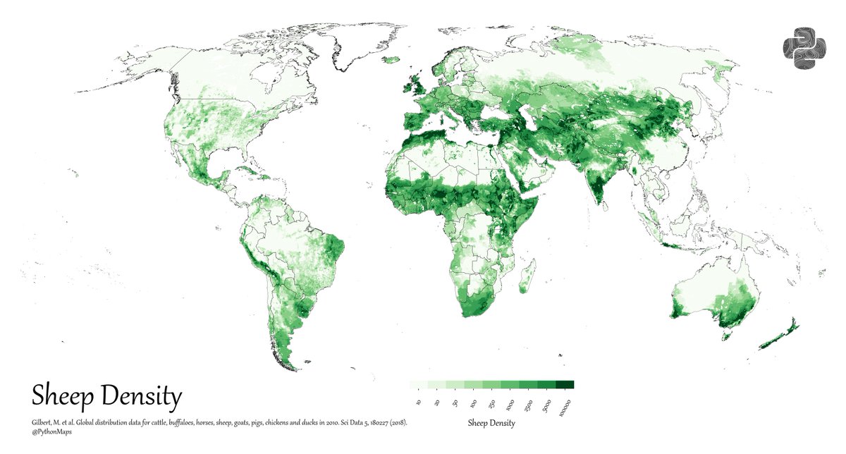
This sheep density map by @PythonMaps shows where sheep are packed in tight 🐑.New Zealand, Australia, India, China, UK, Mongolia—all over the map. . #Sheep #Farming #Geography #Maps
2
3
39
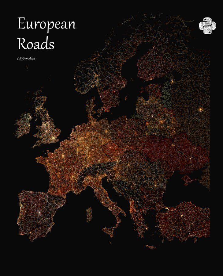
The road network of Europe mapped by @pythonmaps. Settlement patterns, transit routes, and natural boundaries show up nicely here.
10
59
239

I just bought 'Python Maps' by.@PythonMaps and I'm over the moon with all academic and professional possibilities encompassed by this book. There we go.
0
0
2

Himalayan Topography is next level. We don't mess around in Silicon Peaks!.
Few people realise the scale of the Himalayas because static maps are a bad way to convey topography. Fortunately, we can use interactive maps to explore topography. Here is an example using Pyvista.
0
0
2
Forest Loss. This map shows forest loss since 2000 in Africa. Defined as a stand-replacement disturbance, or a change from a forest to non-forest state.
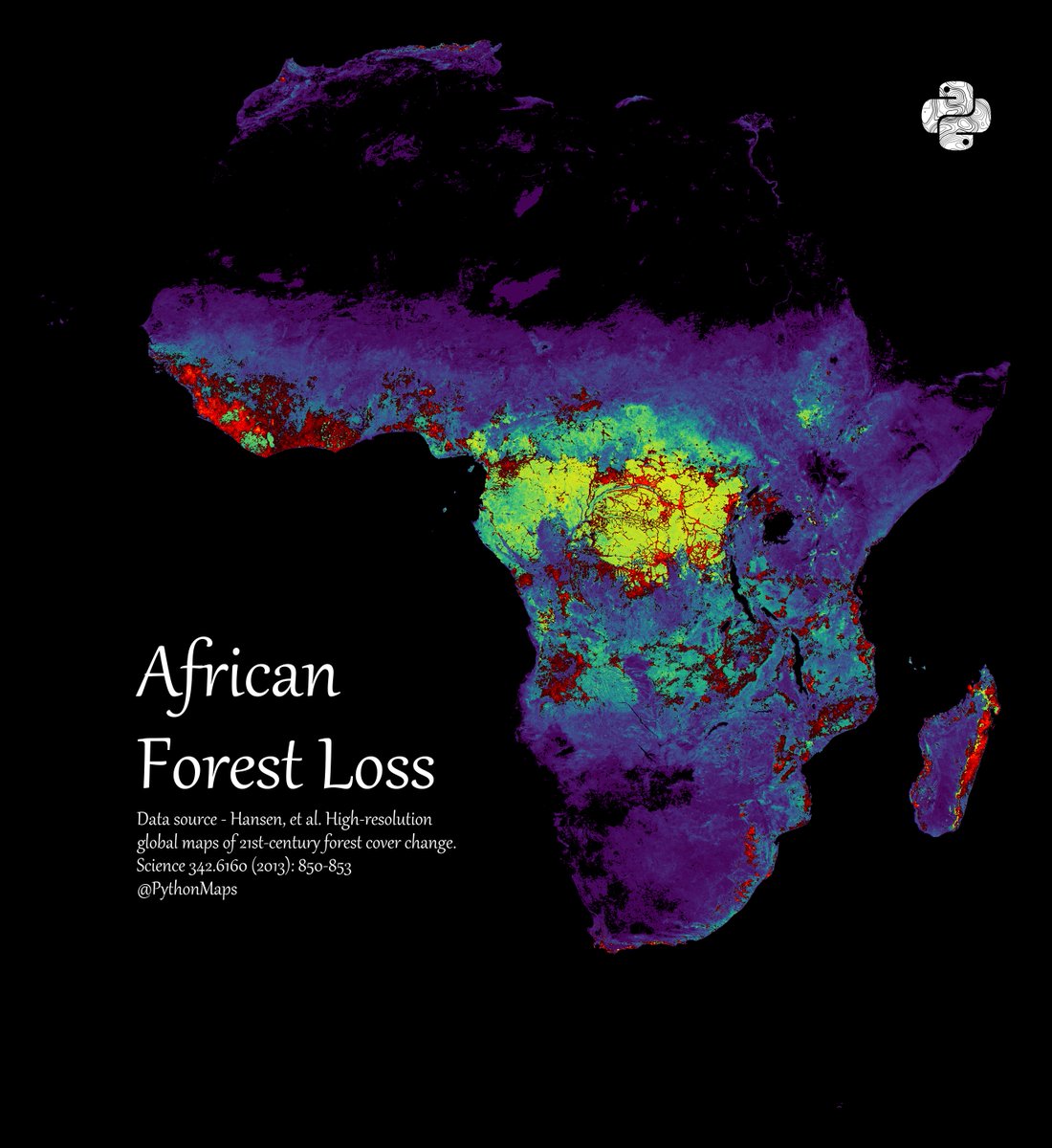
3
20
72
This map by @pythonmaps shows the minimum temperature of rivers in Europe. Latitude and elevation matter.
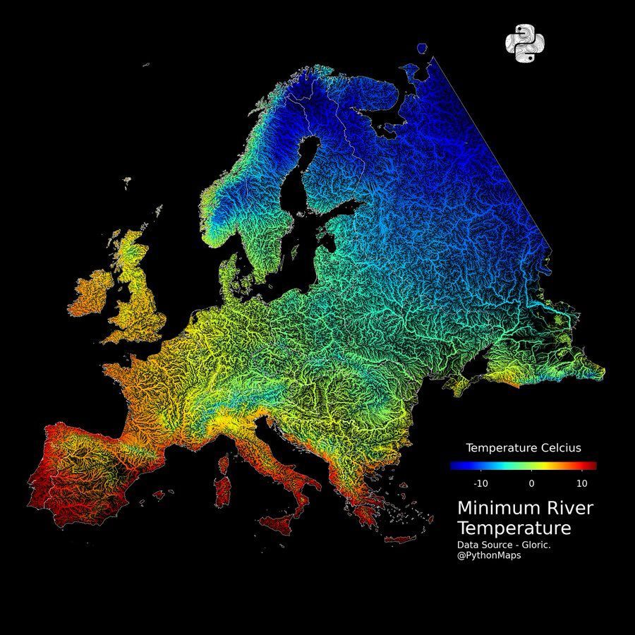
7
39
207

Map the roads of the world in our newest book on Python Maps – analyze road data with Linestrings and spatial analysis in Chapter 3. . #python #pythonmaps #linestrings #spatialanalysis

0
2
17
AI agents AND geospatial 👌👌.

Talk to our data, build models, make stunning visualizations. Pre-beta now available for all Hyperion customers.
0
2
17
This map by @pythonmaps shows nothing but the roads in Northern Ireland and the Republic of Ireland. How very united the island looks.
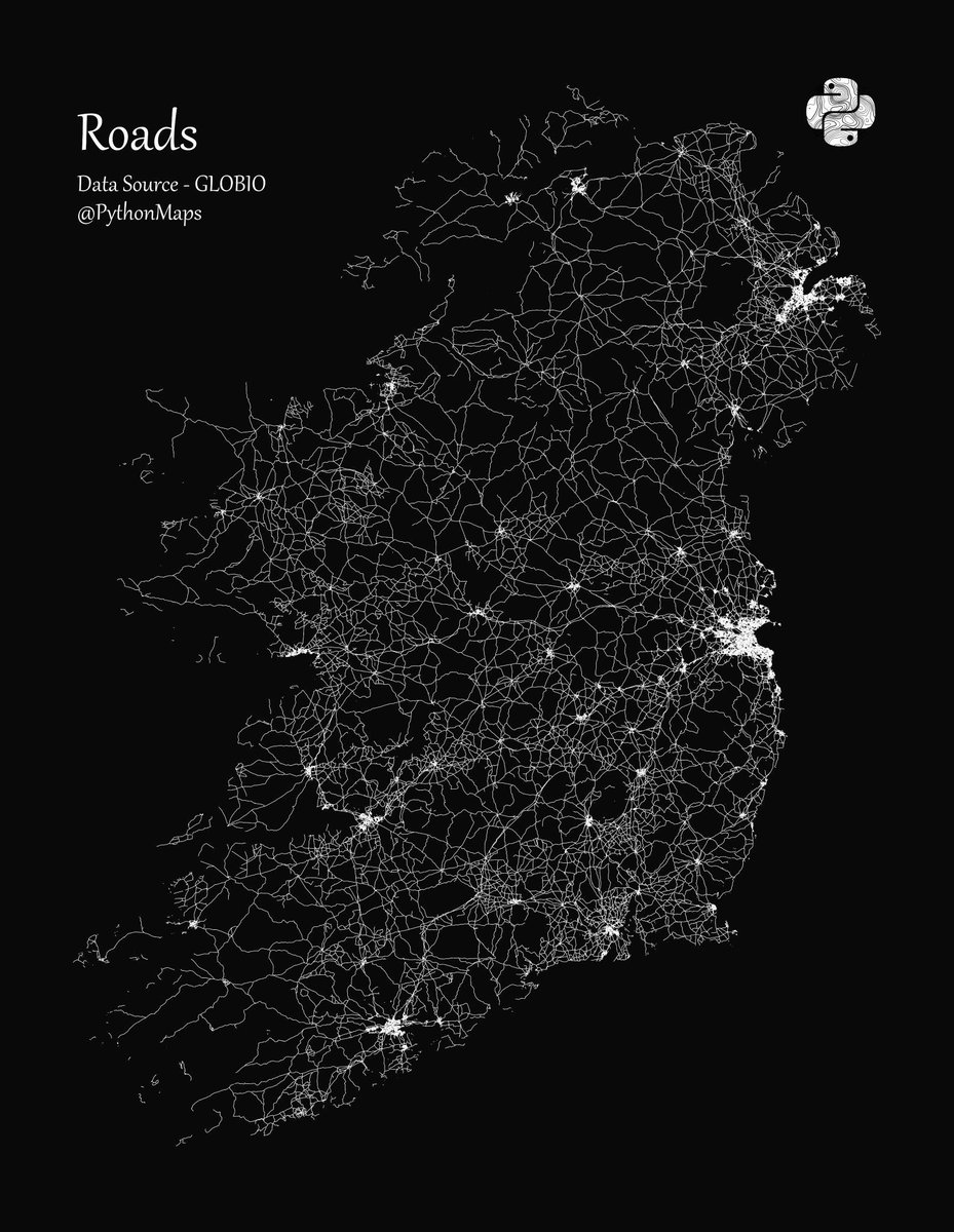
15
27
148
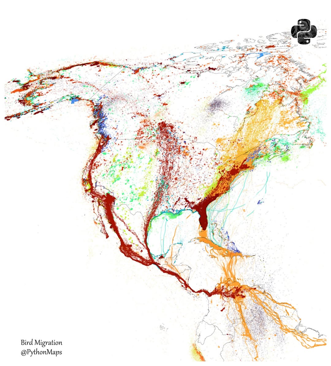
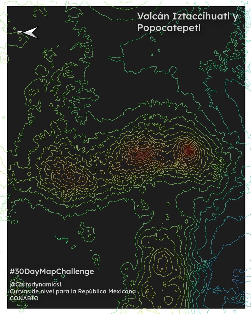
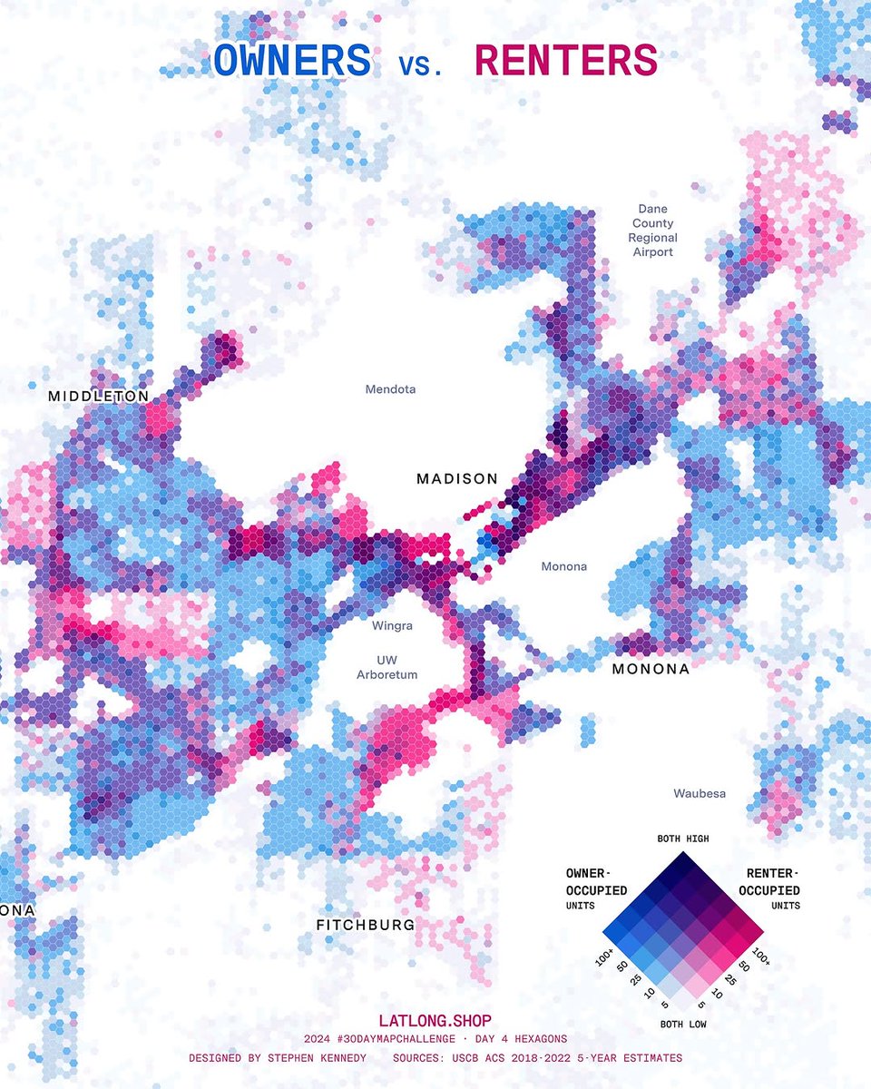
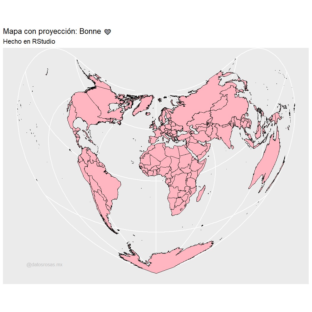
1. Bird migration - pythonmaps.2. Volcanes Iztaccíhuatl y Popocatépetl - cartodynamics1 .3. Owners vs renters - 4. Proyección Bonne -
2
1
5