Explore tweets tagged as #gistraining

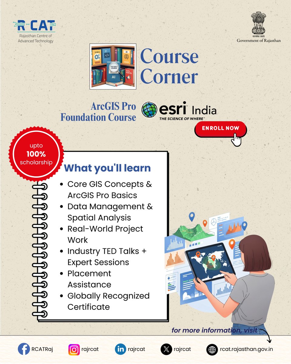
ArcGIS Pro Foundation Course at RCAT.Gain in-demand GIS skills, hands-on project experience, and a globally recognized certificate — with up to 100% scholarship. #RCAT #ArcGISPro #GISTraining #SkillDevelopment #GovtInitiative #GeospatialSkills #DigitalIndia #CareerReady
0
0
0

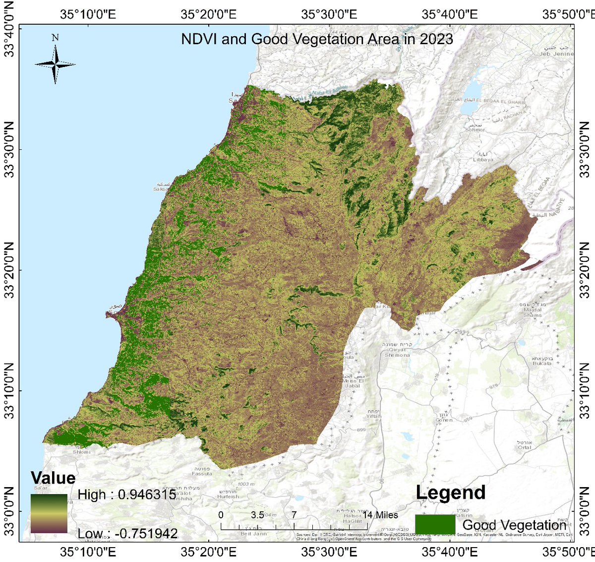
Vegetation analysis using soil moisture data is a powerful approach in remote sensing and environmental monitoring. Soil moisture plays a critical role in plant growth, affecting vegetation health, distribution, and productivity. #GoogleEarthEngine #RemoteSensing #GIStraining
1
13
68

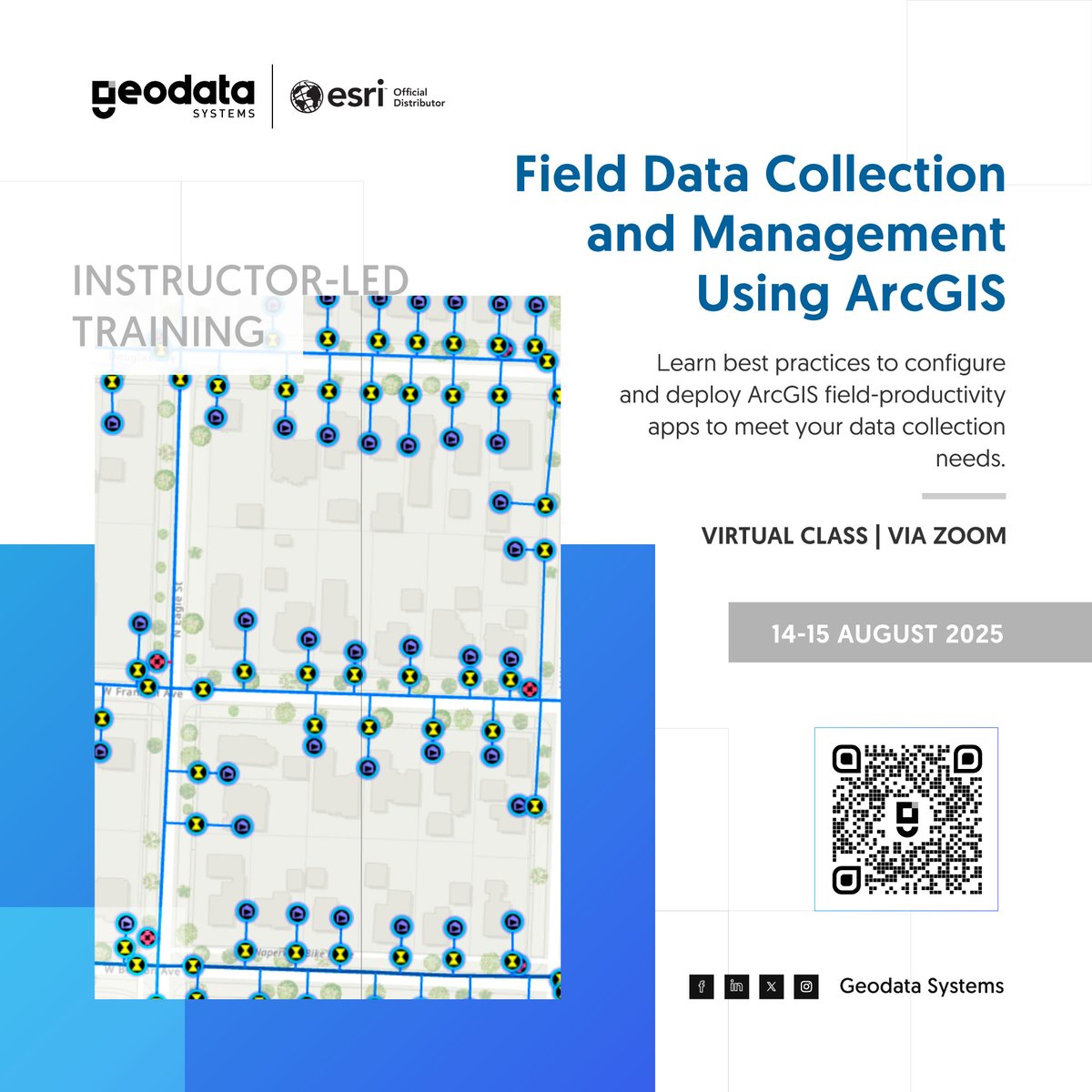
Streamline your field data workflow with ArcGIS! Learn to collect accurate, real-time data and monitor fieldwork using your mobile device in our instructor-led training. 👉 Enroll now: . #DataCollection #GISTraining
0
0
0

🎓 Looking for tailored GIS training?.Our private courses are designed to meet your team's unique needs, whether you're building foundational skills or exploring advanced workflows. Find out more: #GIStraining #PrivateTraining #GeospatialSkills

0
0
0

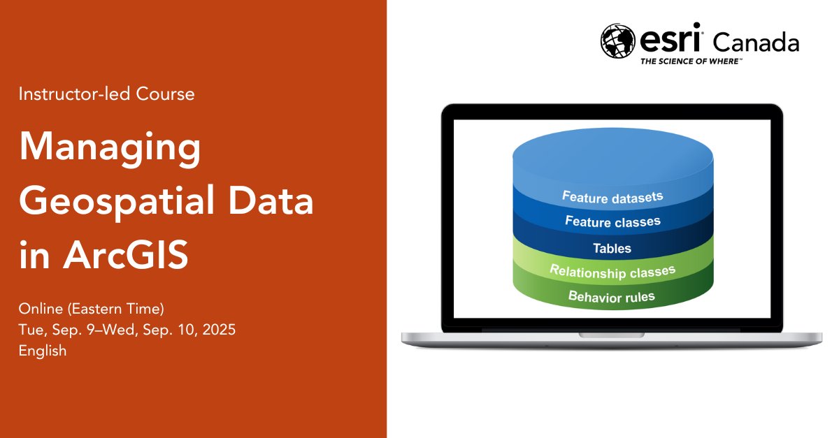
Still juggling shapefiles & spreadsheets in ArcGIS? Level up with Managing Geospatial Data in ArcGIS—your guide to mastering #geodatabases for clean, scalable workflows. Take the course: #GIS #ArcGISPro #GISTraining
0
0
1

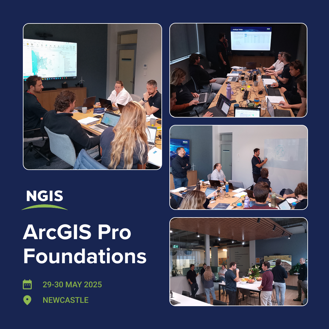
On-site training at Squadron Energy’s Newcastle office! Our team delivered the ArcGIS Pro Foundations course. Thank you to Squadron Energy for hosting us and sharing these moments. Book your spot today:. #GISTraining #ArcGISPro #NGISTraining #Geospatial
0
0
0
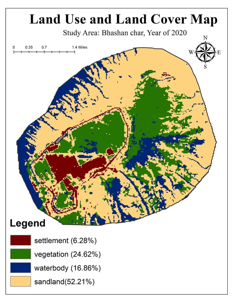
🌍 Land Use and Land Cover Classification Using Machine Learning.Want to enhance your GIS and remote sensing skills with machine learning?.🌐 Registration Link info : #LULC #MachineLearning #RemoteSensing #GoogleEarthEngine #GIStraining #LandCoverMaOnline
1
10
54
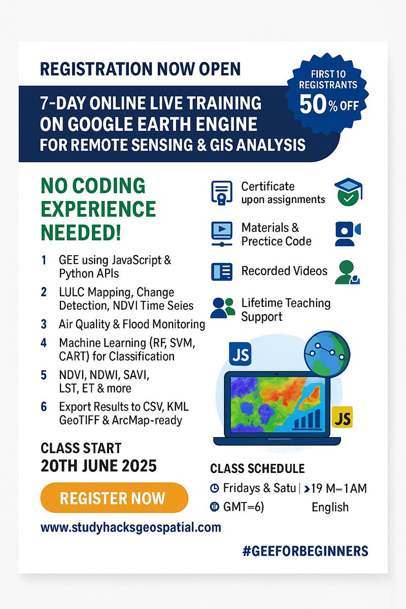
🚨 Registration Now Open! 🚨. 7-Day Online Live Training on Google Earth Engine (GEE) for Remote Sensing & GIS Analysis. 📆 Starts: 20th June 2025📍 No Coding Experience Needed!.#GoogleEarthEngine #RemoteSensing #GISTraining #EarthObservation #GeospatialAnalysis #MachineLearning
0
0
2
📢 Registration is now open for the 32nd Batch of 7-day comprehensive online live training on Google Earth Engine.For more information about registration, visit our website: #GoogleEarthEngine #RemoteSensingTraining #GISTraining #GeospatialAnalysis

0
2
24
Google Earth Engine Hacks for Amazing Satellite Imagery Results.Recorded video link: 🌐 Registration Link:. #GoogleEarthEngine #RemoteSensing #Landsat #EarthObservation #GeospatialData #GIStraining #LiveTraining #SatelliteImagery

0
12
47
Build stunning, responsive web apps—no coding needed! Join our instructor-led ArcGIS training, perfect for GIS pros, designers & storytellers. 👉 #ArcGIS #GISTraining

0
0
0
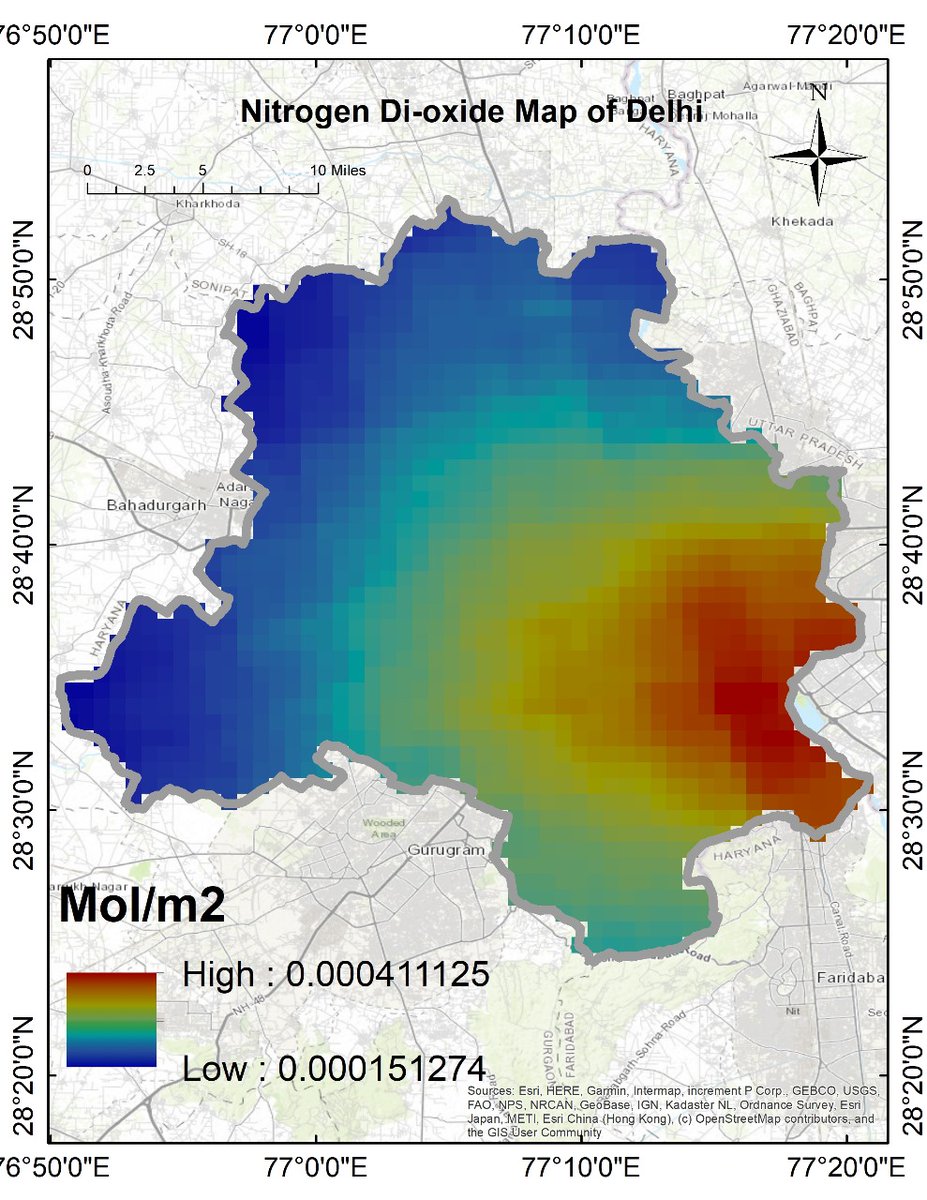
Air Quality Monitoring with Remote Sensing: Nitrogen Dioxide (NO₂).The Registration details: #GoogleEarthEngine #RemoteSensing #GIStraining #EarthObservation #SatelliteData #OnlineTraining #GEEtraining #GeospatialAnalysis #NDVI #LandCoverMapping
0
7
50
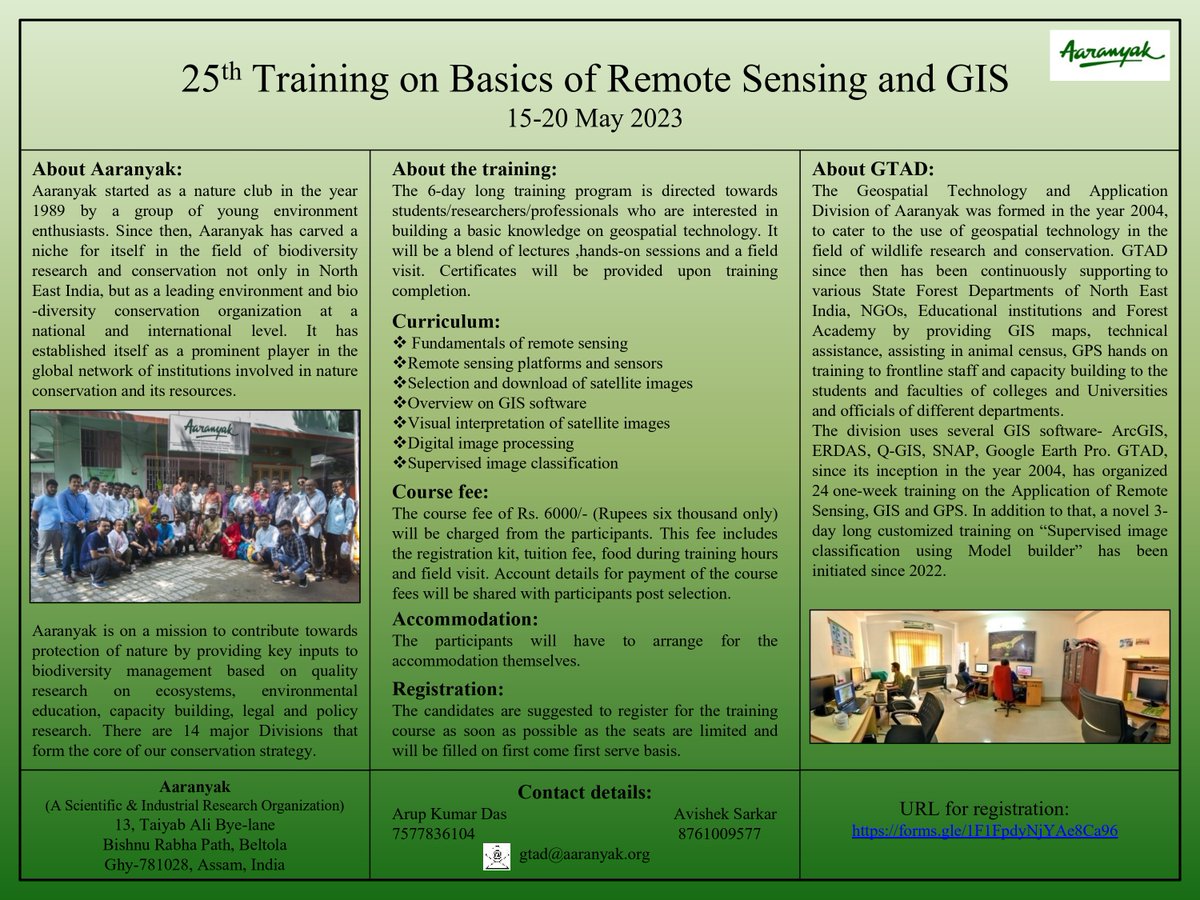
#GISTraining | Last few spots left for the "25th Training on Basics of Remote sensing and GIS", to be organised by #Aaranyak from 15-20 May. #GIS . Check out the poster for details-
0
0
5
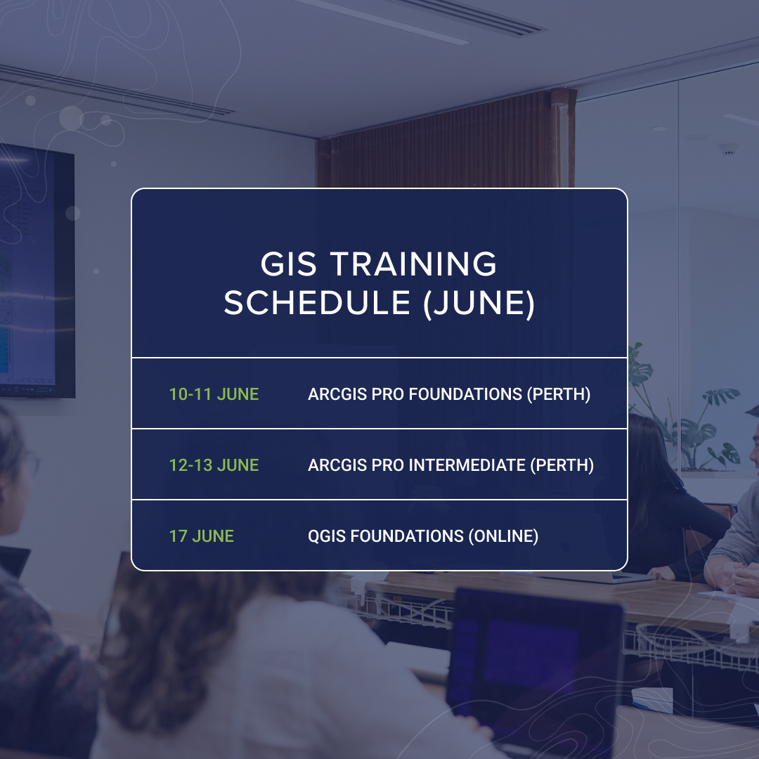
Turn data into decisions with GIS. Discover the power of spatial data and learn to create, analyze, and share maps that matter. 👉Enroll now —and don’t forget to share this with your team or network! #GISTraining #ArcGIS #LearnGIS
0
0
0
0
0
0
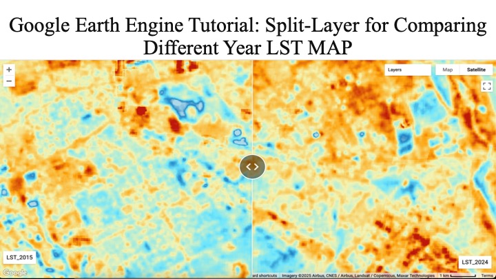
Google Earth Engine Tutorial: Split-Layer for Comparing Different Year LST MAP.Tutorial Link: The Registration details: #GoogleEarthEngine #RemoteSensing #GIStraining #EarthObservation #SatelliteData #OnlineTraining
0
6
42
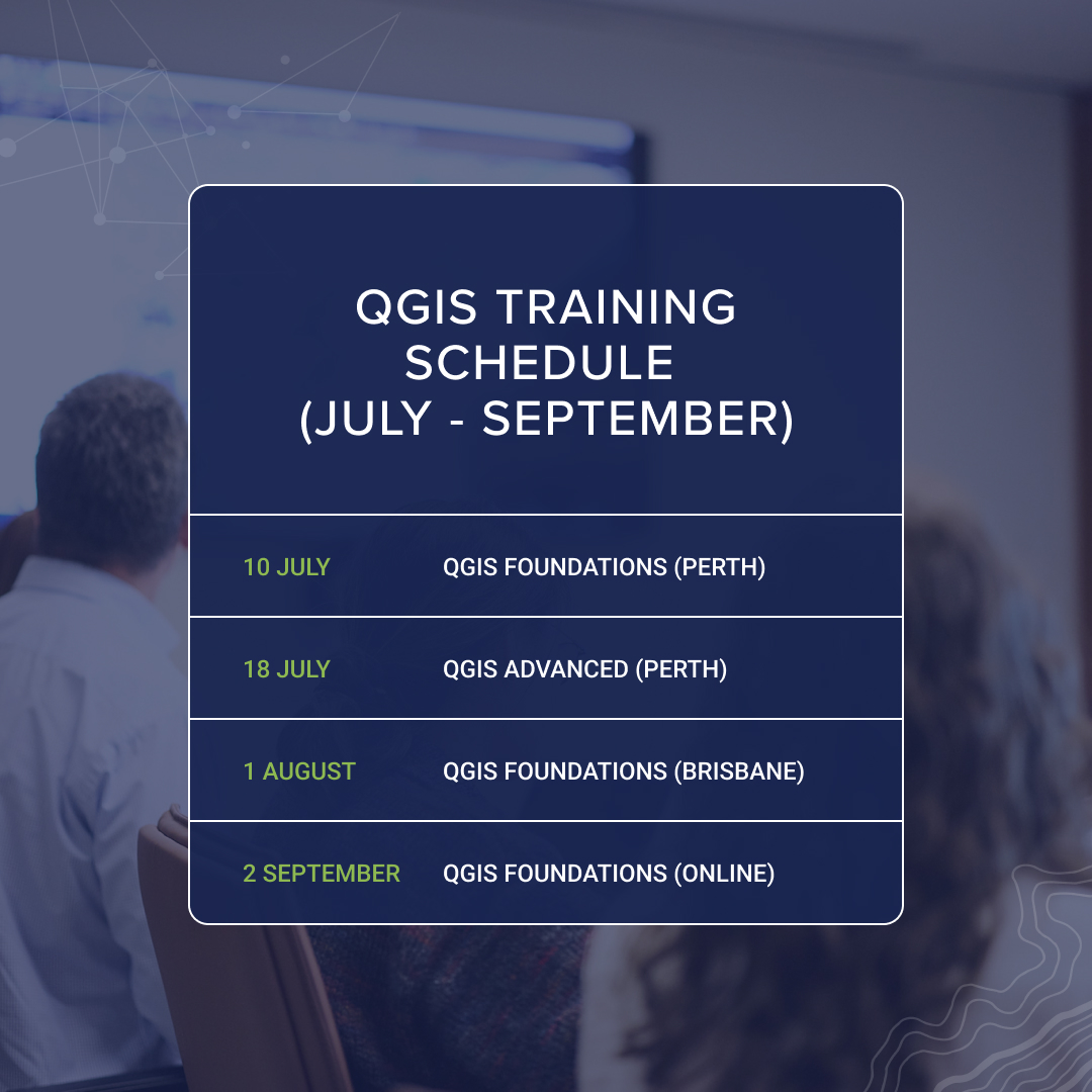
Ready to level up your QGIS skills? 📍. Check out our upcoming training courses, spots fill fast!. 🔗Book today: #QGIS #GIStraining #Geospatial
0
0
0

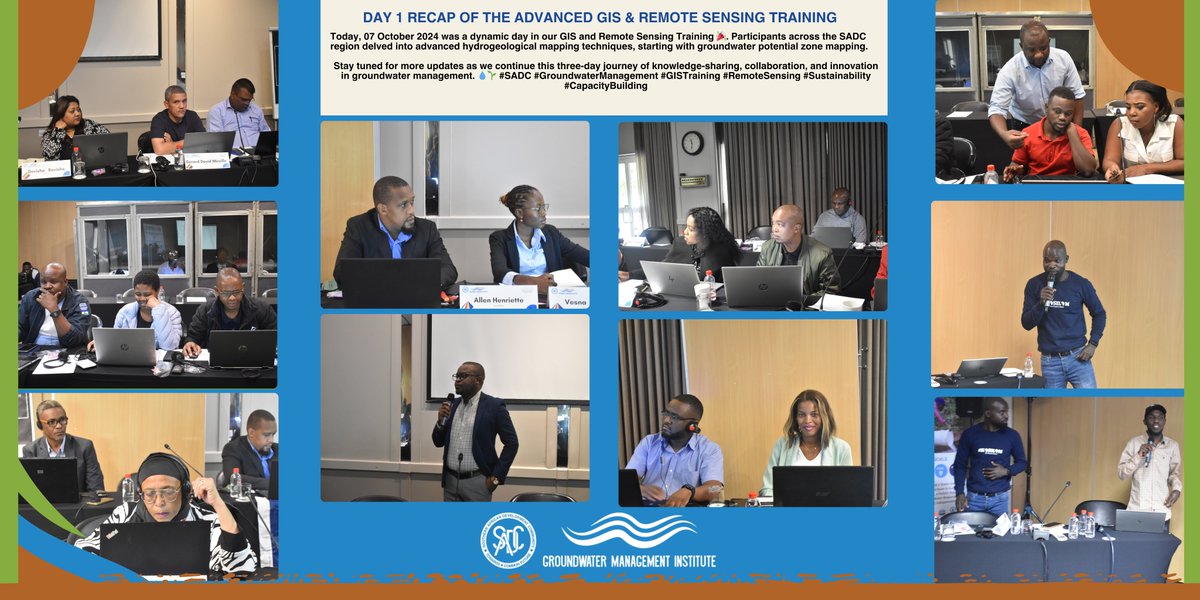
The first day of the Advanced GIS & Remote Sensing Training organized by the SADC -GMI and facilitated by Mzuzu University was a great start. Participants from the SADC region are actively engaged in advanced hydrogeological mapping techniques. #SADC #GISTraining #RemoteSensing
1
0
10