Explore tweets tagged as #GeospatialTechnology
A tutorial about how to monitor the Urban growth analysis using remote sensing and GIS techniques? Tutorial Link: https://t.co/vmtjTeUeWB Registration: https://t.co/i4EFoxX5HU
#UrbanGrowth #RemoteSensing #GIS #UrbanPlanning #SpatialAnalysis #GeospatialTechnology #SmartCities
1
8
60
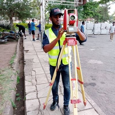
150 mm thick cement treated, Graded crushed stone, stabilized, laid, rolled and compacted to specifications. More watering to cure before laying tarmac. #Highwaygeometry
#Engineeringsurvey
#Geospatialtechnology
10
21
160
Geospatial opportunities, As you keep it #GIS #GeospatialTechnology #remotesensing , here are a few opportunities. · @UNICEF - Consultation internationale (6 mois) - Etude du suivi de la température lors du transport des vaccins et de la cartographie des chambres froides,
2
24
78
1
3
9
We are a Platinum Sponsor at the upcoming AGI NI Conference on June 28th. Our team members will present some interesting topics for this year’s theme, “GI and Spatial for the Future – Here and Now.” @GeoCommunity
#geospatialdata #geospatialtechnology #teamesriireland
0
3
5
🌐 The future of geospatial technology is here, and it's built by Foursquare. The power of location data can define how your consumers interact with the world around them. Learn more 👉 https://t.co/SBHOIpCg81
#Foursquare #geospatialtechnology
1
1
8
Introducing the Gap Analyser tool, crafted by BISAG-N for @TribalAffairsIn under the Particularly Vulnerable Tribal Groups Scheme. This tool meticulously measures gaps in essential parameters outlined by the ministry. 📊✨ #GeospatialTechnology #DigitalIndia
0
8
28
🌍 On #WorldGISDay, we celebrate the power of #GIS to tackle global challenges, drive #sustainable growth, & enable smarter decisions. We’re proud to deliver GIS solutions across sectors, enhancing efficiency & innovation in Qatar. #GeospatialTechnology #GISforGood
0
1
3
#MGISS, one of the UK’s leading technology firms, supports @FMConwayltd to reduce on-site risks using augmented reality. https://t.co/NmVUPwtPmq
@mgissuk #geospatialtechnology
0
1
0
Geospatial World Forum 2023 Heads to Rotterdam this May https://t.co/PVMMWZNem6
#geospatial #geospatialtechnology #mapping
0
3
2
Exciting news! Esri Rwanda, in collaboration with Rwanda Space Agency, is thrilled to announce our GIS Day 2023 celebration with University students and Lecturers at UR, AUCA, and Ines Ruhengeli! #GISDay2023 #GIS #geospatialtechnology
2
8
22
Get ready for an exciting Interactive Talk with Esri Saudi Arabia! Join us as we dive into the world of Geospatially Enabled Digital Twins and explore the transformative power of #GIS, #BIM, and #Reality Mapping. #Esri #EsriSaudiArabia #GeospatialTechnology #DigitalTwins
0
1
1
Thursday Top with ⭐ APGLOS Survey Wizard ⭐ 🌍 🌎 🌏 🌍 🌎 🌏 🌍 🌎 🌏 🌍 🌎 🌏 GWF GEOSPATIAL WORLD FORUM 2-5 May 2023 Rotterdam, The Netherlands. #geospatial #geospatialtechnology #geography #gnss #education #geodesy #geospatialintelligence #mapping #landsurveying
0
2
3
New Applications on Teledyne CARIS Cloud Platform Support S-100 Production https://t.co/1LlXUC7DF2
#geospatial #geospatialtechnology #hydrospatial #technology #cloud
0
2
3
UniqTek Co., Ltd's Surveying in Laos Chandavong Southitham revolutionised Laos surveying with GNSS, RTK, and drone tech, earning IFM 2024 honour. Read more: https://t.co/YLw5QRfKX8
#internationalfinance #uniqtek #chandavongsouthitham #surveying #geospatialtechnology
0
0
0
The #RallyFemenino #GeospatialTechnology workshop involves peer mentors, referred to as "Madrinas" and "Madrinos" (Godmothers). The Godmothers are on call to support participants as they develop proposals for using geospatial technology for #ClimateResilience.
1
9
19
Version 24.1 of the Global Mapper SDKs Include New Features & Updates https://t.co/05UYCnHqgo
#geospatial #geospatialtechnology #gis #mapping #software
0
1
2
#GeospatialOpportunities, As you keep it #gis #remotesensing #geospatialtechnology , @ICRC - International Committee of the Red Cross wants a Geodata & Analytics Lead. Link - https://t.co/tRB7nijwqn Keep it GIS | Keep it Geospatial | Keep it Remote Sensing @africwomeningis
0
7
15
Evaluating Distances Between Point Clouds Using Global Mapper Pro https://t.co/wjyANTCzfF
#geospatial #mapping #mappingsoftware #geospatialtechnology #pointcloud #gismapping #drones #uav
0
1
1


