Explore tweets tagged as #CADmapping

For dependable engineering deliverables, contact us today. #Smartgridsurveying #Civilengineering #Surveydeliverables #Engineeringprojects #BIM #CADmapping #construction #InfrastructureDevelopmen #Architecture

0
0
1
Inspect insurance claims remotely, save on travel costs, and focus resources where needed. #CADMapping #aerialimagery #property #insurance #BirdsEyeView

0
0
1
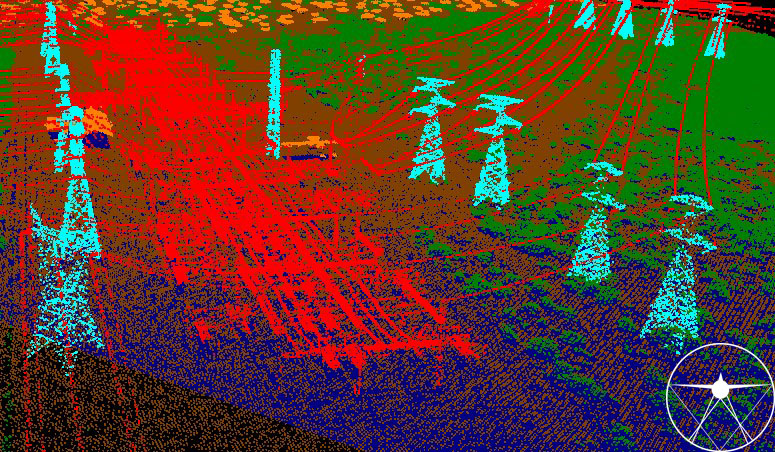
Enhance Power Line Mapping with LiDAR! Capture precise data for inspections with our aerial surveys. #CADMapping #LiDAR #PowerLineMapping #AerialSurvey #PrecisionData
0
0
0
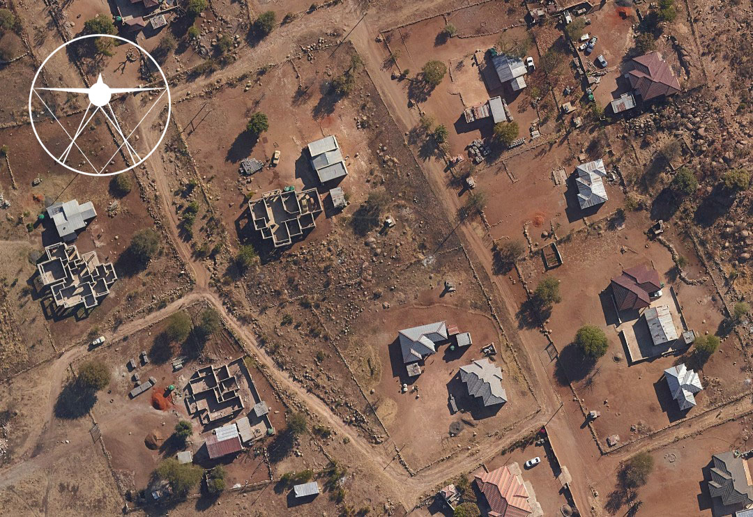
Rapid urbanization is transforming rural areas. CAD Mapping provides high-res aerial imagery for effective urban planning. #CADMapping #aerialimagery #urbanisation #smartcity
0
0
0
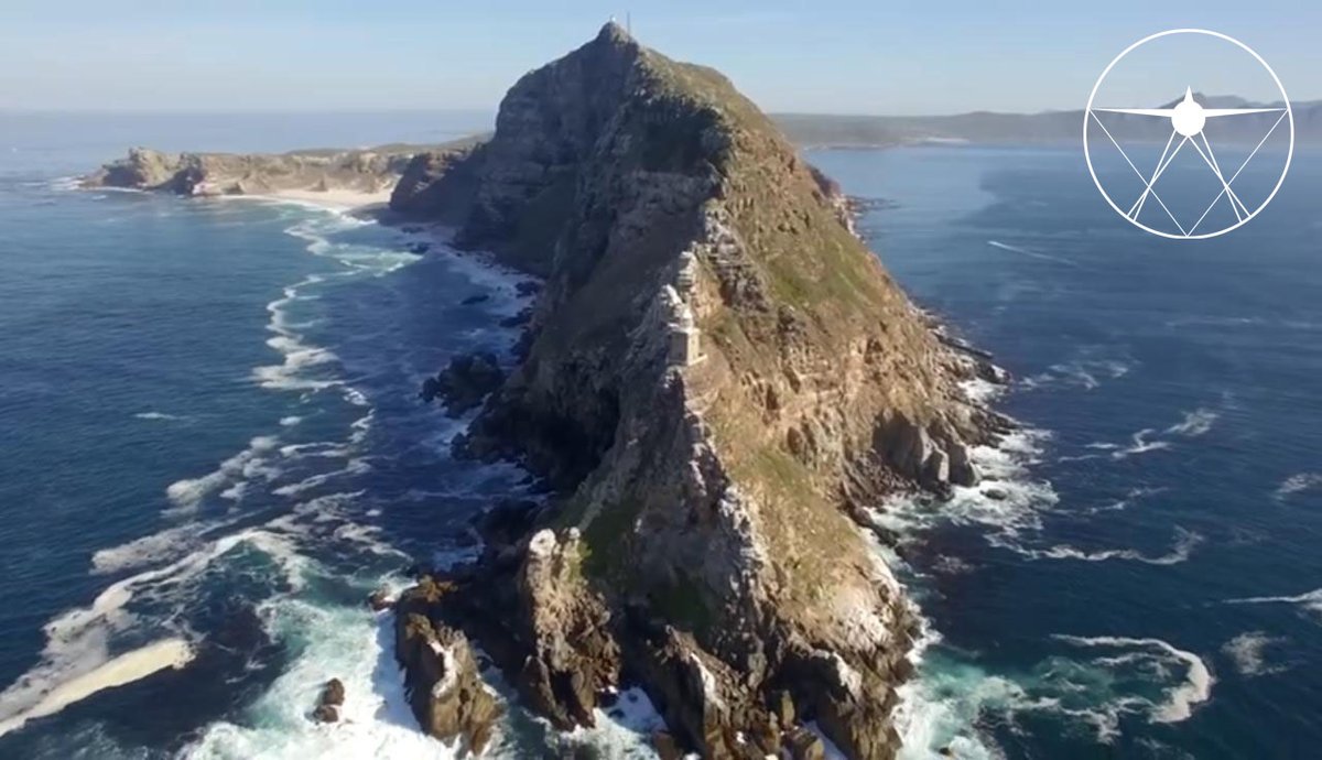
Just wrapped up a 90 000Ha aerial survey in Alexander Bay. On route to Upington we had the privilege of flying over the stunning Augrabies Falls! .#CADMapping #AerialSurvey #AugrabiesFalls #AlexanderBay

0
0
0
Discover Steyn City from a whole new perspective! Our latest aerial survey captured this stunning shot, showcasing the beauty and scale of Steyn City from above. #CADMapping #AerialSurvey #SteynCity #AerialPhotography #ExploreFromAbove

0
0
0
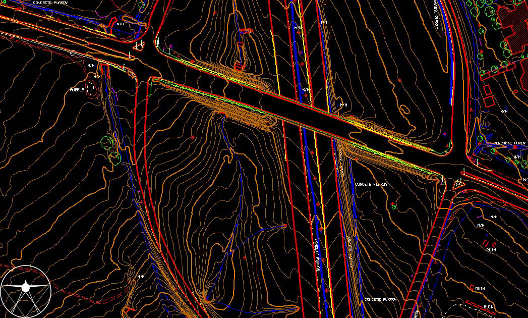
Precision at its peak! Behold the intricate detail captured through our latest aerial survey. Mapping in full compliance with TMH11 Standard Survey Methods. #CADMapping #AerialSurvey #DetailMapping #PrecisionMapping #AerialPhotography
0
0
0
Just wrapped up an aerial survey of Bosfontein. On route back, we had the privilege of Capturing stunning aerial views of the Hartbeespoort dam today!.#CADMapping#AerialSurvey #Bosfontein #DronePhotography #Surveying #Hartbeespoort

0
0
0
Exciting News! CAD Mapping opened a new office in Cape Town! For aerial survey needs, contact us. We provide top-notch solutions with cutting-edge technology. #CADMapping #AerialSurvey #CapeTown #NewOffice #TechInnovation #ContactUs
0
0
0
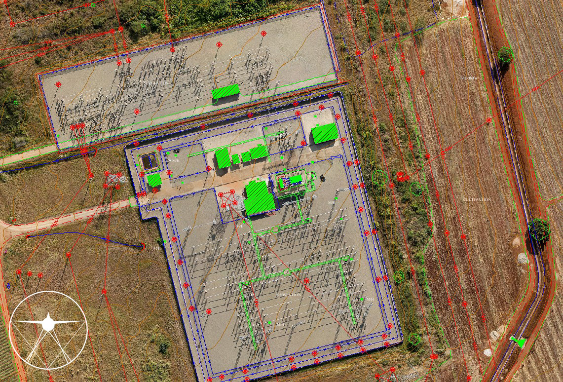
Stunning aerial shot of Eskom's substation, captured with our advanced UAS technology! Mapping highlights the intricate infrastructure that powers our community. #CADMapping #Eskom #DronePhotography #TechInnovation
0
0
0
Discover Upington from above with our aerial survey services! Capture stunning landscapes and rich cultural heritage. From mapping land to aerial footage, we provide high-quality surveys. Unlock new perspectives! #CADMapping #Upington #AerialSurvey

0
0
0
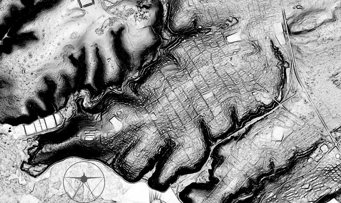
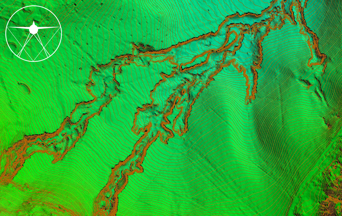
Discover detailed slope information with our Slope Shader. Perfect for assessing land stability and planning. Elevate your projects with precision insights!.#CADMapping #SlopeShader #TerrainAnalysis #AerialSurvey #PortAlfred
0
0
0
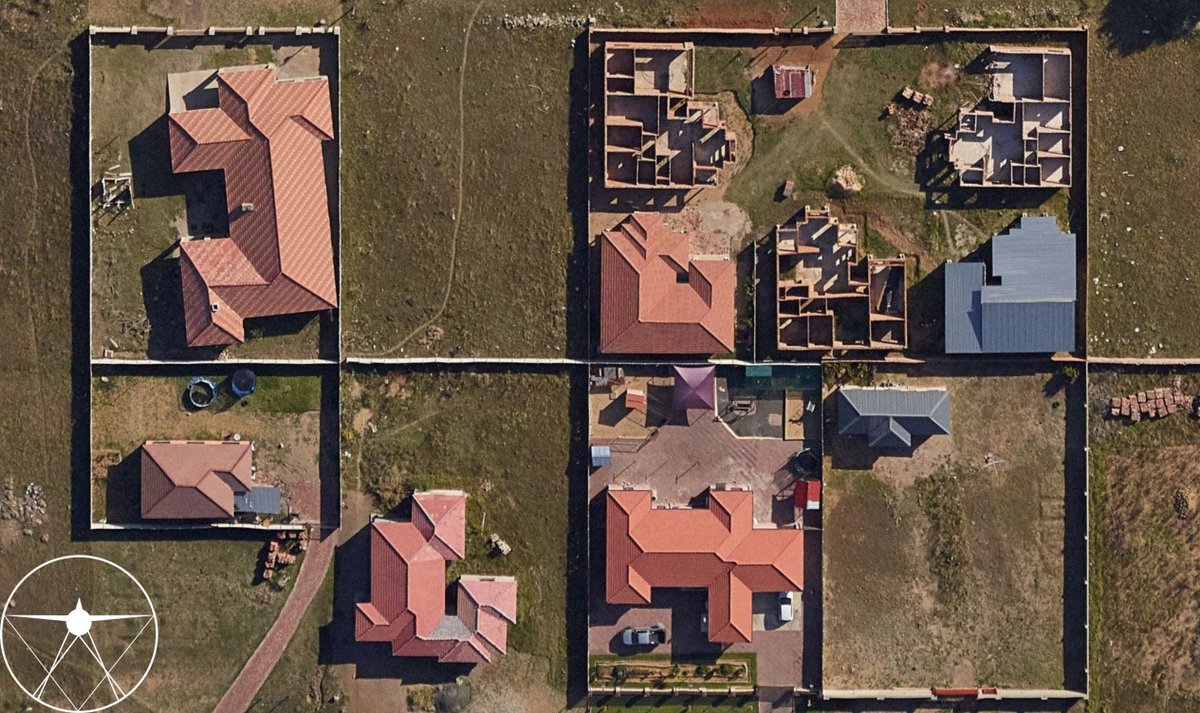
Seamlessly integrate high resolution aerial imagery into your network planning workflow to keep tabs on the planning and execution of your assets without wasting resources and site visits. #CADMapping #aerialimagery #aerialphotography #network #plan #asset
0
0
0
Explore this amazing image of contours and surface models from our latest aerial survey! Our LiDAR data and precise processing capture terrain details with stunning precision. #CADMapping #AerialSurvey #TechInnovation #UAV #geospatial
0
0
0
Check out the front view of our headquarters as a 3D Mesh Model! We are proudly situated in Centurion, where innovation takes flight every day. Come visit us and learn more about our cutting-edge aerial survey and modelling services!.#CADMapping #AerialSurvey #Headquarters


0
0
0
Transforming Mont Rose Intersection into a 3D masterpiece! Witness the magic of aerial surveying with our Matrice 300 drone and oblique camera, turning stunning photos into a detailed 3D mesh model. Explore every angle and detail.#CADMapping #AerialSurvey #3DModeling #Matrice300

0
0
0
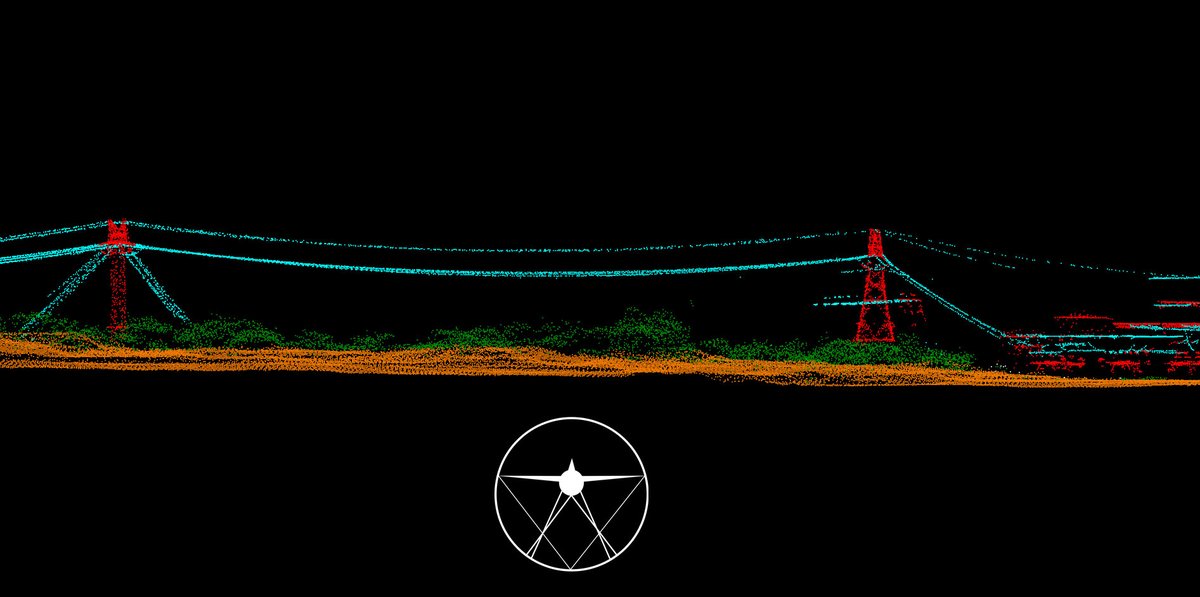
LiDAR point clouds help manage powerline vegetation by measuring distances between tree branches and powerlines, preventing outages and fires. Ensures safety and reliability. #CADMapping #LiDAR #pointcloud #vegetation #monitor
0
0
0
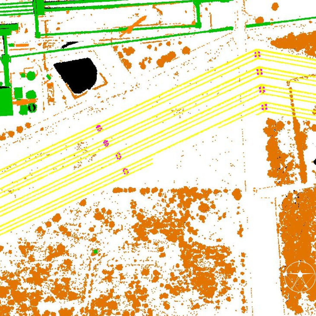
LiDAR technology enables us to classify the point cloud data with pinpoint accuracy!📷 At CAD Mapping, we use LiDAR to create detailed classifications of man-made infrastructure and natural entities, providing the AEC market with valuable insights for their projects. #CADMapping
0
0
0
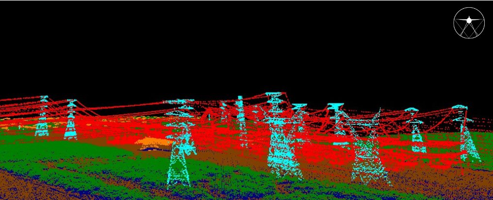
By showcasing the geospatial characteristics of available resources, CAD Mapping plays a vital role in advancing power projects across South Africa, contributing to the nation’s energy solutions.⚡️.#CADMapping #energy #SA #powerline #LiDAR #pointcloud #economy #resources #utility
0
0
1