
Geoapify
@geoapify
Followers
230
Following
556
Media
430
Statuses
819
Location Platform to create location-aware apps! Try our APIs, online tools, tutorials. #maps #maptiles #geocoding #routing #isolines #routeoptimization
Paphos, Cyprus
Joined March 2019
Looking for a Google Places API alternative that doesn’t lock you into restrictive licensing or unpredictable costs? Geoapify’s Places API delivers high-quality POI search, extensive category coverage (500+ place types), and flexible use with OpenStreetMap-based data, all with

geoapify.com
Looking for a Google Places API alternative? Geoapify provides cost-effective location intelligence services with reliable POI data
0
0
0
Add location context to your product with the Geoapify Places & Boundaries API, powered by open data, built for developers. 🌐 Explore now → https://t.co/F3lEBedsCM
#Geoapify #PlacesAPI #POIData #OpenDataPlaces #LocationSearch
0
0
0
Building an interactive map UI? This example uses MapLibre + Geoapify to: ✔️ drop multiple markers on click ✔️ request place details for each point ✔️ render a clean, modern popup Fork the CodePen and adapt it to your app: 👉 https://t.co/hm6hxvEtRt
#JavaScript #Frontend
0
0
0
Leaflet or OpenLayers — which one should you pick? We break down performance, features, ecosystem, and use cases so you can choose confidently. Full comparison 👇 👉 https://t.co/aGzkJuU5Gp
#WebMaps #Leaflet #OpenLayers #WebDev
0
0
0
We love seeing what developers create with Geoapify APIs! 💬 Tag us in your project for a chance to be featured. #Geoapify #Developers #OpenMapping #WebDevelopment #APIs
0
0
0

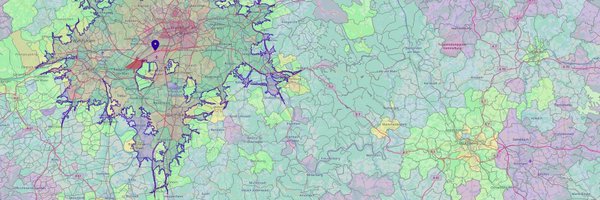
Easily handle your GIS data with DBeaver's Value Panel. You can select one or multiple regions on the map, view detailed information for each, and save your results as an image. The spatial data feature is available in both DBeaver Community and PRO editions. Read more:
0
23
187
Want to show rich place details when users click on a map? 🗺️ This MapLibre + Geoapify code sample: • fetches place details for clicked locations • shows custom marker icons and HTML popups Live demo + full code on CodePen 👇 👉 https://t.co/hm6hxvEtRt
#MapLibre #MapsAPI
0
0
0
Want to demo a route fast? Now the Routing API Playground supports prefilled URLs. One click → route preview. Example 👉 https://t.co/0pVdxcbLcj
#logistics #Geoapify #WebDev #gis
0
0
0
Every Geoapify API comes with detailed documentation and real-world examples. Spend less time searching, more time coding. 📚 Explore the docs → https://t.co/VYobYXrq7L
#Geoapify #APIs #HowToCode #Developers
0
0
0
Python + geospatial = insights. This guide shows how to load data, calculate reachability, visualize results, and integrate API outputs. 👉 https://t.co/eaYrFjKSFF
#DataScience #Geoapify #Geospatial
0
0
0
The Geoapify Maps API lets you design interactive and static maps that fit your UI perfectly, without infrastructure headaches. 🌍 Get started → https://t.co/6CzorHoGT0
#Geoapify #InteractiveMaps #MapVisualization #Frontend #WebMapping
0
0
0
Discover the fundamentals of geospatial data, from vector (points, lines, polygons) to raster (satellite imagery, elevation models), static vs dynamic layers, and how each type shapes mapping, analysis, and decision-making. Perfect read for developers and GIS professionals

geoapify.com
Learn more about geospatial data types, discover purposes of each data type, see examples and different use cases in our guide
0
0
0
A 1km area might be 40px at zoom 4… and 4000px at zoom 18. If you’re building map UIs, this matters. Full explanation + demo: 👉 https://t.co/IyeD0ISGC0
#Geoapify #WebMapping #GI
0
0
0
From public transport to sustainability planning, open geospatial data powers smarter cities. 🏙️ What smart city project would you build with Geoapify? #Geoapify #SmartCity #GIS #OpenData #DataScience
0
0
0
Everybody hits a 401 Unauthorized sooner or later. The trick is knowing what to check first instead of randomly changing things. 🔍 Here’s a checklist-based guide to fixing 401s when calling APIs: 👉 https://t.co/QeQKOTnXsJ
#WebDev #APIs #DevTools
0
0
0
Adding more real-world detail. 🌍 The Places API now includes memorials, cemeteries, and funeral homes — helping apps deliver relevant, respectful results. 👉 https://t.co/0oPaKm3UXc
#Geoapify #PlacesAPI #Developers #Mapping #Geospatial
0
0
0
With the Places & Boundaries API, discover points of interest, administrative regions, and location categories. Power your apps with accurate open-data search — no limits, just possibilities. 🌍 Get started → https://t.co/6rJBqM9gwK
#Geoapify #PlacesAPI #POIData
0
0
0
Heatmaps, labels, DOM overlays… They all break if you guess pixel sizes. Learn how to calculate them properly with map.project() → 👉 https://t.co/IyeD0ISGC0
#Geospatial #Mapping #Developers
0
0
0
Need to analyze accessibility, distances, or city coverage? Combine Geoapify routing/isolines with Python tools for fast, reproducible geospatial analysis. Learn how → https://t.co/eaYrFjKSFF
#Geoapify #Geospatial #Developers
0
0
0
Plan, optimize, and analyze routes with the Geoapify Routing API, powered by open data and designed for developers. 🚀 Learn more → https://t.co/npfYRftwyr
#Geoapify #RoutingAPI #RouteOptimization
0
0
0