
Arno Fiva
@arnofiva
Followers
430
Following
628
Media
78
Statuses
251
Developer Evangelist @Esri | Creating 3D web apps using the ArcGIS API for JavaScript
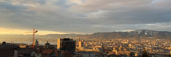
Zurich
Joined February 2011

It’s out! ArcGIS API for JavaScript was just updated with some incredible new tech - like the stunning flow renderer, heatmaps in 3D scenes, a refreshed editing experience, switching between different spatial references and lots more. Here's the scoop: https://t.co/nNJgbDkW6U
1
19
67

Here is a new Storymap Collection of #LaPalmaEruption teaching resources, including a GIS lesson from @lcgeography
https://t.co/BmXZsaqaAD It includes stunning high res #drone imagery of the lava flow from @lapalmaopendata plus a selection of GIS based apps #geographyteacher
10
343
1K
Together with the source code on @github:

github.com
Limmern Hydro Power Plant Demo. Contribute to arnofiva/2021-dev-summit-plenary-demos development by creating an account on GitHub.
0
0
2
#3D underground view of the Limmern hydroelectric power station in the Swiss Alps ⚡️ The interactive version is available here: https://t.co/fcWZfwppKQ Created with the @ArcGISJSAPI #3DWebGIS #WebGL #geodev #JavaScript
3
13
19
Highlight #3D buildings and their shadows with the @ArcGISJSAPI Demos, source code and blog post with @nicolaraluk available here: https://t.co/vGwAaVil8F
#3DWebGIS #WebGL #geodev #JavaScript
1
16
44
The breaking change was caused by the sketch view model removing the cancel state on update events: https://t.co/6s0pDP5Vgm
developers.arcgis.com
Release notes for 4.15 (April 2020)
0
0
0
Plus I was able to throw out a bunch of custom code in favor of relative-to-scene elevation mode, to place #3D objects on rooftops https://t.co/eOuPC0k5jk
1
0
1
#3D objects and @glTF3D imported from @Sketchfab are rendered with #PBR materials, making your urban plans look more realistic
1
0
1
Rotation and snapping help draw rectangular buildings and parallel streets (if that is what you like) https://t.co/mbegEVBxfj
1
0
0
Upgraded the @ArcGISJSAPI in one of my first apps from version 4.14 to 4.20. Or... 1.5 years of new #3D features and improvements vs. one breaking change! https://t.co/lShUFwSOZ5 Read more 👇 about the changes in our #CitizenEngagement demo app:
Use the @ArcGISJSAPI to create your next neighborhood in 3D! I wrote a blog post about the demo app we created for the @EsriDevSummit showing participatory planning: https://t.co/D84jtUC0T5
#esrijs #ArcGIS #WebGL #geodev #JavaScript #3D
1
1
3
Don't forget to crank up the quality mode to get the most out of it 🙂
0
0
1
How do you like the new @swisstopo satellite imagery that just got added to @ArcGISOnline? https://t.co/0NmWkeaHC7
2
9
53
Try it out with this demo scene: https://t.co/PdFAEtPP8O (look out for the edit icon in the upper left corner) Or read more about it in our latest release blog:
0
1
0
#ArcGIS API for #JavaScript was just updated! Version 4.20 brings WFS layers, shadow analysis, improved snapping, analysis layers, and the beginnings of the utility network on the web. Learn more in the release blog https://t.co/6WiUkIcltf
2
36
86
Great example of intersecting building footprints using the @ArcGISJSAPI geometry engine 👍

Line of sight analysis with @Esri @ArcGISJSAPI to dynamically calculate visible areas around street light poles based on visibility range and minimum distance between poles https://t.co/QhX3Ucfau1
0
0
2
The brick is a point made up of built-in cube and cylinders symbols 🙂
Another #worldmap in the making... using the #3D @ArcGISJSAPI 💻 https://t.co/Z4SuQmo0Yb
#3DWebGIS #WebGL #geodev #JavaScript
0
0
3
Another #worldmap in the making... using the #3D @ArcGISJSAPI 💻 https://t.co/Z4SuQmo0Yb
#3DWebGIS #WebGL #geodev #JavaScript
3
11
17
Excited to see my colleague @nicolaraluk present at @frontzurich this year - which is planned to be an in-person conference again!

Have you ever wondered how web technology influences the craft of map making? @nicolaraluk will go under the hood of three web maps in her talk. You’ll learn how to create web maps and understand the technology behind them. Join us at #FRONT21.
1
2
7
Have you ever wondered how web technology influences the craft of map making? @nicolaraluk will go under the hood of three web maps in her talk. You’ll learn how to create web maps and understand the technology behind them. Join us at #FRONT21.
0
11
26