
Mary Muthee
@_marymuthee
Followers
2K
Following
2K
Media
143
Statuses
333
It's all about Spatiality😃...In my mappy era💃... Tweeting: #gis #geospatial #programming #RemoteSensing #maps
Kenya
Joined February 2022
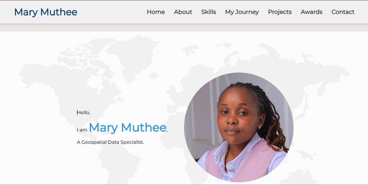
18/08/2025 . I’ve updated my portfolio with new #projects plus a #ProfessionalEngagements section (my favourite section) showcasing trainings, mentorships and events I've been involved in the #geospatial space. Check out the new updates here-

2
10
85
23/08/2025. We just concluded our second session of the #Google #Earth #Engine training! A big shout-out to all those who joined us! See y'all in the next one! @youthmappers @Kip__Emmanuel . #geospatial #YouthMappers #GIS #RemoteSensing


Our 2nd #Google #Earth #Engine session is happening this Saturday! @Kip__Emmanuel will be our facilitator!. Level: Intermediate & above.Looking forward to seeing you all! @youthmappers. Register here: #geospatial

2
9
40
Our 2nd #Google #Earth #Engine session is happening this Saturday! @Kip__Emmanuel will be our facilitator!. Level: Intermediate & above.Looking forward to seeing you all! @youthmappers. Register here: #geospatial
1
17
72

26/7/2025.Our #Google #Earth #Engine session was a success! 🌍✨.Grateful for all the amazing participants and the kind, positive feedback , it truly means a lot! .See y'all in the next session! .#YouthMappers #Geospatial. @youthmappers


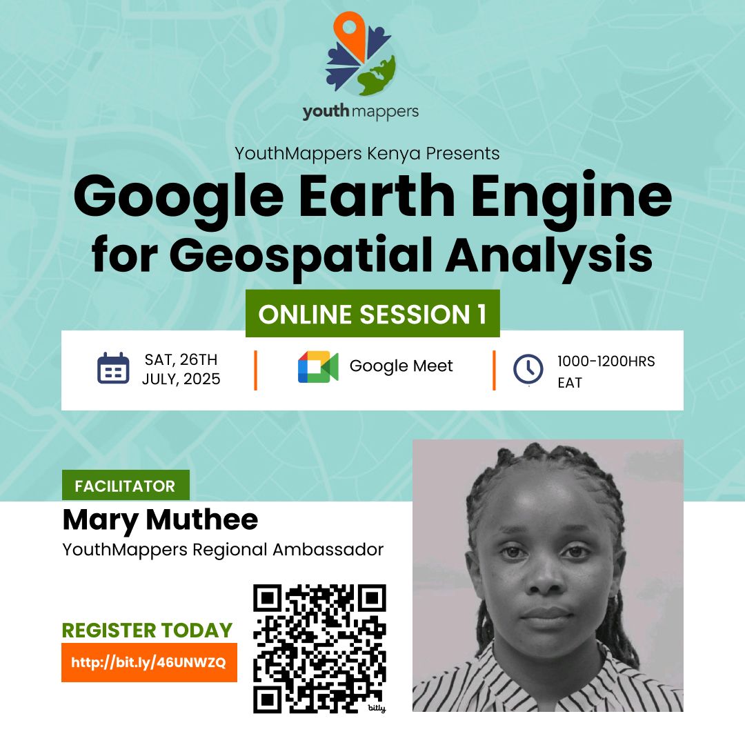
We will be having training on #geospatial analysis using #Google #Earth #Engine on 26th July 2025. The first session will be beginners friendly!. Registration link- @youthmappers
3
5
39
We will be having training on #geospatial analysis using #Google #Earth #Engine on 26th July 2025. The first session will be beginners friendly!. Registration link- @youthmappers
4
57
245


You obviously don't wanna miss this upcoming #free webinar on how to build #QGIS plugin by @spatialthoughts . Registration link-

1
13
34
20/06/2025.One challenge I face is managing storage space on my computer when working with large datasets in #RStudio as it saves temporary files locally. To solve this, I set up my scripts to direct temporary files to an external disk. Code snippet below 👇 .#R #geospatial

1
5
20
Some years back, I tried doing #development but made no progress. Joining my current workplace @LocateIT_KE reignited that spark. I’ve built my portfolio ( with #HTML & #CSS and now learning #JavaScript!.Grateful to @KevinKi69601686 for the mentorship
0
11
60
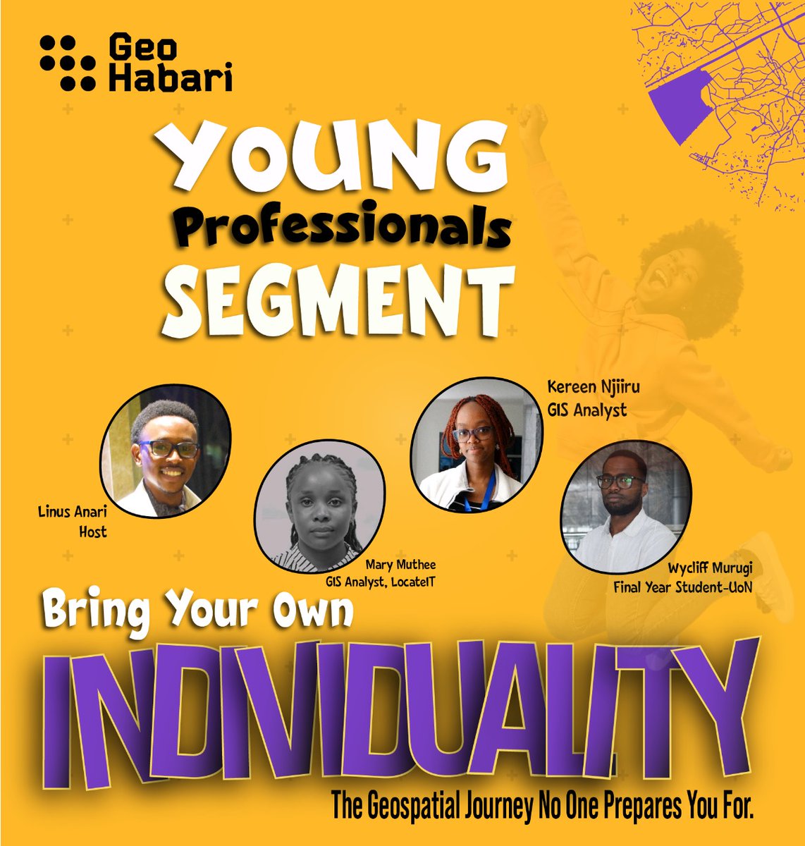
We recently did a young professionals segment podcast with @geohabari . The segment covers the Kenya #geospatial curriculum, the transition from class to the job market among others . You can listen to the podcast here ( . #TimeofMyLife #geospatial
0
6
27


6/05/2024.Explored visualizing Earth Engine data directly in QGIS using the GEE plugin—smooth and powerful! Took it further with the Globe Builder plugin to see my layers on a 3D globe 🌍 Huge thanks to @spatialthoughts for the amazing learning resources! #GIS #QGIS #geospatial


3
11
108
13/04/2025. The Geofresh talk by @youthmappers Kenya was a success!Grateful to the amazing speakers who shared their #geospatial journeys and everyone who tuned in. The energy was unmatched. See y'all in the next one!.Onwards and upwards!🥳


2
11
36
Wondering how to venture into the #Geospatial industry after school? Having questions on how to get jobs? Join us (@youthmappers -Kenya) this coming Sunday as we hear from these talented recent graduates and get to know how they did it. Registration link -

1
15
57
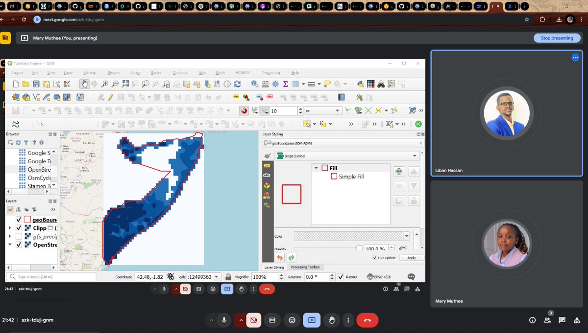
29/03/2025.Saturdays like this make me so happy! Had two great sessions with @LibanXassan and @ackon_sam .helping out with #GEE and #QGIS (plus some R). I’m so passionate about this and always look forward to these moments—distance doesn’t matter when we’re learning together!🌎✨

1
4
42
Last year a time like today 💃. And yes we have already grabbed the degree 🙂. Maybe a Masters should be the next thing?😄.
27/03/2024. Excited to share that I've officially defended my undergraduate research project! 🎓🎉 Grateful for the journey, the support of my mentors, and the chance to contribute to my field. Onwards and upwards!! #geospatial #GIS


4
7
55
11/03/2025 .Using #lidR package in R to process point-cloud data, computing Canopy Height Models (CHM), classifying points, segmenting trees, and handling large LiDAR datasets efficiently. With rgl and lidRviewer, one can explore point clouds interactively. #geospatial #R
1
19
75
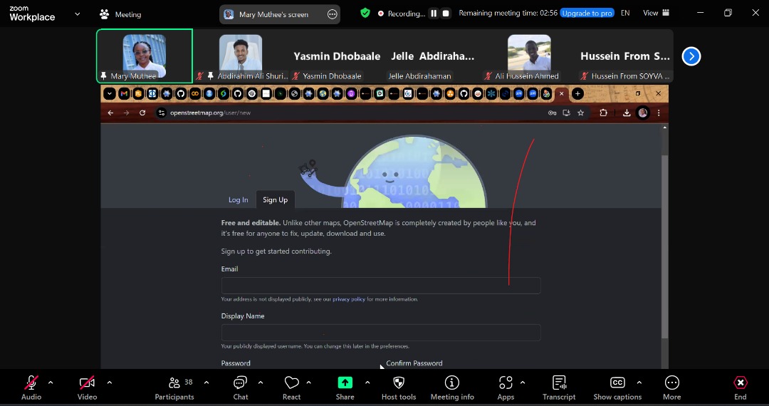
2/03/2024.Excited to have had my first online session for 2025 with @youthmappers chapter from @ICESomalia today! Being a new chapter, I introduced them to what we do as @youthmappers and how they can join the #openmapping community (@openstreetmap ). 💃


1
8
41