
Kilian Vos
@_kvos
Followers
1K
Following
1K
Media
160
Statuses
655
Remote Sensing, Machine Learning, Coastal, #opensource developer, #CoastSat, Coastal webGIS https://t.co/eGGJugJ2ia | alumni @UNSWWRL @EPFL_en
Sydney, New South Wales
Joined October 2018
New #opensource toolbox to map water surface areas from #Landsat and #sentinel2 developed with Shirui Hao, available at It provides a very efficient raster-based process that can be deployed in @Google Earth Engine for monitoring large areas at low cost.
1
12
77
🛰️Big update!🌊.New EO platform at with updated satellite-derived shoreline change time-series from 1984 to 2024 with #CoastSat and #Landsat for Australia, California, Mexico, Japan, NZ, Peru, Chile, US East Coast (Delaware to Texas). #EarthObservation
0
0
14

I'll be attending the Space Tech Expo Europe tomorrow in Bremen, if anyone is also planning to be there would be nice to catch up and discuss the latest in Earth Observation!. #SpaceTechExpo

invt.io
Register for free
0
0
0
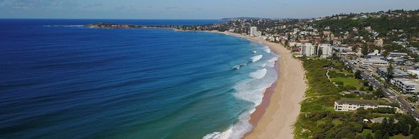
First Medium article on: Mapping coastal change from space (Part 1)
link.medium.com
While beaches may seem static to the holidaymaker, they are one of the most dynamic regions on Earth. Sand is transported by winds, waves…
0
3
4

RT @anardeeek: I am advertising a two-year postdoc related to remote sensing of chronic coastal floods. The position will be jointly at UNC….
0
14
0

🌍FIRST PAPER OUT🌍 Our open-source tool for mapping #coastalchange is now live! Using free #satelliteimagery and #AI, VedgeSat detects vegetation edges to assess coastal health & storm impact; great for global #climatechange risk management 🌊🌱🛰️ (1/5).
1
0
1
nice story from USGS on our collaborative work on shoreline monitoring using publicly available satellite imagery.

In a significant first for satellite-derived #shorelinemonitoring, researchers including @USGS have created a benchmarking framework aimed at evaluating the accuracy of shoreline change observations derived from #satellite #remotesensing:

1
3
29
Last call to register for the .UNESCO IGCP Project 725 Virtual workshop on "Mining the Historical Coastal Record". It is free and only takes 1 minute to register (. Full program below 👇 #freeworkshop #coastalchange

1
1
7
📢New #CoastSat release (:.- create an animation with the mapped shorelines like below.- advanced time-series analysis including long-term trends.- option to adjust the s2cloudless probability threshold for better cloud masking.#coastal #Landsat #Sentinel2
0
6
32
RT @timothydprice: 📢#PhD vacancy! @TjeerdBouma and me seek a candidate for a 4-year, fully-funded project:. Enhancing estuarine flood resil….
0
7
0

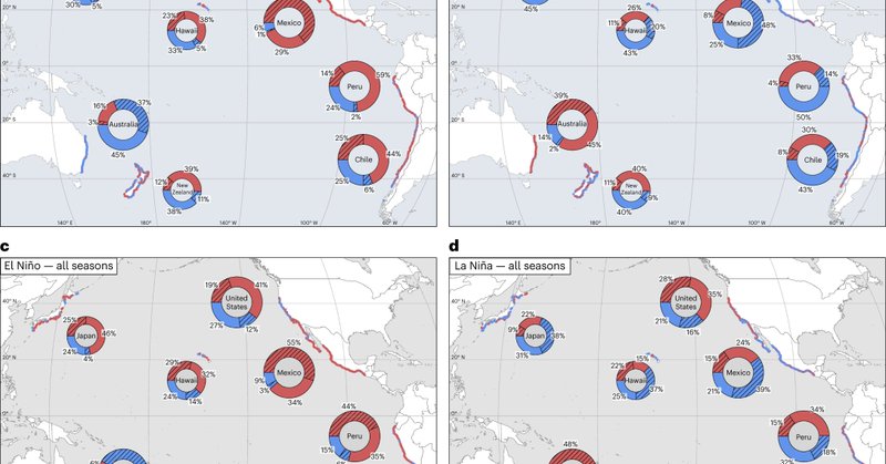
I have uploaded on @EarthArXiv a preprint of the accepted version of our paper "Pacific shoreline erosion and accretion patterns controlled by El Niño/Southern Oscillation" published in Nature Geoscience. This is possible after the 6 months embargo period.
nature.com
Nature Geoscience - The El Niño/Southern Oscillation drives coherent patterns of beach erosion and accretion around the Pacific Rim, according to analysis of satellite imagery covering over...
0
7
25
RT @CommsEarth: A benchmarking study of five satellite-derived shoreline mapping algorithms at four sandy beaches demonstrates a horizontal….
0
4
0
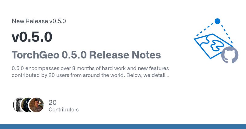
RT @calebrob6: 1/ 🎉 I'm really excited to announce the release of TorchGeo 0.5.0! This is a Python library for using PyTorch with geospatia….
github.com
TorchGeo 0.5.0 Release Notes 0.5.0 encompasses over 8 months of hard work and new features contributed by 20 users from around the world. Below, we detail specific features worth highlighting. High...
0
65
0
I would like to thank all my co-authors from the 5 different SDS teams who contributed greatly to this work and were super enthusiastic to share data and outputs throughtout the project.
0
0
0
The repository can be used to transparently test new developments and future enhancements in satellite-dervied shoreline mapping. Join the 'SatelliteShorelines' organisation if you are interested in the topic!

github.com
Home to open-source projects mapping coastal change from satellites - SatelliteShorelines
1
0
2
Based on the analysis of the sources of error, the following areas of improvement are identified:.- implement automated co-registration to reduce georeferencing errors.- develop new shoreline proxies for macrotidal beaches that can be mapped automatically (like wet/dry line).
1
0
1
We found that "no one algorithm is more accurate than all others in every situation". Overall, the horizontal accuracy is around 10 m at microtidal sites, but deteriorates as the tidal range increases to more than 20 m for a high-every macrotidal beach (Truc Vert, France).
1
0
2