

Geospatial UK
@UKGeospatial
Followers
132
Following
46
Media
28
Statuses
153
Joined April 2021
🌍 Do you study or teach Geography at KS4 - 5 and want to highlight the importance of location and maps? . 💻 Geospatial UK has been created to broaden awareness and understanding of geospatial skills and technologies and its applications for the future .
geospatialuk.org
At Geospatial UK, our aim is to broaden awareness and understanding of Geospatial skills and technologies and its applications, supported by eight industrial partners. In particular we aim to...
1
15
30
🗨 ". the applications of Geospatial Engineering are endless, whether it is urban planning, analysing flood risk, detecting deforestation, producing digital elevation models or 3D modelling, you will always find something that interests you.".
0
0
0
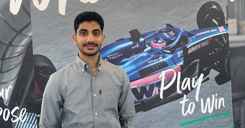
🤔 Considering a Summer placement?. Read about @UniofNewcastle's Geospatial Engineering student, Mohamed Al Hashmi's Summer placement experience with @bp_UK. Read more 👇.
geospatialuk.org
Mohamed Al Hashmi, BEng Geospatial Surveying and Mapping student at Newcastle University, shared his experience of a Summer placement. 1. Where did you do your industry placement? The internship was...
1
2
4
🎉 We are pleased to introduce our new #supporter @TrimbleNews! . 🌎 We are looking forward to working with you to inspire the next generation of #geospatial experts!. @KORECGroup
0
1
6
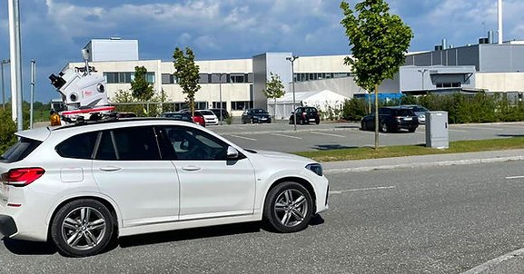
🚗With over 11,000km of dual carriageway, find out how the Danish Road Directorate used #pointcloud data and #panoramicimagery to #map their roads 👇. @LeicaGeo_UKI • @RICSnews • @bp_UK • @THS_UKI.
geospatialuk.org
A national road network is one of the most important pieces of infrastructure any country will ever built and maintain. Ensuring that these public highways are kept to the highest possible standard...
0
1
2
🗨 "It’s quite rare that a degree has so many applications that you can take your #skill set and apply it to whatever subject area interests you.". @LeicaGeo_UKI • @RICSnews • @bp_UK • @THS_UKI.
0
0
3
🤔 Considering an Industry Placement?. Jennifer, BSc #GeographicInformationScience student at Newcastle University, shared her experience of a Year in Industry. 👉 #GIS #Undergraduate #Degree #Student #Subject #YearInIndustry.
geospatialuk.org
Jennifer Merridew, BSc Geographic Information Science student at Newcastle University, shared her experience of a Year in Industry. 1. Where did you do your industry placement? Sixense Monitoring,...
1
1
3
📚 Back to #school? 🏫. 👀 Looking for #FREE workshops, resources or careers info?. Check out for a range of geospatial topics including #Geography, #Maths and #Physics!. @LeicaGeo_UKI • @RICSnews • @bp_UK • @THS_UKI . #Teacher #Workshops #FreeResources
0
0
1
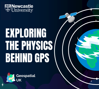
🤔 Ever wondered how #GPS knows where you are on Earth? 🌍. It's all about #physics! 🛰. Book our NEW #workshop for your class this term to explore the physics behind GPS!. 👉 #Teachers #Geography #Maths #Geospatial #NewTerm #FREEWorkshop
1
3
5
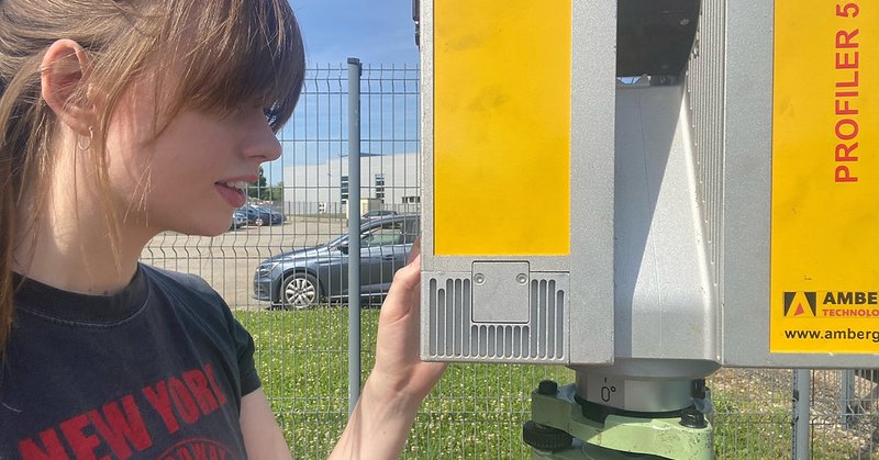
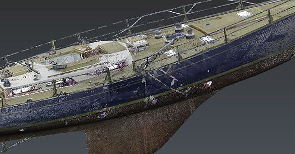
Think #3DLaserScanning can only be used for buildings? 🏢. ❗Think again❗. Digital Dry Dock use 3D laser scanners to capture a 20-meter classic racing #yachts! ⛵. Find out how they did it 👇.
geospatialuk.org
Imagine that your vessel is on charter in the Caribbean, while a European shipyard uses its digital twin to plan the next refit, or that you could start designing and building modifications to a ship...
0
0
0
🥳 We’re looking forward to a new year of inspiration and education! Thanks for being part of the journey!.
0
0
0
👏 A huge thanks to our outstanding network of supporters: .@HexagonSIG • @LeicaGeosystems • @RICSnews • @bp_plc • @HydSocUKI • @KORECGroup • @Plowman_Craven • @m_geospatial • @MalcolmHughesUK • @Survey_Solution • @fugro • @UniofNewcastle.
1
1
3
🎂 Here at Geospatial UK, we're celebrating #1Year of inspiring the next generation of geospatial experts!. 🌍 We've been busy over this past year engaging with young people to raise awareness of the #geospatial sector and help them make the right decisions for their #future.
2
4
6
For those that love #numbers, the new hospital will. Be 7️⃣ storeys high. Include 3️⃣2️⃣0️⃣ individual inpatient rooms. Support 2️⃣2️⃣ operating theatres. #Geospatial #GeospatialUK #Surveying. @LeicaGeosystems • @RICSnews • @bp • @HydSocUKI.
0
0
0
3D laser scanning allows #GeospatialEngineers to survey their site even when certain areas are inaccessible!. 🏥 Find out how BAM Ireland use #3DLaserScanning to construct the New Children's Hospital (NCH) in Dublin 👇.
geospatialuk.org
Referred to in planning documents simply as the New Children’s Hospital (NCH), the new facility is due to combine the services currently provided at Dublin’s three tertiary children’s hospitals:...
1
1
2
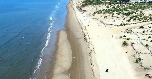
These factors, plus the coastal geomorphology, makes the north west area sensitive to the effects of climate change. Find out how #surveying helps to protect the coastlines of the North West British Isles 👇
geospatialuk.org
The North West Strategic Regional Coastal Monitoring Programme was established in 2008 to coordinate the collection of coastal monitoring data for the north west coast of England.It is part of the...
1
0
1
In addition, parts of north west are influenced by shallow groundwater and the flood risk from surface water and main rivers.
1
0
1
🌊 #Flood risk and #CoastalErosion are serious issues for authorities in north west England. The councils take these risks very seriously, having suffered severe coastal flooding a number of times in the early 2010s.
1
0
2