

Met Monkey
@ThermoConveyor
Followers
3K
Following
2K
Media
908
Statuses
3K
UK Meteorologist (Keith Baker-Biggs) providing trustworthy severe weather updates & analysis covering the geographical domain of the United Kingdom.
United Kingdom
Joined June 2014
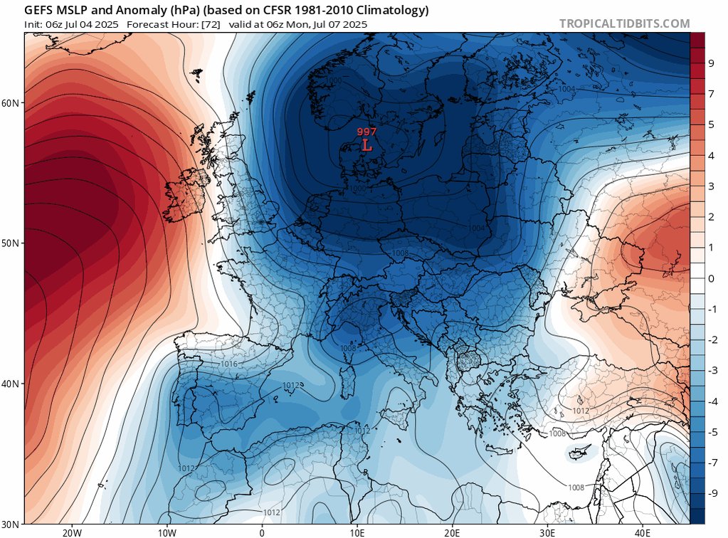
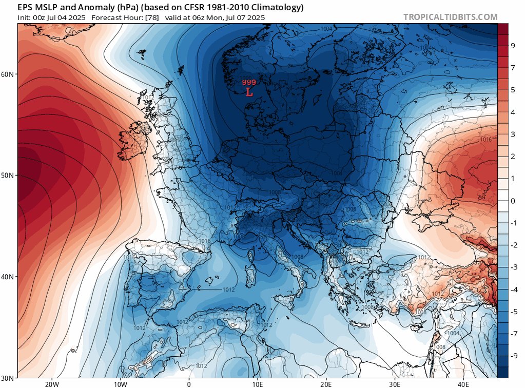
Following a marginal blip this weekend where conditions will not be as warm or hot and on occasion a little more unsettled - the weather pattern looks to reset with the Azores ridge looking to build in again by Monday or Tuesday next week. There is growing confidence for further
1
1
9

Lift off in early zone being monitored surrounding counties Northants. Bucks. late AM.

0
0
1
There is a moderate risk of thunderstorms on Sunday. Heavy showers and thunderstorms are likely to develop on Sunday afternoon downstream of an approaching shortwave/upper trough from the West, a combination of differential advection through cooling aloft, atop a warm moist

4
3
19
RT @MENnewsdesk: Diogo Jota: Police confirm cause of Lamborghini car crash after Liverpool star and brother Andre Silva killed https://t.co….
0
3
0
Rest in peace to Liverpool Player, father of 3 children, recent husband to a loving wife, parents of a super star and loved by many many millions of fans Diogo Jota. Devastating news. Everyone is standing by you god bless x.
0
0
4

RT @metoffice: Here is some good advice about driving in severe weather from our partners @TheRAC_UK and @NationalHways. .
0
8
0
1st inland lightning strikes of the day E of Cumbria. Expect thunderstorms to develop further North and East through the day, clearing into the N Sea late afternoon/early evening. Some large rainfall totals possible (especially in slight risk areas).

0
0
0
A scattering of heavy showers and a few thunderstorms are possible today for Eastern parts of Scotland and North East England in response to cooling aloft, diurnal heating/insolation and developing convergence zones. Some uncertainty on where these convergence zones precisely

2
0
4
Cooling aloft and the translation East of a post frontal trough may allow for some convection to develop across parts of Northern and Eastern Britain later today. There remains a very low/low likelihood due to dry air entrainment and relatively robust subsiding air associated

0
0
2
Further hot and humid weather is set to build over the coming days, likely peaking in intensity across the South East on Monday where temperatures are likely to exceed 35oC quite widely. A new June record is possible. It is Monday into Tuesday that the next potential for

0
0
10
There is a generally a low chance of elevated thunderstorms skirting parts of South East England later this evening and overnight. Most lightning should remain across the channel, however, there is still a chance of Eastern most counties of East Sussex and more especially

0
0
2
Early advanced watch for the possibility of elevated thunderstorms for parts of South East England from late 21Z on Wed through into the early hours of Thu. The most likely scenario is for the bulk of electrical activity to be confined to the English Channel with steady N

1
0
7
Further incursions of warm/hot moist air will push up from the near continent in the coming days. Atlantic fronts will attempt to engage with these high theta-W plumes skirting SE England. There is the possibility of further elevated thunderstorms later on Wed/Thu this week


2
1
11