

Spexi
@SpexiGeospatial
Followers
5K
Following
752
Media
470
Statuses
1K
Decentralized Aerial Intelligence. Powered by @LayerDrone Join https://t.co/3pTLuuSAdQ
Joined April 2022
🔥Spexi Series A Fundraise Announcement🔥 We are so excited to announce our $11.5M Series A fundraise lead by @BlockchangeVC , followed by @MoonshotsCap and @protocollabs. We are transforming the aerial data industry with the largest, fastest-growing fully standardized drone
23
19
108
Who wants cool merch? Tell us what got you started in drones? 👇
7
0
2

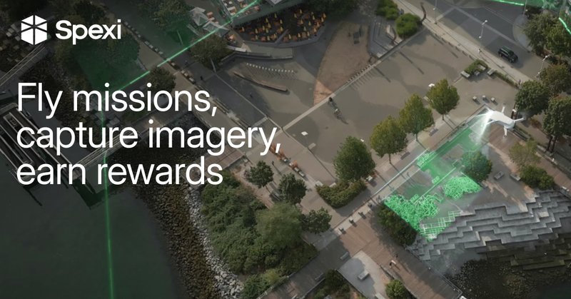
Earn $ for capturing vital drone imagery with Spexi. Learn how 👇 https://t.co/n8m6cAg3RX
spexi.com
Join the Spexi Network and earn rewards for capturing high-resolution imagery. Use our app for autonomous flights and hassle-free operations.
0
0
1
Statesboro = unlocked🔓 Standardized, high-resolution aerial coverage is coming to South Georgia.
1
0
1
Spexigons have launched in the City of Roses 🌹 → Fly missions in Thomasville, GA → Get paid through Spexi → Build your rep on @LayerDrone → Upgrade the world map with every image It’s aerial intelligence made better.
0
0
4
Looking to join hundreds of drone pilots earning rewards for flying their drone? Check out Spexi! Learn how to get started as a pilot 👇 https://t.co/n8m6cAg3RX
spexi.com
Join the Spexi Network and earn rewards for capturing high-resolution imagery. Use our app for autonomous flights and hassle-free operations.
0
0
0
New skies unlocked: Hello Lake City, Florida! ☀️ Local pilots can officially start capturing ultra-clear drone imagery that supports smarter planning and growth for North Florida. Every flight counts. Every image builds the future of aerial intelligence.
1
0
2
New City: Palatka, FL joins the network! 🚣 @LayerDrone pilots are now flying over the “Gem City of the St. John’s River” → capturing standardized high-rez drone imagery → expanding coverage of North America → supporting key industries like environmental monitoring and city
0
2
38
Spexi is where drone pilots turn their hobby into rewards. Fly your drone. Capture vital aerial imagery. Get paid for helping us build the @LayerDrone network. Learn more: https://t.co/n8m6cAg3RX
spexi.com
Join the Spexi Network and earn rewards for capturing high-resolution imagery. Use our app for autonomous flights and hassle-free operations.
0
0
0
New Spexigons have been added to Bluffton, South Carolina! 🏞️ Pilots in this historic town can find missions in the Western neighborhoods of Island West, Hampton Lake, and surroundings. Time to upgrade Bluffton’s digital map. One flight at a time.
1
1
3
When your infrastructure is built on tools that people already have, you get moments like this ✨ LayerDrone is powered by off-the-shelf consumer drones allowing anyone, anywhere to contribute. The result: a simple, seamless experience for network pilots.
22
19
58
Looking for on-demand, ultra-high resolution aerial imagery at a fraction of the cost of traditional imaging methods? Or maybe you’re a drone pilot looking to turn your hobby into passive income? Spexi is the solution: https://t.co/gSNccEK0W5

spexi.com
Spexi transforms aerial imagery with AI-powered insights and high-resolution micro-drone technology.
0
0
0
White Rock, BC Update 🗺️ → 512 new Spexigons added to the area → Total pilot rewards of $5000+ CAD Location refreshes like this are how we ensure the most consistent and up-to-date visual record of Earth on the market. For pilots, it means: ✅ More @LayerDrone missions ✅
2
0
0
Join thousands of pilots earning rewards with @LayerDrone and Spexi. Download our mobile app to get started 📱 https://t.co/n8m6cAfw2p
spexi.com
Join the Spexi Network and earn rewards for capturing high-resolution imagery. Use our app for autonomous flights and hassle-free operations.
0
1
1
Meridian, Mississippi is ready for capture! 🚀 Pilots across North America are helping us build the freshest, most detailed visual record of Earth by uploading standardized aerial imagery with off-the-shelf consumer drones. Today, Meridian gets added to that map 🗺️
1
1
3
Kilgore, Texas just joined the LayerDrone network✅ With a population shy of 13,600 people, many might assume it would be impossible to crowdsource drone imagery here. Only hours after launch, we have nearly a third of the total Spexigons either awaiting submission (denoted in
Spexigons are live in Kilgore, TX! ⭐ On-demand drone imagery isn’t just for big cities. Even in remote towns like this, pilots are capturing ultra-detailed aerial data that support oil & gas, land management, archaeology, and local infrastructure. Built by its own community.
0
3
41
You could be joining thousands of other pilots in earning rewards for flying your drone too. Learn more about Spexi as a pilot at
spexi.com
Join the Spexi Network and earn rewards for capturing high-resolution imagery. Use our app for autonomous flights and hassle-free operations.
0
1
2
Spexigons are live in Kilgore, TX! ⭐ On-demand drone imagery isn’t just for big cities. Even in remote towns like this, pilots are capturing ultra-detailed aerial data that support oil & gas, land management, archaeology, and local infrastructure. Built by its own community.
1
1
4
Earn rewards for flying your drone with Spexi. ✅ Flexible flight schedules ✅ Automated missions + flight paths ✅ A community of thousands of active pilots Learn more →
spexi.com
Join the Spexi Network and earn rewards for capturing high-resolution imagery. Use our app for autonomous flights and hassle-free operations.
1
1
3
Now Live on Spexi: Desert Hot Springs, CA 🏜️ One of SoCal’s fastest-growing cities is getting mapped in drone imagery. Even in the desert, @LayerDrone pilots are ready to upload the aerial data that the city needs to plan smarter and build sustainably. Let’s fly!
3
1
4