

Polosoft Technologies
@Polosofttech
Followers
307
Following
522
Media
589
Statuses
863
Developing Technology That Matters to Our Customer! Looking for a solution? Email: [email protected] #GIS #LiDAR #CAD #Geospatial #Analytics #Web #Ecommerce
Bhubaneshwar, India
Joined August 2017
🌟 Leadership Announcement 🌟.We are delighted to welcome Mr. Sanjib Satpathy as the Chief Strategic Officer (CSO) – #HR & Operations that brings exceptional strategic insights, in-depth knowledge, and proven leadership. #PolosoftTechnologies #StrategicGrowth #TeamPolosoft #CSO

0
0
1
🎤✨ Heartfelt voice, unforgettable performance. ✨🎤. Join with us to congratulate Sonali Behera on her stellar performance!. #PolosoftAnnualFunction #CelebratingTogether #MusicalEvening #TeamPolosoft #UnforgettableMoments.#employeeappreciation #employeeengagement #teamwork
0
0
1
🌟 #Excellence #Recognized! 🌟. A huge round of applause to @Dillip Rath for receiving the Excellence in #BusinessGrowth Award 🏆. #Excellence #businessgrowth #recognition #employeeappreciation #employeeengagement #teamwork #workcelebration #employeerecognition #TeamPolosoft
0
0
0
🌟 New Excitement is #ComingSoon! 🌟. Something big is on the way at #PolosoftTechnologies 🚀. We’re gearing up to bring you #innovation, growth, and fresh opportunities that will redefine possibilities. Stay tuned… the future is unfolding soon!. #StayTuned #NewBeginnings
0
0
0
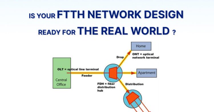
Is Your #FTTHNetworkDesign Ready for the Real World?.At Polosoft Technologies , we focus on #FTTHnetworkdesign evaluation, delivering the confidence & numbers you need to build right the first time in the Telecom industry. #Telecom #SmallworldFTTH #FTTH.
blog.polosoftech.com
Rolling out a fibre-to-the-home (FTTH) network is capital-intensive, and the difference between a profitable build and a costly one often lies in the quality of the design.
0
0
0
🇮🇳 Happy 79th Independence Day! 🇮🇳.At Polosoft Technologies, we’re proud to contribute to this digital revolution, creating solutions that make India shine brighter on the global stage. #IndependenceDay2025 #PolosoftTechnologies #AI #Innovation #TechForGood #ProudToBeIndian
0
0
0
🌸✨ Happy Raksha Bandhan! ✨🌸.On this special day of love, protection, & endless memories, Polosoft Technologies extends heartfelt wishes to all the amazing brothers and sisters out there! 💙💖.#HappyRakshaBandhan #PolosoftWishes #SiblingGoals #GrowingTogether #FestivalOfBonds
0
0
0
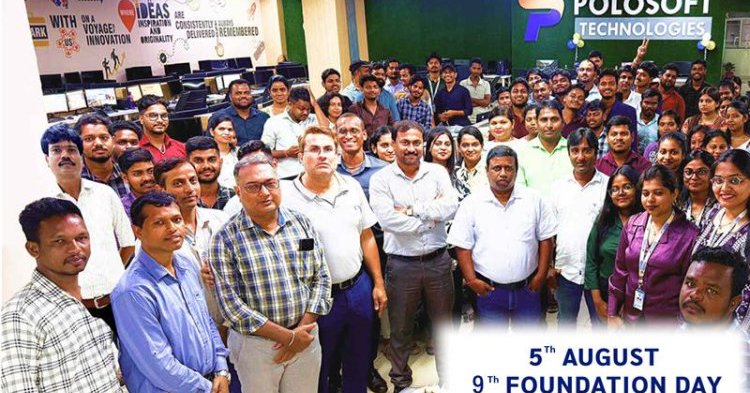
#Happy #FoundationDay, Polosoft Technologies ! . A big thank you to our incredible #clients, dedicated #colleagues, and #trustedpartners. Your continued support fuels our journey every step of the way!. Let’s continue to #grow, #build, and #inspire together.

0
0
0

Looking for Small Cell Site Drafting Services that meet today’s high-speed demands?. Connect with us:.#TelecomDrafting #SmallCellSolutions #5GReady #SitePlanning #CADDrafting #PolosoftTechnologies #NetworkDeployment #PermittingSupport #SmartCities

0
0
0
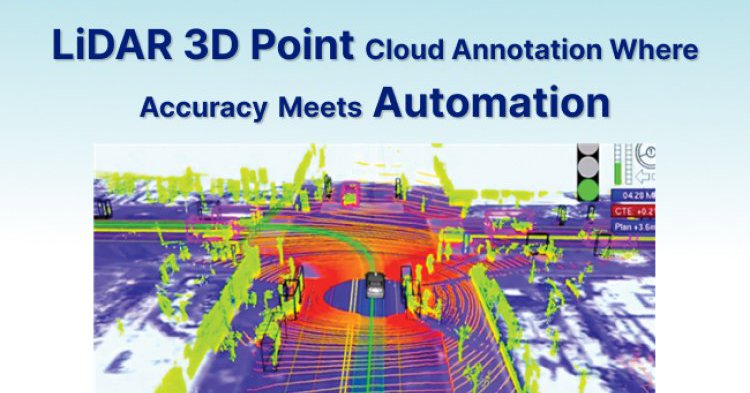
LiDAR 3D Point Cloud Annotation Where Accuracy Meets Automation.#annotation #lidardata #lidarpointcloudannotation.@LandSurveyorsU @esriuk #lidar @lidarnews @LiDARLatam .
blog.polosoftech.com
Accurately label and classify 3D objects from LiDAR data for advanced perception and spatial analysis.
0
0
0
WordPress is a powerful platform that helps businesses grow online with ease. #WordPressDevelopment #WebDesign #OnlineBusiness #DigitalGrowth #WebDevelopment #SmallBusinessMarketing

0
0
1
How Does Accurate LiDAR Classification Empower Powerline?.#Powerline #LiDARClassification #powerlineclassification #lidardata .

blog.polosoftech.com
In an era of rapid digital transformation and energy demand, powerline infrastructure needs to be more reliable, efficient, and safe than ever.
0
0
0
Why is Bare Earth Classification in Such High Demand Today? #BareEarth #Classification #LiDAR #lidardataprocessing #DEM #DSM #DTM #AdvancedClassification #PowerlineClassification #Utility #LiDARData #terrainmodelling @LandSurveyorsU
0
0
0
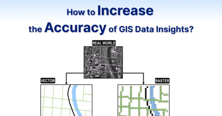
How to Increase the Accuracy of GIS Data Insights?.#GIS #GISdata #GISinsights #GISservices.#LiDAR #Geospatial .@LandSurveyorsU .
blog.polosoftech.com
In the age of location intelligence and geospatial decision-making, accuracy in GIS (Geographic Information System) data is critical. Whether it's for urban planning, environmental analysis, disaster...
0
0
0
How do we extract powerlines from LiDAR point clouds?. #LiDAR #RemoteSensing #GIS #PowerlineDetection #AI #MachineLearning #Drones #Infrastructure

0
0
0
Partner with Polosoft Technologies in Network Design & Regulatory Success. #Telecom #TelecomNetworkDesign #FibreNetwork #5Gnetwork.
0
0
0
This Independence Day, let’s celebrate not just America’s legacy, but its interconnected future with the world. Happy 4th of July! 🇺🇸✨. #FourthOfJuly #IndependenceDay #GlobalLeadership #Economy #Partnerships #USAturns248 #USIndependenceDay #USday #UnitedStates
0
0
0
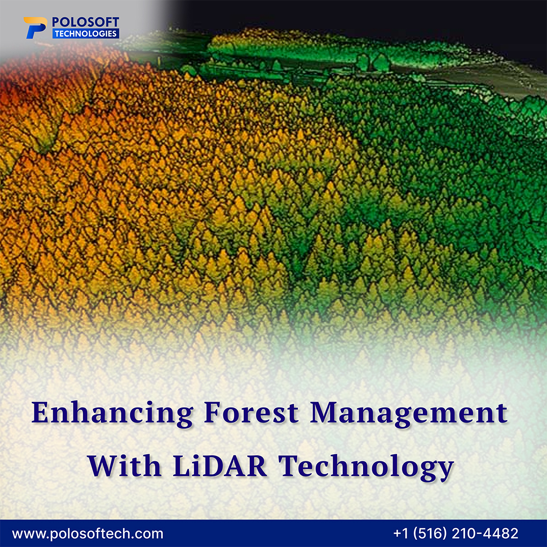
#PolosoftTechnologies’ LiDAR solutions accurately analyze tree vegetation, canopy structure, and forest health for smarter, sustainable decisions. #LiDARMapping #ForestManagement #TreeVegetation #LiDAR #TreeMapping #PrecisionForestry @LandSurveyorsU
0
0
0