
Peyton Simmers
@P_SimmsWX
Followers
2K
Following
23K
Media
4K
Statuses
12K
MU Meteorology Alum 2025 | Meteorologist | @accuweather Meteorologist | Project TILTTING | 1🌪| 5 🌌| Packers Fan! | Opinions my own
Central Pennsylvania
Joined March 2021
The Bills losing to the Dolphins was not on my cards for today. I'm sure you're very happy @EthanKerr2003!
0
0
0
There is going to be isolated snow rates of 6" per hour within some of these lake effect bands given the favorable atmospheric conditions. The LES bands will move around but some places will end up with double digit snow totals.
0
1
3
The Madden-Julian Oscillation (MJO) could get to phase 8 later this month, which is a cold phase for Dec. However, the MJO has to traverse the -ENSO waters and hasn't done well at doing that this year, so it could bury in the CoD. But a -NAO/AO, makes me favor a colder December.
3
1
37
The eye of Typhoon Fung-Wong/Super Typhoon Uwan is getting ready to move onshore. Life-threatening impacts are expected. PAGASA has called this a super typhoon, along with Hong Kong Observatory.
0
1
2
Now that is a lake effect snow sounding! Deep moisture up to about 450 mb, large negative omega values of nearly -6 Pa/s right in the DGZ. CAPE around 400 J/Kg so there will be thundersnow. Big rates are expected in this band in an impressive thermodynamic & dynamic environment.
0
0
11
Typhoon Fung-Wong/Uwan is soon going to make landfall on the Philippines at a category 4 equivalent hurricane strength.
0
0
2
It is amazing to see all of the agencies that forecast tropical cyclones in the WPAC. Each of these agencies forecast differently too. The CMA also issues tracks along with the JMA (official governing body), JTWC, HKO, and PAGASA.
0
0
1
Fung-Wong has strengthened into a typhoon and will continue to gain intensity as it moves towards the Philippines.
0
0
1
I think the very strong -IOD is going to weaken fairly quickly during the winter and eventually lead to El Niño (+ENSO) developing during 2026, could potentially be as early as spring.
2
10
79

We are deeply saddened by the tragic news of the passing of Cowboys’ Marshawn Kneeland. Our thoughts and prayers are with his girlfriend Catalina, family, friends and his teammates.
1K
6K
46K

Severe Thunderstorm Warning including DuBois PA, Clearfield PA and Treasure Lake PA until 6:15 PM EST
0
5
11
Typhoon Kalmaegi continues to move towards Vietnam and will make landfall in a few days. The impending Fung-Wong will become a powerful typhoon and probably a super typhoon as it heads towards the Philippines.
0
1
4
A large smoke plume is visible on radar following a UPS Plane crash near Louisville International Airport.
0
0
1
A -NAO/AO and +PNA pattern is going to bring us a cold shot next weekend and into early next week. There can be lake effect snow with a look like this.
0
0
3
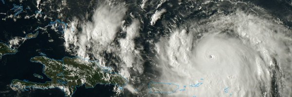
The next tropical cyclone is expected to develop in the Philippine Sea this week and drift northwest. Favorable conditions support a typhoon, and could potentially be a super typhoon. The next name on the list is Fung-Wong and Uwan in the Philippines.
1
2
17
No.

Do you believe the Packers can win a Super Bowl with LaFleur as head coach?
0
0
2
Everything went wrong here, literally everything. Bad play calls, injuries, blocking issues, and missing field goal.

0
0
2