

Ordnance Survey
@OrdnanceSurvey
Followers
59K
Following
65K
Media
13K
Statuses
64K
Britain's mapping agency. Setting the benchmark in location data. Online 9-5 Mon-Fri.
Southampton, UK
Joined March 2009
Introducing new updates to the OS NGD 🎉 🔵 Address - Royal Mail Address 🔵 Buildings - Physical state 🔵 Land Use - Operational status 🔵 Land - Intertidal areas 🔵 Water - Continuous tidelines 🔵 Transport - Bus & Cycle lanes Discover the new data: https://t.co/S7lHpEUbXu
1
2
5
Did you know the Crier of Claiffe is the only named ghost to be on OS Maps? 👻🗺️ Deep in the Lake District, near the shores of Windermere, legend tells of a ghostly figure who once haunted Claiffe Station, wailing for lost love and scaring off unsuspecting walkers. 😱
0
2
14
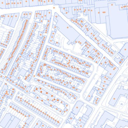
Ever wondered how your daily routes are mapped and connected? 🛣️ OS Open Roads dataset reveals the structure behind GB's road network through: 🟢 Motorway Junctions 🔗 Road Links ⚪Road Nodes Discover more: https://t.co/IDJ862jso9
2
0
3

0
2
2

Calling UK charities! 📣 OS is seeking a new Charity Partner for 2026 - 2028 to help tackle digital exclusion in education. We’re looking for a charity that empowers underserved communities, supports early careers, promotes STEM or explores AI. Applications open 4 November.
1
1
0
New basemap styles just dropped! 🎉 OS NGD Tiles API now features: 🖤 Black & White 🛣️ Road 🌤️ Light Built for developers, planners & map lovers: https://t.co/3eC0yYSBs5
0
0
8
Smarter coastal planning starts here 🌊 OS NGD Land data now includes: 🌍 More complete coverage of intertidal zones 🌍 Coverage of intertidal areas beneath piers & jetties 🌍 Data for habitat monitoring & flood risk Discover the new OS NGD data: https://t.co/NqkkaI127N
1
0
1

National Highways deploys strategic road network model https://t.co/XxyWjbnelV
@NationalHways @OrdnanceSurvey #roads #data

ukauthority.com
1
2
2
Discover how North Wales is using location data to deliver smarter public services. Hear from OS experts, explore OS NGD updates, and connect with your public sector peers. 📍 Llandudno, 25 November PSGA members register free: https://t.co/Ny38BDt0Jz
0
0
0
We’ve teamed up with @NationalHways to launch the Network Model - bringing timely, detailed geospatial data to England’s motorways and A roads. 🛣️ Smarter journeys, less congestion, and better planning for everyone: https://t.co/thVpQcZx2c
0
2
14
📨 New and enhanced attribution Access the new data: https://t.co/oLZupI5SXc 2/2
ordnancesurvey.co.uk
New Address, Buildings, Land, Water and Transport data and attribution is available to access in the OS Data Hub.
0
0
1
The Royal Mail Address enhancement within OS NGD delivers an innovative solution to accessing UK Addressing data from one single, trusted source. It includes: 📨 Full copy of Royal Mail PAF with Geometry 📨 Unique UPRN to UDPRN relationship intelligence 1/2
1
2
3
Inspired by Department of Conservation masterpiece on the geographical knobs of New Zealand. We present to you: The bottoms of Britain. 🍑 A bottom is a legit geographical term for low-lying land, often found in valleys; and we've discovered 4,159 of them across GB.
0
3
27
Roundabouts everywhere... a big clue to this week's #MapMonday! Do you recognise where we are today?
8
0
7

Whether you are new to the industry or looking to expand your network join AGI Early Careers Network and @OrdnanceSurvey in Southampton for this excellent chance to connect and learn! Read more and register 🔗 https://t.co/J77L79bcW0
0
1
1
Explorer House was buzzing recently as we welcomed back 120 OS alumni for a special reunion! From stories spanning the 1970s to today’s tech, we celebrated the legacy and innovation that shape Ordnance Survey. 🎉
0
0
1
Today is National #GetOutsideDay 🌿 We're encouraging everyone to enjoy the outdoors just as much in colder seasons as in warmer ones. Whether it’s a crisp walk or a muddy adventure, map your moment in OS Maps.
0
1
7
Discover how Scotland is using location data to deliver smarter public services. Hear from OS experts, explore OS NGD updates, and connect with your public sector peers. 📍 Edinburgh, 4 November PSGA members register free: https://t.co/tDZ0zL6gXL
0
0
0