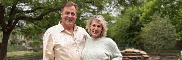
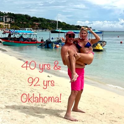
Chief Met. KFOR-TV OKC. 7 Reg/Nat’l Emmy's. Best OK. Wxcast 12X, 7th Gen. OK. Kids, TOR Tracker 1974, AMS Seal. Marla, Sinatra, Marla insta: mikemarlamorgan
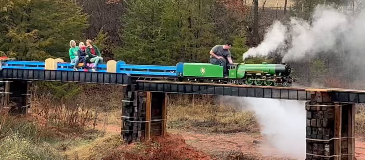
UPDATE!! Nearly ONE MILLION VIEWS! THANK YOU OKLAHOMA! Our 13.5 year father-son dedicated project! This is Oklahoma’s largest operating steam locomotive, with my 25 year old Edmond Memorial Director of bands public school teacher as engineer with 3 gens of genuine Okies! 12.24.23
Our most sincere and heartfelt condolences to the family and friends of 3 OU Meteorology students who were killed in a tragic crash on I-35 last night near the Kansas/Oklahoma border. We are OU family.
#Oklahoma
My sister Susan Morgan Niemi passed away early Monday morning from respiratory failure due to complications from COVID19. This picture Christmas Eve 1963 Tulsa shows me as newborn and all my brothers and sisters in descending age order. Susan was a very kind soul. RIP sister.
**NOT LIVE** Mike Duncan captures “The Moment”. This is painful and tough to watch because there was great loss of life in BridgeCreek at this moment. F5’s are a mismatch in so many respects. 5.3.99
#okwx
#wxtwitter
@kfor
#tornado
5.3.22
Further information concerning Idabel, Oklahoma. South and East portions of Idabel direct hit. Search and Rescue’s in progress. Wide damage swath, debris lofted to height in sky indicating EF4+ tornado. 7:10pm this evening with long track.
#okwx
#txwx
This is the tweet of the week.
.
If it were in Oklahoma in mid May on beautiful, sunny day like this with Tornadoes in forecast, this guy would be in fetal position by exactly 6:47PM. That is, if he even saw it coming.
#OklahomaNotMessingAround
#GizmoThoughts
@ReedTimmerAccu
Do not get caught off guard today folks. PLAN AHEAD. This is the real deal today. Tornadoes likely, large, long tracked violent tornadoes quite possible. Anywhere near these cities.
#okwx
#wxtwitter
@kfor
@Jeff_Piotrowski
@ReedTimmerAccu
Monday May 2, 2022
Been out of country for a while, but Marla and I are hearing our Oklahoma is considering to “locking the clock” on Daylight Saving Time? Folks if clock is to be locked, it must be on Standrd Time. Winter would be too unsafe for our kiddos on Daylight Time. Feel free! bump this!
The "cap". Not easiest concept in
#Meteorology
, but keen observer can decipher code. If you can combine the "cool pool" from above with thickening warm, moist layer from below with favorable timing of both you can break it explosively with confidence in forecast
#wxtwitter
#okwx
This. This is why we need to wear a mask, at least in tight quarters. Our healthcare workers. Marla has had the appropriate PPE on since 11AM. That’s 6 hours now. PLEASE LIKE and SHARE if you agree. We are all in this together, Marla is a native daughter.
#Oklahoma
#COVID
ー19
Major
#tornado
damage in Idabel folks. There are reports of loss of life. Far SE Oklahoma. Adjacent NE Texas in Paris area also hard hit.
#okwx
11.4.22
Robert Moose. This young man of just 42 years passed away Saturday night. Behind the scenes, no one in world was more dedicated when severe weather threatened. Not hyperbole, No one. Way before Twitter, right back to May 3rd folks, and uncounted days till now. God rest his soul.
HEADS UP Oklahoman's! My SVR Storm/Tornado Risk for 1PM-11PM Sat. Looks very muck like a classic outbreak of sct Supercells. 2PM West of hwy 81 corridor, moving ENE I-35 corridor 4:30PM to 8:30PM As you know 50 years of this for me,this is what I think Review your plan Mike
#okwx
#okwx
#wxtwitter
#oklahoma
#tornado
@kfor
5.1.22 HEADS UP FOLKS, real chance “high end” Supercells come directly thru central Oklahoma 5pm-8pm timeframe from initiating West tomorrow Monday May 2, 2022. Real Deal.
So mentioned "Life Threatening" for the first time about next Thursday. That's a gimme with 70MPH and -20WCI....even if there is not a blizzard in Oklahoma, but if there is........
#okwx
#wxtwitter
@kfor
12.16.22
I hear there is some kind of fight?? between OKC and Tulsa TV meteorologists?? What if I’m BOTH? All that really matters to me is that Marla, 4 months into dating her here in 1986 at
#KJRHHD
TV-2, thought I looked like JFK Jr. Lucky for me.
#HappyValentinesDay2021
I’m calling it right now: Giant winter storm with near blizzard conditions slams most of Oklahoma next Wednesday. But the “dry slot” from SW Oklahoma limits snow totals in OKC Metro.
@Eddie_Rado
running around in Bill Murray hat is “disappointed”.
#okwx
#groundhogday
1.29.22
Someday someone in
#wxtwitter
community will do "Force Power Rankings" for all major TORS in modern times. Force Power Rankings = Max Velocity+ Extent of Max Velocity + Areal Coverage of Tornado (Path Width + Path Length) It will reveal a new tornado nomenclature
@ReedTimmerAccu
Things that happened today! Firing and driving a real steam engine from OKC to Edmond on a Thursday afternoon. Going to Cimarron Middle School to talk
#Science
#STEM
! Defs
#GizmoThoughts
approved
@ReedTimmerUSA
! 3.28.24
Barnsdall Tornado from yesterday. The high temperature in Barnsdall just before the tornado hit was 77 degrees, and that is exact same high temperature as OKC Metro. The difference was the low level wind shear was not quite there for Central OK. compared to Barnsdall area.
#okwx
This literally brings tears. The BEST example of what we do and why we do it, and it's not us talking here, it's from folks in the path of yesterday's storms. Many moments over the many years, and this segment is definitely another.
#Love
#okwx
#Oklahoma
@kfor
#wxtwitter
4.20.23
10:30PM Wednesday look at Thursday's Severe Storm Risk. I have intentionally put a focus in the darkest shade of ORANGE. Local tornado outbreak is possible folks. Stay weather aware. OKC 6PM to 9PM. Mike
#okwx
#wxtwitter
5.10.23
41 fatalities, 583 injured, 1.6 Billion $ in damages, 8,132 homes damaged or destroyed, 1,041 apartments damaged or destroyed, 260 businesses damaged or destroyed, 11 public buildings and 7 churches damaged or destroyed. 301 MPH +\- 20 MPH
#okwx
#kswx
OG&E has SUSPENDED the order for rolling outages as of 2:30PM Monday. As of this time no additional rolling outages are planned, but its a fluid situation going forward.
#OKWX
@kfor
Tears of JOY!! Marla just got her
#COVID19
vaccination! Now she and her buddies can go on doing what they love, caring for Oklahoman’s in need without ever present scourge of COVID. So proud of you Marla It’s a new day! 🌈🌈🌈12.16.20
#OkieERNurse
#MIOMarla
#Oklahoma
#OKC
#Nurse
6:30PM Wednesday May 3rd, 2023
@kfor
will be airing a special presentation "May's Fury 10 Years Later". A look at May 2013 and the violent, deadly tornadoes we endured.
#okwx
#wxtwitter
5.1.23
Keystone Lake sunset this evening by my niece Julie Niemi who lost her mom Susan to COVID-19 last week. I grew up on this lake and I can tell you this was taken from the dam. We are Oklahoma. 7.28.20
The weather pattern right now over the Southern Plains of North America is a bit like when your Mother-in-Law says she is coming down for an extended stay, but she won’t tell you exactly when, or for how long. All she says is that she is bringing egg nog for the holidays.
#okwx
3:50PM Wednesday 3 miles SE of Meeker near the county line. Temp 46 degrees as the bands of snow were just moving in. Yes, Oklahoma can do this too!!
#okwx
#wxtwitter
@kfor
From Nancy Chester!! 3.27.24
Now that will get your attention! A "non-severe" supercell produces a weak, but ominous funnel cloud centered 1.5 miles NW of downtown Edmond very close to Kelly-Danforth April 1st, 2024. Never a warning on this small but inflow unimpeded SUP as it crossed West-North OKC!
#okwx
IT’S OFFICIAL! Our son Tanner Morgan is now an Oklahoma Public School teacher! Long painstaking process, but he has passed with flying colors! Perhaps most important, Tanner with his twin are a PRODUCT of our Oklahoma Public School System
#Oklahoma
#Proud
#Harrah
#Jazz
5.10.22
Here is your latest version of “clickbait” folks OR here is another installment of my accurate and consistent messaging about Thursday designed to prepare and save lives.
#okwx
#wxtwitter
@kfor
12.17.22
My VERY latest TORNADO RISK Monday, May 20th, 2019 based on latest data as of 9PM Sunday. I believe the risk for Tornadoes is HIGH in Red shaded area with multiple/numerous SUPERCELLS, possible tornado outbreak. I will have more at 10PM.
#OKWX
#kfor4
@kfor
HEADS UP Oklahoma! Expect Severe Storms with a TORNADO THREAT. Generally West to East. Tornado threat appears maximized in the deep ORANGE color. OKC Metro timeline is 5PM to 8PM.
@KFOR
#KFOR4
#OKWX
Mike
HISTORIC OKLA SNOWFALL/ALL TIME RECORD COLD folks. It's looking more likely that Okla sees GIANT WINTER STORM combined ALL-TIME RECORD LOWS. (-17) Dangerous, life-threatening weather. Time line is Sat. thru Mon. Please share for safety of your fellow Oklahoman's.
#OKWX
Mike
So thankful on this Good Friday! I got “the call” literally one minute before live 6:45pm Thursday weathercast. I just got “I was in wreck, mostly OK, standing in middle of Penn/ Memorial”. Had to hang up since live TV doesn’t wait. UGH!! Here she is as I arrived. All are OK 🙏🙏
Certainly example of one of very most significant December supercell tornadoes in history of December tornadoes. Tornado path may or may not be interrupted for over 250 miles, hitting Monett, AR. one hour earlier with multiple fatalities.
#okwx
#arwx
#mowx
#tnwx
#kywx
12.10.21
First time this Spring I have said it for the main body of our State, so I will say it now. Finally a weather pattern favorable for Tornadoes Tuesday of next week. May 18th.
#okwx
#wxtwitter
A Public Service Announcement.
All further questions and comments will be forwarded to Gizmo “Leadwave” Timmer for analysis and consideration, if any.
#wxtwitter
#okwx
#tornado
#Oklahoma
4.27.22
Thanks “Twister”! The residuals are still pouring in! Even in the year known as “2020” I’m sure I can figure out a way to keep Marla entertained on this one for a while!
#okwx
#Oklahoma
#twister
#tornado
#coronavirus
Look Sharp!! Monarch Butterflies incoming!! The well defined wind shift with the front has Monarch's riding the wave of the front! The front with the butterflies is moving SE, thru the Metro the next 2 hours. 530PM Monday.
@kfor
#OKWX
Mike
***NOT LIVE*** TBT! MAY 24, 2011. Most under acknowledged OKC Metro threat day perhaps all time. Not 1, but 3 large/very large high end TORS in Metro. This is tornado # 3, which rained down debris in Norman, tornado
#2
lifted SW of Will Rogers Arpt.
#tornado
#okwx
@kfor
4.7.22
I see a heat wave of historical proportions going forward folks. OKC may well hit 110 degrees the last week of July and indications are the heatwave holds into August too. UGH!
#okwx
#kfortv4
Mike 7.15.22
This was one of the strongest, if not the strongest tornado in our State for May 6th, 2024. The last 6 “High Risk” days in Oklahoma have produced an average of 19 tornadoes per risk. May 6, 2024 in Oklahoma there have been about 10 tornadoes.
#okwx
#wxtwitter
Marla is 9 months in and recent blood work suggested it was time. Are masks important? Is vaccine important? Well, Marla has never had
#COVID19
and she LIVES in it. Has since March 2020.
#OkieERNurse
#MIOMarla
#hero
#selfless
9.2.21
Barnsdall Tornado this evening, Osage County. Make no mistake, this was a powerful tornado. The supercell formed just ahead of the line and was moving NE at well over 60MPH.
#okwx
#wxtwitter
5.6.24
I was sent this video by Barnsdall, Oklahoma resident
@CalebEaves9
as the tornado entered town. He says his family is okay but much of the town is being evacuated because of gas leaks. They appreciate prayers for the town.
#barnsdall
#tornado
@NWSNorman
RARE and likely the best photo of the Mannford, Oklahoma F4 tornado moving into Mannford from the SSW on the warm front. 10:40AM Sunday 4.29.84 THE day
@Jeff_Piotrowski
went from rumor to fact with me!
#okwx
#wx
#tornado
Our dear friend Jim Williams passed away on 2.10.20. Jim represented wonderful things to Okla. and K4. From Muskogee, Jim was Air Force as he learned METR and auditioned at K4 in '58. He stayed 32 years. Jim and I overlapped in OKC for 3 yrs. Honored to be his friend. Jim was 91
So this is very cool, a small verified
#tornado
in far Southern Garvin County on West side of I-35. Mesocyclone aloft and obviously a small tornado.
#okwx
10.25.23
My son Tanner is a genius. This single cylinder steam traction engine was non functioning, he rescued it, rebuilt perfection. Steam Lorry, which occasionally makes runs to Starbucks, built from rough kit in boxes. Didn’t use manual. Paintwork to functionality, all perfect 5.22.22
Well, here we are, 5PM May 3, 2023. It is a very good thing that tomorrow’s Supercell Ingredients are “Only Moderate” and not “High”. That Jet Stream Storm is perfectly timed West to East PM Thursday, just like April 19th, 2023. Anybody remember Jet Streak 5.3.99??
#okwx
@kfor
INCOMING! Moving NE at nearly 50MPH. Currently Severe with up to quarter size hail, winds up to 60MPH and very heavy rains. Time of arrival late Tuesday evening here. Mike
#okwx
#wxtwitter
@kfor
May 24th, 2011 and EF4
#Tornado
debris ball between Chickasha and Newcastle. Was borderline EF5 with heavy ground scouring of baked red clay on ridge line. Note the centrifuging debris. Tornado was mostly obscured moving thru N. Newcastle.
#okwx
@Jeff_Piotrowski
@ReedTimmerAccu
Happy 29th Wedding Anniversary to my Marla! I am not worthy of this woman. If I'm really lucky, I might see her just before Midnight tonight after she works a 13 hour day in COVID19 helping fellow Oklahoman's. Like she always has.
#OkieERNurse
#COVID19
#MIOMarla
#Loveconquorsall
I expect at least an ENHANCED RISK for Thursday, but the magnitude of the SUPERCELL ingredients may well support a MODERATE RISK. Flash Flood is also a BIG CONCERN. Heads up on this one folks. Mike
#wxtwitter
#okwx
6.14.23