Luan Hanratty
@LuanHanratty
Followers
3,014
Following
2,337
Media
496
Statuses
3,458
Author and Educator
55°0'41"N 1°25'22"W
Joined April 2011
Don't wanna be here?
Send us removal request.
Explore trending content on Musk Viewer
Gojo
• 235806 Tweets
WE MUV ML
• 114297 Tweets
#BRIDGERTON
• 103381 Tweets
ولي العهد
• 79205 Tweets
Colin
• 70891 Tweets
Apolinho
• 63925 Tweets
RPWP CONCEPT PHOTO 3
• 61376 Tweets
billie
• 59849 Tweets
#세븐틴만_아는_SPELL로_주문거네
• 56433 Tweets
KING KONG CONCEPT SPOILER
• 52257 Tweets
Silvio Luiz
• 49736 Tweets
Boebert
• 39573 Tweets
Penelope
• 37123 Tweets
Ultimate Team
• 33607 Tweets
JUNHUI
• 30912 Tweets
2NE1
• 30005 Tweets
Blake
• 26760 Tweets
#岩本照誕生祭2024
• 20738 Tweets
#SelahattinDemirtaş
• 14865 Tweets
my tears ricochet
• 11284 Tweets
ひーくん
• 10664 Tweets
ピクトマンサー
• 10586 Tweets
HAPPY BDAY HARSHAD CHOPDA
• 10547 Tweets


Pinned Tweet

NEW POST: Sit back, crack a tinny, download the pdf and enjoy this marvel of destop publishing that's been months in the making. Lots of new info in here with
@TyneSnapper
@allensafc
@admgry
credited:
2
9
36
My exasperated thoughts on the state of the Cooperage 🙈
34
68
309

Lovely in here. Like stepping back in time to the 1930s
10
16
251
This forgotten field in Byker, with its spectacular view across the city, is the site of Stanley Street, home of the original football club that would go on to become Newcastle United. Unbelievably, there is nothing here to commemorate it.
21
50
240
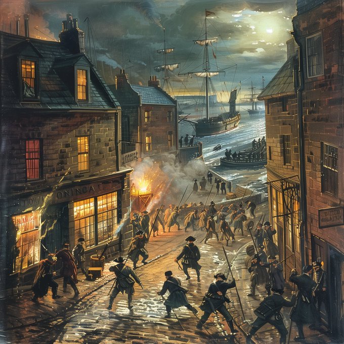
The press gang causing mayhem on the Fish Quay in 1805, dragging people from the Low Lights Tavern off to the ships.
14
24
240
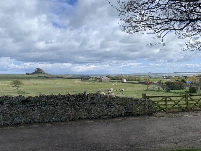
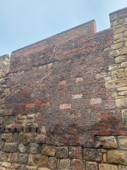
During the Middle Ages, Newcastle was said the have the best town walls in England, maybe even Europe... This is the history of them ⚔️
8
27
195
The High Level Bridge is the oldest iron bridge in the NE. It had to be made with iron as the river bed wouldn't support an entirely stone bridge of this magnitude. It shows there was no limit to Stephenson's genius, yet today we can't even build high speed rail in the UK...
11
31
192
Newcastle is unique in having so much common land in the form of the Town Moor. Every town had a common for pasture and roaming, but these were sold off as urban centres grew. Through its preservation, we get a direct link going back to medieval times in the middle of the city.
13
21
191
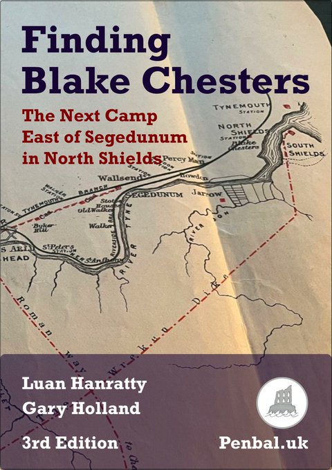
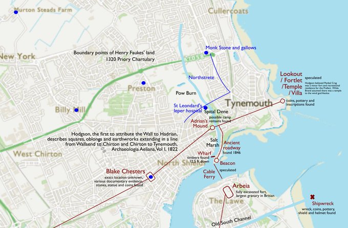
Hadrian's Wall ended at Wallsend, but the frontier carried on to the sea. We've identified the site of Blake Chesters, the lost & forgotten camp in North Shields.
The evidence includes a 1320 scroll written in Latin and the head of a statue of the god Pan
9
31
181
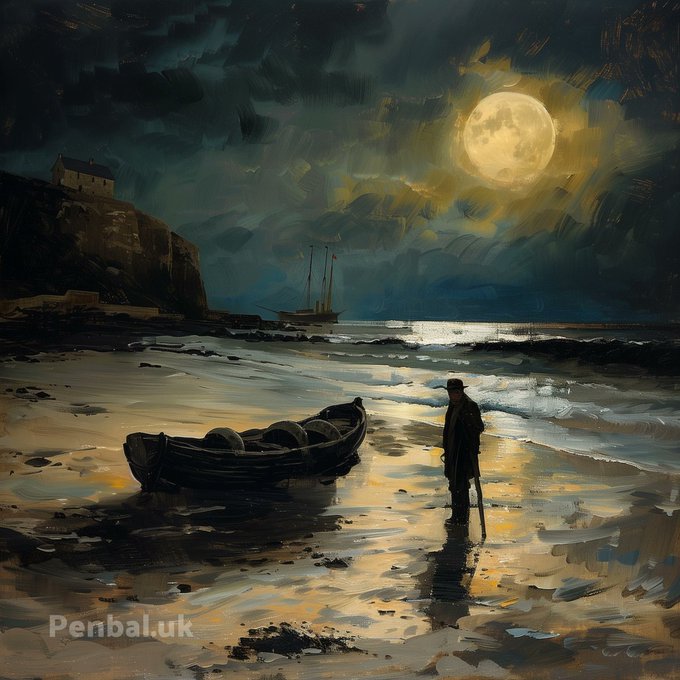
Smuggling was so important to Cullercoats in the 18th century, it likely involved the whole village.
Back then, Captain Thomas Armstrong was the Smuggler King and beneath his house he built secret cellars and a tunnel to hide the tea and brandy he had seized 🏴☠️⛵️
7
20
176
There was a time when Welsh was spoken all across England, and some of it remains in the very oldest features of the land. Take for example, Pen Bal Crag in Tynemouth
12
37
172
Richard Grainger transformed Newcastle into one of the finest towns in the country architecturally. This is the story of his rise & fall and the project he built.
6
28
174
The Lort Burn was an open sewer in medieval times (lort = 'crap' in Danish). It's thought the earliest commercial activity in Newcastle centred around this tributary to the Tyne and Low Bridge Street, where I'm standing, was where Hadrian's Wall crossed the burn.
17
22
168
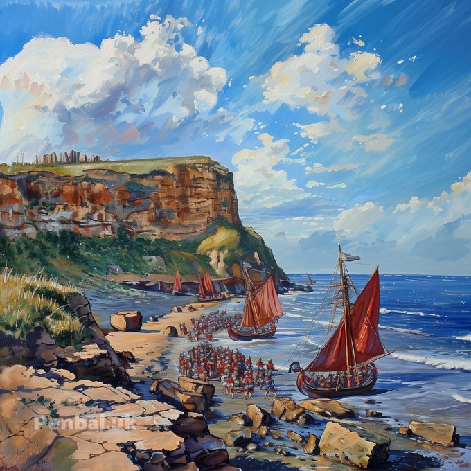
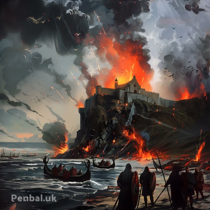
The Black Middens have always been a lethal magnet for ships, but few know about the Viking longboat that was wrecked there in 794 after attempting to plunder Tynemouth and Jarrow.
As the Viking savages were escaping the Tyne after being routed at Jarrow, they hit the rocks,
16
26
150
The real Jingling Geordie was Captain Thomas Armstrong, ‘the Smuggler King’. Beneath his house on Cullercoats Bay he built secret cellars and a tunnel to hide the tea and brandy he had seized. In this picture his sloop Mermaid lies off the bay. To learn more about him watch this
3
23
149
Mosley Street was originally the main the east-west thoroughfare in the Town, linking the Cloth Market and Pilgrim St. It was also the first street in the world to be lit by electricity, thanks to Joseph Swan's genius 💡 (Previously lamps required the use of whale oil...)
11
22
137
The story of Knotts Flats, Tynemouth, and why it wasn't bombed in the War... 🤔
13
16
133
Hadrian's Wall ran right across the Ouseburn, from Shields Rd to Stepney Bank. Recently Turret 3A was found, which is bigger than other Wall turrets. It also sits at a strategic point rather than a standard distance from Milecastle 3, which was under Byker Bridge.
7
17
128
Newcastle's Town Wall was only ever breached by the Scots during the siege of 1644. This happened at two points on 19th Oct: with artillery at Forth St 💥 and with explosives here on Orchard Street 💣
7
11
128
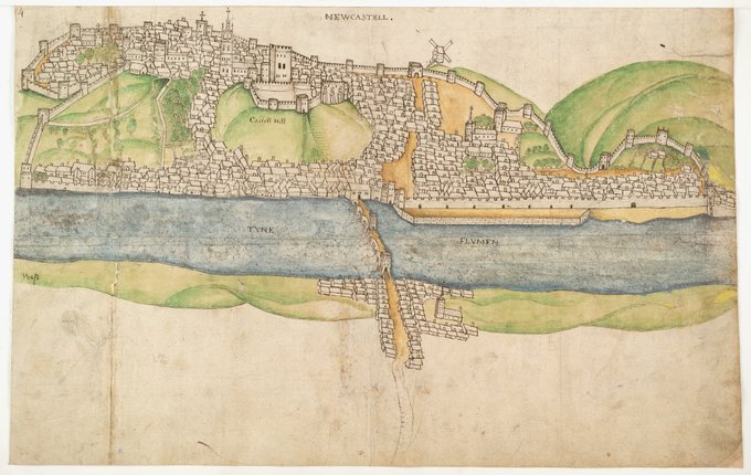
Newcastle in 1545 by Gian Tommaso Scala, who was employed by Henry VIII to fortify the Castle and headland at Tynemouth. Note that Pilgrim Street forms the main avenue through the town.
3
22
128
The Holy Jesus Hospital has a long history, as it sat on the ancient route north along Pilgrim Street. It's one of the only extant 17C buildings in town and would've been lost if it wasn't for the influence of T Dan Smith on the City Council when the Central Motorway was built.
8
13
125
Daniel Defoe led an amazing life and lived in Gateshead from 1706-1710 to avoid his creditors while working as a spy and propagandist for the government. It's said that he wrote Robinson Crusoe here and his accounts of the area are well worth a read 👀
5
17
123
The Civic Centre was commissioned by T Dan Smith, Newcastle's great visionary. It contrasts the sandstone and brick buildings of the Town and is designed in the style of post-War idealism, when architects had a lot of freedom and big budgets to play with.
23
19
124
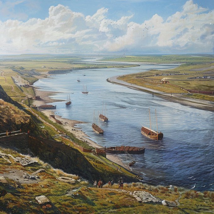
River Tyne from Arbeia in 80 AD, 40 years before the Wall. A portion of Agricola's fleet are being resupplied before his campaign in Caledonia. Watch this video to learn about the history of the fort at South Shields
3
15
122
The Swing Bridge is a symbol of Newcastle's role as the most technologically advanced city in the world. That's why we need it working again. It's also the site of the original Roman Bridge, which stood for over 1000 years.
9
16
118
St Mary's Well, Jesmond, is as old as Newcastle itself. It was famous as a healing well akin to Lourdes, after an apparition there, probably caused by clouds of vapour on cold days. The yew tree next to it symbolises it's pre-Christian origin, representing healing & protection 📿
8
7
114
Earl Grey is famous for his tea and for being Prime Minister, but he was lauded in his lifetime for his role in bringing democracy to the nation. At least, he began that long process. The public rewarded him with this monument, and you can't get more pride of place than that.
22
14
112
Howard Street is North Shields' great boulevard that provided the canvas for much of John Dobson's early work and was the home of Mary Ann Macham, who escaped slavery in Virginia and made her life in the town.
18
18
107
@iansumm03608301
Steel Rigg Car Park is a few hundred yards from the site along the Hadrian's Wall Path. Winds were around 40mph.
18
2
102
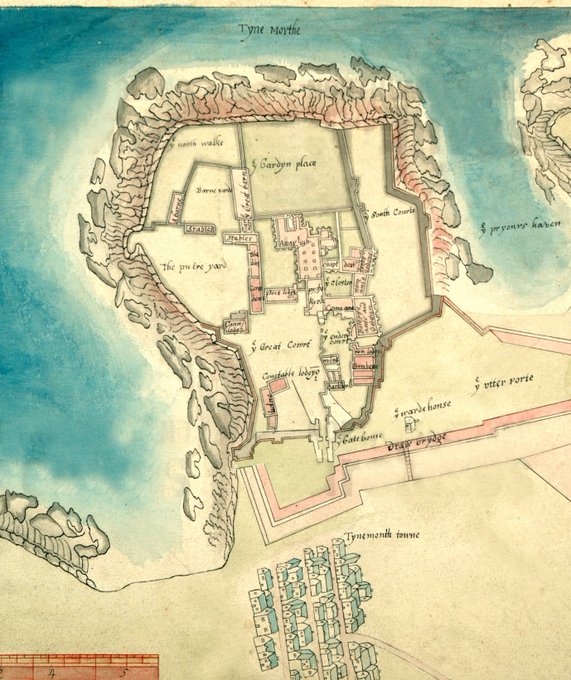
The Story of the Milestone and Adrian's Mound, Tynemouth
More hidden treasures of Northumberland Park
10
11
106
Table Rocks at Whitley Bay was a natural lido that became a popular attraction in the 1890s. It catered to the first craze in open sea swimming among tourists arriving at the coast on the railway 🏊♀️🏊♀️🏊♀️
11
12
102
Why I love Arbeia, South Shields. One of the best Roman forts in the country 🤩
12
15
99
𝗧𝗵𝗲 𝗣𝗶𝗲𝗿 𝗕𝗹𝗼𝗰𝗸 𝗬𝗮𝗿𝗱 - 𝗠𝗼𝗿𝗲 𝗛𝗶𝗱𝗱𝗲𝗻 𝗧𝗵𝗶𝗻𝗴𝘀 𝗶𝗻 𝗧𝘆𝗻𝗲𝗺𝗼𝘂𝘁𝗵 😮 Some interesting secrets in the shadow of Collingwood's Monument
5
15
99
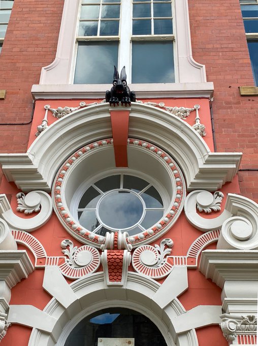
A demonic rabbit lurking, ready to pounce on graverobbers in St Nicholas Churchyard, Newcastle 🧛♂️🐰🩸
6
11
95
Before Cuthbert Collingwood fired the first broadside at the Battle of Trafalgar, he doubleshotted all of the 32-pound cannons on the 100-gun Royal Sovereign
13
20
96
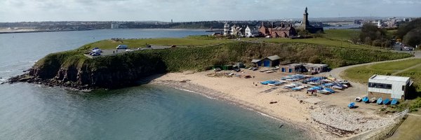
In a small forgotten park in North Shields town centre, I lay out 6 reasons why this was the site of a Roman camp called Blake Chesters.
It formed the mid-point in the defences between the eastern end of Hadrian's Wall and the sea.
10
13
93
Trinity House were formed as a seafarers' guild in Tudor times and have occupied the same piece of same land on the Quayside ever since. They have saved countless lives at sea and in their courtyard is an anchor from the Spanish Armada ⚓️
13
12
93
Marden Quarry lay in the middle of the old Whitley Waggonway, which ran from Hartley to the Lowlights Staiths in North Shields. Today it's one of the prettiest and quiestest parks you'll find 🦆🦢
7
9
95
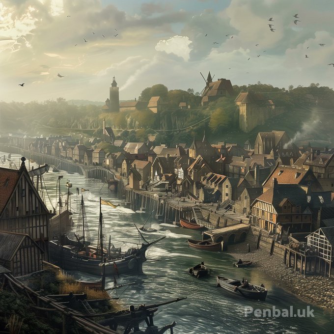
North Shields celebrates its 800th birthday next year. Here's the story of its early growth and how it was attacked and burned down by the merchants of Newcastle:
1
16
95
Richard Irvin was one of the fathers of modern North Shields, responsible for shaping the Fish Quay and the fishing industry as a whole. But beneath his building there was a great discovery made that gives us a glimpse of the founding of the town 798 years ago in 1225 🐟🐟🐟
4
16
93
Queen Victoria Park, in the middle of Tynemouth. This is where Garibaldi, the father of Italian nationhood, stayed. He spent time here gaining support from local industrialists and Chartists. Less well known is that Charles I is said to have hidden here in 1646 while a fugitive.
9
20
94
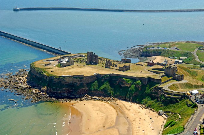
How King Edward I, aka Longshanks, was responsible for building Tynemouth Castle in stone, as we see it today, to protect the area from the Scots.
As well as a glimpse into Jingling Geordie’s Cave and the beautiful cove that surrounds it, aka the Short Sands 😍
10
20
94
St James's Park may be the only city centre stadium in the world. This is because it was part of the Town Moor, and is still leased to the Club.
But SJP is just one part of the sporting, cultural and historical legacy of the place.
5
16
93
I'm back in North Shields. This time on the bank top at Dockwray Square, now Laurel Court, where fashionable society lived in the 1700s, in the rarefied heights above the crowded dwellings on the Fish Quay 🚢👀
14
11
92
Cullercoats Harbour and the Navigational Landmarks of North Tyneside's Coast ⛵️
#GeordieRiviera
8
15
92
St Mary's Island - shipwrecks, sanctuary, smuggling and seals 🦭🦭🦭🌊🛟
5
17
88
Roman soldiers land on Tynemouth Haven in 79 AD. The local population have already fled inland.
These two posts look at what form the interactions between the Romans and the Iron Age Britons of Penbal Crag would have taken:
Where Were They? The Absence of Roman Settlement in
5
9
86
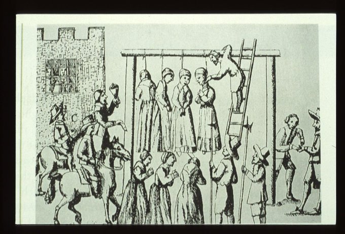
It's not always been fun and games on the Town Moor. In 1650 there were notorious witch trials that created a terror in the Town, as random women and girls were accused and tried. 14 women and one man ended up being hanged on the Moor on 21st August. In 2008, their bones were
10
15
84
From poverty, he became the most celebrated Victorian engineer and built a global business empire including about 30% of the rail network in this country. And it all started here, just off Forth Street, Newcastle.

@LuanHanratty
Poignant that today is the anniversary of Robert Stephenson's birth on 16th October 1803. Born at Willington Quay. Image courtesy of Wikipedia.
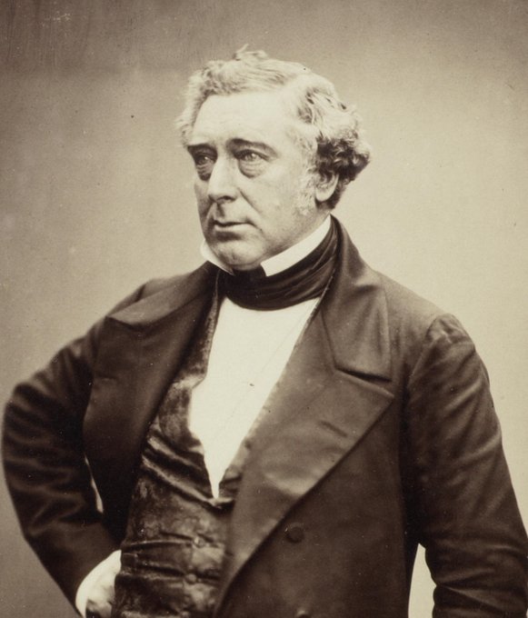
0
4
22
6
11
84
This is the remains of the Blyth & Tyne Railway between Tynemouth and Hartley. It was opened in 1860, but the passenger line was soon replaced by the more scenic route following the coast, which forms the Metro line today.
4
14
84
𝗝𝗮𝗸𝗲𝘆𝘀 𝗕𝗮𝘆 𝗮𝘁 𝗟𝗼𝘄 𝗧𝗶𝗱𝗲🐦 History, nature and what remains of the Marden Burn that once flowed between Cullercoats and Whitley.
5
14
83
All Saints is said to stand on the site of a Roman pantheon—a temple to all the gods (maybe that's where the name 'Pandon' comes from). The 18thC church is a homage to that idea, with the only circular nave in Britain, an unsupported roof, two pediments and a columned facade 🏛️
3
9
84
How Swan Hunter carried the torch in world shipbuilding during the golden age of ocean liners, by adopting Parson's cutting edge turbine technology 🚢
9
12
78
The Story of Lloyd's Jetty and the Pilots Who Walked Across the Tyne 🛟
6
11
81
There's a ton of history at St John the Baptist's Church ✠ on Grainger Street, including in a window from 1375, the first depiction of Newcastle's coat of arms of three silver castles on a red shield ♜♜♜
6
11
80
On this day in 685, King Ecgfrith of Northumbria founded the monastery at Jarrow, established by Benedict Biscop and home to Saint Bede as well as the greatest library in Britain, acquired through Biscop's travels to Rome.
The dedication stone reads:
"Dedication to the Basilica
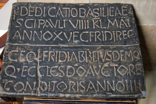
3
15
76
The Spanish City had the 2nd biggest dome in the country (behind St Paul's) when it was built in 1910.
But not everyone knows of the Whitley Pier that was planned for the sea front (pic in vid). It never got built, but that didn't stop Whitley becoming a mecca for tourists 😎🏖️
5
9
76
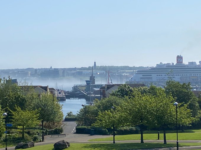
Sea Fret on the Tyne. Overlooking Northumbrian Quay from Redburn Dene, North Shields ☀️
Photo Credit: James Linkleter
20th May 2023
1
7
75
South Shields' 3 lost bays and the story of The Saint Cuthbert Code - the secret of where his body is supposedly hidden 🌊🌊🌊
6
10
74
Another depiction of the Tyne god, Cor, mentioned in the last video. This one is displayed in the Central Library and shows him carrying coal. This is his myth:
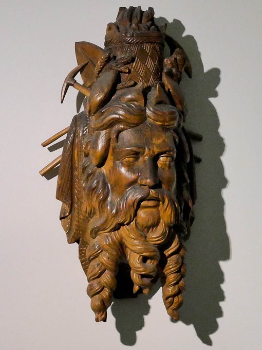
6
16
75
Did you know that Newcastle was the original 'Wallsend' and Segedunum was added after the Wall was built? Standing on this reconstucted section, above the original, I explain why I think it was called 'Segedunum'.
5
15
73
@MCaruso_Cabrera
Nothing really new here. The problem stems from trying to shoehorn ideology into reality.
3
4
74
The story of St Cuthbert's Miracle, told by Bede in 716, is the first appearance of Tynemouth in the pages of history. You can read about it and the origins of Tynemouth here:
0
9
72
𝗧𝘆𝗻𝗲𝗺𝗼𝘂𝘁𝗵 𝗣𝗶𝗲𝗿 - 𝗩𝗶𝗰𝘁𝗼𝗿𝗶𝗮𝗻 𝗖𝗼𝗻𝘀𝘁𝗿𝘂𝗰𝘁𝗶𝗼𝗻 𝗮𝘁 𝗶𝘁𝘀 𝗕𝗲𝘀𝘁 🌊 Some fascinating facts about the North Pier and the lighthouses of North Shields
5
10
71
Smith's Dock was for decades the busiest shipyard in the world ⚓️ Today it remains derelict wasteland where nothing grows
13
9
69
Women often get forgotten about in history, but the new 'Herring Girl' sculpture destined for North Shields Fish Quay is a tribute their role in the fishing trade of the town.
2
15
69
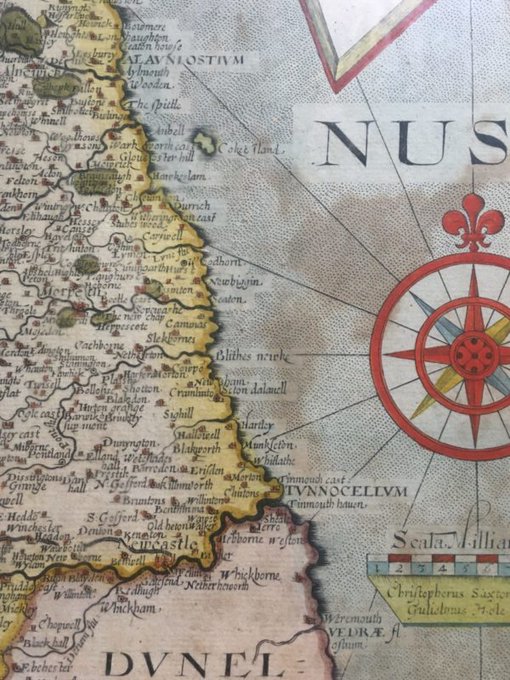
𝗔 𝗥𝗼𝗺𝗮𝗻 𝗙𝗼𝗿𝘁 𝗮𝘁 𝗧𝘆𝗻𝗲𝗺𝗼𝘂𝘁𝗵? 𝗦𝗮𝘅𝘁𝗼𝗻’𝘀 𝗠𝗮𝗽 𝗼𝗳 𝟭𝟲𝟯𝟳 A guest post examining a 400-year-old map with some place names that are easily recognisable to us today: Munkseton, Blakworth, Whitlathe, Chirtons, Jerro and Sheales.
11
11
66
The story of King John's Palace. No one really knows why it's got the name, but it was the seat of Adam of Jesmond, a widely loathed Sheriff of Newcastle. When he failed to return from the Ninth Crusade, his house fell into disrepair, and today it stands as a ruin in Heaton Park.
6
13
66
Jesmond comes from 'Ouse mound' and earlier, 'Ouse mouth'. But the oldest trees in Jesmond Dene are yew trees. A venerable clump of them sit here alongside the river. 'Ouse' may come from the root for water (see Gaelic: uis), but could it not mean 'yews burn' (Gaelic: iúr)? 🏞️
5
7
65
St Mary's Chapel, Jesmond, first mentioned in 1272, received pilgrims to the nearby shrine from all over the country. That made Pilgrim Street in Town a bustling hive of inns and alehouses catering to the rich & poor, able & infirm alike. Probably with quite a party feel to it.
3
18
65
In 794, one year after the first Viking raids in England on the island of Lindisfarne, Tynemouth was attacked by marauding norsemen. This 2-part story, exclusive to Penbal, by the novelist Robert Westall (1929-1993) describes the raids and how the local population fought back!
1
8
63
Lord Armstrong stood more to gain than anyone from the Tyne Improvement Commission, which dredged 800 acres of sandbanks and built the Piers. That's why he designed this accumulator tower to operate the lock at Albert Edward Dock, as well as the Swing Bridge in Newcastle.
3
11
62
“Ryoutous and Rowtous” Armed Mobs at Tynemouth Castle and the Longsands in 1593⚔️
A new blog post about a fascinating trial involving Henry Percy and the brothers of Peter Delaval.
2
10
57
Ballast Hills or 'Plaguey Fields' was the resting place of thousands of people until 1853 when it had to be closed following cholera outbreaks that caused a public health crisis in the city. There's no church associated with it as it was reserved for religious dissenters.
12
8
54
Romans soldiers overlooking the Tyne Valley in 150 AD. Hadrian's Wall is generally understood to be a multi-purpose construction. All great infrastructure really is. These functions were:
💥 To defend the Empire from barbarian tribes
💥 To provide a tangible limit to the Empire
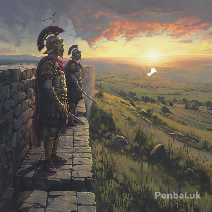
6
16
58
The wreck of the Gothenburg City in Smugglers' Creek and the most vivid tale of what they found when they boarded her 😱🤢
6
7
55
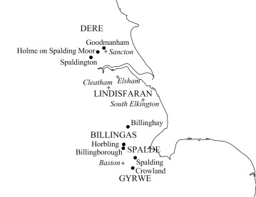
Notice the 5th Century name for the eastern part of Lincolnshire, LINDISFARAN (Land of the Lindissi People). But also notice the name GYRWE in Cambridgeshire, which is also the ancient name for Jarrow. Did they migrate to Northumbria in the 6th Century as a royal dynasty?
9
7
56
100% of people in Newcastle want this saved. A crowdfunding effort would be overwhelming.
3
2
56
St Hilda's, South Shields, built by Robert Trollope in 1675, is probably the site of a church since 647, in the time of Aidan and Oswin. Back then, standing below the Deiran royal seat at Caer Urfa, you would've been able to see Bede's monastery on the other side of Jarrow Slake.
4
6
56
Exploring the Wreck of the SS Zephyros on Browns Bay, Cullercoats 🛟 below Marconi Point, home to one of the earliest radio stations, which transmitted and intercepted Morse Code between Britain and the Continent 📻 -.-. --- --- .-..
4
8
55
A 250 Year Old Plan of Land Ownership in North Shields This plan is dated five years prior to the Enclosures Act of 1773, thus it captures the last vestiges of agriculture involving people tending to scattered sections of land in open fields, before
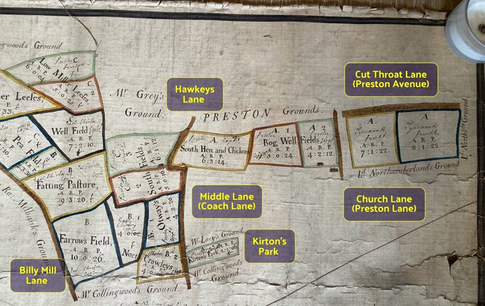
4
11
53
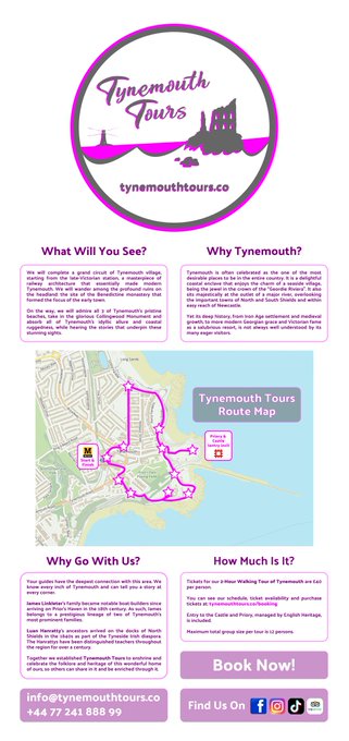
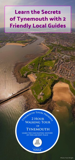
If you want to learn about the deep and fascinating history of Tynemouth, book a ticket on this amazing new guided tour 🌅⛴️🌊📜🏴☠️📍
6
20
52
𝗧𝗵𝗲 𝗺𝗲𝗱𝗶𝗲𝘃𝗮𝗹 𝗹𝗲𝗽𝗲𝗿 𝗵𝗼𝘀𝗽𝗶𝘁𝗮𝗹 𝗶𝗻 𝗡𝗼𝗿𝘁𝗵𝘂𝗺𝗯𝗲𝗿𝗹𝗮𝗻𝗱 𝗣𝗮𝗿𝗸, 𝗧𝘆𝗻𝗲𝗺𝗼𝘂𝘁𝗵 This may have been founded around the same time as North Shields, under direction of Prior Germanus, and was probably ran by the Benedictine nuns of St Bartholomew
2
12
54
As it's Black History Month, I'm in Summerhill talking about Frederick Douglass, the great anti-slavery campaigner who stayed here in 1846 with the Richardsons, who were famous Quakers and civil rights activists at the time.
6
12
51
Segedunum! The fort at the end of the Wall. Its branch wall led into the Tyne and had a statue of Hadrian on the end, possibly in the guise of Neptune.
I also describe a typical fort, the spiritual centre of which, in some ways is the origin of churches 🏦
4
10
50
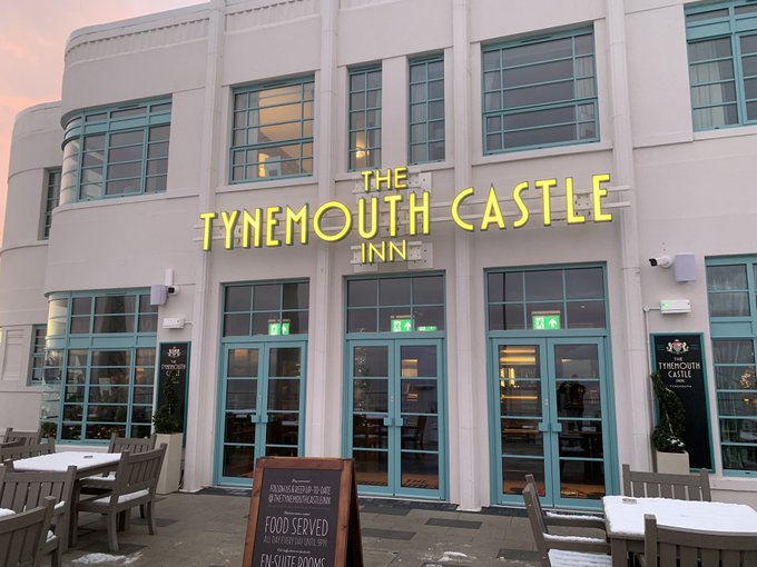
NEW POST: The Best Outcome for Tynemouth Outdoor Pool "More than anything, this kind of flagship development would fund the running of the pool, while creating a hotspot on the seafront that provides an ideal counterpoint to the Tynemouth Castle Inn, half

4
7
45
The Secret Story Behind Clifford's Fort and the Seed of What Grew into North Shields
4
15
50
North Shields has a gun battery and two guiding lights covering this most treacherous stretch of water. But directly opposite on the Lawe roundabout, which was once a Roman parade ground, there was also an array of cannons and two historically vital navigation beacons 🌟🌟⛴️⚓️
4
8
49
Arbeia, South Shields, could be in the Med! Named 'Place of the Arabs', as it was home to a unit of Tigris bargemen. The Romans built a massive fort here and were determinded to conquer all of Britain because of the kudos gained from civilising the wild natives beyond the sea.
1
11
45
@debs151969
@MayorJD
It's a well known area and there's nothing unsafe about it and it's next to the Military Way road. There was also a storm last night, so no one around. Easy enough for the perp to get in, fell it and get away without being seen.
7
1
45
These seem like very weak reasons given here by the Council officers. The Council really need to show some vision for the seafront and the region
@NorthTyneCA
@Norma4Mayor

14
4
46
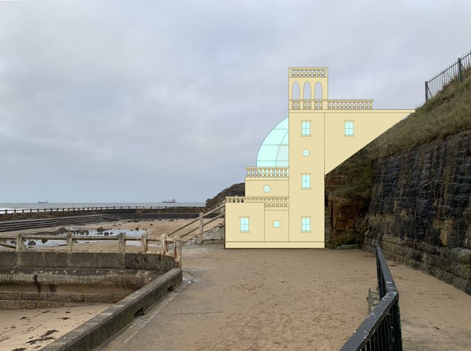
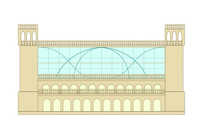
If Tynemouth Outdoor Pool gets renovated, why couldn't the structure on the bankside look like this? 🤔
G&1 Floors - Retail arcade
2rd Floor - Saunas & hotsprings
3rd Floor - Clubhouse bar
4th Floor - Rooftop dining terrace at street level
10
8
47
A Close Look at an Early Chart of the Tyne These detailed maps of the Tyne, Blyth and Wear were created by Captain Greenville Collins in 1676, working under Trinity House and Samuel Pepys, and were commissioned by Charles II.
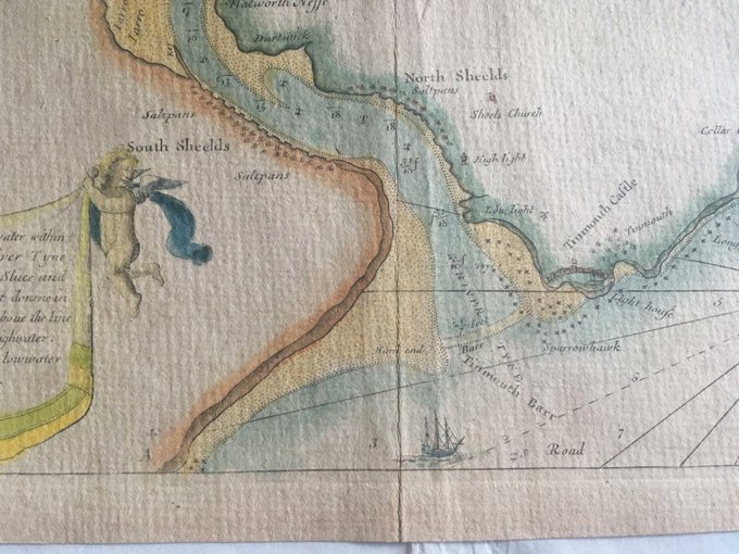
5
9
46
William Armstrong, and later the company Armstrong Whitworth, had deep business interests with Japan and most of Japan's battle fleet were built at Elswick in the late 19th & early 20th centuries. The former Ouseburn School built in 1892, is a homage to his ties with the country
9
7
42