
lisa hidalgo
@LisaDenver7
Followers
8K
Following
5K
Media
16K
Statuses
22K
7News Meteorologist Lisa Hidalgo - your source for the best Denver-metro forecast!
KMGH 7News
Joined January 2012
Flood Watch goes into effect at 1pm today! Pockets of heavy rain are possible along the Front Range. Get ready for some wet roads during tonight's commute! #cowx

2
3
7
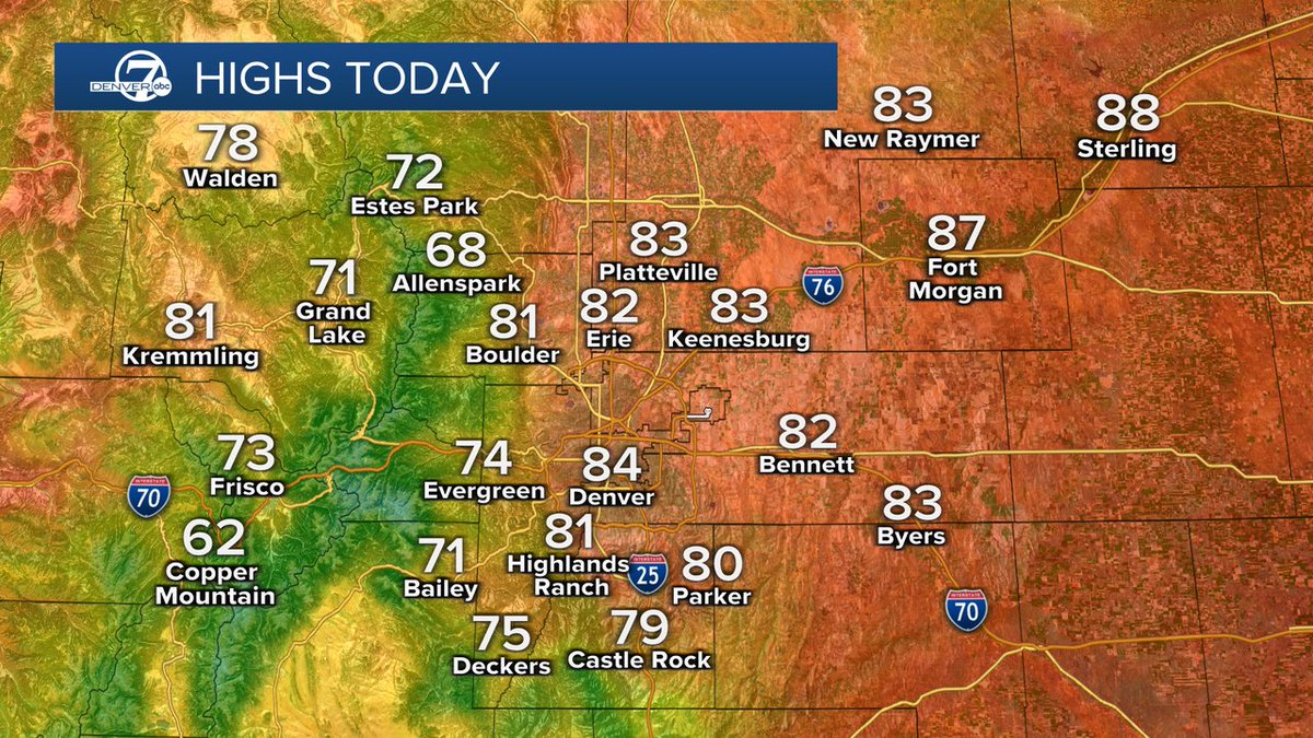
Sooooo much cooler for the next few days. After three days of 97-degree highs. we're talking low to mid-80s for the next four days! AND. some heavy rain. especially on Wednesday. #cowx
0
2
4
Toasty start to the week, with 90s today and tomorrow! We'll also see a chance of storms each afternoon but there's a low risk of severe weather! #cowx
0
1
0
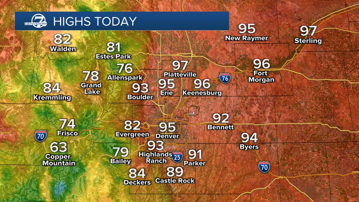
It's gonna get hot, hot, hot! Today could be Denver's first triple-digit day of the year, with highs near 100 across the metro area. #cowx

0
4
10
Some intense heat building across the region. Highs in the 90s today and then record-breaking heat on Friday and Saturday, with highs near 100 degrees! #cowx

0
1
0
Another round of storms heading toward a spot that was hit hard overnight. You'll see more rain and potentially even more hail near Milliken, Johnstown, Fort Collins and Wellington within the next hour. #cowx

0
1
2
Tornado Warning has been issued for a cell northwest of Colorado Springs near Woodland Park. This storm is capable of producing a tornado and is moving east at 15mph. #cowx

0
2
3
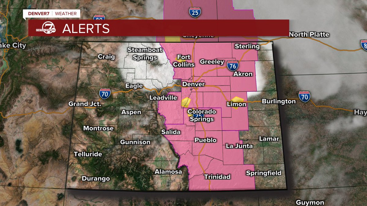
Severe thunderstorm watch covers the entire Front Range (counties in pink) and most of eastern Colorado. Storms developing along the Front Range right now will gradually move east over the next few hours. Large hail and pockets of heavy rain are possible. #cowx
0
4
3
Strong storms developing along the Front Range. One cell near the Cameron Peak burn scar is producing heavy rain and flash flooding is possible. #cowx

0
3
2
Strong cell developing near Agate. could produce nickel size hail, gusty winds and lightning. #cowx

0
2
2
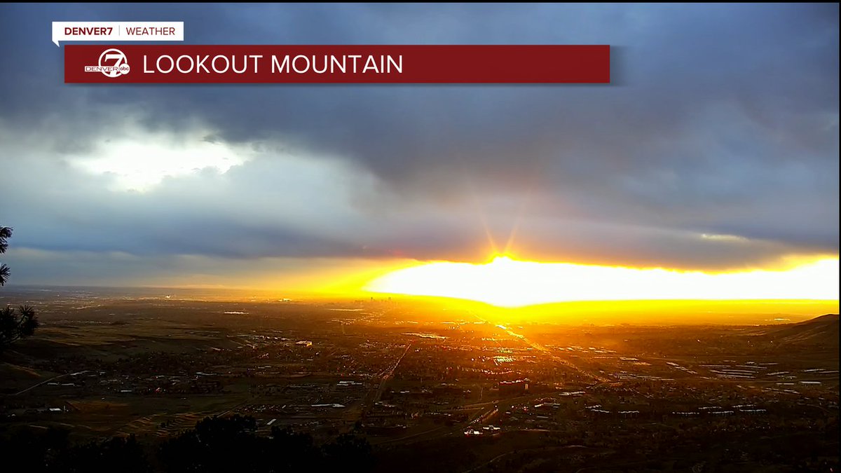
A strong and fast-moving storm is now pushing through the region. A gorgeous sunrise this morning, with some rain and snow developing across the metro area pretty soon. This afternoon?. drier but windy! #cowx
0
1
2
A strong and fast-moving storm will roll through Colorado on Friday. Gusty winds will be the biggest issue for the eastern plains. We'll also see a rain/snow mix early on. so be ready for a wet commute! #cowx

1
1
1
0
1
0
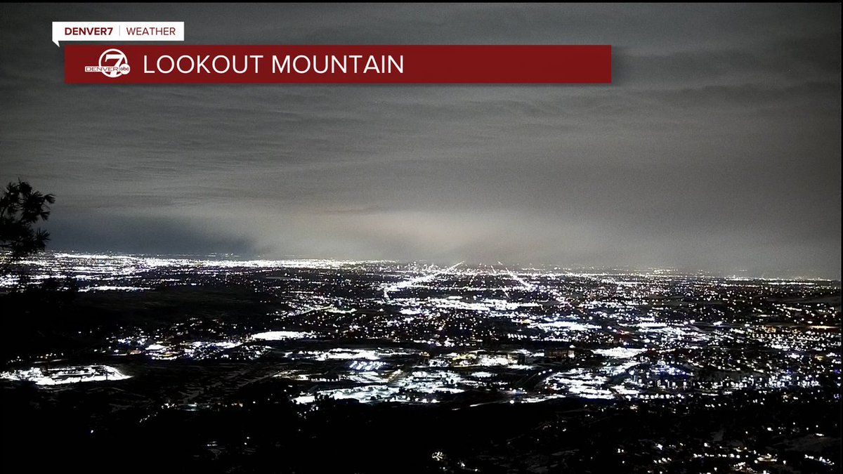
A cool shot of the snow that's falling across parts of the metro area this morning. It's bone dry on the west side of town and we aren't expecting much of anything there with this storm. #cowx
1
3
6
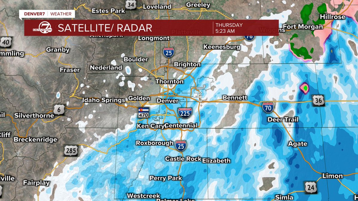
A wide range of conditions this morning across the Denver metro area. Heavier snow will fall south and east of Denver, with around 4" to 6" likely along the Palmer Divide. Skies will quickly clear out this afternoon, with highs in the 40s! #cowx
0
1
5
Mostly sunny and mild again today!! BUT. snow is on the way. Snowfall totals will be tricky because Denver is on the northwestern edge of the heavier snow. Any small change in movement with this storm will drastically change the snowfall totals!! #cowx

1
1
2
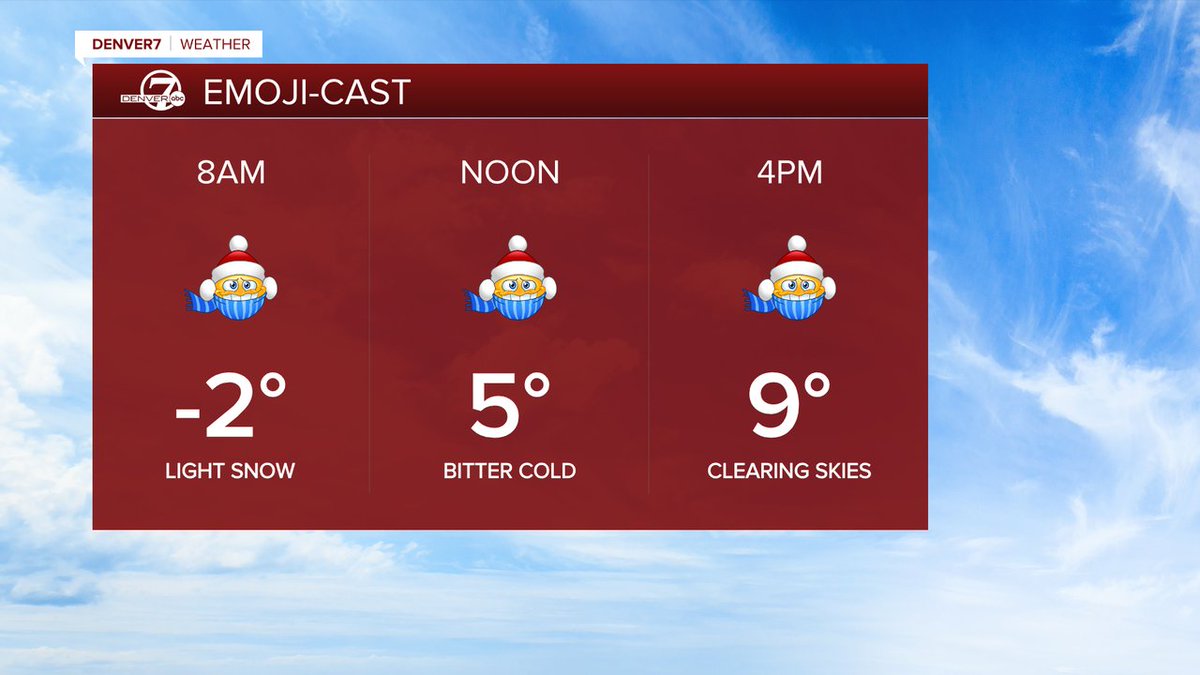
Brrrrr for sure! I mean. that's kind of an understatement. Temperatures have dipped below zero this morning and we're only going to see single-digit highs this afternoon. #cowx
0
1
3
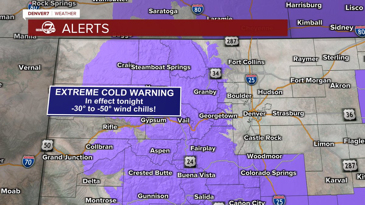
Cold weather advisory for the metro area and an Extreme Cold Warning tonight for the mountains. This will be the coldest 24 hours of the cold snap. between Monday morning and Tuesday morning. #cowx
2
2
6
Two rounds of snow expected this weekend! The first will be the heaviest and will hit the Denver metro area on Friday night. Looks like around 2" to 5" by Saturday, with another round of light snow on Sunday. #cowx

1
2
9
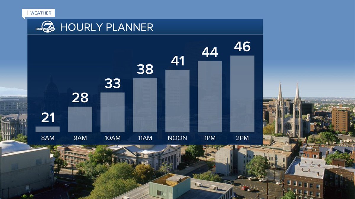
A high of 47 degrees is sounding pretty good considering what we're looking at this weekend. From 40s today. to 50s tomorrow. to single digit highs on Sunday! #cowx
2
2
3