
LOSC
@LaStateClimate
Followers
601
Following
963
Media
2K
Statuses
2K
The Louisiana Office of State Climatology strives to improve the public's understanding of climate through services, research, and education.
LSU
Joined April 2014
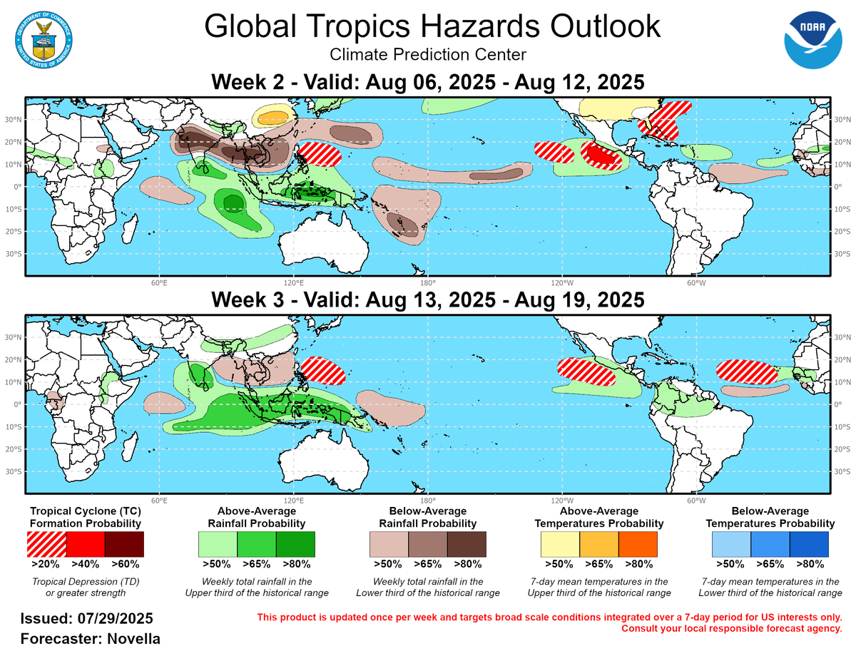
Typically the tropics will start to ramp up in August and that is reflected in the latest Global Tropics Hazard Outlook from the CPC. While odds are currently low, it highlights an area including the eastern Gulf in early August and an area off the African coast in mid-August.
0
0
0
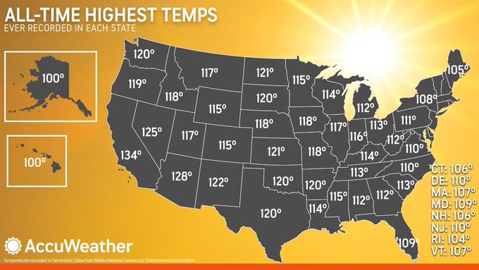
Every state in the U.S. has recorded a temperature at or above 100 degrees! The highest recorded temperature in Louisiana was 114 degrees at Plain Dealing 4 W, on 8/10/36. Even Alaska recorded a 100 degree temperature at Fort Yukon (northeast of Fairbanks) on 6/27/1915!
0
0
0
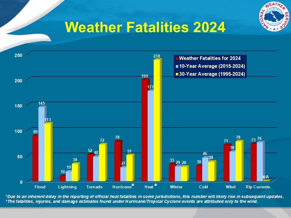
It is a sweltering day across Louisiana during the hottest time of year; take care of yourself and check in on others as necessary. In 2024, 199 deaths were attributed to heat, the most of any weather phenomenon. The 10-year and 30-year average deaths from heat are also the most.
0
1
1
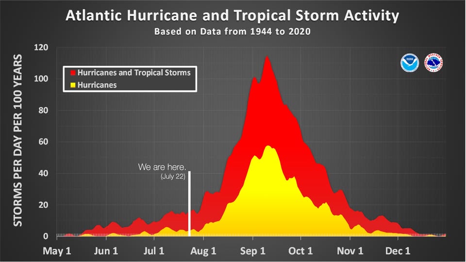
Don't be lulled to sleep by the currently quiet tropics. Things really don't start getting going until the middle of August. Now is the time to have your plans in place so if/when Louisiana is threatened, you'll be prepared.
0
0
1
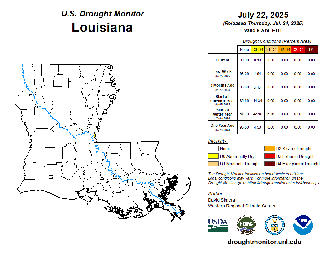
The new USDM map was released today. The low pressure system that passed through Louisiana last week dropped enough rain in Terrebonne parish to eliminate D0 "abnormally dry" conditions. New D0 was introduced in southwest Mississippi which just barely bled over into the state.
0
0
0
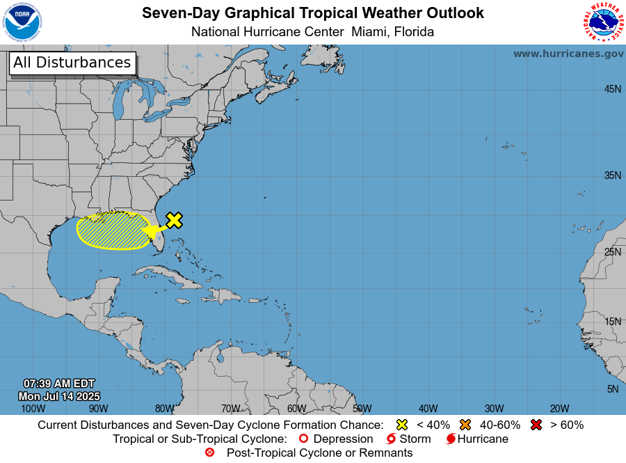
The NHC is watching the northern Gulf for possible tropical development as a low pressure is forecast to move along the northern Gulf coast. Right now, development chances are small and it appears that this low pressure will track further south than the low pressure last week.

0
0
1
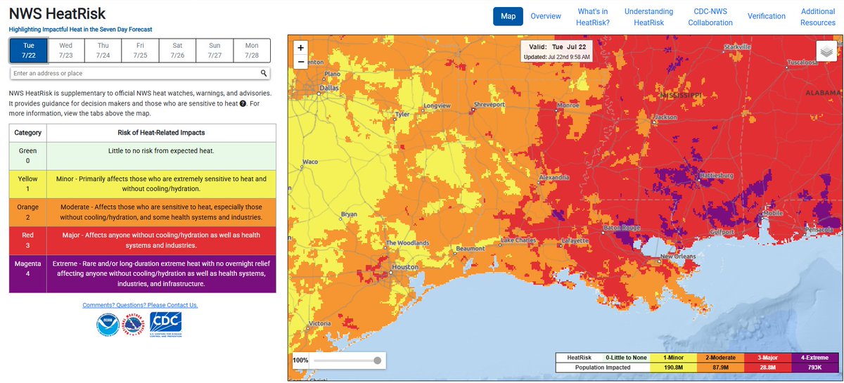
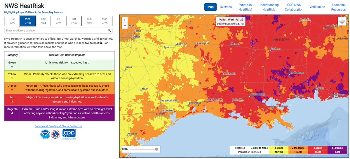
Until relief possibly arrives later in the week, heat/humidity will be the story. Much of Louisiana is expected to sustain major to extreme impacts from heat/humidity Tuesday-Wednesday per the NWS HeatRisk map. Heat advisories/watches/warnings are in effect for the entire state.
0
0
1
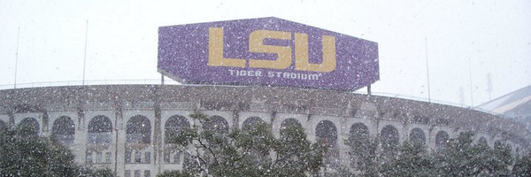
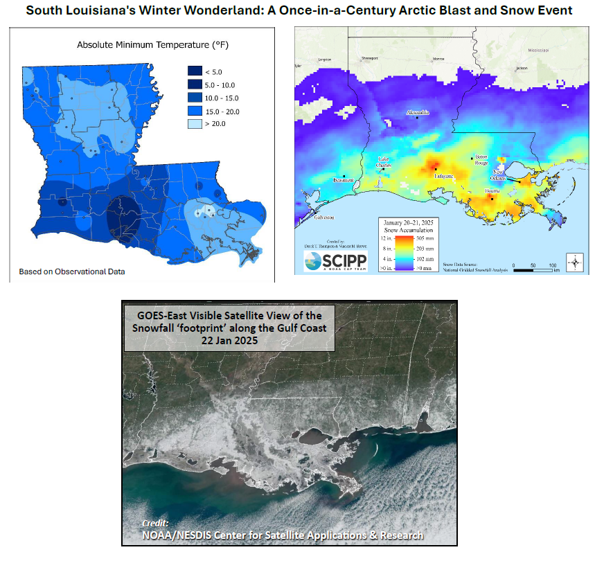
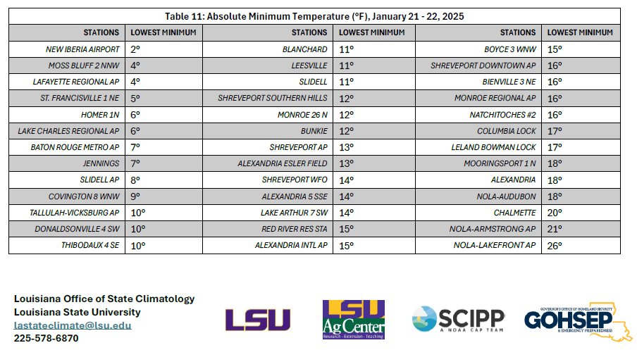
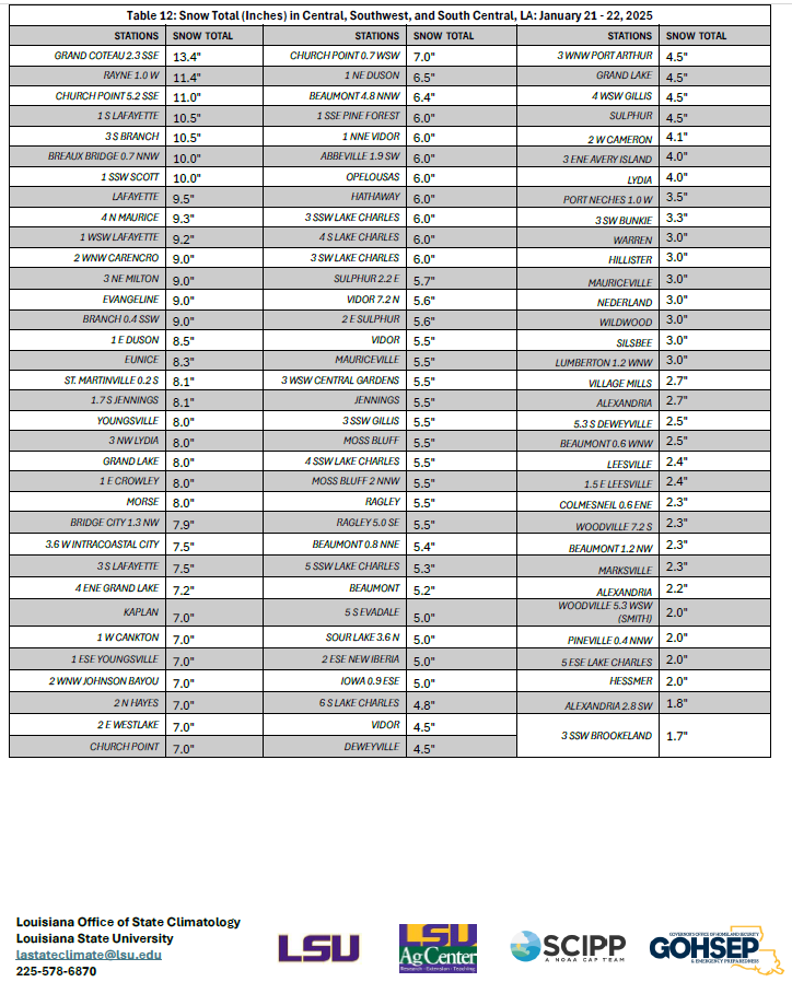
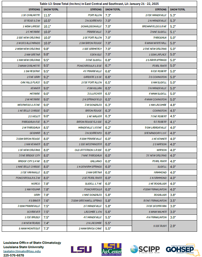
It's now been six months since the winter weather event of Jan. 20-22, 2025. Observed low temperatures as low as 2 deg F and measured snow totals as high as 13.4" made for what will go down as the greatest Louisiana winter weather event to this point.
0
1
2
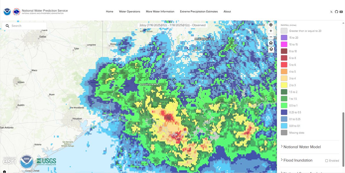
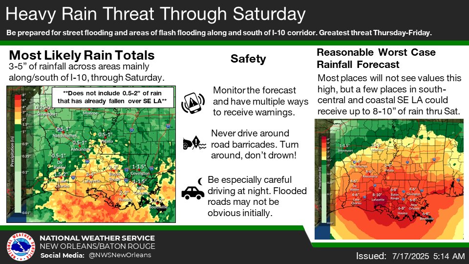
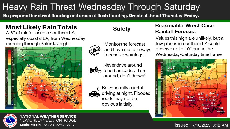
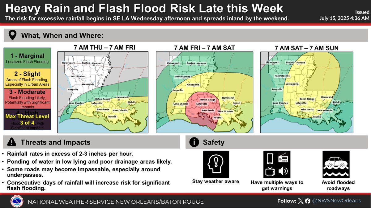
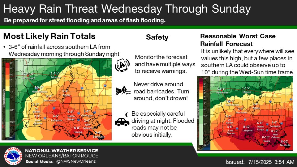
Rain continues to fall across Louisiana as the low pressure system moves through the state. The precipitation bullseye so far is southeast of Lafayette, where 10"+ has fallen. The bulk of the remaining precipitation is forecast to fall across southwestern Louisiana.
0
0
1
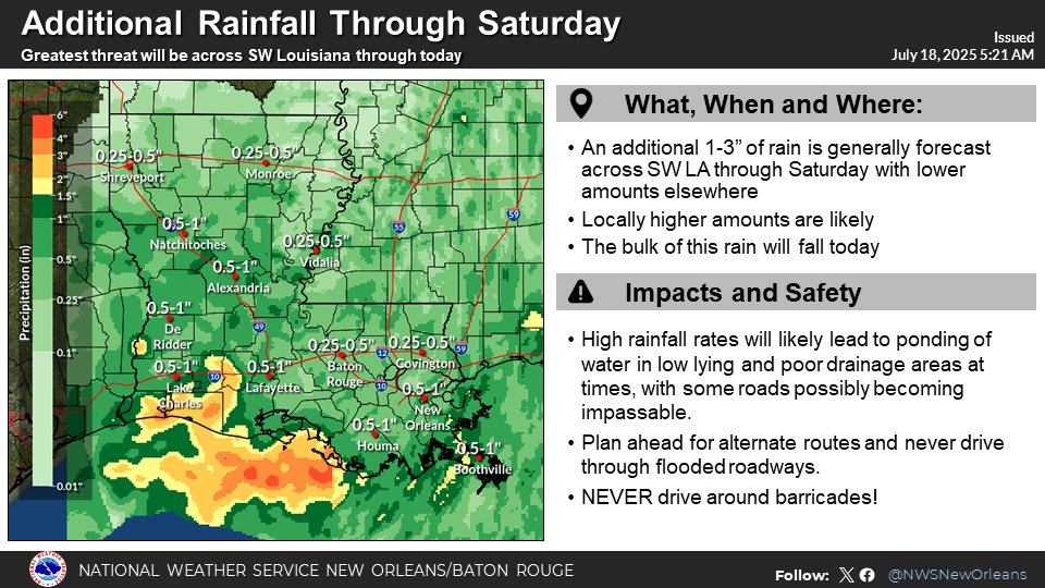
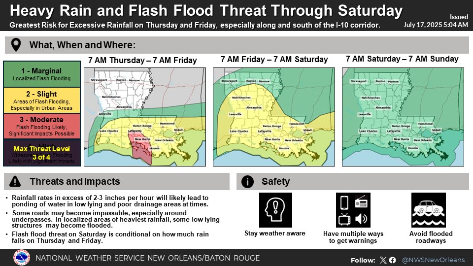
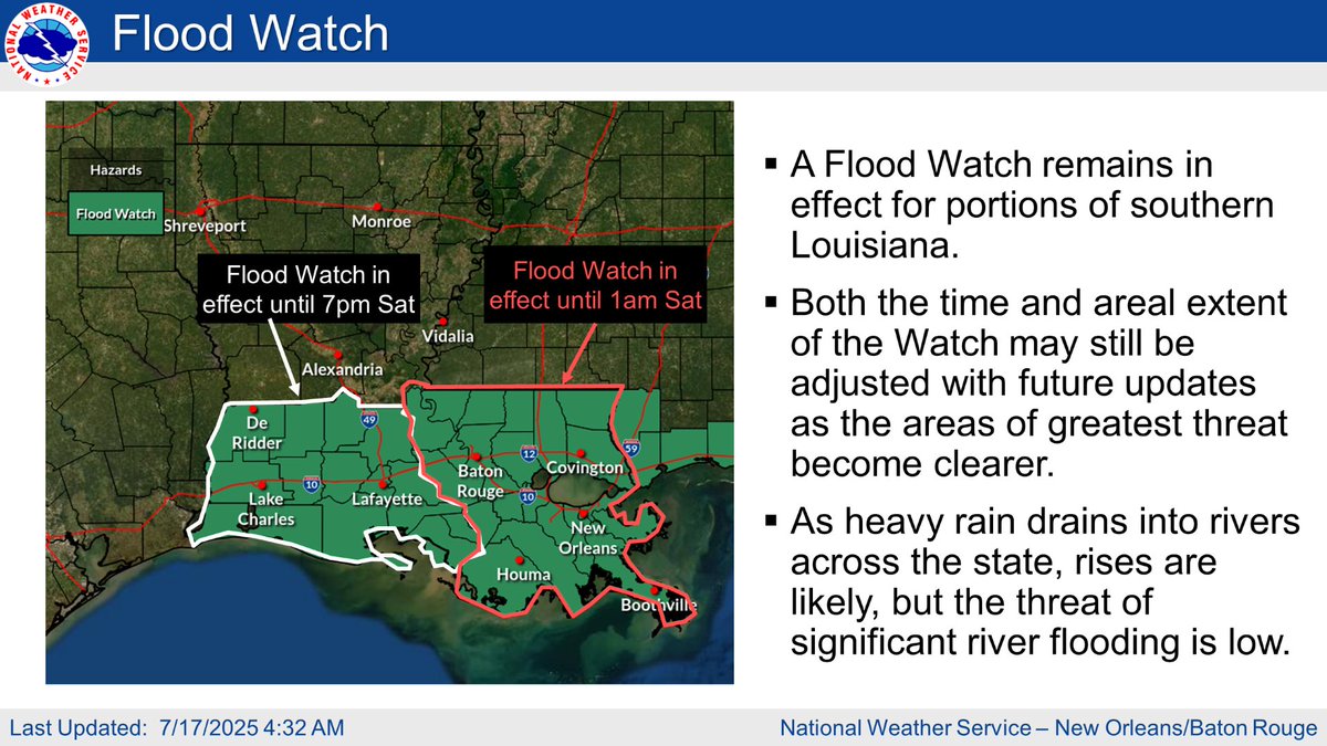
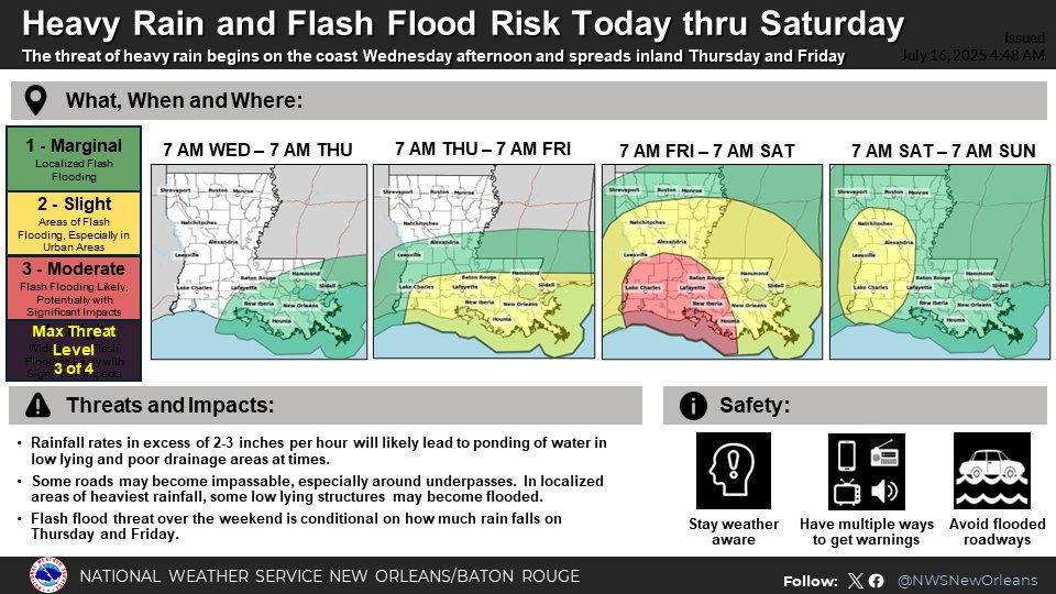
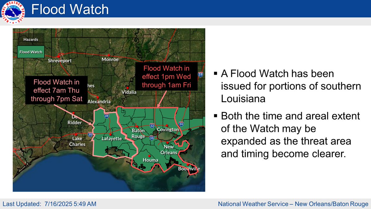
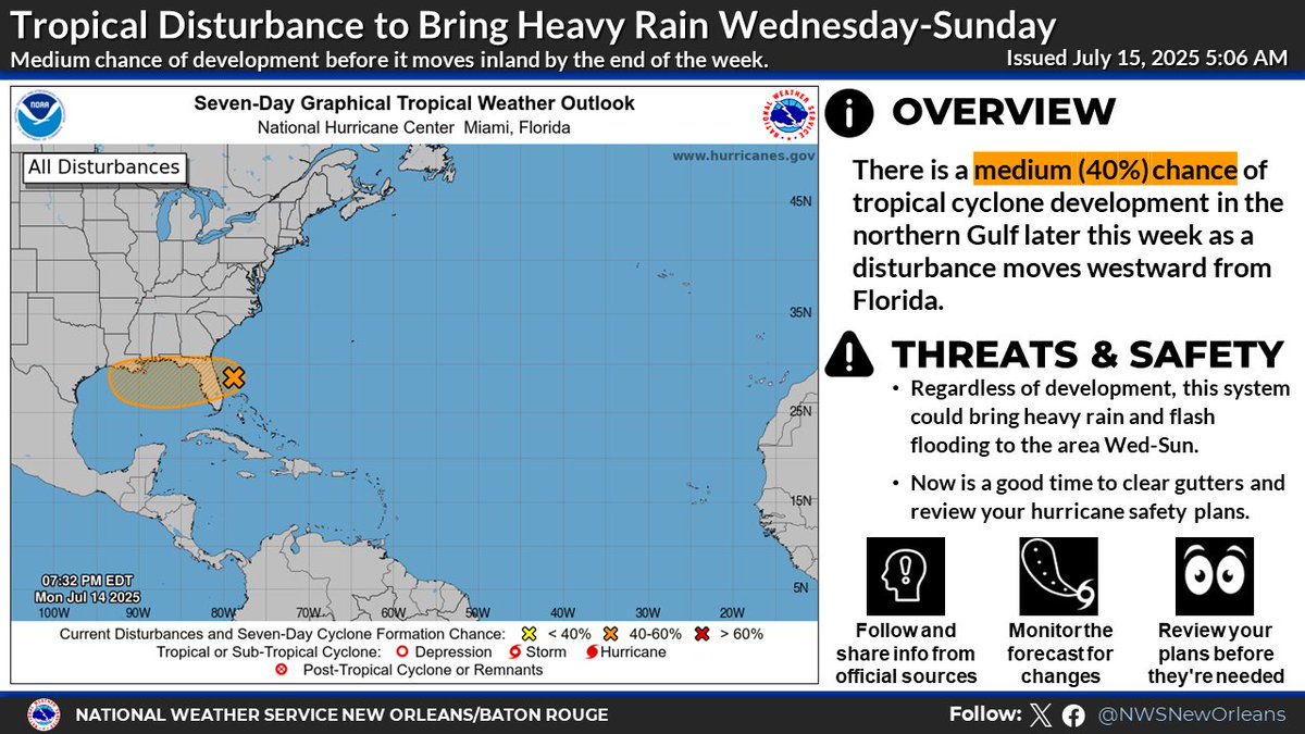
While the low pressure moving towards Louisiana isn't likely to acquire a name, it has and will continue to pose a flooding threat, particularly in the southern portion of the state. The greatest risk of excessive rainfall has shifted from Friday to today.
0
0
1
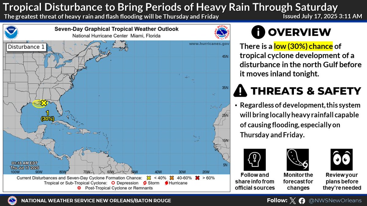
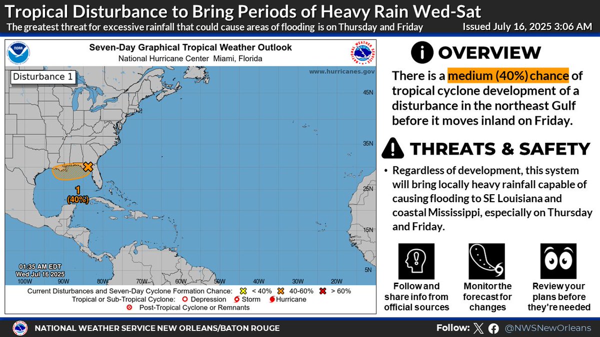
We are continuing to follow the disturbance now centered south of the FL panhandle. Regardless of whether or not it gets a name, heavy rain and flooding are expected, especially Thursday and Friday, with some areas possibly receiving a storm total of 10"+.
0
0
1
The NHC continues to watch an area of low pressure currently off the eastern coast of Florida for possible tropical development. Even if it does not become a named storm, there is a threat of flash flooding, particularly Friday into Saturday.
0
0
1
The National Hurricane Center is monitoring an area of disturbed weather that is expected to move into the northeastern Gulf later this week. Whether or not it officially develops into a storm, it could present flooding concerns should it move into Louisiana.
0
0
0
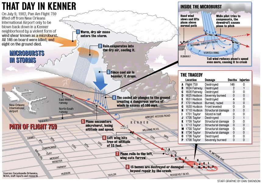
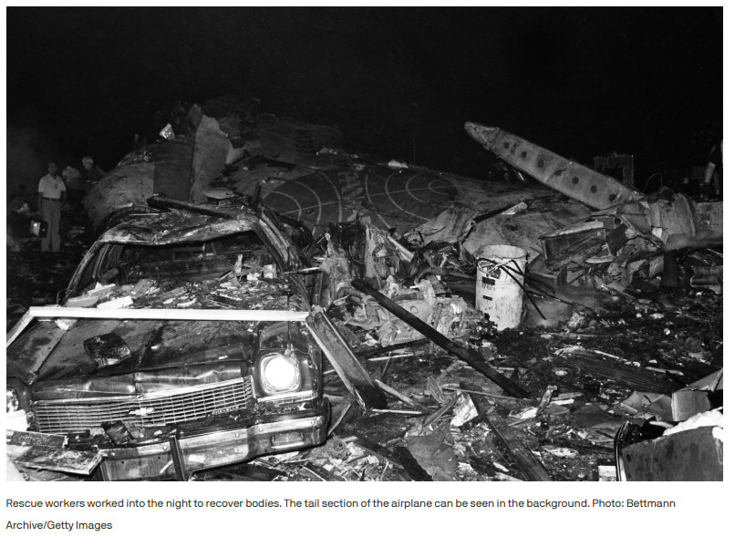
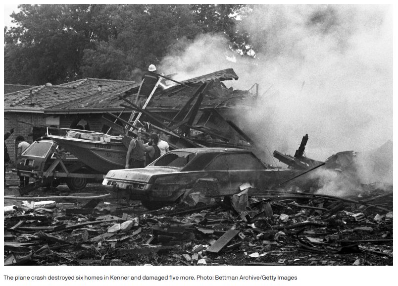
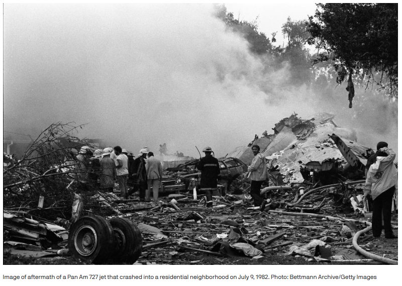
Earlier this week marked the 43rd anniversary of the crash of Pan Am Flight 759 in Kenner. On July 9, 1982, the flight took off from New Orleans, only to encounter a microburst which brought the plane down. All 146 people on board were killed and eight on the ground also died.
0
0
2
For more information concerning CSU's Atlantic hurricane season forecasting, visit:
0
0
0
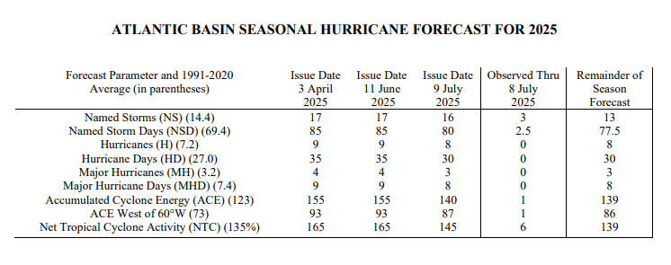
CSU's updated Atl. hurricane season forecast slightly lowered the anticipated number of storms; however, it still calls for activity above the '91-'20 average. Forecast shear over the Carribean is the main factor, which can inhibit storm formation and strengthening.
1
0
0
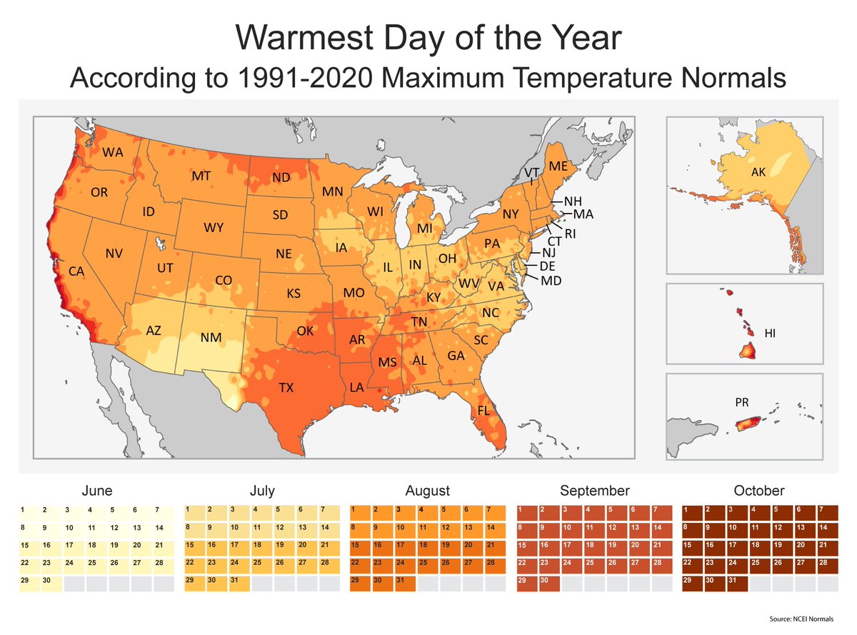
The length of daylight is getting shorter, but we are just entering the warmest time of the year. According to the NCEI, Louisiana should expect the warmest day of the year to occur in mid to late-August. Don't forget about the humidity, which tends to peak in July and August.
0
0
2
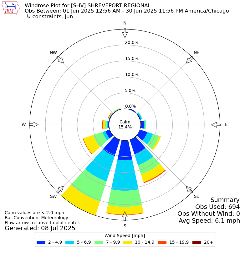
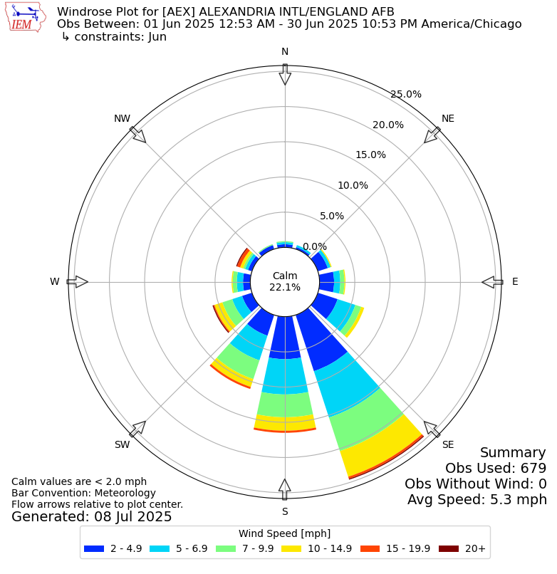
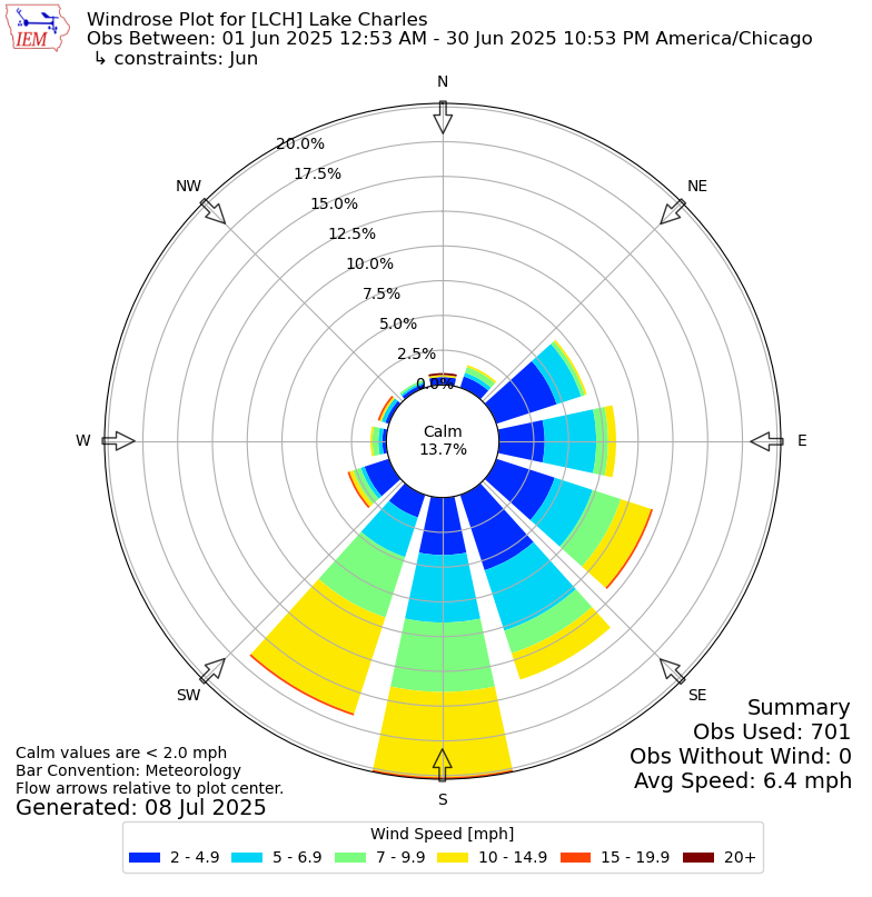
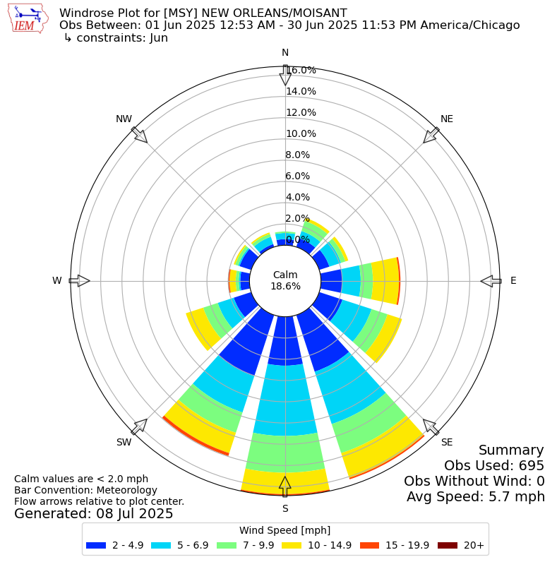
The June wind rose plots for Shreveport, Alexandria, Lake Charles, and New Orleans show the primary wind direction being from the south-southwest in SHV, the south-southeast in AEX, and the south in LCH and NOLA. The steady flow from the Gulf kept Louisiana nice and humid!
0
0
0
Although not surprising since we are far from the peak of the Atlantic hurricane season, it's good to report that the Climate Prediction Center is not expecting any tropical development in the Gulf or western Atlantic through at least 7/22.

0
0
0
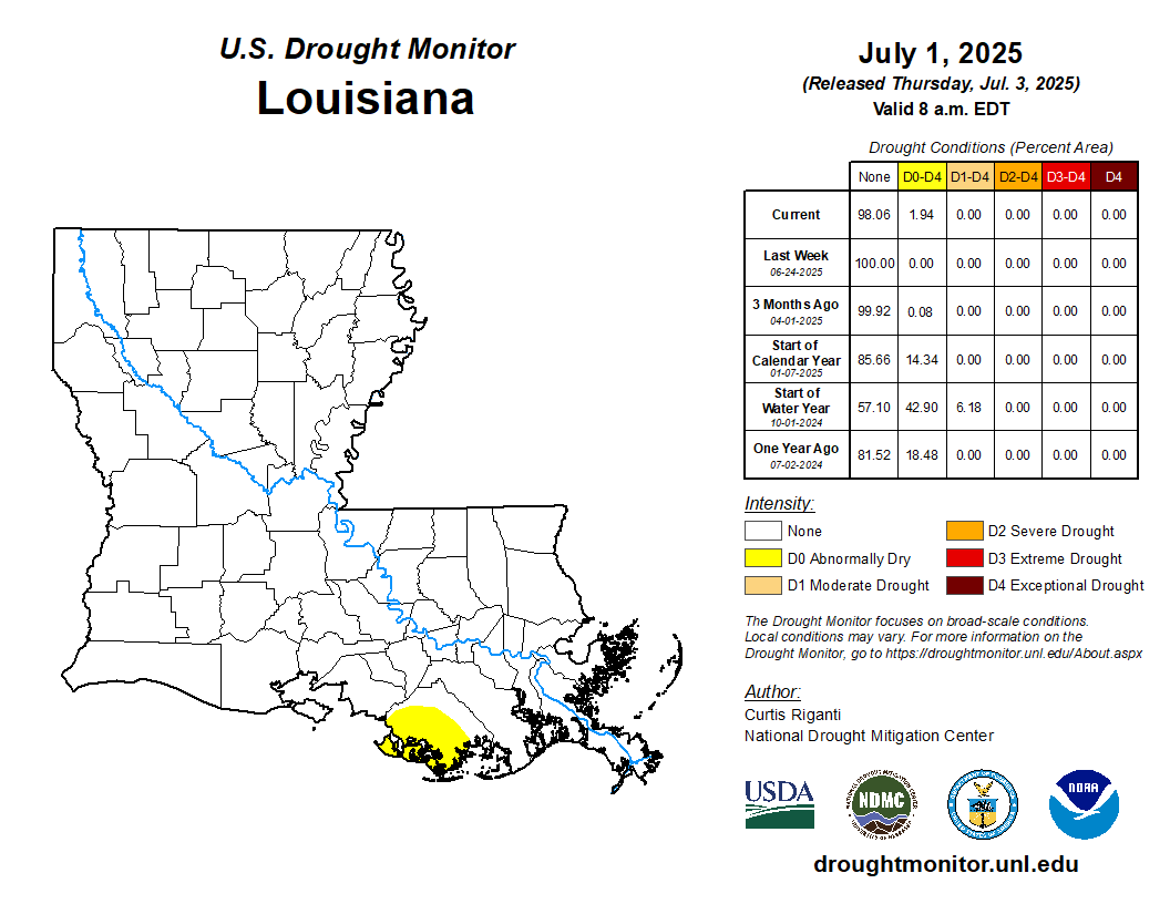
The new U.S. Drought Monitor depiction was released today and for the first time since May 6th, there is an area of D0 (abnormally dry) conditions in Louisiana to the south and west of Houma. D0 is not yet drought but could become drought should dry conditions continue.
0
1
1