
LOCMaps
@LOCMaps
Followers
34K
Following
1K
Media
4K
Statuses
6K
Official account of the @LibraryCongress Geography & Map Division, the largest map library in the world. All Library accounts: https://t.co/T907knoXYf
Washington, DC
Joined June 2011
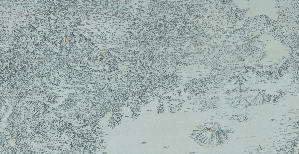
A very happy birthday to Marie Tharp, a pioneering cartographer who first mapped the ocean floor! Read more about her and her work in our newly published blog post about her physiographic ocean maps. Read post here:
0
2
4
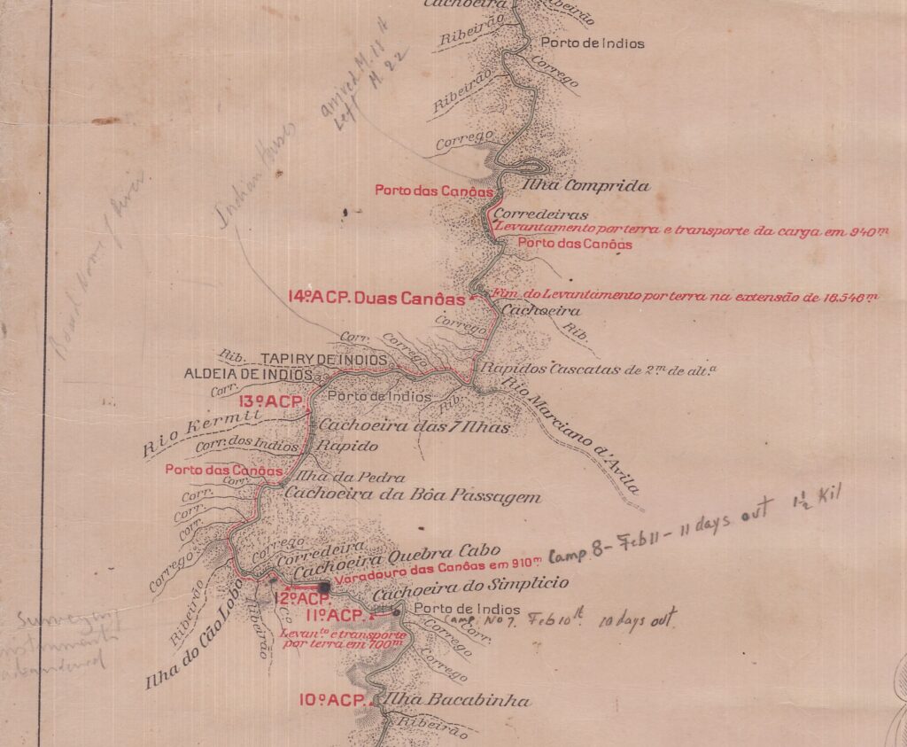
Don't miss our recent blog post "Mapping the Brazilian Amazon – The Roosevelt-Rondon Expedition of 1913-14," which explores Roosevelt River, a 470-mile tributary of the Madeira River located deep in the Brazilian Amazon. The post is available online here:
0
2
4
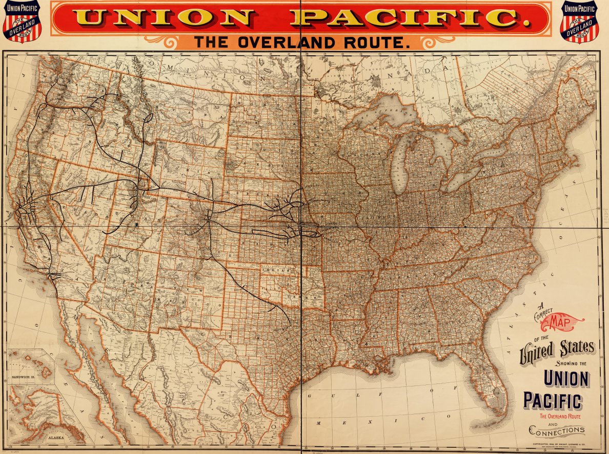
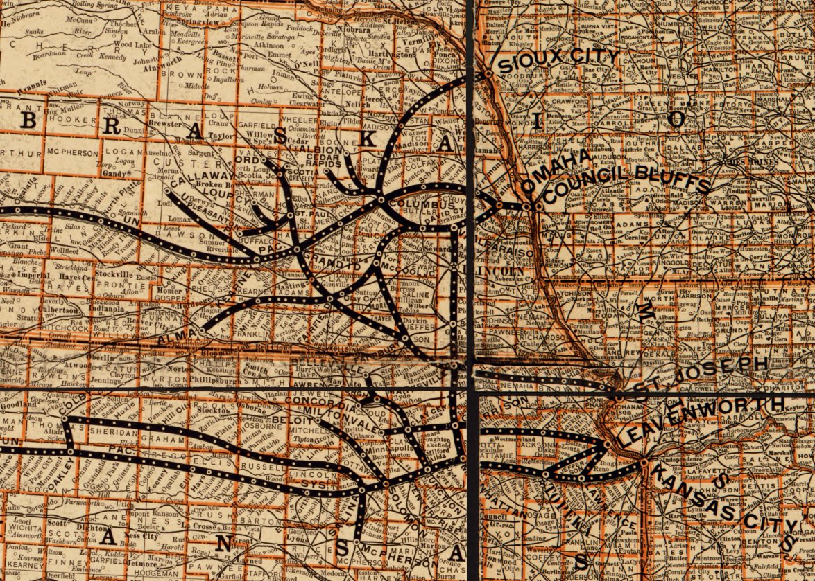
This incredibly detailed 1892 railroad map focuses on the Overland Route of the Union Pacific Railroad, stretching from Iowa and Missouri to the West Coast!. Take a closer look here:
0
3
17
Read all about Teddy Roosevelt and Cândido Rondon's expedition down the "River of Doubt" in the Brazilian Amazon in 1913-14 in our latest blog post!. Read the post here:

0
1
10
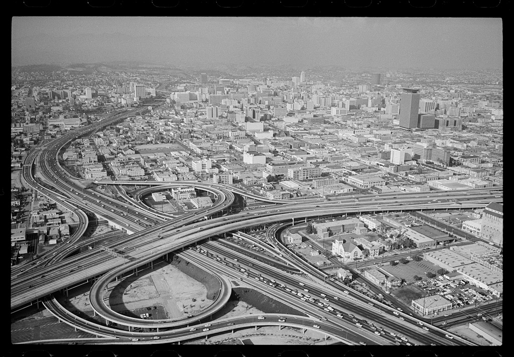
Attention cinephiles! Read all about the Geography & Map Division's recent acquisition of 1980s film set maps in our recent blog post "Exporting the American Aesthetic: filming location maps of Los Angeles.". The full post is available online here:
1
5
6
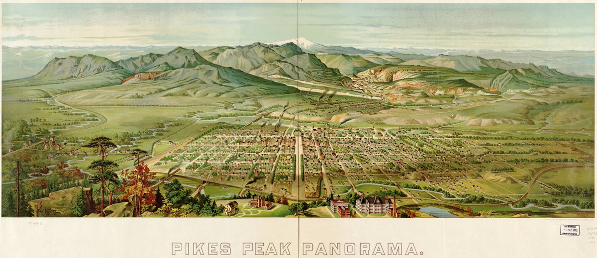
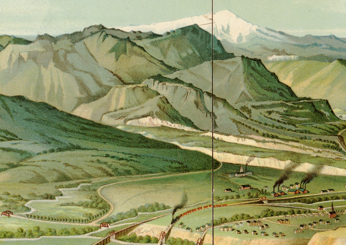
This incredible 1890 panoramic map is a true work of art, with majestic Pikes Peak towering over the bustling city of Colorado Springs, Colorado. Take a closer look here:
0
3
19
Conducting research in the History of Cartography or GIS?. The 2026 Philip Lee Phillips Society Fellowship is now accepting applications through September 15, 2025. The fellowship offers an $11,500 stipend for 8 research weeks!. See all the details here:

1
1
4
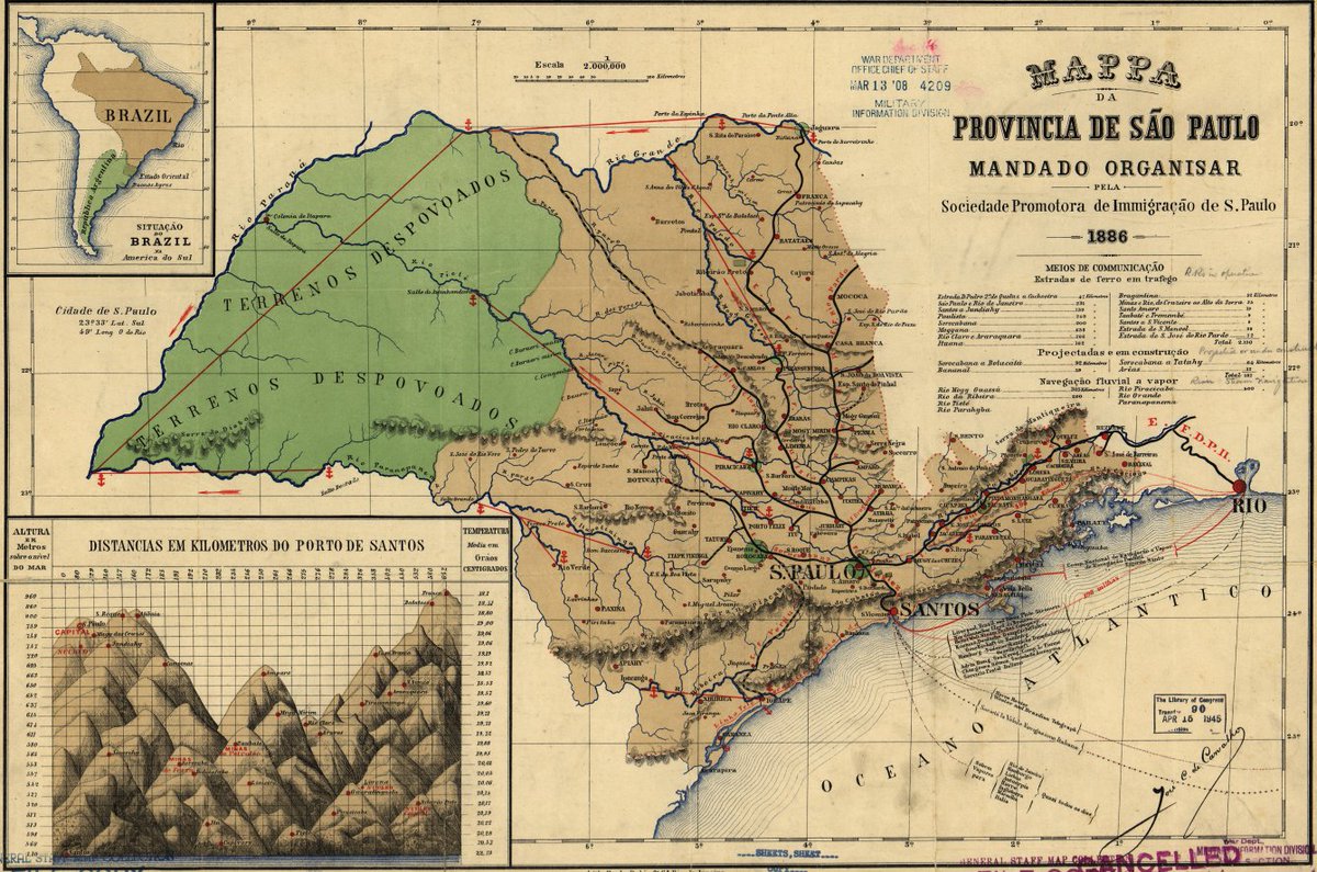
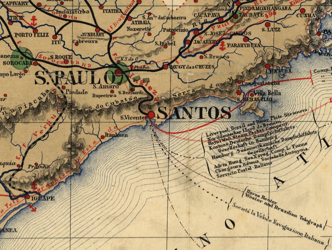
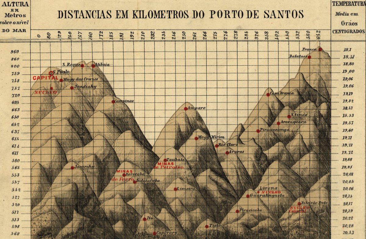
This fascinating 1886 map of the Brazilian state of Sao Paulo highlights shipping and telegraph connections, and features an illustrated chart of town elevations!. Take a closer look here:
0
2
9
This British-produced Revolutionary War map shows the locations of British ships, American defenses, and attack sites on the Delaware River near Philadelphia. See the full map here:

1
2
3
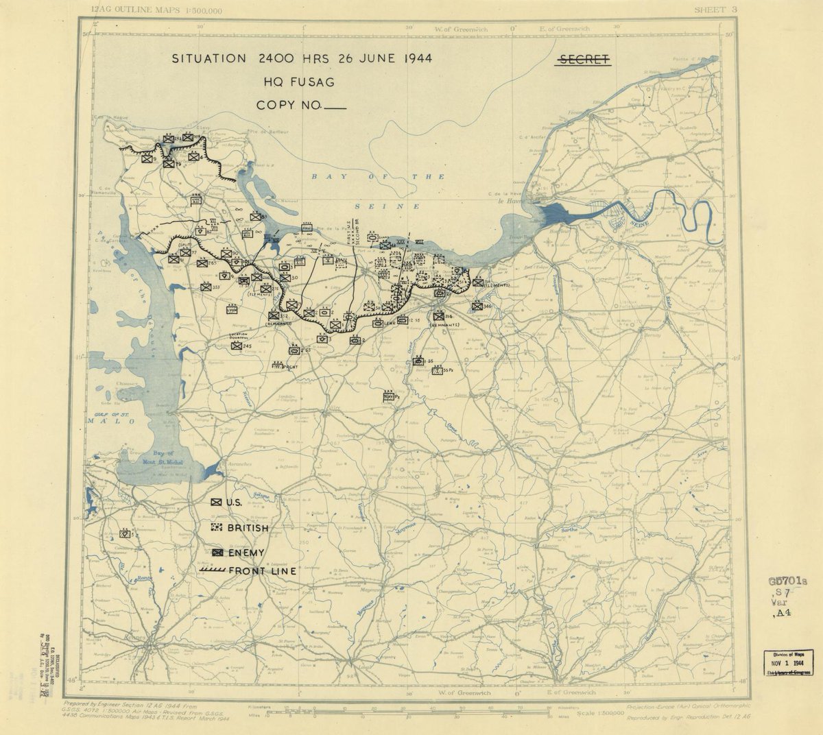
On this day in 1944, the US Army Twelfth Army Group was still in Normandy, France - check out their positions on this HQ Twelfth Army Group situation map:. The full map is online here: Browse our WWII Military Situation Maps:
1
5
7
This incredible 1702 work by William Godson features an annotated world map, celestial charts, polar views in various map projections, and more!. Take a closer look here:
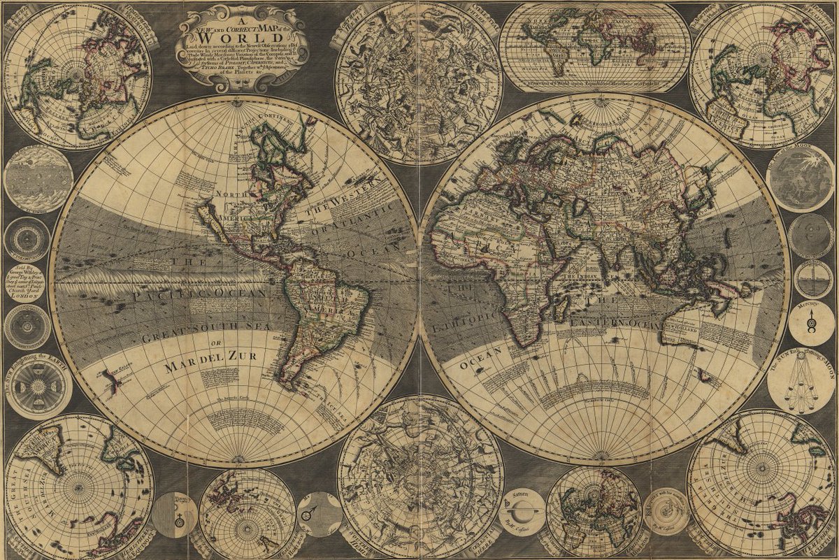
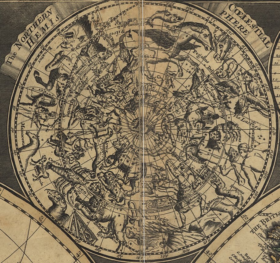
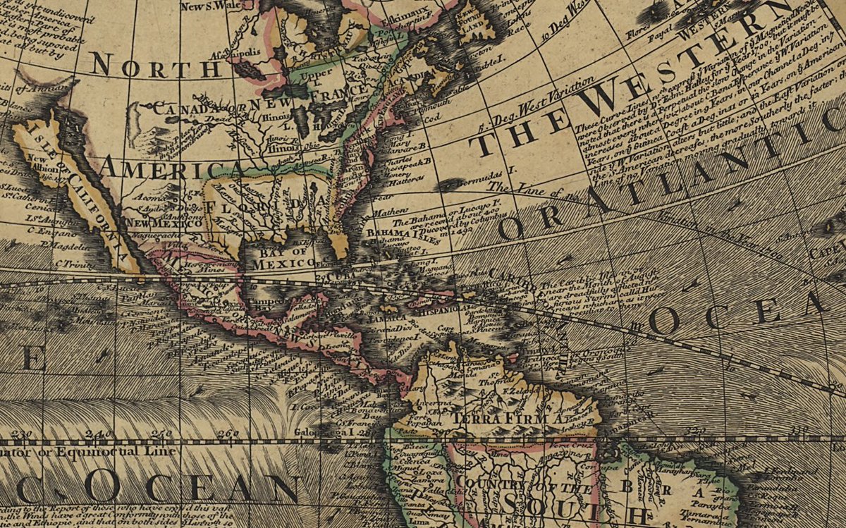
0
2
9
This fascinating 19th century Japanese map of the world includes illustrations of people of various nationalities from around the globe!. Take a closer look here:
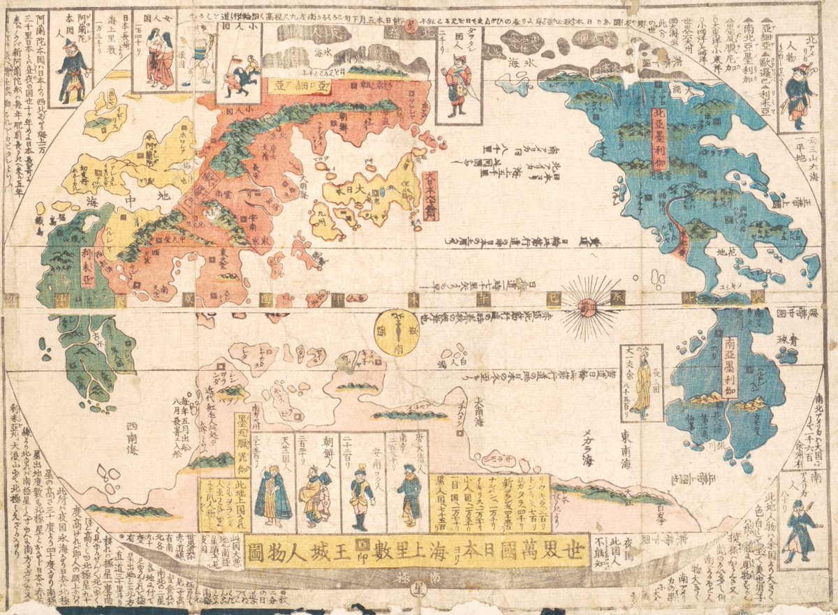
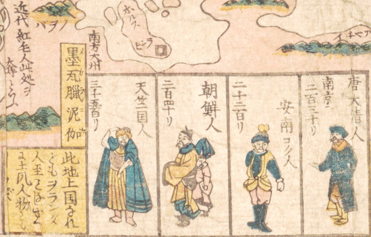
1
3
13
William Hooker's "new pocket plan of the city of New-York" was created in 1830 and shows points of interest in lower New York City below 31st St (including markets, banks, theatres, and gardens!). See the full-size image here:
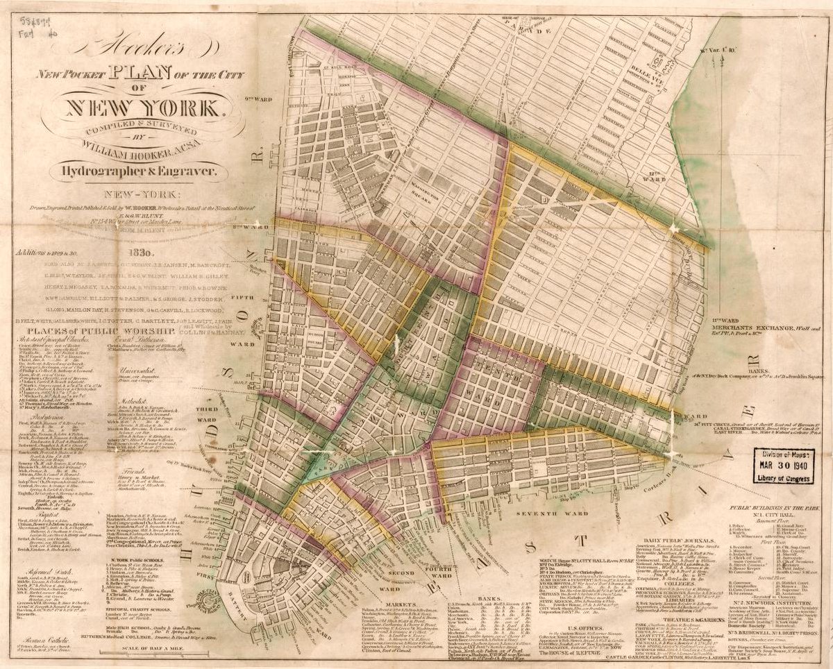
1
1
11
It's not too late to register for tomorrow's virtual orientation on Maps of World War II!. Register here:
Join us next Tuesday 6/10 at 3pm Eastern for a virtual orientation to the Geography & Map Division! In this session, learn about maps and other cartographic items in the Geography & Map collections from World War II. Register here:
0
0
3
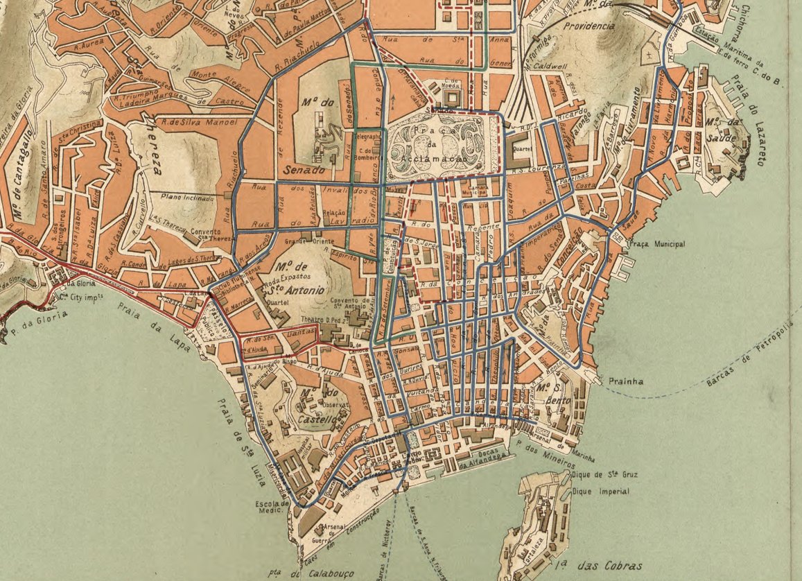
This colorful map, created between 1900 and 1910, shows streetcar timetables and routes through Rio de Janeiro. Take a closer look here:
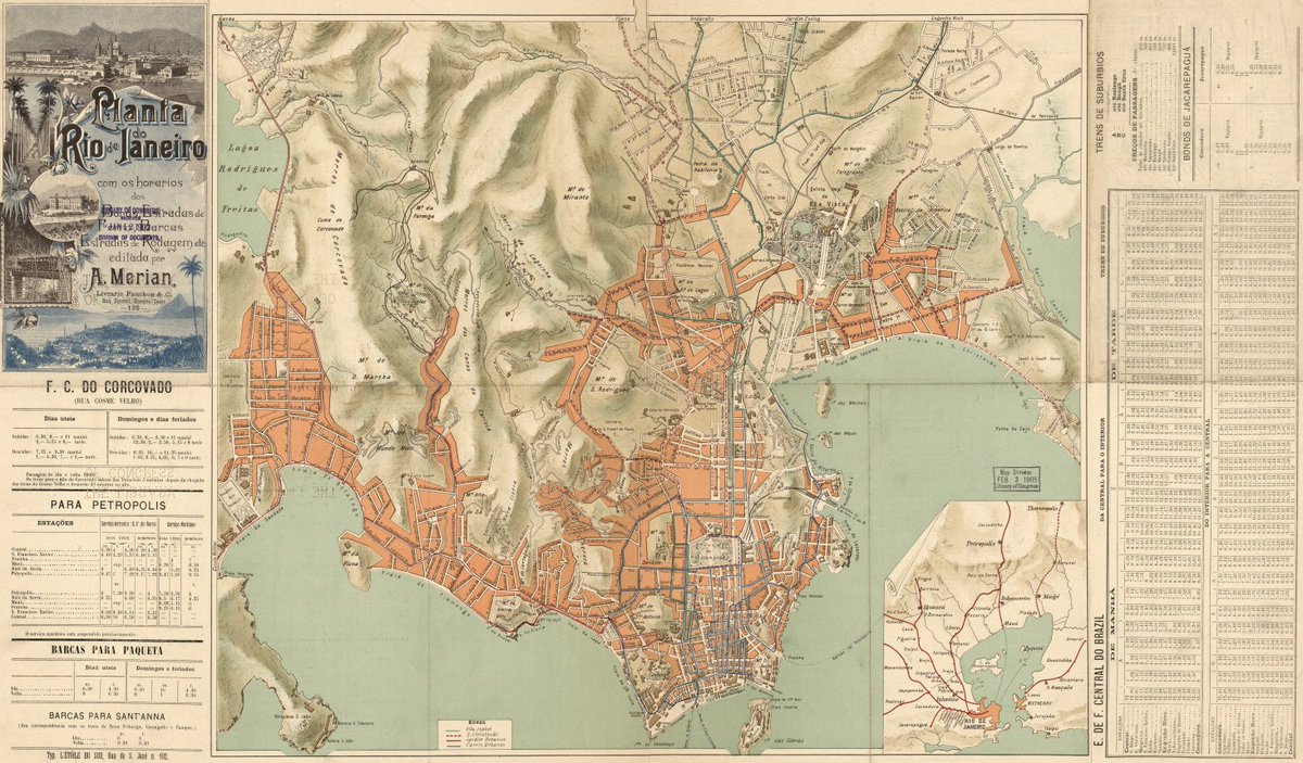
0
0
12
Join us next Tuesday 6/10 at 3pm Eastern for a virtual orientation to the Geography & Map Division! In this session, learn about maps and other cartographic items in the Geography & Map collections from World War II. Register here:
0
3
10
The 2025 Philip Lee Phillips Society Fellowship is now accepting applications through September 15, 2025. The fellowship offers an $11,500 stipend for 8 research weeks!. Full details available here:

0
3
4
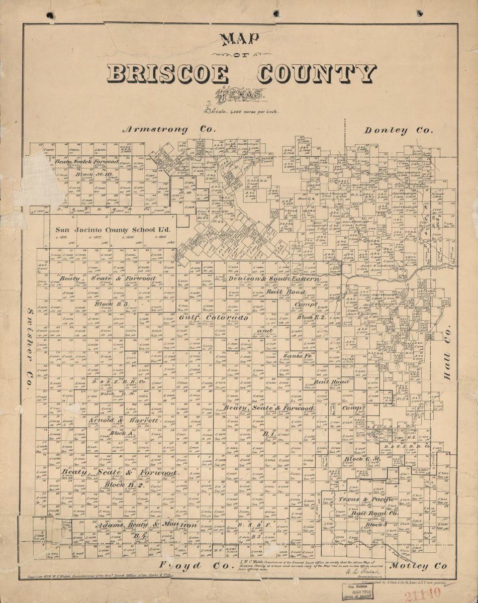
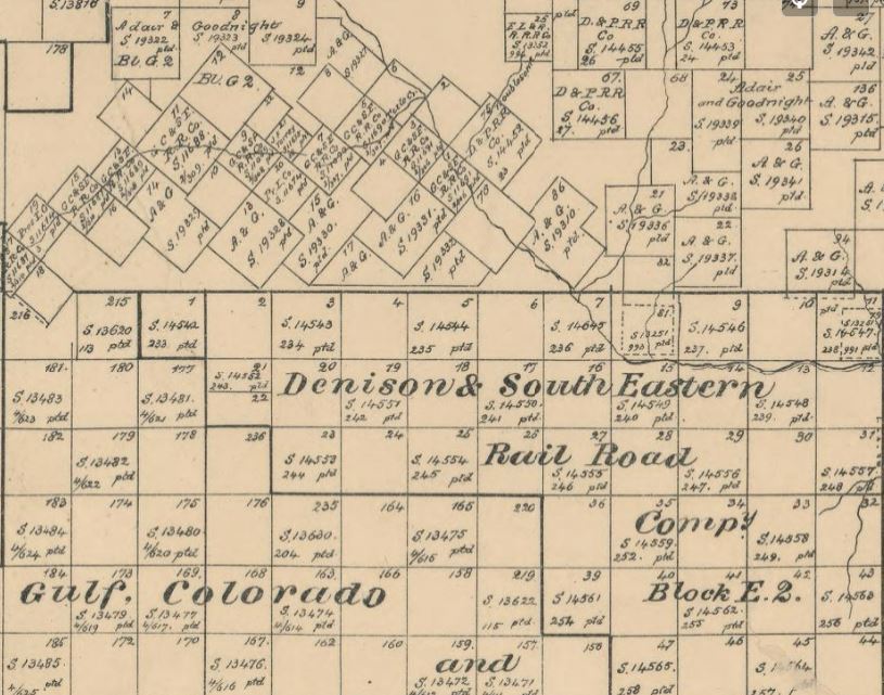
This map of Briscoe County, Texas was published in 1897 by the Texas General Land Office. It shows boundaries for land ownership in the county, including areas owned by railroad companies. Zoom in for full details, here:
0
1
5
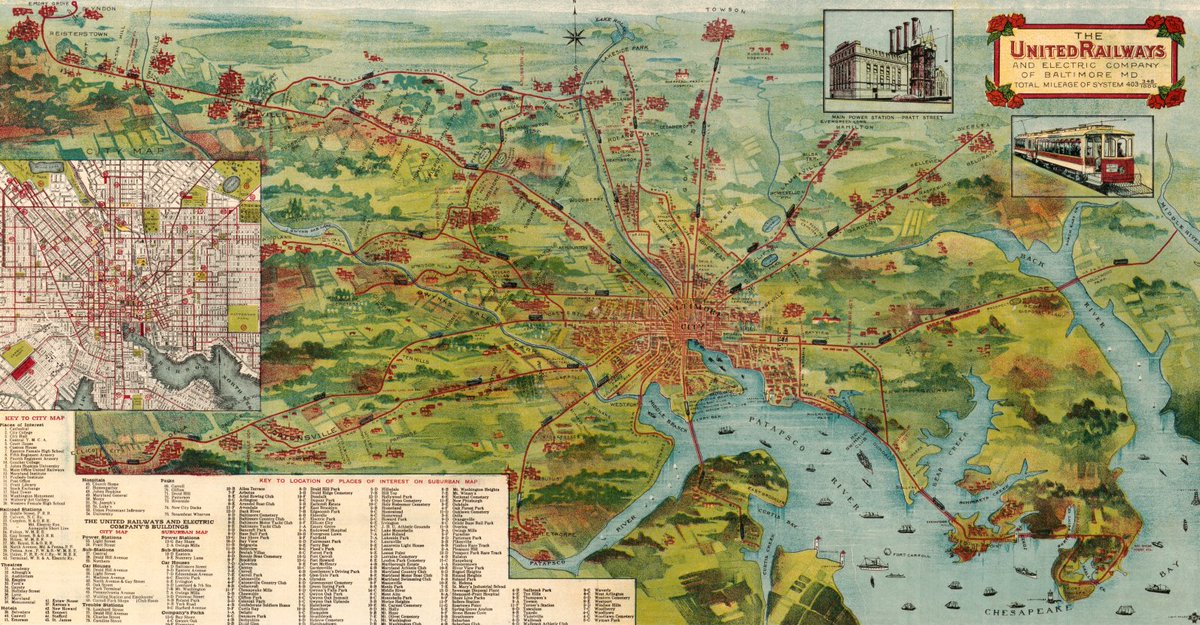
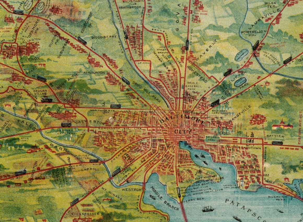
This vibrant pictorial map shows the once vast trolley network of Baltimore in 1913, extending from the city center to surrounding suburbs. Take a closer look here:
0
5
20
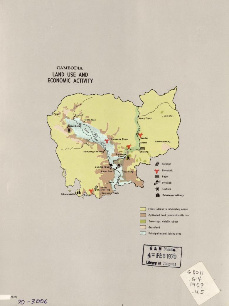
This map of Cambodia was produced by the Central Intelligence Agency in 1969. With the theme of "Land Use and Economic Activity," the map shows production areas for cement, livestock, paper, plywood, textiles, and more. See the full image online here:
0
3
13