
Hurricane Forecast
@Hurricane4Casts
Followers
373
Following
7
Media
49
Statuses
182
Hurricane Forecast, severe weather warnings, weather news syndication, Baja Hurricane Center, Hurricane warnings based in public weather forecast news
Eye of the Hurricane
Joined June 2011


🇺🇸🌀 | ALERTA INMINENTE Las imágenes no mienten: un video que muestra la destructiva marejada ciclónica de Ft. Myers durante el huracán Ian sirve como advertencia aterradora para lo que podría enfrentar Tampa con la llegada del huracán Milton, que amenaza con una subida de hasta
316
5K
19K
.....YOU should be shaken too, and demand....

I debated whether to share this. I did apologize on the air. But I invite you to read my introspection on @BulletinAtomic of how extreme weather 📈 driven by global warming has changed me. Frankly, YOU should be shaken too, and demand #ClimateActionNow.
0
1
0
1. EP96 - red: Showers and thunderstorms have changed little in organization a couple of hundred miles of the southern coast of MEX 2. Yellow: Area of low pressure could form late this week a few hundred miles south of the coast of southwestern Mexico. https://t.co/IMWkebfIOV
0
0
1
Rapid strengthening is forecast, and Beatriz is likely to become a hurricane on Friday. Beatriz expected to rapidly intensify while moving near the coast of Mexico. At 19:00hr CDT was located about 180km (110 mi) South of Acapulco. https://t.co/IyoajIHVWt

mastodon.online
Attached: 1 image Beatriz expected to rapidly intensify while moving near the coast of Mexico. At 19:00hr CDT (0000 UTC), the center of Tropical Storm Beatriz was located about 180km (110 mi) South...
0
2
0
At 800 AM EDT (1200 UTC), the center of Hurricane Ian was located by NOAA Hurricane Hunter aircraft, Cuban and Key West radar data about 10 mi/15 km NNE of the city of pinar del rio cuba about 130 mi/240 km SSW of the dry tortugas maximum sustained winds 125 mph/205 km/h
0
0
1
At 06:00hr Kay was about 590 km from the southern tip of the Baja peninsula. https://t.co/sV14FPsWjj
0
2
2
Kay is forecast to strengthen into a hurricane while it moves northward toward the Baja California peninsula later this week. https://t.co/W5r3S3N3PG
0
1
1
Satellite images indicate that an area of low pressure located about 200 miles south of Acapulco, Mexico, is becoming better defined and showers and thunderstorms continue to show signs of organization https://t.co/0j8aNh6AId
@Goegginger @Bajapreneur
mastodon.online
Attached: 1 image Satellite images indicate that an area of low pressure located about 200 miles south of Acapulco, Mexico, is becoming better defined and showers and thunderstorms continue to show...
0
1
3
Was Javier yesterday the prelude?? Heavy rain possible along the coasts of southern and southwestern Mexico during the next few days, and interests in those locations and the Baja California peninsula should monitor the progress of this disturbance. @BajaWeather @AlemanEnBaja
0
1
3
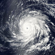
Tropical Cyclone GENEVIEVE located off Mexico’s Pacific Coast, continues to move northwest as a Category 2 Hurricane. On 18 August at 3.00 UTC its center was located approximately 340 km south-west of Manzanillo with maximum sustained winds of 157 km/h. https://t.co/B7loKnufIf
0
0
0
NASA Catches Tropical Storm Lorena’s Landfall Approach. As Tropical Storm Lorena was nearing landfall in northwestern Mexico, NASA-NOAA’s Suomi NPP satellite provided forecasters with an image of the storm. https://t.co/FHqsWEhF1b
nasa.gov
Blogs Archive - NASA
0
0
0
18:00hr update: Eye of hurricane #Lorena near the southern portion of the Baja California peninsula future track of the hurricane is highly uncertain! 95 km (60 mi) NNE of Cabo San Lucas about 95 km (65 mi) SE of La Paz now moving again @LaPazMexico @La_Paz_BCS @Hurricane4Casts
0
3
3
Nothing here in the Fidepaz area of La Paz so far. Very hot, 31°C, here and now a windgust, that's it. Friends in Todos Santos report in cloudy and little wind. @LaPazNet @LaPazMexico @Hurricane4Casts @Baja_Weather @Pacenos @todos_santos
1
3
2
With the help of Mexican Navy automatic weather stations, at 01:00 hr CDT (24:00 hr La Paz / 06:00 hr UTC), the center of Hurricane Lorena was located about 40 km (25 mi) WNW of Manzanillo and about 150 km (90 mi) SE of Cabo Corrientes Mexico @BajaWeather
https://t.co/7a9FAlvZgV
0
0
0
Cameras outside the International Space Station captured views September 1 of Hurricane Dorian from 260 miles in altitude at 12:16 p.m. Eastern time as it churned over the Atlantic Ocean @BajaWeather
https://t.co/uSuM20OJjM
0
0
1

Tropical storm #Juliette to become a hurricane on Monday. At... https://t.co/t7lMd4VXlo
#BajaSur #Clima #bajaweather #bajaclima
0
1
0
Why We’re Stuck With An Inadequate Hurricane Rating System
0
3
0

Eastern Pacific- New Low Pressure System and Rosa The National Hurricane Center is issuing advisories on recently upgraded Hurricane Rosa, located about 500 miles west-southwest of Manzanillo, Mexico. New Low Pressure System ... https://t.co/5XDqJv0WAz
0
5
4