
Geohazard Risk Mapping Initiative
@GeohazardMaps
Followers
1K
Following
737
Media
311
Statuses
1K
Providing simplified, high-precision flood hazard maps across Africa. https://t.co/WdqDWtOOeh
Nigeria
Joined September 2020
#ClimateEmergency compels us to convert our shared concerns into direct, data-guided action. Join our flood risk reporting initiative, and contribute to proactive strategies built on real data from real incidents. Visit https://t.co/c5RLJCf3gJ
#FloodRiskManagement #ArcGIS
survey123.arcgis.com
The survey app was developed by Geohazards Risk Mapping Initiative (www.georiskmap.org) , the main purpose of this tool is to support the National Emergency Management Agency with information on...
0
9
15
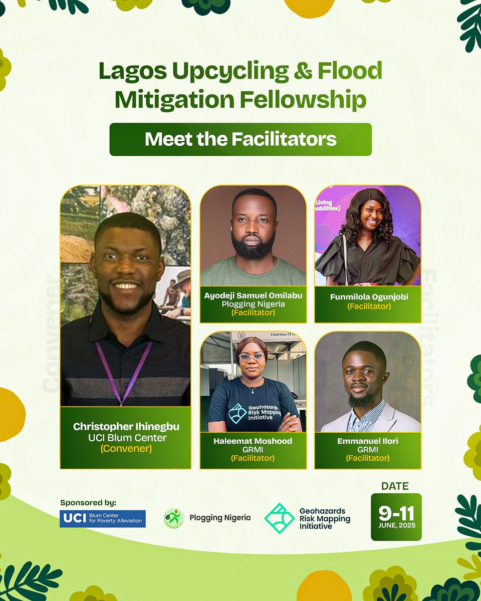
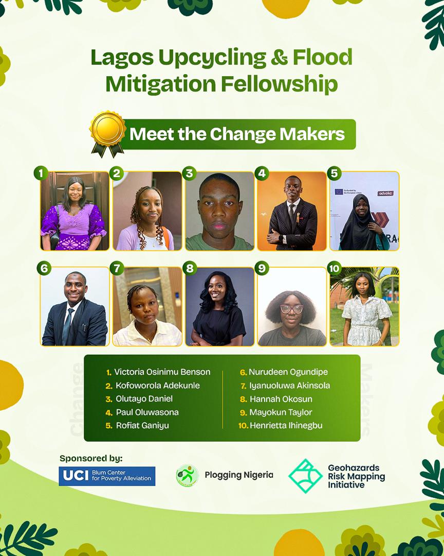
🚨 The Lagos Upcycling & Flood Mitigation Fellowship is here! 📅 9–11 June 2025 🌍 Changemakers will co-create flood solutions + turn waste into value! Facilitators from @UCIBlumCenter, @ploggingnigeria & @GeohazardMaps . #Lagos #ClimateAction #SDG11
0
2
3
EXTENDED: Deadline now May 14th! 📅 Program Dates: June 9–13 🔗 Apply here: https://t.co/uo368awoeE 🕒 New Deadline: May 14, 2025 Let’s build a greener, flood-resilient Lagos, one leader at a time. #ClimateAction #FloodMitigation #YouthLeadership #Upcycling #Lagos

0
1
4
Climate risk doesn’t begin with disaster. It begins with ignored data. In Ghana, rising temps, erratic rain & toxic rice reveal a deeper crisis. At @GeohazardMaps, we used MODIS, CHIRPS & GEE to map what’s changing, & why it matters. 📍 Read more: https://t.co/ZyLZyiDLRg

0
2
4
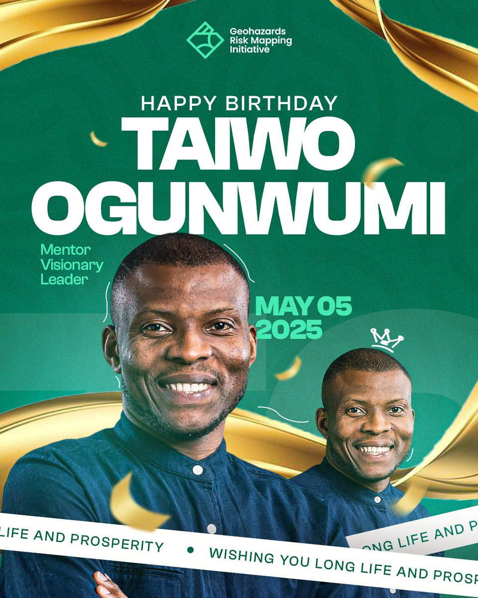
To us, leadership is defined by the courage to create change. Today, we celebrate a change maker, @T_Ogunwumi, the Founder of GeoHazards Risk Mapping Initiative. We appreciate your leadership. Happy Birthday! 🎉 🥳
0
2
7

If you're 18–25 in Lagos and ready to lead on climate, upcycling, and flood resilience, this is for you. 📅 June 9–13 📷 https://t.co/uo368awW4c Deadline: May 9th 2025. #ClimateAction #FloodMitigation

0
2
1
Most talk about sustainability. A few act. Here is an opportunity to act. If you're 18–25 in Lagos and ready to lead on climate, upcycling, and flood resilience, this is for you. 📅 June 9–13 🔗 https://t.co/uo368awW4c 🕐 Apply by May 9. #ClimateAction #FloodMitigation

1
9
10
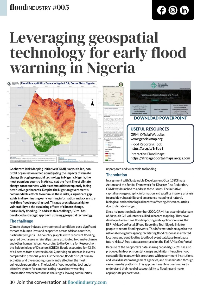
We are excited to share that we got featured in the latest edition of Flood Industry Magazine! Our work in geospatial tech is driving flood early warning systems in Nigeria, helping communities stay prepared. 🔗 https://t.co/Gv8NU6zTDi


3
1
2
Join us in welcoming @HB_Cezo, Hussaini Usman as GRMI’s Geospatial and Disaster Risk Reduction Expert! His passion for innovative solutions and building resilient communities inspires us all. Welcome to the team, Hussaini! 💡🌍

0
2
10
Our focus on the impacts of floods on children and teenagers centers on understanding their unique vulnerabilities, addressing the disruptions to their education, health, and overall well-being, and creating targeted interventions to build resilience.

0
1
1
Flooding disrupts education for millions of Nigerian students. GRMI’s survey, featured in the Tribune, calls for action: ✅ Flood-resilient schools ✅ Mental health support for students ✅ Youth-led disaster risk mapping https://t.co/4ZRXVWLzaX


0
2
3
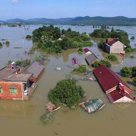
Flooding disrupts more than land, it disrupts futures. At @GeohazardMaps, we’re building resilient communities in Lagos & Kogi. Watch how we’re making an impact & gearing up for more in 2025. Together, we can create a safer, stronger tomorrow. 💪 @UNDRR @T_Ogunwumi
0
3
8
🚨 53+ school days lost annually due to flooding. Our survey in Kogi State reveals the harsh realities faced by students in flood-prone areas. 📖 Read more: https://t.co/vs90aMXN1A
@UNDRR @T_Ogunwumi @UNDP @hotosm @mkbadeniyi @Oxfam @WorldBankAfrica @UNDRR_Africa @UNOCHA
medium.com
Extreme weather events such as floods, heatwaves, and droughts are significantly disrupting education systems in low- and middle-income…
0
3
7
Wishing a Merry Christmas to all our volunteers, partners, staff and everyone celebrating around the world 🎄.

0
1
6
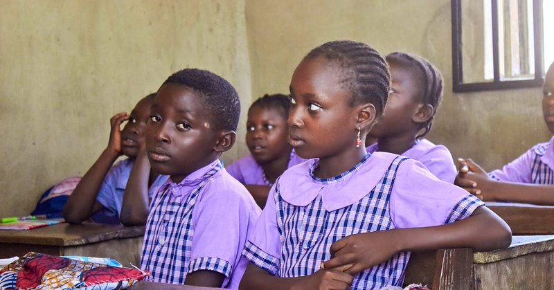
Every number has a story, and every story shapes a solution. 🌍✨ Here’s one of our volunteers listening to children’s experiences with flooding. It’s not just data, it’s their reality, and it’s guiding how we create lasting, meaningful change. #FloodResilience #Community

0
1
3
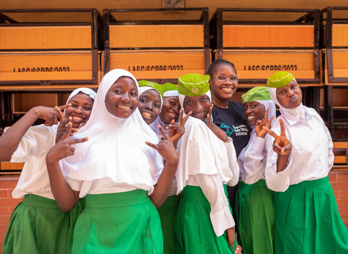
Smiles, resilience, and hope. At @GeohazardMaps, we're empowering the next generation to rise above challenges like flooding. Together, we're building a future where every child has the tools to thrive. 🌍 #YouthEmpowerment #FloodResilience #SustainableFutures
0
1
2
Our latest pilot survey reveals how flooding disrupts education, mental health, and daily life for children in Lagos. We're committed to building resilience through innovative solutions and community engagement. https://t.co/dNskBelOxc
@UNDP @nemanigeria @IFRCAfrica

medium.com
Nigeria experiences various types of flood events, including flash floods, riverine floods, and coastal floods, all of which have…
0
1
6
Resilience against floods starts with the next generation. Teach kids disaster prep, flood risk, and sustainability today, and they’ll build a safer, stronger future tomorrow. 🌍🌊 #ClimateAction #DisasterRiskReduction
@T_Ogunwumi @UNDRR_Africa @UNICEF
0
1
4
Flooding shouldn’t take away any child’s chance to learn and grow. We’re working to keep schools open, protect children’s well-being, and ensure their voices are heard through the Children’s Charter for DRR. https://t.co/zbU75K1Lzv

medium.com
Kogi State, located in Nigeria’s northcentral region, faces a longstanding history of severe flooding due to its unique geographical…
1
1
2

https://t.co/1PLpWviPzt "Building a resilient future! 🌍 @GeohazardMaps is championing the Children’s Charter for Disaster Risk Reduction in Nigeria, empowering young voices to shape safer communities. #DisasterRiskReduction #YouthEmpowerment #ResilientFuture"

0
2
4