
GeoSpatial Integrations
@GSI3D
Followers
6
Following
1
Media
21
Statuses
60
We bring the world to you.
Columbus, Ohio
Joined February 2023
Dive into the #OrthoShowdown! We've transformed bulky orthographic files into sleek base maps. 🌐 From a massive 5.82 GB to a handy 14.2 MB. No high-end gear is needed; it is seamless integration across your favorite software.
0
0
0
Sadly, Marie Tharp passed away on August 23, 2006. Her pioneering work in remote sensing and oceanography has impacted our understanding of Earth's geology and the dynamic processes beneath our oceans. Today, we celebrate her incredible achievements! 🌊🛰️🌍
0
0
0
Tharp's contributions were eventually recognized despite challenges as a woman in a male field. In 1997, she was awarded the Lamont-Doherty Earth Observatory Heritage Award. In 2001, the Library of Congress named her one of the four greatest cartographers of the 20th century.
1
0
0
Tharp's ocean floor maps were groundbreaking and visually striking. In 1977, National Geographic published her world ocean floor map, which showcased the intricate topography of Earth's underwater landscape. 🌐🌊
1
0
0
Tharp's work revealed the presence of a continuous underwater mountain range, now known as the Mid-Atlantic Ridge, running from Iceland to the tip of the Antarctic continent. This discovery would ultimately lead to the acceptance of the theory of plate tectonics. 🌍
1
0
0
At Lamont, Tharp worked alongside Bruce Heezen, a fellow oceanographer. Their collaboration would become a turning point in the history of oceanography. Tharp meticulously analyzed thousands of sonar readings collected during naval expeditions to map the ocean floor. 🗺️
1
0
0
Tharp earned a Master's degree in geology from the University of Michigan in 1944 and a Master's in mathematics from the University of Tulsa. In 1948, she joined the Lamont Geological Observatory (now the Lamont-Doherty Earth Observatory) at Columbia University. 🎓
1
0
0
Born on July 30, 1920, in Ypsilanti, Michigan, Marie Tharp grew up surrounded by science. Her father was a soil surveyor, and her mother, a Latin and German teacher, was also a keen map enthusiast. This combination of influences would shape Tharp's future career. #WomenInSTEM
1
0
0
🌐🛰️ #ThrowbackThursday: Today, let's dive into the remarkable life and achievements of Dr. Marie Tharp, a pioneering figure in remote sensing and oceanography who played a vital role in our understanding of Earth's oceans! 🌊 #TBT #remotesensing #marietharp
1
0
0
🧵Comparison Tuesday: 5/5 📝 Coming Soon: In-Depth Blog Post 📝 Stay tuned for our upcoming blog post, diving deeper into these tips and resources for finding the best drone mapping services near you! #blogpost #dronemapping #industryexpert
0
0
0
🧵Comparison Tuesday: 4/5 💰 Discuss Pricing and Timelines 💰 Ensure the provider: - Offers a contract with goals - Can meet your project deadlines - Hourly rates for extra work or possible add-ons #pricing #timelines #projectmanagement
1
0
0
🧵Comparison Tuesday: 2/5 📏 Determine Your Mapping Needs 📏 Before you begin your search, consider the following: - Size and complexity of the area to be mapped - Specific features or data required - Budget and timeline for the project #mappingneeds #projectplanning
1
0
0
🧵Comparison Tuesday: 1/5 📍Finding the Best Drone Mapping Services Near You 📍 In today's #ComparisonTuesday, we're diving into the essential factors for finding the best drone mapping services near you. Let's get started! #dronemapping #droneservices #droneindustry
1
0
0
Share your thoughts and favorite models in the comments below! Let's celebrate the power of drone photogrammetry together! 🚀
0
0
0
5/5 🔥 Thermal Modeling Meets RGB 🔥 We love pushing boundaries! Check out this unique 3D model. We combined thermal modeling with RGB imagery to create a visually stunning and informative result. #thermalmodeling #innovation #3Dmodelingmonday
1
0
0
🤝 Demo Model for a Partner 🤝 We're always happy to collaborate! Here's a demo model we created for another company, showcasing our skills in processing imagery for high-quality 3D models. #collaboration #demomodel
1
0
0
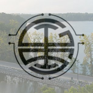
🌉 Just for Fun: A Bridge! 🌉 We also like to have some fun with our drone! Check out this incredible 3D model of a bridge we created just for the thrill of it. #photogrammetryfun #bridgemodel
1
0
0
🏢 Commercial Roofs 🏢 We've utilized drone photogrammetry to create detailed 3D models of commercial roofs for estimating purposes. This innovative approach saves time and ensures accuracy for our clients. #roofing #estimates #drones
1
0
0
🌟 3D Modeling Monday 🌟 Welcome to #3DModelingMonday! Today, we're showcasing our best drone photogrammetry models. Get ready to be amazed by these incredible creations! https://t.co/O2TvNvFZ07
#dronephotogrammetry #3dmodeling #modelingmonday
1
0
0