

FloodMapp
@FloodMapp
Followers
3K
Following
2K
Media
726
Statuses
2K
Real-time flood intelligence for Emergency Managers. Improve safety, prevent damage. #GIS #AI #climatetech #emergencymanagement #resilience
USA / Australia
Joined February 2017
We are excited to work with the City of Waynesboro, VA, to deploy an operational, impact-based flood forecasting system. This project, made possible by @RiseResilience and funded through the Virginia Department of Housing and Community Development, will help strengthen flood
0
0
1
🌧️ A multi-day atmospheric river is putting more than 30 million Californians under flash flood risk, with some cities forecast to receive months’ worth of rain in just days. https://t.co/u52FRuZ9yg For emergency managers, knowing where flooding will happen, who will be
foxweather.com
An atmospheric river has begun to slam California that is expected to bring days of heavy rain, strong wind gusts and potentially feet of mountain snow to the Golden State through early next week,...
0
0
0
We are excited to work with the City of Roanoke, VA, to deploy an operational, impact-based flood forecasting system. This project, made possible by @RiseResilience and funded through the Virginia Department of Housing and Community Development, will help strengthen flood
1
0
0
💸 Flooding costs U.S. businesses over $70 billion each year in direct damage, downtime, and lost productivity. https://t.co/5q4803cT3N When roads close, supply chains stall and critical services are cut off, not just disrupting operations, but people's lives and livelihoods.

jec.senate.gov
The Joint Economic Committee’s Democratic staff estimates that the total cost of flooding in the United States is between $179.8 and $496.0 billion each year in 2023 dollars. The graph below shows...
0
0
0
We are excited to work with the Town of Pulaski, VA to deploy an advanced operational impact-based flood forecasting system. This project is made possible by funding from @RiseResilience, which is funded through the Virginia Department of Housing and Community Development.
1
0
1
🌎 How do agencies prepare for the floods of tomorrow, when catchments are already saturated today? https://t.co/vyB5ZFnfWt Operational, impact-based flood forecasting is changing how emergency managers, utilities, and other service providers, respond and recover. Our latest blog
0
0
1
Our hearts are with the people of the Philippines following the devastation of Super Typhoon Fung-wong. 💙 https://t.co/jA2fFyPaYE With more than a million displaced and widespread flooding across the country, this disaster reminds the world how quickly extreme weather can

theguardian.com
About 1.4 million people evacuated as storm sparks flash floods and landslides and leaves millions without power
0
0
0
💰 Protecting U.S. infrastructure from flooding could cost anywhere from $68.9 to $344.5 billion, but impact and intelligence-driven planning can help prioritize those dollars. https://t.co/bFECicRIri Outdated drainage and aging levees and bridges can't keeping up with today’s
jec.senate.gov
The Joint Economic Committee’s Democratic staff estimates that the total cost of flooding in the United States is between $179.8 and $496.0 billion each year in 2023 dollars. The graph below shows...
0
0
0
We’re proud to share that our co-founders, Juliette Murphy (CEO) and Ryan Prosser (CTO), have been recognized on Australia’s 250 Young Entrepreneurs list for 2025, a celebration of the bold #innovators shaping the future of business across the country. Juliette and Ryan have
0
2
0
🌧️ Flooding silently drains up to 1-2% of the U.S. GDP every year, between $179 and $496 billion in damages. https://t.co/pJMDTpl3vq That’s not just a natural disaster statistic. It’s a national economic challenge that compounds every year across every sector. Communities,
jec.senate.gov
The Joint Economic Committee’s Democratic staff estimates that the total cost of flooding in the United States is between $179.8 and $496.0 billion each year in 2023 dollars. The graph below shows...
0
0
0
🌊 When you're forecasting and visualizing flood impact, accuracy matters. FloodMapp’s Validation Reports show how our technology performs in real-world flood events, comparing outputs against on-the-ground photos, gauge data, and satellite imagery. The result? Street-level
0
0
1
💚 Our hearts go out to those affected by the flash #flooding that brought tragedy to New York City this week. https://t.co/AJQQM3RI9R Advanced flood intelligence can help change that story, enabling agencies to see where water will rise before it happens, monitor it as

foxweather.com
Two people were killed in New York City on Thursday when an intense line of storms dumped torrential rain across the mid-Atlantic and Northeast, triggering widespread flash flooding.
0
0
0
🌊 From statewide scale to street-level precision; get real-time flood forecasts and live impact monitoring, right inside your existing systems. No new tools. No new workflows. Just the insights you need, when you need them. ✅ Pre-flood: Plan evacuations and stage resources ✅
0
0
0
[WEBINAR] Get ready for the wet season Join Esri Australia × FloodMapp, with expert insight from the Queensland Police Service (QPS), for a discussion on the ArcGIS workflows leaders use to anticipate impacts, prioritize crews, and align public warnings 📅 Fri 31 Oct | 🕙 10:00
0
0
0
As Hurricane Melissa gains strength over Jamaica and the Caribbean, this Category 5 storm forecasts point to catastrophic rainfall, storm surge, and landslide risk. Emergency managers know all too well that the real challenge is when the water rises where you least expect it.

weather.com
Melissa will be one of the most devastating hurricanes on record in Jamaica, with widespread flooding, landslides and destructive winds. Flooding rain is also a grave concern in Hispaniola and Cuba....
0
0
0
This weekend, severe storms are forecast to sweep across the South. bringing hail, damaging winds, and a real risk of flash #flooding. ➡️ https://t.co/zMf4mp3BTq For emergency managers, these fast-moving systems can be the most difficult to prepare for. A few inches of rain in
0
0
0
When every minute counts, visibility is everything. You already have sensors, models, and historical studies, but can your tools keep up when conditions shift fast? FloodMapp delivers the operational flood intelligence you need to act early and confidently, from planning to
0
0
1
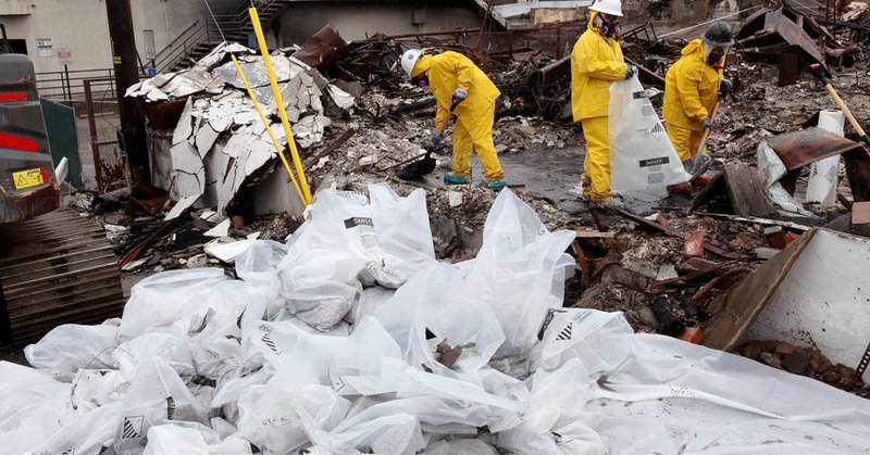
What do wildfires have to do with flooding? More than you might think. Our new blog, written by Matt Larson, breaks down how wildfire burn scars and atmospheric impacts are reshaping flood risk across Australia and the U.S. Read the full piece ➡️ https://t.co/wa4NW5bqBr
0
0
0
💧 Communities in Western Alaska Devastated by Record #Flooding Our hearts are with the people of Alaska after catastrophic flooding, fueled by remnants of Typhoon Halong, inundated nearly 50 communities. Entire towns have been displaced, hundreds evacuated, and homes destroyed.

abcnews.go.com
In the aftermath of a destructive typhoon, communities across western Alaska have been destroyed from historic floodwaters, causing hundreds of evacuations.
0
1
1
➡️ Lead the wet season with operational clarity. https://t.co/wKSGy2NSvn Australian councils are under pressure to make faster, safer decisions when floods threaten. Join @esriaustralia × FloodMapp—with insights from the Queensland Police Service (QPS)—for a concise session on
0
0
0