

Michael Ferragamo
@FerragamoWx
Followers
13K
Following
29K
Media
5K
Statuses
11K
New England → Oklahoma ☈ OU Meteorology. Tropical Cyclone Enthusiast & Hurricane Historian. A Boston boy living the Tornado Alley life!
Boston, MA - Norman, OK
Joined May 2019
It's finally done. Over 3 days of hand-plotting 173 years' worth of data. The end result is unbelievable. What an incredible dataset to look at.

1K
5K
34K


Invest 92L looking a lot like a developing tropical cyclone on satellite. NHC now gives it a 70% chance of development.

2
6
40
We certainly name more sloppy/junk systems now than we used to, but that can be due to better technology and detection practices. At the end of the day, naming 3 junk systems might help the storm total, but it doesn’t help the ACE forecast much.

Yet another named storm that lasts roughly ~12-24hrs. and doesn’t amount to much. Good way to hike up those storm total numbers. #FLwx #WxTwitter #TropicsWx.
3
0
17
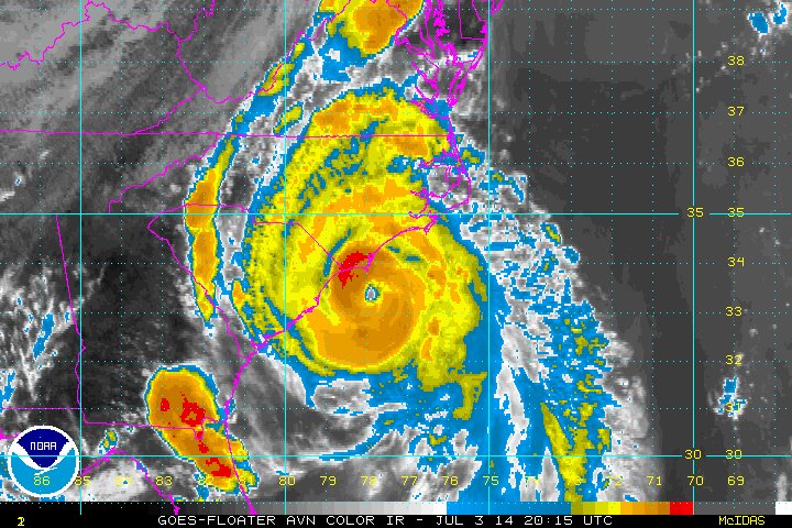
The 4th of July in 2014 was a little different, with Hurricane ARTHUR making landfall in North Carolina — the earliest hurricane landfall ever recorded in NC.

5
29
220
Convection has increased within Invest 92L off South Carolina. Could become a brief TD/TS. Hurricane Hunters en route to investigate later today.
2
12
86
The active 2025 Eastern Pacific season continues, with a high chance of development right behind #FLOSSIE. 2 major hurricanes already this season.

2
10
56
The post from @iCyclone certainly sparked the interest for researching these pre-database hurricanes. The true track maps for Category 5s over the last several centuries likely look along the lines of this 👇 but sadly we’ll never know!.

All known Category-5 #hurricane landfalls in North America (going back to 1851). Five in the US: San Felipe 1928, Labor Day 1935, CAMILLE, ANDREW, MICHAEL. Only 1 in the Eastern Pacific: OTIS. I penetrated 3: DEAN, MICHAEL, DORIAN.

1
2
27
I went through some records and accounts of powerful hurricanes pre-1851, and I compiled a map of some storms that may have been Category 5 huricanes before our database began. Unfortunately, because these are just records, this map is primarily for entertainment purposes only,

23
37
276
We always talk about TCs having “the look” with a classic shrimp cloud pattern, but look at this guy in the WPAC — Tropical Storm #MUN. Perfect 🍤 shape!. However, this organization won’t amount to much, as its forecast to stay OTS and become a minimal typhoon in the higher
1
7
80
5 pm MST update holds #FLOSSIE at 95 kts, and I agree. Satellite presentation currently not quite screaming major hurricane, but I do think it’s close — especially as the eye clears out.
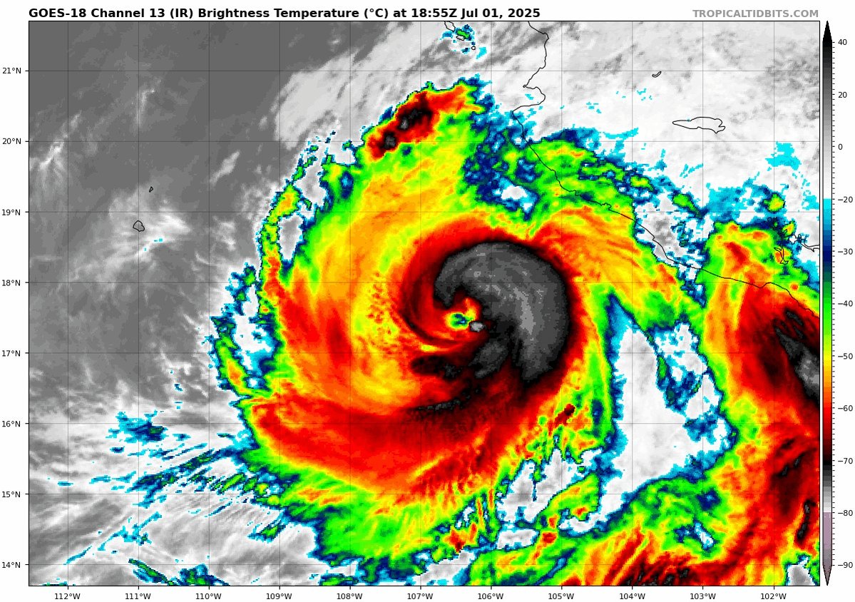
#FLOSSIE looking much better this evening vs. this morning — it could already be a 100 kt Category 3 based on satellite, so we’ll wait for the next NHC update. C3 is likely, can’t rule out a brief C4 into tomorrow. NHC has a peak of 110 kts (125 mph).

1
2
28
#FLOSSIE looking much better this evening vs. this morning — it could already be a 100 kt Category 3 based on satellite, so we’ll wait for the next NHC update. C3 is likely, can’t rule out a brief C4 into tomorrow. NHC has a peak of 110 kts (125 mph).
3
20
121
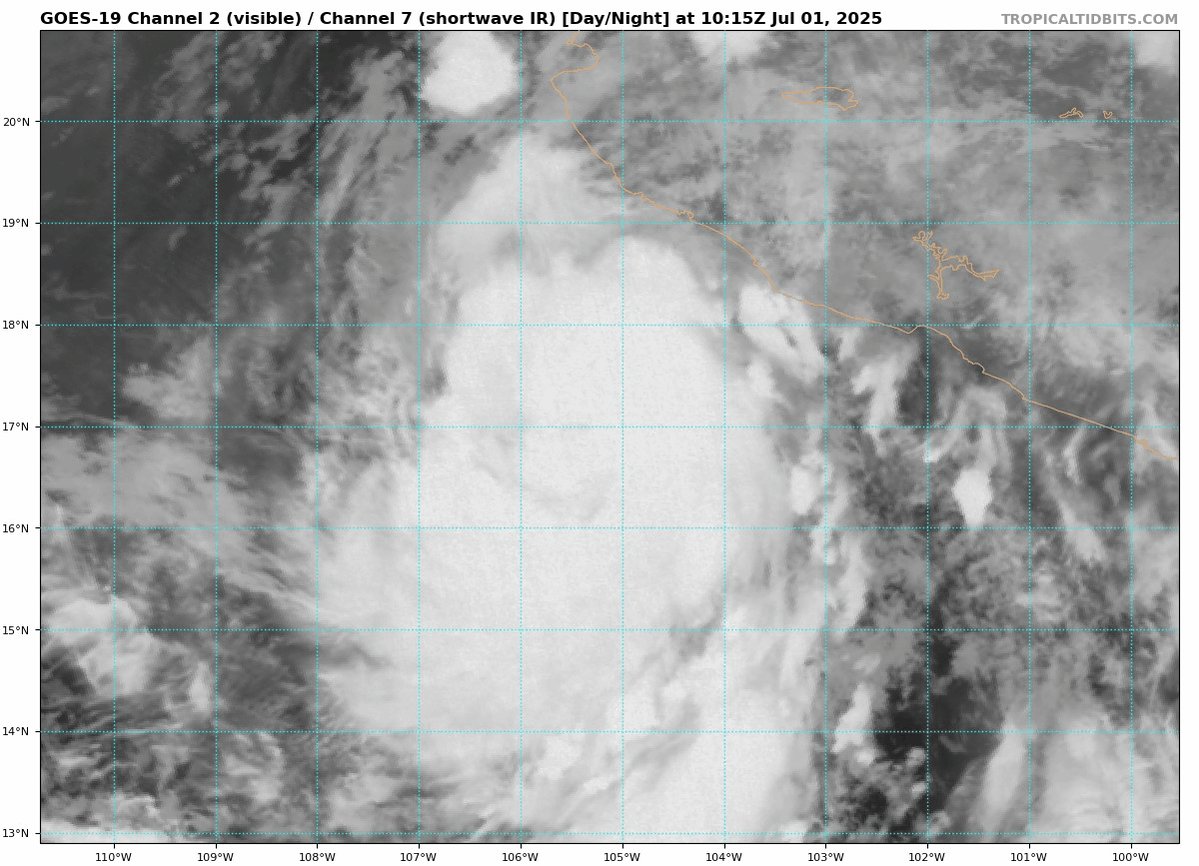
Definitely could become a strong Category 3. It remains off the coast of Mexico!.

Imagery via @NOAA's #GOESWest 🛰️ shows an eye developing as #HurricaneFlossie churns over the eastern Pacific today. #Hurricane #Flossie is currently a strong Category 2 storm. #GOES18 . Latest updates: .
0
0
9
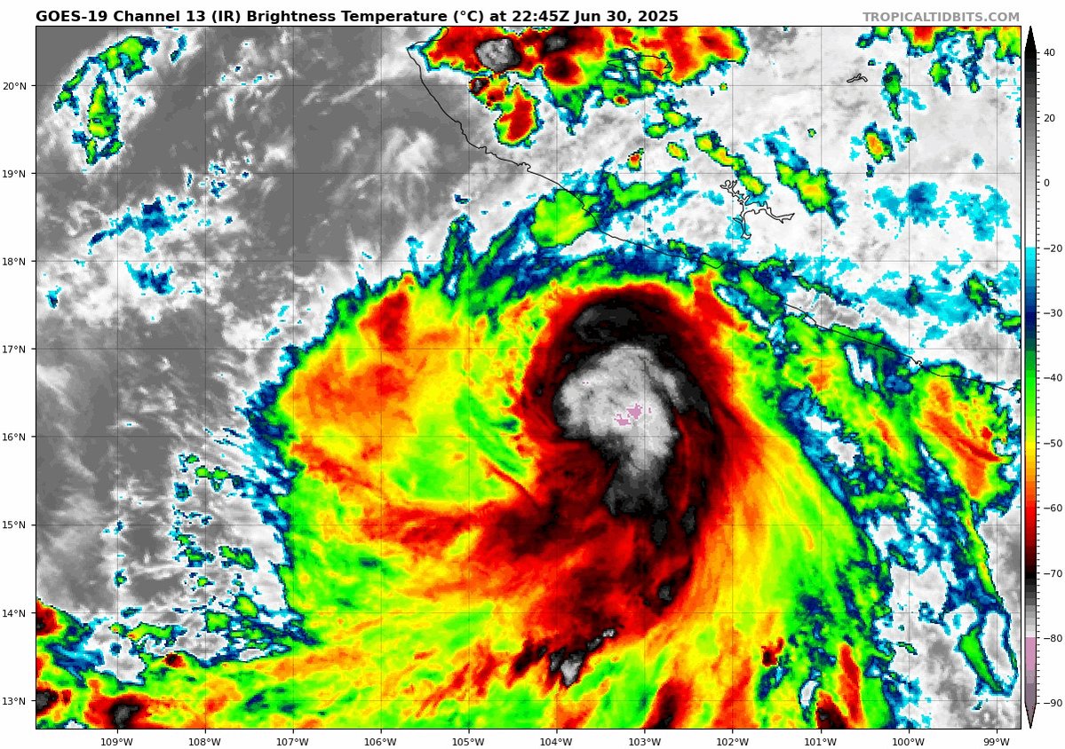
#FLOSSIE now a Category 2 with 85 kts (100 mph), 974 mb. It’s now forecast to briefly become a major hurricane Wednesday morning.

Hurricane #FLOSSIE up to 80 kts (90 mph). Microwave imagery shows a well defined eye below — should start to appear on satellite in the coming hours. Category 2 status likely later today.

1
3
28
Hurricane #FLOSSIE up to 80 kts (90 mph). Microwave imagery shows a well defined eye below — should start to appear on satellite in the coming hours. Category 2 status likely later today.
3
3
39
Cloud patterns in #FLOSSIE tell me it’s getting close, if not already a Category 1 hurricane — microwave reflects this. Should become a hurricane very soon.


3
4
53
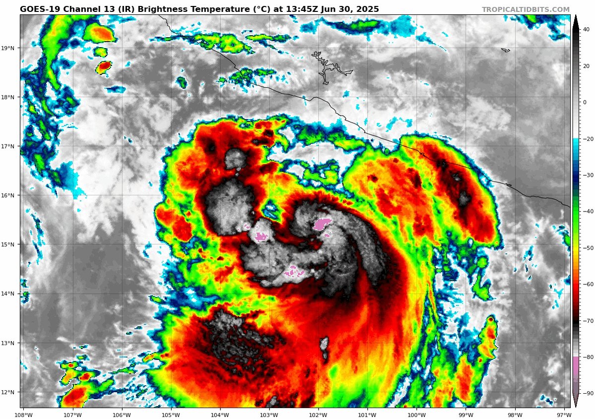
Tropical Storm #FLOSSIE strengthening this afternoon. Decent satellite presentation with nice banding — microwave showing a nearly wrapped center (notice how crucial microwave imagery is). Won’t be long until it’s a hurricane.

1
12
77
Tropical Storm #BARRY named earlier today. Not a good looking system — and it’ll stay weak all the way to landfall Sunday night. 40 kts (45 mph) is the landfall forecast as it strikes northern Veracruz tomorrow night.


0
5
44
Soon to be Tropical Storm #BARRY should be similar to BRET 2005, becoming a tropical storm for a few hours before striking Mexico. Not much of an impact besides several inches of rain.


1
7
74