Atlas (Chenxiao) Guo
@CartoGuophy
Followers
512
Following
645
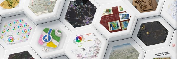
Media
202
Statuses
274
MAP EVANGELIST; Ph.D Candidate @UWMadisonGeog SCDM Lab; Student Cartographer @UWCartLab; Ex-Intern @Apple Maps @UNDP @ILSR; Alumnus @GeographyUGA @sysu_1924.
Madison, WI + Athens, GA
Joined June 2020
🌎I’m actively seeking full-time roles as a #Cartographer (on-site / remote). With rich experience in cartography & GIS, my work has been widely recognized with 70+ achievements. If your team’s hiring or you know openings, I’d truly appreciate any referrals or shares! #OpenToWork
3
1
3
#30DayMapChallenge | Day 13 10-minute map I didn’t have my #LEGO elements with me, so I used whatever pieces I had to build a tiny #Georgia map. It’s probably the least geometrically/topologically accurate LEGO map, but it's still a strong candidate for the cutest one.😅🍑
0
1
11
Had a wonderful day at @cobbcountygovt #GISDay sharing my #LEGO maps and U.S. #NaturalHazard visuals. I truly enjoyed the conversations and loved seeing people discover info or fun moments through the maps. Huge thanks to the organizers for the invite and the great event today!✨
0
0
3
#30DayMapChallenge | Day 12 Map from 2125 | TBD Imagining a map 100 years ahead is tough. I’ve got ideas to share later, just not today. For now, here’s a map I made last year for 100th anniversary of my alma mater, Sun Yat-sen University #SYSU on Nov 12, birthday of #SunYatSen.
1
1
31
This Friday 11/14, I will be attending Georgia's Cobb County @cobbcountygovt GIS Day event with a booth sharing physical and digital LEGO maps (similar to but more than this photo), U.S. natural disaster map posters, and FREE LEGO map stickers! Looking forward to the event!😉
0
0
1
#30DayMapChallenge | Day 8 Urban | This is an HDF laser-cut 3D #Madison city flag, which reads as a map, including the two lakes and an isthmus land, with a four-wing capitol building at center. I gave it a watercolor coat and made it a magnet. What a little Madison souvenir!
0
0
2
#30DayMapChallenge | Day 11 Minimal Map | I turned my Day 3 recolored AI-generated low-poly map of the contiguous US into a simple watercolor painting. It's fun when a rough handmade meets futuristic low poly, but staying faithful to satellite image colors over AIGC fabrications.
0
2
20
#30DayMapChallenge | Day 10 Air | This is an exploratory bivariate map illustrating global temperature patterns based on WorldClim bioclimatic variables: annual mean temperature (BIO-1) and annual temperature range (BIO-7). Read more: https://t.co/bgdLuNkMKQ
1
4
33
#30DayMapChallenge Day 9 Analog | I’m an amateur Irish whistle player. I previously made two tiny #Ireland #LEGO maps with 30×30 km cells and 75 m per vertical brick. I gave one away to my Irish music session at Madison, and bring the other with me for LEGO community events.☘️🪈
0
0
1
#30DayMapChallenge Day 7 Accessibility & 8 Urban | #Atlanta #Metro (#Marta) Map | It's challenging to represent linear features using LEGO due to limited angles and resolution. This map illustrating Atlanta's @MARTAtransit and I-285 shows the potential of this mapping approach.🚊
0
0
1
#30DayMapChallenge Day 5&6 I just completed my first #globe design, a virtually rendered #LEGO cube globe! The colors were derived from a pixelated Natural Earth raster layer (Cube Projection). As usual, I applied some manual curation to preserve recognizable geography. Enjoy!
0
3
33
#30DayMapChallenge Day 4: My Data. I spent a special summer interning at #Apple Maps—my first time in the #BayArea and first time exploring a place by #bike. I meant to just map my rides, but ended up refining many details (still ongoing) as it was such a rewarding experience!
0
2
14
#30DayMapChallenge Day 3: Polygon (Low-Poly US Terrain Map) I love #LowPoly graphics, so I asked ChatGPT to generate a US map and then filled each triangle in #Photoshop with a single color roughly sampled from satellite imagery. It is abstract, simple, and surprisingly joyful!
0
2
12
#30DayMapChallenge Day 2: Line (#Shanghai #CityWalk Route Map Series) Shanghai Dérive (魔都漂移) is a #PublicHistory project exploring how history lives in urban space, where I designed event maps, linking routes, places, and memories through geography. View more on my website~
1
1
12
#30DayMapChallenge Day 1: Point 🍑✨ This was one of my early explorations in #LEGO mapping, back in Spring 2024. Now I turned this design into a 3D model using round tiles (flat points), creating this "flat" 3D map of #Georgia. View more: https://t.co/MuvVsJtJlU
0
0
4
#30DayMapChallenge This November is turning out to be one of my busiest months ever, but I really don’t want to miss out on this amazing party. I might join a few days late or randomly here and there, but that’s part of the fun! Hope to share some extra mappy joy with you all!✨
0
0
11
Happy 80th Birthday (1945.10.24-2025.10.24), #UnitedNations!🌐 I made this quick map as a small cartographic tribute to mark this milestone. Grateful for my previous internship at @UNDP ✨
0
0
0
Sharing my latest map: Scenic #Yosemite National Park, as a cartographic tribute to the birthplace of the national park idea. The design style is inspired by #NationalParkService. Read more and download for free: https://t.co/8LsjNcA2sf Feedback is highly appreciated!
0
0
3
I created this guide map for our historic tour by Shanghai Dérive 魔都漂移, following the photographs of a renowned journalist and photographer (a UW-Madison alumnus) to uncover historical moments in Shanghai during WWII. Follow our WeChat and RedNote account for more details.
0
0
0