

1DegreeOutside
@1DegreeOutside
Followers
32K
Following
769
Media
8K
Statuses
56K
The ONLY Digital Weather Source Covering ALL of New England. The only forecast you need to know. For all seasons. From @mattnoyes & @danielle_noyes
Boston, MA - New England
Joined January 2009
WHAT DOES THE REST OF DECEMBER HOLD FOR NEW ENGLAND? More cold snaps & quick-hitting disturbances. Watch your Monthly Forecast here: https://t.co/KPzooWTcB3
0
0
4
Our new partnership with the @ROCCC911 & @DXFD_PIO brings Duxbury, Plympton, Halifax, Rochester, Hanson, Hanover & Pembroke first-responders & town departments operational weather intelligence, including a coastal flood forecast just for Duxbury Harbor:

1degreeoutside.com
Serving Duxbury, Plympton, Halifax, Rochester, Hanson, Hanover & Pembroke We’re excited to announce a new partnership with the Regional Old Colony Communications Center (ROCCC) – the regional...
2
2
11
Some light snow Tuesday night, rain & snow for Wednesday... Timeline + amounts in Insights: https://t.co/HjpnDgXVCh
0
1
10
This is one cold start - and the chill will last into Tuesday. Matt Noyes is predicting wind chill values stuck in the single digits for many today and subzero for most tonight. Get the full video 24-hour forecast + Noyes' Notes right here: https://t.co/pvx7205MrT
0
1
15
YEAR 2! @mattnoyes & @danielle_noyes offer a meteorologist’s slope, snowmobile & backcountry weather discussion for New England/Upstate NY + daily maps covering 89 ski areas & 121 snowmobile clubs in New England. Read today’s, sign up month-by-month: https://t.co/K8RwF0h20J
0
4
37
Light snow arriving for some...cold on the way for all! Wind chill hovers below 10° from Monday into Tuesday and goes subzero Monday night. From the School Day "Feels Like" Forecast to another midweek disturbance, Matt has you covered in the full video linked here:
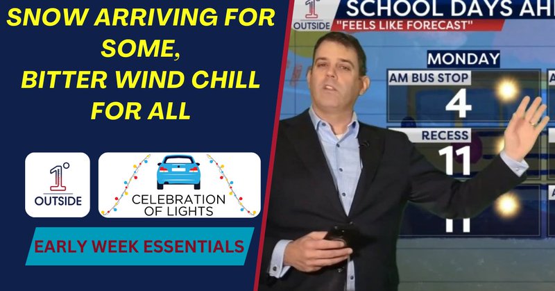
1degreeoutside.com
Light snow tonight mainly north (coating–2", 2–4" higher ME terrain), then a bitter Monday: highs teens/20s, 30–40 mph gusts, single-digit wind chills and subzero Monday night.
0
2
14
Weekend at a glance! Excerpt video here, full video at: https://t.co/ocHGFQw6C3 Sat: Scattered rain/snow showers. Treated roads OK. Evening: Patchy black ice possible where roads don’t dry. Sun eve/night: Light snow/rain fills in. Mon: Blustery!
0
2
19
Brrrr! We've stepped into the winter freezer!! Bright & beautiful looking day...but bundle up! Some light snow showers develop tonight...watch your full 24-hour forecast video: https://t.co/Ayvw8FGCfa
0
2
24
The howling wind you hear outside right now is delivering the coldest air of the season so far. But Matt & Danielle know this is really just a chunk of good ole' New England chill! In recent years, we always hear about the polar vortex...here's the science behind it:
0
3
24
4:25pm: Snow Squall Warning for SE NH as a line of squalls drops southeast across the Queen City. Towns and times of expected arrival in this image. Coating the roads with moisture and snow - with temps now mid 20s behind it. Fast road icing in spots.
0
0
6
3:07pm: Snow squall dropping southeast through the Lakes Region drops the temp below freezing immediately behind it. Where it coats the ground, conditions will turn slick. Gusty wind kicks up with biting wind chill dropping thru the teens. Track with radar in our app!
0
1
8
LOTS TO KEEP AN EYE ON! Coating of snow for some Saturday, more possible Sunday night & another cold blast. Highlights in the clip & FULL video is always up here and on our website, app & streaming network: https://t.co/NIofmy5sbI
0
1
21
Track Radar today: In our 5-star app: 1DegreeOutside Weather on App Store/Google Play On our website: Radar window at https://t.co/EzuscJneq1 By watching New England's only weather network:

1degreeoutside.com
width="850" height="480" frameborder="0" scrolling="no" allowfullscreen="allowfullscreen" data-ruffle-polyfilled="">
0
0
4
Snow squall warnings from Rutland County VT to PA (blue/white polygons) - scattered & dropping southeast along an arctic front. Note temps on the map - above freezing ahead, drop quickly behind - this can lead to icing. Stay alert & monitor radar (see comments for radar links).
1
1
10
HERE COMES A PIECE OF THE POLAR VORTEX! Timing out scattered snow showers & squalls, gusty wind & dropping temps as bitter chill arrives. Highlights in the clip, full video here: https://t.co/9XKaHxQhyT
0
2
25
WHAT DID YOU END UP WITH? ❄️ And we know some of you many comment "nothing" 🤣 Big thank you to everyone for sending in your weather reports & snow totals to us! Shout-out to the @WX1BOX for all of your hardwork - we appreciate all that you do!
5
2
19
SCATTERED COATINGS TO 1" OF SNOW THURSDAY...❄️ As an arctic front pushes in. They're hit or miss in nature, but if you're under one, you'll know it! Expect briefly reduced visibility & localized slick spots. Wind kicks up & bitterly cold air arrives with sub-zero chill chill. 🥶
0
3
25
WATCH YOUR STEP! Some icy/slick spots this morning on untreated surfaces...use caution! Many rise above freezing later, brisk wind in place. Arctic front & bitterly cold temps arrive tomorrow night. Watch your 24-hour forecast here: https://t.co/qwQbUEmtGf
0
3
15
Straight from our 24/7 Streaming Weather Network: "As New England Winter Storm Moves Away, Matt Outlines What's Left" Snowing hard for some, mix for many. Matt says 1-4" of snow still to fall with icy spots even for some who didn't see snow. Find out what to expect right here!
0
3
18
5" in Temple, NH as of 4:40PM - courtesy of "snow lover" Robert Saari
0
1
11