
Response Services
@oldhamalert
Followers
3K
Following
702
Media
52
Statuses
9K
Oldham Council's Response services team co-ordinates emergency planning and response issues on behalf of the Council. Twitter not monitored 24/7
Oldham, Greater Manchester, UK
Joined February 2010

Next week 👇 🌤️ A cold and settled start with high pressure dominating 🌧️ However, quickly becoming mild and unsettled with low pressure systems moving in from the Atlantic
6
38
151
FRIDAY NIGHT Showers rattling through, some heavy, low risk of thunder and lightning. Min 7°C
0
1
7
Struggling to manage your debts? Don’t worry because we can help. Speak to one of our speciality advisors on our helpline - 0161 770 7007 (Monday to Friday, 9am to 5pm) or access our text service on: 07860 022876 #DebtAwarenessWeek #Oldham #WeCanHelp
4
5
5

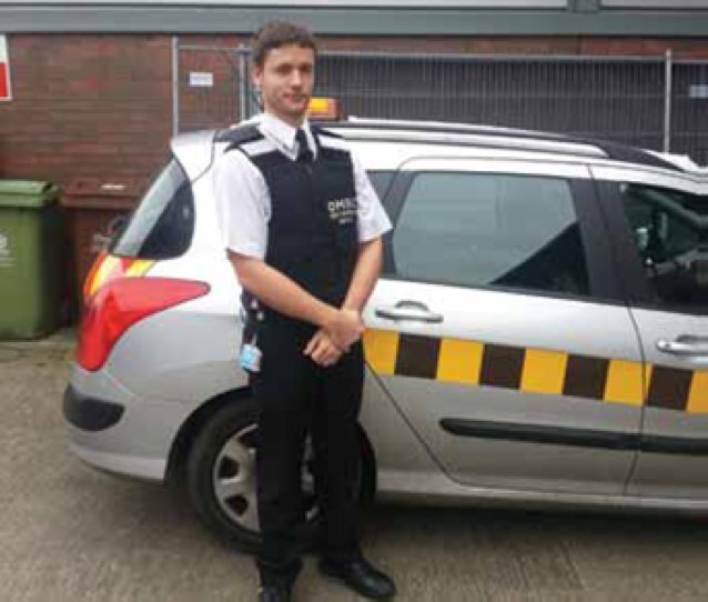
❗ Calling all drivers in Greater Manchester. When you’re out and about in your car, remember to check in the distance, at a mid-point and at a near point when turning and watch out for other road users. #CheckThreeTimes
1
2
7
Our £1m investment into a brand-new pitch at Boundary Park is going to have a massive impact to people who play local sports at a grassroots level. Here’s what @Roughyeds chairman Christopher Hamilton had to say on this… #Oldham #OAFC #Roughyeds #Sport
8
3
13
Odd snow shower during next week's cold spell seems to be the best we will get as snow showers will be mostly confined to the coast & N. So if you're holding out for a sledging snow-day it's not happening. Although one eye will be on Thursday. #uksnow
3
5
32
🥶Up-and-coming colder spell will last Mon PM to Fri. 📈Milder next weekend. 🌨️Some wintry/snow showers around, Mon, Thu & Fri AM favourable. ❄️Frosty nights. ☀️Sunniest days on Tue & Wed. 💨Bitter wind-chill at times. 🌼After this, roll on double-figure temps!
5
12
48
FRIDAY 🌤️ Early freezing fog lifting, although stubborn in places, then a decent DRY (yes dry for the first time since December 15th) day with plenty of sunny spells. Frost returning into the evening. Light winds. Cold where fog lingers the longest. Max 5°C Min -2°C
0
3
15
Yesterday was only the 5th day, since my records began in August 2012, where the daytime maximum temperature didn't get above 0°C. #iceday 🥶
4
3
31
Going onto frozen ponds, reservoirs, lakes and canals is dangerous and can have fatal results. It might be tempting to walk or play on the frozen water but the ice can easily break. The temperature of the water is cold enough to take your breath away and lead to drowning.
1
28
21

ℹ️ A message for customers travelling through Manchester Airport.
40
19
56
TONIGHT Slowly less mild overnight but remaining windy with any showers easing away to clear spells. Min 6°C
0
1
6
Going to be close but #colder weather might return around #ChristmasDay, and with it, the risk of #snow. Updates later in the week.
2
4
40
Baltic temperatures this morning. Lowest for years, 12 years I'd say. Could go slightly lower as dawn breaks too. 🥶📉
5
8
25
This time next week, we could be back into double-digits 📈.
7
5
35
☁️ SATURDAY ❄️ Mostly cloudy with some wintry showers, falling as snow in some places, especially inland. Not much expected but can't rule out 1-2cm in favourable spots. Showers easing later. Widespread ice and further frost overnight. Max 2°C (milder out west) Min -2°C
0
5
17