Explore tweets tagged as #MapView

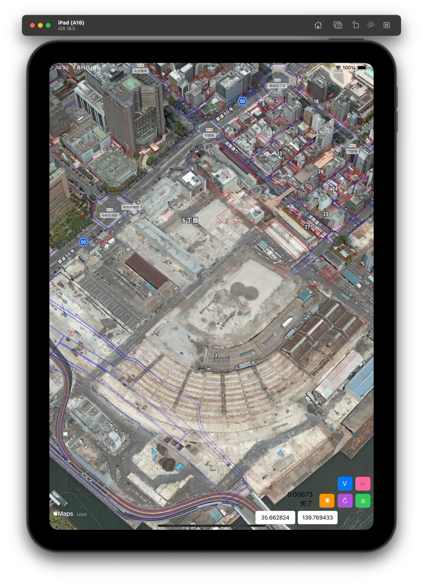
MapViewのハイブリッドを3Dにして、PLATEAUのデータを重ねた、築地市場、AppleのデータよりもPLATEAUが新しいのです。ごにょごにょいじっていますが、なかなか面白い。
0
0
7


Bruce Highway, Bald Hills. Single vehicle Crash - Lane or lanes reduced, Southbound towards Brisbane.
0
0
0


🗺️ The car map view a user requested is a lot of work but almost done... Done: Database and API Next: Making the MapView look good Initially I thought I would load all images, but there are currently 1,000+ car images from users, can't have each user download thousands of


0
0
1


An interactive map in a single tweet: tidycensus::get_acs( geography = "tract", variables = "B19013_001", state = "OR", geometry = TRUE ) |> mapview::mapview( zcol = "estimate", https://t.co/tTyKyICGu9 = "Median household income" ) #rstats #GIS #demographics
6
39
242

I wonder if we could make this Marketplace Mapview look and feel more like Homelands

1
0
34
One of my favorite #rstats interactive mapping tricks: using the `|` operator in mapview to create a swipe map. Here - showing the results of the `erase_water()` function in the Seattle area!
1
18
154

推友 有遇到过 MKMapViewDelegate 的 mapView(_:didDeselect:) 方法传递一个 空对象过来的情况么? annotation 这个对象明明是 非 optional 的......

0
0
0

Added a detail screen for each of the “Job opening” Up next 📝: Working on adding a MapView for users to search job based on location. Built with 🧡 using SwiftUI Disclaimer: These openings are fictional and the entire data is generated by ChatGPT :)
1
0
7
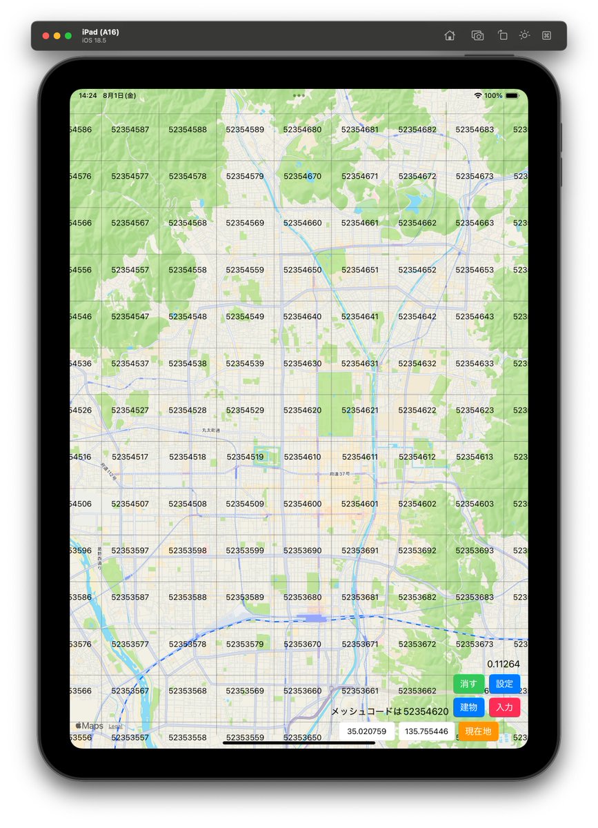
DEMの解析完了! MapViewに黄色で描画したらこんな結果に、 京都のDEMは2次メッシュっすが、中身は実は3次メッシュ単位になっている。 このデータをJw_cadの2.5Dに持って行ってみる。 どうなるか?
1
0
4

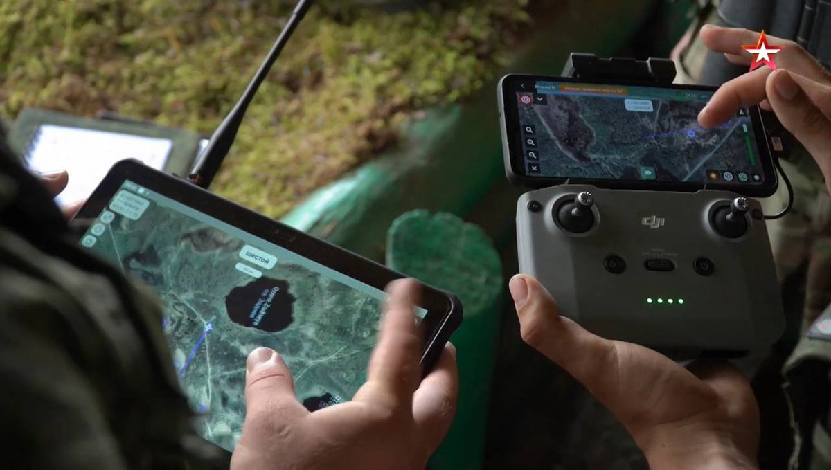
Wow, really intrigued by what's going on here. Seems like the DJI Fly running on RC-N1, but with some modifications to add POI/mark targets in the mapview, did the orcs break SecNeo @d0tslash ? Looks like it, no?


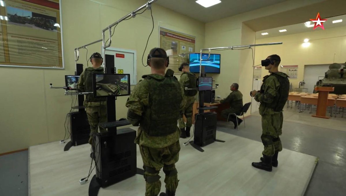
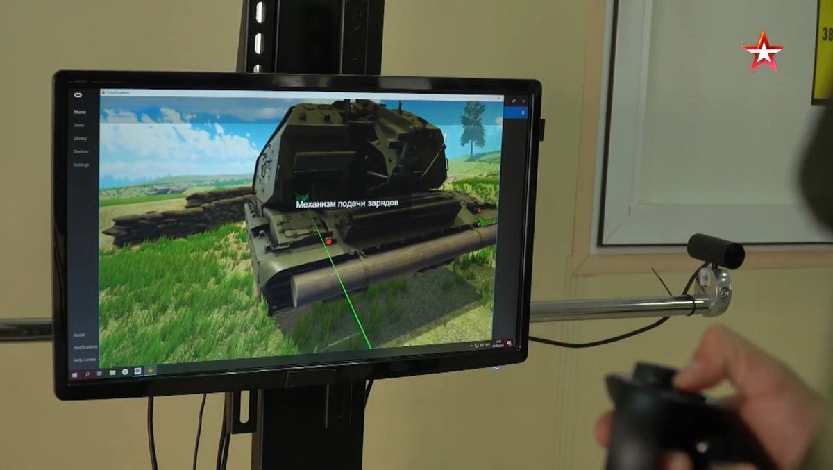
Footage from Russia's Mikhailovskaya Military Artillery Academy where cadets are trained to work with artillery using quadcopters, various software and VR designed to transmit information from UAV operators to tank crews, artillery crews and command posts. https://t.co/1sJKEY3cdr

4
3
18

Playing around with @kyle_e_walker's excellent TidyCensus package and mapview, I refined the population map to add visual cues for tract populations. Code is still super easy. 1/2

1
1
5


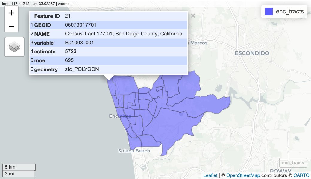
@joepowers16 encinitas <- tigris::places(state = "CA", cb = TRUE) |> dplyr::filter(NAME == "Encinitas") enc_tracts <- tidycensus::get_acs( geography = "tract", state = "CA", variables = "B01003_001", geometry = TRUE, filter_by = encinitas ) mapview::mapview(enc_tracts)
3
1
16

#dataviz How to use {mapview} to plot interactive maps - a basic example of historical sites in Haryana (India) using data from @openstreetmap with {osmdata} Full code & Interactive View: https://t.co/HDoifvD1pE Tools #rstats #ggplot2 #terra #tidyterra #osmdata #leaflet #mapview

0
5
38