

FLYGHT7
@_FLYGHT7
Followers
54
Following
37
Media
81
Statuses
162
FLYGHT7 creates tracks that aircraft & pilot can follow to have a safe & efficient flight. We provide: PANS-OPS, PBN, Aeronautical Charting & Training
Joined July 2020
We didn't notice this was an option! We just figure it out and very happy with it. What a great touch from the QGIS project to provide this to make it easier to demonstrate we are authorized to provide QGIS training.

0
1
2
RT @antoniolocandro: Waiting for the @_FLYGHT7 plugin to be approved, exciting times. Currently it only draws the area, and the analysis pa….
0
5
0
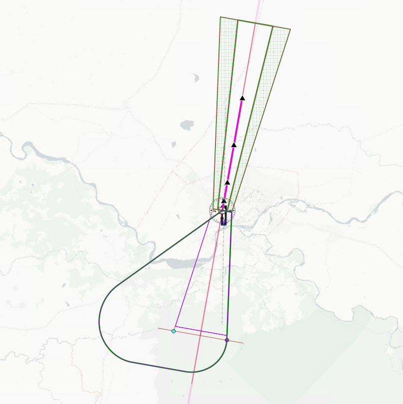
RT @antoniolocandro: 🚀 Here we go @_FLYGHT7 plugin update: now builds RNP APCH (LNAV) straights—Initial, Intermediate, Final. Turns? Plann….
www.youtube.com
Quick update on where the plugin development is going at the moment.
0
3
0
RT @antoniolocandro: Open-source QGIS plugin for Aviation – TakeOff Flight Path Area (TOFPA) updates! Docs & GitHub coming soon. Free too….
www.youtube.com
The first update of the plugin development we are doing with QGIS! Interested? Go check out https://www.flyght7.com
0
8
0


Thank you all the joined our webinar on Terrain and Obstacle Database, if you couldn't attend here is the video uploaded to Youtube on our blog post. #aviation #tod #aixm #terrain #obstacle #ifpd.

flyght7.com
Discover the essentials of Terrain and Obstacle Data in our expert-led webinar with Global Coordinates. Learn about its importance in aviation and GIS, data collection methods, and practical applic…
0
0
0
A few weeks ago we did an Aeronautical Studies and Safety Assessment (ASSA) course at our facility in Tegucigalpa, Honduras. We had two colleagues join us live and a third one via Zoom so it was a blended course!. #aeronauticalstudy #safetyassessment


0
0
0
🎉 Happy Labour Day! 🎉. Today, we take a moment to celebrate the incredible dedication, resilience, and hard work of workers around the globe. 🌍. Thank you for your tireless dedication and for keeping the world running. Happy Labour Day!

0
0
0
RT @FoxATMRadar: @icao Council adopts new aviation Standards and Recommended Practices (SARPs) for remotely piloted aircraft systems, these….
0
2
0
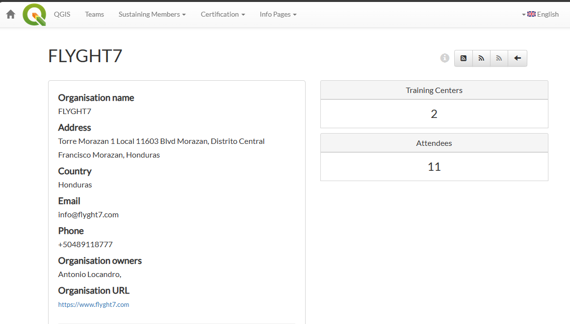
FLYGHT7, currently the only QGIS-approved aviation training provider, has certified 11 professionals since Nov 2023. Discover how QGIS enhances aeronautical workflows at 🛩️✨ #aviation #GIS #certification #FLYGHT7
0
1
1
RT @antoniolocandro: I really want to implement a workflow manager / business rules engine so that I can map tasks either manual/automatic….
0
1
0
RT @antoniolocandro: Quick example of what I'm talking about, each numbered step would probably have internal steps to review also or separ….
0
1
0
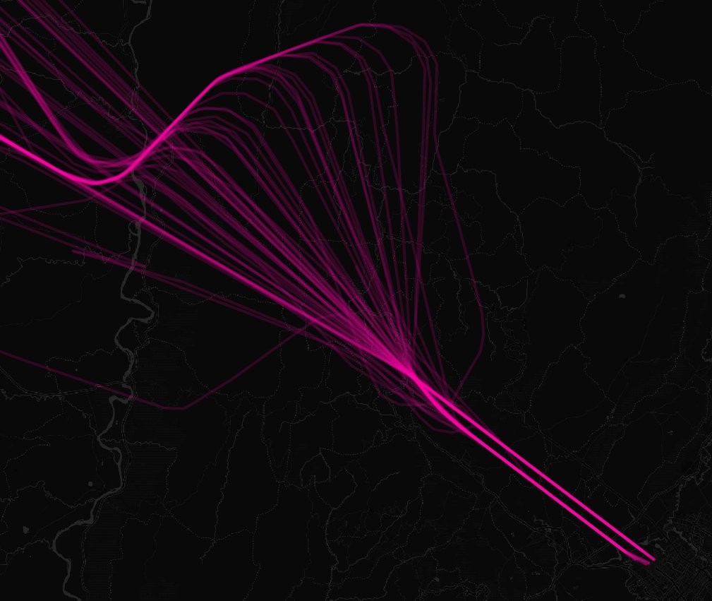
Exploring new obstacle limitation (OLS) generation using QGIS for airports. Cost-effective & efficient alternative to traditional methods. A lot of potential to have some sort of automation that is a lot quicker, more precise + opensource. #QGIS #aviation #opensource


0
1
2

