
3D Geoinfo @TU Delft
@tudelft3d
Followers
2K
Following
61
Media
155
Statuses
546
3D Geoinformation Research Group at @tudelft, the Netherlands
Delft, the Netherlands
Joined December 2014

De nieuwe 3D BAG release op basis van AHN4 data is eindelijk uit! Iedereen bedankt voor het geduld! Er is veel veranderd, lees de release notes op:
1
5
11

After a long long time, the new release of the 3D BAG is out! Personally, I'm very happy with it. It contains a lot of improvements, so do read the release notes 🙂

linkedin.com
After a long long time, the new release of the 3D BAG is out! Personally, I'm very happy with it. It contains a lot of improvements, so do read the release notes 🙂
0
2
3

📰Updates on the IfcOpenShell 0.8.0 version. A thread. IfcOpenShell is committed to staying one of the most advanced and versatile #opensource #IFC #BIM implementations to solve the multi-disciplinary challenges of the future🤓. Here's how.
1
12
52
#30DayMapChallenge Day 30: Remix For the remix, we made a GIF of all of our maps. Sorry we think we’re just tired after this intensive month... and we need a break until the #30DayMapChallenge2023 !
0
2
23
#30DayMapChallenge Day 29: "Out of my comfort zone" This is a 4D polychoron, composed of two LoDs of a building, projected in 3D space and then rendered in 2D. Do you see it? 🤓 The map is created with azul4d: https://t.co/WmRKk9R7E2
0
3
7
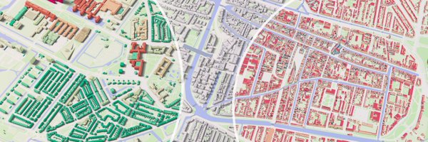
#30DayMapChallenge Day 28: 3D Why would you want 3D building models? This #blender render of our https://t.co/pRdpmBAc2D dataset showcases three possible answers to that question!
1
17
122
While you're here, it's the cover page of our textbook about terrain modelling, free to use:

github.com
"Computational modelling of terrains" book: source code + PDF - tudelft3d/terrainbook
0
0
1
#30DayMapChallenge Day 27: Music The "elevation" of the Netherlands (based on AHN3 https://t.co/noeAe8vplk) à la Joy Division's Unknown Pleasures. We shamelessly stole the idea from https://t.co/vm0so3rjYS (and improved it we think!). Credits go to @hansakwast

#30DayMapChallenge Day 24: Elevation. The #Netherlands in Joy Division Unknown Pleasures style. You can clearly see the ice-pushed ridges from the Saalien ice age. #opendata: #AHN from @PDOK_online. Made with #QGIS.
1
2
14
#30DayMapChallenge Day 26: Islands A 3D render of the Cyclades islands in Greece, a monument to the Mediterranean’s rough but beautiful nature! This is based on the wonderful work of https://t.co/LJaMCKSWNU.
0
10
20
#30DayMapChallenge Day 25: 2-colour Friday A bit of Zen for Black Friday! Integrating the 2 poles into the Yin Yang symbol. Our artistic interpretation of the constant interaction between land and sea across the globe. Maps of the poles: https://t.co/tAmyW6w9c0
0
1
17
#30DayMapChallenge Day 24: Fantasy A map connecting our fantasies! We utilise stable diffusion-based generative AI model to create this video by animating characters as a component of our interactive map. Which characters are you familiar with? Credit: https://t.co/P0S9nfof3o
0
2
7
#30DayMapChallenge Day 23: Movement How far can you travel in one hour? Isochrones for public transit in Mexico City. Follow this link to hover over the different stops: https://t.co/NB5C5xZCls Code is available at: https://t.co/rl33nvziVz
0
4
27
#30DayMapChallenge Day 22: NULL Nerding out on the National Dutch Amersfoort / RD New map projection system #EPSG28992 #QGIS
1
4
18
Code is available at:

github.com
Estimate urban populations from Kontur population dataset - kenohori/konturpop
0
0
0
#30DayMapChallenge Day 21: Kontur Population Dataset Which are really the world's biggest cities? Here are the ones with 1M+ urban population based on classifying and clustering the Kontur population dataset. Link to the entire globe: https://t.co/XjAtf2waK5
1
2
6
#30DayMapChallenge Day 20: "My favourite..." A map linking our favourite paintings! We compiled a list of styled cities and paintings by employing a stable diffusion generative AI model for transitions between the two artistic styles. Which cities or paintings do you recognise?
0
2
5
#30DayMapChallenge Day 19: Globe A selection of global terrain elevation measurements by spaceborne LiDAR as measured by @NASA_ICE and @GEDI_Knights. By @3vetion.
0
1
15
#30DayMapChallenge Day 18: Blue Friday 3DBAG ( https://t.co/pRdpmBzEd5) from a #RoyalDelftBlue perspective. Looking forward to getting this ceramic tile from @RoyalDelft!
0
3
9
#30DayMapChallenge Day 17: A map without a computer We used the business cards of previous and current members of our group to discretise the map of the world. Cheers to all the people who help shape our group! Now... can you spot the Mediterranean sea? 😉
0
1
7