

Land & Carbon Lab
@landcarbonlab
Followers
2K
Following
4K
Media
327
Statuses
2K
Convened by @WorldResources & @BezosEarthFund to develop breakthroughs in geospatial monitoring of the world's land and nature-based carbon.
Joined September 2021
Grasslands—including shrublands & savannas—cover ~40% of Earth, supporting 1B+ people & storing vital carbon. Yet, only 10% are protected. The #GlobalPastureWatch consortium is creating groundbreaking data to monitor & protect these critical ecosystems. https://t.co/jOceKks3bR
0
11
23
📢Another big release from Land & Carbon Lab & Global Pasture Watch! 🌾First-ever global annual maps of short vegetation height (1–7m) at 30m res, 2000–2024. ➡️ Read the blog and access the data: https://t.co/PYPLLF9YMk
0
13
42
🛰️ We are entering a new era in planetary data & intelligence. Join us for AI, Meet Nature — a special event introducing our powerful new AI tool designed to make environmental insight more accessible, intuitive & actionable. 📅 Sept 17, 3–4:30 PM ET ➡️ https://t.co/nTaMQvELV3

0
2
8
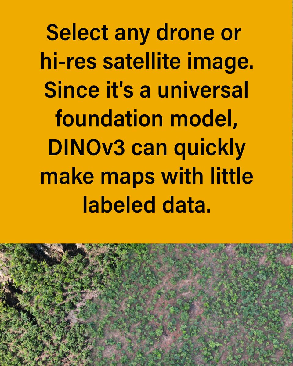
🚀 Most AI vision models need months of training to work effectively. DINOv3 works out of the box and performs better than models built for specific tasks. For us, that means faster, cheaper and more reliable insights to track restoration. 🌱 Learn more: https://t.co/XXKiIfyje4
0
0
5
What you can do with it: 📈 Track carbon uptake by plants over time. 🌱 Detect shifts in productivity to spot early signs of stress or land degradation. 🦋 Support conservation planning 🌾 Strengthen sustainable agriculture
0
0
1
🌾 How healthy are the world’s ecosystems? Using two decades of Landsat imagery & a light use efficiency model, Land & Carbon Lab & Global Pasture Watch have created the first global maps of Gross Primary Productivity at 30 m resolution. ➡️ https://t.co/dLXdBnZyJc
1
0
1

🚨 Breakthrough in ecosystem monitoring! We’re releasing the first global Gross Primary Productivity (GPP) dataset at 🌍 30m resolution, spanning 2000–2024 with bi-monthly updates. 🌱 What is GPP? It measures the amount of carbon that plants take from the atmosphere. In short

2
51
168
🚨 New data from the Global Pasture Watch research consortium: Farmers, land managers, policymakers & scientists can now track land productivity worldwide at 30-m resolution — with a consistent bi-monthly record spanning more than two decades. ➡️ https://t.co/dLXdBnZyJc
0
0
5


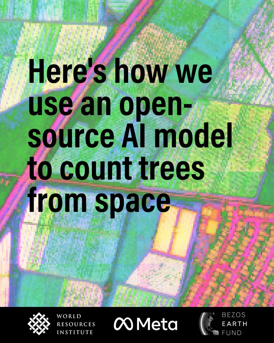
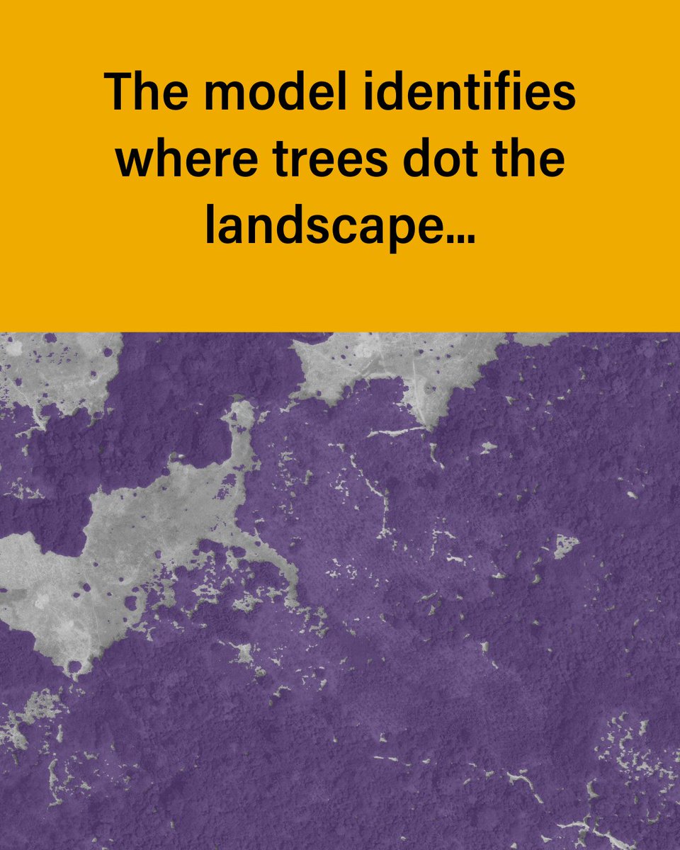
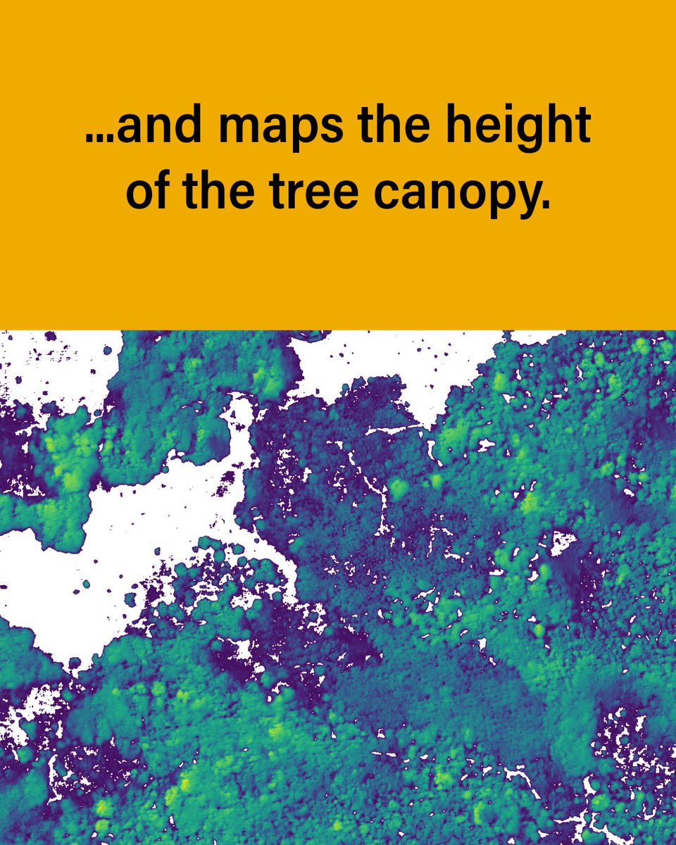
DINOv3, developed by @AIatMeta with support from @WorldResources is setting a new standard for environmental monitoring. This is how we use it to map the height of individual trees globally — faster & more accurately than ever before: 🔗 https://t.co/1rF8VrQ2gI
@BezosEarthFund
1
2
3
🌱 Restoration needs data that moves as fast as the work on the ground. That’s why @AIatMeta’s new open-source DINOv3 vision model — paired with innovation at @landcarbonlab & on-the-ground results through @WorldResources — is a breakthrough. 🔗 https://t.co/IUyt6COUf9
2
5
14
@AIatMeta For @landcarbonlab & @WorldResources, it means turning innovation into impact for people, nature & climate at a speed and accuracy we’ve never had before. Learn more:
landcarbonlab.org
A new AI foundation model, DINOv3, is making it possible to transform restoration monitoring and unlock finance for nature restoration.
0
0
2
Today, @AIatMeta launched an advanced open-source AI vision model, & for how we monitor the world’s land, it’s a game-changer. Unlike previous models — which needed months of training & labeled data — DINOv3 models work out of the box & can outperform models built for the job.
1
0
4
🔥 Wildfires have caused 75% of forest loss in UNESCO World Heritage Sites since 2001. 20 sites have already shifted from carbon sinks to sources. With data from Land & Carbon Lab, @UNESCO is gaining critical insights to inform response & planning. ➡️ https://t.co/nbuX1vY7Q0

0
0
1
Europe’s forests are continuously changing. 🌲 Harvesting is overtaking regrowth in the north 🔥 Fires are intensifying in the south 🐛 Pests & biomass demand are reshaping forests in the center We’ve built a free tool to help track where, how & why. ➡️ https://t.co/0ztOmRk1Pp

0
3
13
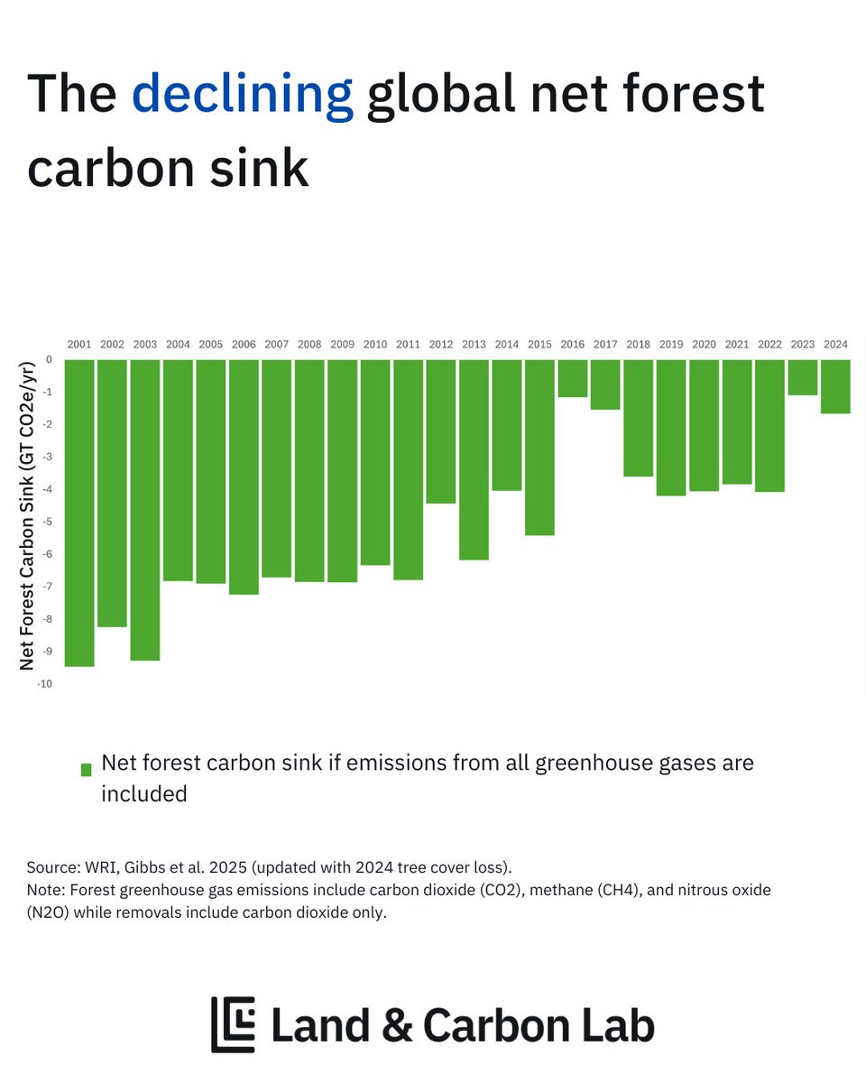
🔥 Bolivia’s forests became a carbon source in 2024 — their worst fire year on record. 1.5M ha burned. 400M tons CO₂e released. 60% of emissions from fire alone. This as the world’s forest carbon sink hit a 20+ year low. 🔗 https://t.co/nCnTDNxFIv
@WorldResources


0
0
1
Stay up to date with our cutting-edge research and innovation, bringing unprecedented transparency to the world’s land and nature-based carbon. 📬 Join our mailing list: https://t.co/YMY11GVFEd Our July newsletter drops this week!

0
0
1
🌍 In 2023 & 2024, the world’s forest carbon sink hit its lowest point in 20+ years. Fires & deforestation drove forests to absorb just 25% of their usual carbon — with parts of 🇨🇦 & 🇧🇴 flipping from sink to source. The margin is narrowing fast. ➡️ https://t.co/nCnTDNxFIv

1
12
17
@UNESCO With satellite data from Land & Carbon Lab, UNESCO is gaining a clearer view of what’s driving that change — and how to respond faster. ➡️ Learn how this data is helping protect the world’s most important forests: https://t.co/nbuX1vY7Q0
#WorldHeritage #NatureBasedSolutions


0
0
1
🌿 Over 200 @UNESCO World Heritage Sites are forested carbon sinks — absorbing more carbon than they emit. But even these global icons are under pressure: since 2001, they’ve lost forest cover across an area larger than Switzerland.


1
0
0
🛰️ Land-sector GHG models haven’t changed much since the ’80s. They inform the global “big picture” — but miss local land-use impacts. Land & Carbon Lab is working to change that. ➡️ Explore our GHG research: https://t.co/GYpDKwAD8R


0
4
8